Photo: Wikipedia
Strategic Assessment of Thurmont, MD
Multiple tactical vulnerabilities. Population density, target proximity, or disaster risk are likely compounding. A retreat property and exit planning is required.
What does the Strategic Assessment tell us?
Our Strategic Assessment grades tactical survivability of an area. Major population centers, military targets, fallout zones, natural disasters, and border exposure all drive risk — lower exposure means a more defensible position in a crisis.
This is heavily inspired by Joel Skousen's Strategic Relocation book. Highly recommended you checkout the book ($)What does this tell us?
Our Strategic Assessment grades tactical survivability of an area. Major population centers, military targets, fallout zones, natural disasters, and border exposure all drive risk — lower exposure means a more defensible position in a crisis.
This is heavily inspired by Joel Skousen's Strategic Relocation book. Highly recommended you checkout the book ($)Strategic Pillars

Key Distances
Regional Safe Places
Below is our recommended "safe zones" in Maryland and the surrounding area based on our strategic heuristics. For most people, it's unrealistic to live in a “safe zone” full-time due to work, family or other personal reasons. They tend to be more rural. However, many of these areas are perfect for second homes and retreat properties that double as a vacation home or even a short-term rental.


Important Note: For informational purposes only. This does not mean nothing bad ever happens in the green zones. Please use common sense. This is based on public data and modeled with AI. We tried to take a conservative approach but mistakes happen. We update this regularly as new information becomes available.
Solar Generator Recommendations
Backup power matters more here than in safer locations. We've picked three solar generators across budgets and capacity tiers — start with the budget unit if you only need a few essentials, or step up if you want to run a fridge and HVAC for days at a time.

Jackery Portable Power Station Explorer 300
Budget OptionPower on the Go: Weighing only 11 lbs, it's convenient to set up and store with book-sized foldable solar panels

BLUETTI Portable Power Station AC180
Designed for both indoor and outdoor scenarios, AC180 is highly capable as it has a robost capacity and continuous output power.

EF ECOFLOW DELTA Pro Ultra Power Station
Upgraded PickEcoFlow DELTA Pro Ultra is a whole-home energy system designed to grow with your family. Integrated with the Smart Home Panel 2, it scales to meet your evolving energy needs — keeping your home powered, intelligent, and secure through every stage of life.
We earn a commission, at no additional cost to you.
Strategic Assessment Analysis
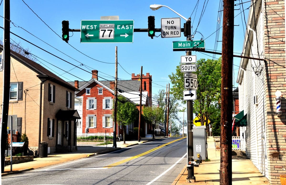
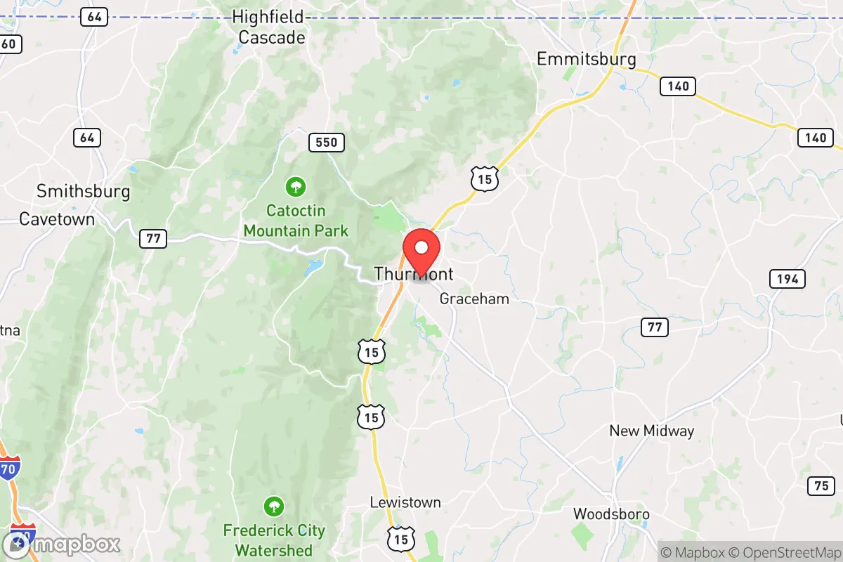
Thurmont, Maryland, offers a surprisingly resilient strategic position for those prioritizing self-sufficiency and distance from major population centers, while still being within a practical driving range of critical infrastructure. Nestled at the base of Catoctin Mountain, this town of roughly 6,500 people sits in a geographic sweet spot: far enough from the Baltimore-Washington corridor to avoid the worst of any cascading collapse, yet close enough to access medical and logistical resources if they remain functional. For a relocator with a prepper mindset, Thurmont’s key advantage is its location within a natural choke point—the mountain gaps and forested terrain provide both concealment and defensibility, while the surrounding agricultural land offers a foundation for long-term food security.
Geographic position and natural buffers: why this spot matters
Thurmont’s location at the northern end of the Frederick County panhandle places it directly adjacent to the Catoctin Mountain range and the Cunningham Falls State Park, creating a natural barrier between the town and the more densely populated areas to the south and east. This is not flat, open farmland—it’s rolling hills, hardwood forests, and rocky ridgelines that break line of sight and slow movement. The town itself sits along U.S. Route 15, a major north-south artery, but the surrounding secondary roads (like MD-77 and MD-550) are narrow, winding, and easily blocked or monitored. For someone thinking about retreat or relocation, this terrain offers multiple fallback positions: the mountains to the west, the state forest to the north, and the agricultural valleys to the east. The proximity to Camp David (about 5 miles south) is a double-edged sword—it guarantees a federal security presence and potential helicopter traffic during crises, but it also means the area is not a complete backwater. The nearby Fort Ritchie (now a redevelopment site) and the Raven Rock Mountain Complex (the alternate Pentagon, about 20 miles north in Pennsylvania) are both within a 30-minute drive, which adds a layer of strategic significance that most small towns lack.
Risks, exposures, and proximity to fallout-relevant landmarks
The most significant risk for Thurmont is its proximity to the Baltimore-Washington metropolitan area, home to over 8 million people and the federal government. In a scenario involving civil unrest, grid collapse, or a major terrorist event, the I-270 and US-15 corridors would become evacuation chokepoints, and Thurmont could see a surge of refugees from the south. The town is also within 50 miles of the Calvert Cliffs Nuclear Power Plant (south on the Chesapeake Bay) and the Peach Bottom Atomic Power Station (north in Pennsylvania), both of which are potential fallout sources in a worst-case event. Additionally, the Raven Rock Mountain Complex and Camp David are high-value targets in any conflict scenario, meaning the area could experience secondary effects from a strike or attack aimed at those facilities. On the natural disaster front, the region is low-risk for hurricanes and earthquakes, but winter storms can be severe—the mountain elevation means Thurmont gets more snow and ice than the surrounding valleys, and power outages lasting 3-7 days are not uncommon. Flooding along the Little Hunting Creek and Owens Creek is localized but can cut off access to certain rural roads. For a relocator, the key takeaway is that Thurmont is not a remote bunker—it’s a buffer zone. You’re close enough to the danger to be affected, but far enough to have time to react if you have a plan.
Practical resilience: food, water, energy, and defensibility on the ground
Thurmont’s practical resilience for a relocator is above average for the Mid-Atlantic, primarily because of its agricultural base and water access. The surrounding farmland produces corn, soybeans, hay, and livestock, and there are multiple working farms within a 10-mile radius that sell direct to consumers—you can buy a side of beef or a quarter hog from a local farmer without ever entering a grocery store. The town itself has a municipal water system drawing from groundwater wells, but most rural properties outside the town limits rely on private wells, which is a major advantage for off-grid capability. For energy, the area has good solar exposure on south-facing slopes, and wood heat is practical given the forest cover—many homes already have wood stoves or fireplaces. The Catoctin Mountain area also has numerous springs and streams, though you’ll want to test for agricultural runoff. Defensibility is where Thurmont shines: the terrain creates natural kill zones on the approaches, and the small population means you can know your neighbors. The local sheriff’s office (Frederick County) is professional and well-funded, but response times to rural properties can be 20-30 minutes. Community is the real force multiplier here—there are active church groups, volunteer fire departments, and a strong hunting culture, which means a higher-than-average percentage of residents are armed and trained. For a single individual or family, the ability to trade skills (medical, mechanical, security) with like-minded neighbors is a tangible asset that no amount of stored supplies can replace.
The overall strategic picture for Thurmont is that of a well-positioned fallback zone rather than a final redoubt. It offers the best of both worlds for a conservative-leaning relocator who wants to stay within a few hours of the East Coast’s economic and political centers but does not want to be caught in the blast radius when things go sideways. The town’s small size, agricultural surroundings, and natural barriers provide a solid foundation for a prepared lifestyle, but the proximity to high-value federal assets and major population corridors means you cannot afford to be complacent. If you are looking for a place to build a resilient life—with good soil, reliable water, defensible terrain, and a community that still values self-reliance—Thurmont deserves a serious look. Just make sure you have a plan for the first 72 hours of any event, because that’s when the corridor from D.C. will become a problem, and you’ll want to be on the right side of the mountain when it does.
* Values derived from national, state, county, city and local statistics and may differ in a specific area. Last updated: 2026-04-22T02:34:52.000Z
Narrative content on this page is AI-generated and may contain mistakes. Verify any details that matter before acting on them.
ReloMaps may earn a commission from affiliate links at no extra cost to you.