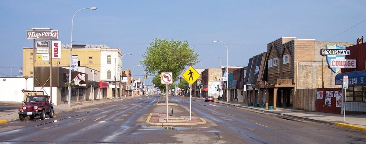

Photo: Wikipedia
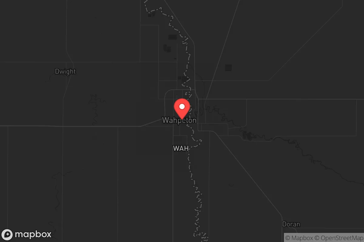
Strategic Assessment of Wahpeton, ND
Workable tactical position. Some exposure to population density or targets, but generally defensible in a crisis.
What does the Strategic Assessment tell us?
Our Strategic Assessment grades tactical survivability of an area. Major population centers, military targets, fallout zones, natural disasters, and border exposure all drive risk — lower exposure means a more defensible position in a crisis.
This is heavily inspired by Joel Skousen's Strategic Relocation book. Highly recommended you checkout the book ($)What does this tell us?
Our Strategic Assessment grades tactical survivability of an area. Major population centers, military targets, fallout zones, natural disasters, and border exposure all drive risk — lower exposure means a more defensible position in a crisis.
This is heavily inspired by Joel Skousen's Strategic Relocation book. Highly recommended you checkout the book ($)Strategic Pillars

Key Distances
Regional Safe Places
Below is our recommended "safe zones" in North Dakota and the surrounding area based on our strategic heuristics. For most people, it's unrealistic to live in a “safe zone” full-time due to work, family or other personal reasons. They tend to be more rural. However, many of these areas are perfect for second homes and retreat properties that double as a vacation home or even a short-term rental.
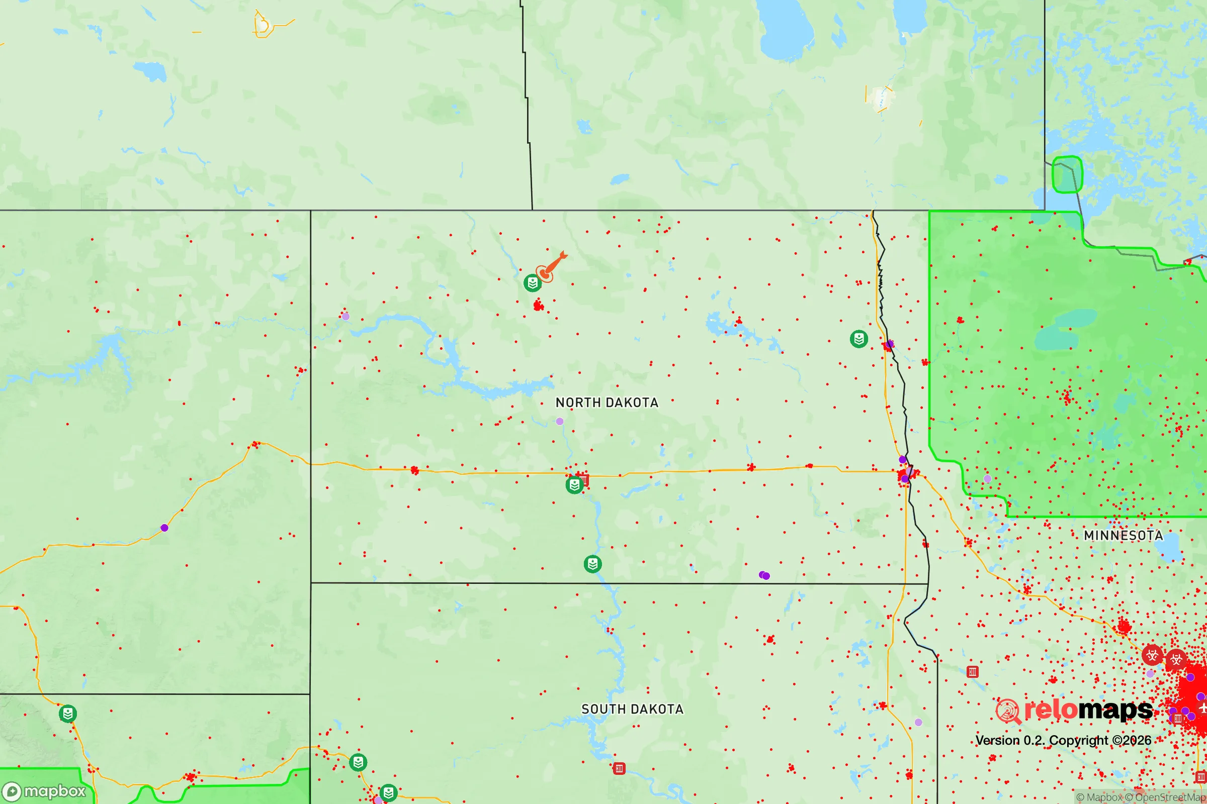
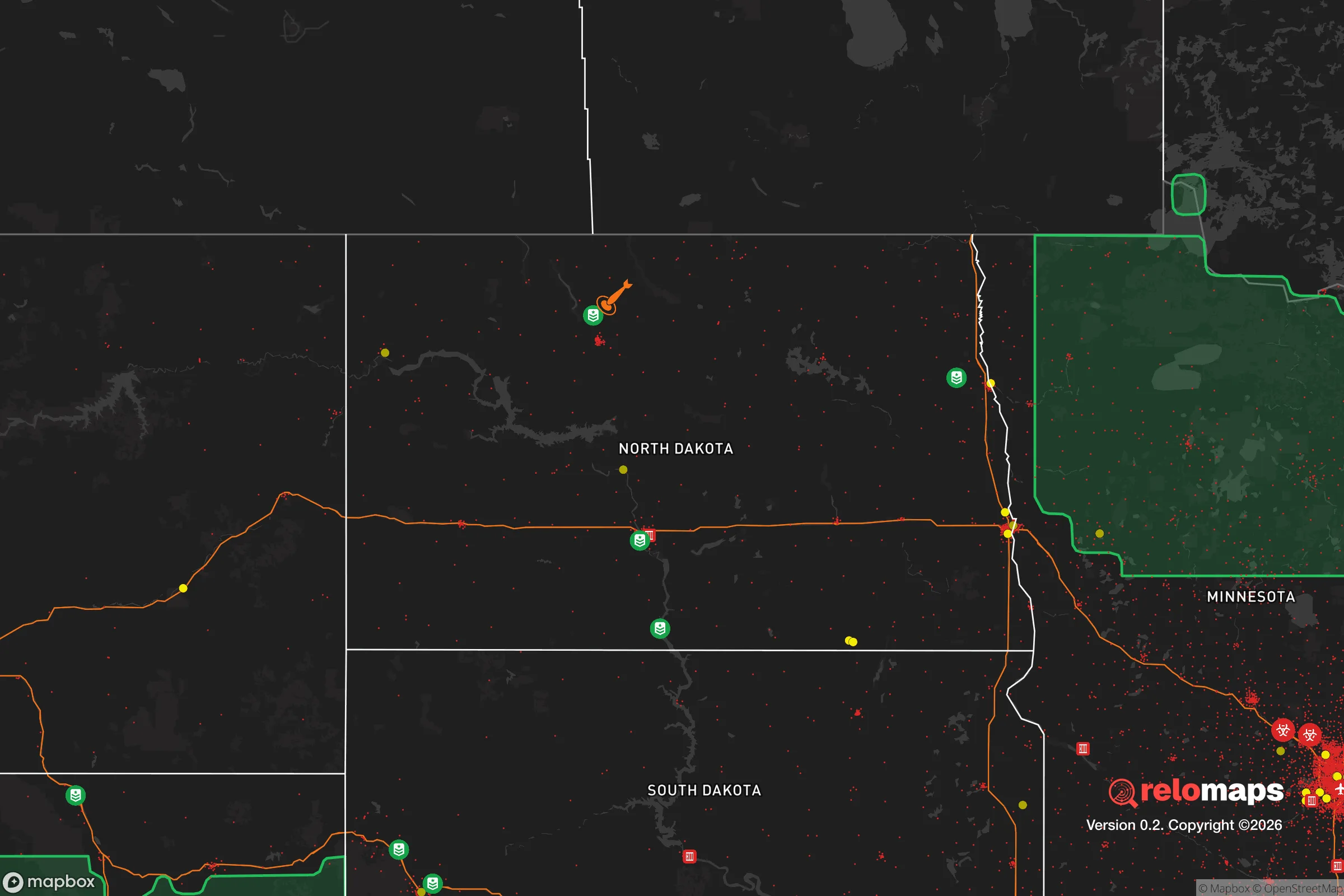
Important Note: For informational purposes only. This does not mean nothing bad ever happens in the green zones. Please use common sense. This is based on public data and modeled with AI. We tried to take a conservative approach but mistakes happen. We update this regularly as new information becomes available.
Solar Generator Recommendations
Backup power matters more here than in safer locations. We've picked three solar generators across budgets and capacity tiers — start with the budget unit if you only need a few essentials, or step up if you want to run a fridge and HVAC for days at a time.

Jackery Portable Power Station Explorer 300
Budget OptionPower on the Go: Weighing only 11 lbs, it's convenient to set up and store with book-sized foldable solar panels

BLUETTI Portable Power Station AC180
Designed for both indoor and outdoor scenarios, AC180 is highly capable as it has a robost capacity and continuous output power.

EF ECOFLOW DELTA Pro Ultra Power Station
Upgraded PickEcoFlow DELTA Pro Ultra is a whole-home energy system designed to grow with your family. Integrated with the Smart Home Panel 2, it scales to meet your evolving energy needs — keeping your home powered, intelligent, and secure through every stage of life.
We earn a commission, at no additional cost to you.
Strategic Assessment Analysis
Wahpeton, North Dakota, sits in a sweet spot that few people are talking about: far enough from the major metro corridors to avoid the worst of a collapse scenario, but close enough to Fargo (about 45 minutes east) and the Minnesota border to maintain supply access and medical evacuation routes. The town’s population hovers around 7,900, giving it a small-town footprint with a surprising amount of industrial and agricultural infrastructure. For someone thinking about long-term resilience—whether that’s weathering a supply chain disruption, a civil unrest event, or a broader societal breakdown—Wahpeton offers a combination of geographic isolation, resource self-sufficiency, and community cohesion that’s hard to beat in the upper Midwest.
Geographic position and natural advantages for long-term survival
Wahpeton is anchored at the confluence of the Red River of the North and the Bois de Sioux River, which gives it a reliable freshwater source—something that becomes non-negotiable in any extended crisis. The surrounding Red River Valley is some of the most fertile agricultural land in the country, with rich, black topsoil that supports corn, soybeans, wheat, and sugar beets. That’s not just a farming statistic; it means local food production capacity is enormous relative to the population. The area sits in a flat, open landscape with few natural choke points, which is a double-edged sword—good for visibility and farming, less ideal for defensible terrain—but the lack of dense forest or mountainous cover also means fewer places for hostile groups to stage ambushes. Winters are brutal, with average January highs around 16°F and wind chills that can drop to -30°F, which acts as a natural population filter: only those truly committed to self-reliance will stick around. The Missouri River and Lake Traverse are within a two-hour drive, providing secondary water sources and fishing access. For a relocator, the key takeaway is that Wahpeton sits in a region where food, water, and fuel (via local ethanol plants and oil pipelines) are produced locally, not shipped in from hundreds of miles away.
Risks, exposures, and proximity to fallout-relevant landmarks
No location is a fortress, and Wahpeton has its vulnerabilities. The biggest concern is the Fargo metro area, 45 miles to the north, which has a population of about 130,000. In a mass evacuation scenario—say, a major earthquake along the New Madrid fault or a coordinated attack on Minneapolis—Fargo could become a funnel point for refugees heading west and south. Wahpeton sits directly on Interstate 29 and U.S. Highway 75, both of which are primary north-south corridors. That’s a risk: in a crisis, these roads could become clogged with traffic, and the town could see a surge of people passing through. However, the town’s small size and limited lodging capacity mean most transients will keep moving. More concerning is the proximity to the Sheyenne River and the Red River floodplain. The area has a history of severe flooding—1997, 2009, and 2011 all saw major events—and climate models suggest heavier spring rains could increase flood frequency. A flood event during a societal breakdown would be catastrophic, cutting off roads and contaminating water supplies. On the plus side, the North Dakota National Guard has a strong presence in the region, and the state’s conservative governance means emergency response tends to be swift and well-funded. There are no nuclear power plants within 100 miles (the closest is Prairie Island in Minnesota, about 200 miles southeast), and no major military bases or chemical storage facilities nearby that would be primary targets in a conflict. The closest high-value target is the Grand Forks Air Force Base, about 100 miles north, which hosts drone operations and could be a secondary strike location in a major war. For a prepper, the risk profile is moderate: flood danger is real, but the absence of high-density urban targets and the distance from the East and West Coast corridors make Wahpeton a relatively safe bet for a long-term retreat.
Practical resilience for a relocator: food, water, energy, and defensibility
If you’re moving to Wahpeton with a prepper mindset, the practicalities are straightforward. Water is abundant—the Red River and Bois de Sioux provide surface water, and the local aquifer (the Dakota Sandstone) is deep but accessible with a well. Most homes in the area are on municipal water, but rural properties within a 10-mile radius can drill wells at depths of 100-300 feet. Food production is the real strength. The Red River Valley is one of the few places in the U.S. where you can grow a full diet on a small plot—potatoes, carrots, beans, corn, and squash all thrive. Local farmers’ markets and co-ops (like the Wahpeton Farmers Market, active June-October) mean you can source seeds and livestock without relying on national supply chains. Energy is solid: North Dakota is a net energy exporter, with natural gas and oil production in the western part of the state, and the local utility (Otter Tail Power Company) runs a mix of coal, natural gas, and wind. In a grid-down scenario, solar panels with battery storage are viable—the area gets about 200 sunny days per year, though winter daylight is short. Defensibility is mixed. The flat terrain means you can see threats coming from miles away, but it also means you have no natural cover. A rural property with a good perimeter fence, a well, and a root cellar is your best bet. The town itself has a low crime rate (violent crime is about 60% below the national average), and the local police department is well-funded relative to the population. For a single individual or a family, the community is tight-knit and conservative—church attendance is high, and the local culture is “mind your own business but help your neighbor.” That’s a valuable social asset in a crisis. The biggest practical challenge is winter: you need a reliable heating source (wood, propane, or natural gas), a backup generator, and a vehicle with winter tires. Without those, a two-week power outage in January could be lethal.
Overall, Wahpeton presents a strong strategic picture for someone looking to relocate with resilience in mind. It’s not a bunker—it’s a working town with real vulnerabilities, especially around flooding and its position on a major highway. But the combination of local food production, abundant water, low population density, and a conservative, self-reliant culture makes it a viable base for weathering the kinds of disruptions that are becoming more common. The key is to buy property outside the floodplain, invest in winter preparedness, and build relationships with local farmers and tradespeople before you need them. If the country heads south, Wahpeton won’t be a fortress—but it will be one of the last places to run out of food, water, and community.
* Values derived from national, state, county, city and local statistics and may differ in a specific area. Last updated: 2026-04-19T07:14:37.000Z
Narrative content on this page is AI-generated and may contain mistakes. Verify any details that matter before acting on them.
ReloMaps may earn a commission from affiliate links at no extra cost to you.