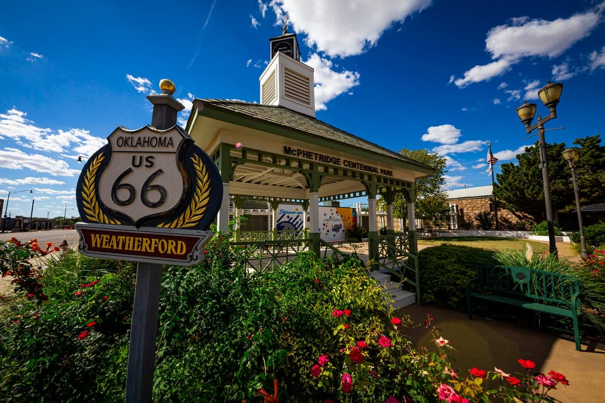
Strategic Assessment of Weatherford, OK
Workable tactical position. Some exposure to population density or targets, but generally defensible in a crisis.
What does the Strategic Assessment tell us?
Our Strategic Assessment grades tactical survivability of an area. Major population centers, military targets, fallout zones, natural disasters, and border exposure all drive risk — lower exposure means a more defensible position in a crisis.
This is heavily inspired by Joel Skousen's Strategic Relocation book. Highly recommended you checkout the book ($)What does this tell us?
Our Strategic Assessment grades tactical survivability of an area. Major population centers, military targets, fallout zones, natural disasters, and border exposure all drive risk — lower exposure means a more defensible position in a crisis.
This is heavily inspired by Joel Skousen's Strategic Relocation book. Highly recommended you checkout the book ($)Strategic Pillars

Key Distances
Regional Safe Places
Below is our recommended "safe zones" in Oklahoma and the surrounding area based on our strategic heuristics. For most people, it's unrealistic to live in a “safe zone” full-time due to work, family or other personal reasons. They tend to be more rural. However, many of these areas are perfect for second homes and retreat properties that double as a vacation home or even a short-term rental.
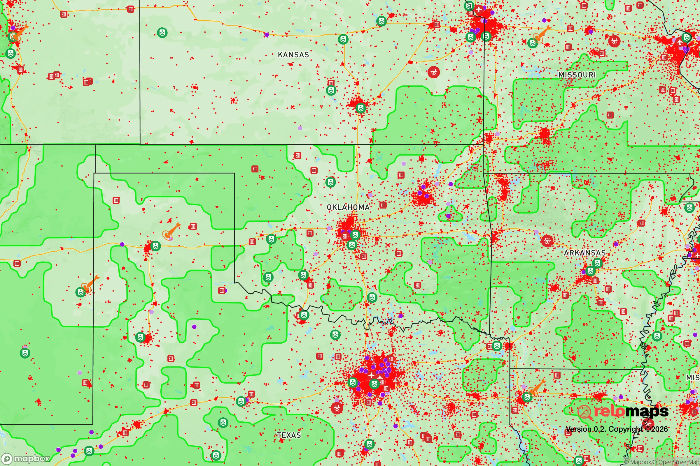
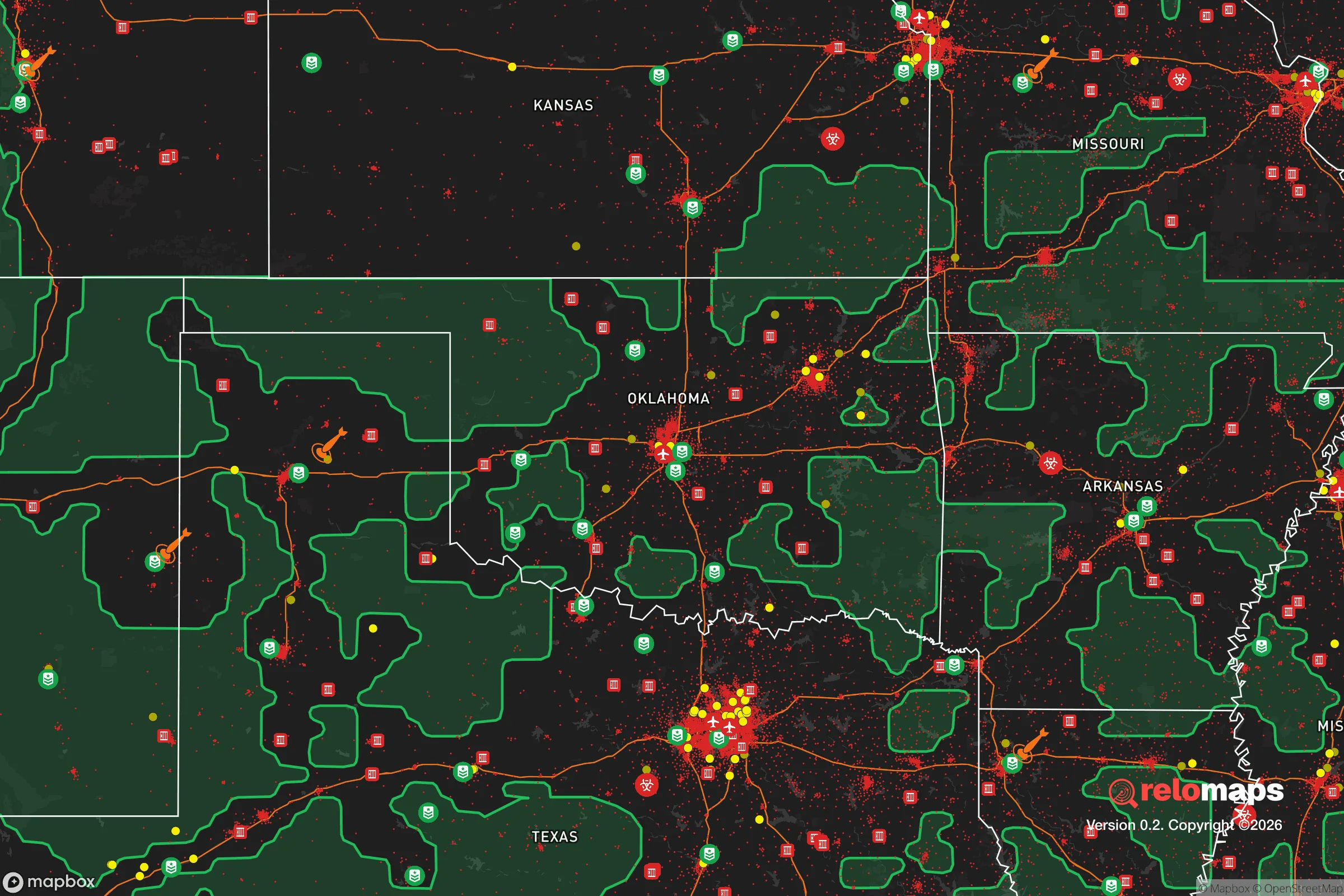
Important Note: For informational purposes only. This does not mean nothing bad ever happens in the green zones. Please use common sense. This is based on public data and modeled with AI. We tried to take a conservative approach but mistakes happen. We update this regularly as new information becomes available.
Solar Generator Recommendations
Backup power matters more here than in safer locations. We've picked three solar generators across budgets and capacity tiers — start with the budget unit if you only need a few essentials, or step up if you want to run a fridge and HVAC for days at a time.

Jackery Portable Power Station Explorer 300
Budget OptionPower on the Go: Weighing only 11 lbs, it's convenient to set up and store with book-sized foldable solar panels

BLUETTI Portable Power Station AC180
Designed for both indoor and outdoor scenarios, AC180 is highly capable as it has a robost capacity and continuous output power.

EF ECOFLOW DELTA Pro Ultra Power Station
Upgraded PickEcoFlow DELTA Pro Ultra is a whole-home energy system designed to grow with your family. Integrated with the Smart Home Panel 2, it scales to meet your evolving energy needs — keeping your home powered, intelligent, and secure through every stage of life.
We earn a commission, at no additional cost to you.
Strategic Assessment Analysis
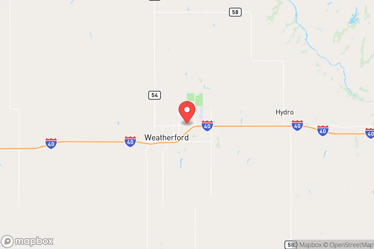
Weatherford, Oklahoma, sits in a sweet spot that few relocators from either coast fully appreciate: it’s far enough from major population centers to avoid the worst of cascading collapse scenarios, yet close enough to a regional hub (Oklahoma City, about 70 miles east) to access critical supplies and medical care when the system still works. The town’s position along I-40 and its status as a regional education and energy center give it a structural resilience that matters when you’re thinking about the next decade, not just next year. For a conservative-leaning individual or family looking to plant roots in a place that can absorb shocks—economic, social, or environmental—Weatherford offers a defensible, resource-rich base that doesn’t require living off-grid in a bunker.
Geographic position and natural advantages for long-term stability
Weatherford’s geography is its first line of defense. The town sits on the high plains of western Oklahoma, roughly 1,600 feet above sea level, which means it’s outside the flood-prone zones that plague eastern Oklahoma and the Mississippi basin. The Washita River runs nearby, but the terrain is rolling prairie with good drainage—not the kind of bottomland that turns into a swamp after a week of rain. The climate is semi-arid, averaging about 30 inches of rain per year, which is enough for dryland farming but not enough to breed the mold, mosquitoes, and humidity-related infrastructure failures that plague the Gulf states. Winters are cold but manageable, with average January highs around 48°F; summers are hot (July highs near 94°F) but dry, meaning you can cool a house with a swamp cooler if the grid goes down. The area sits on the Anadarko Basin, one of the most productive natural gas and oil fields in the country, which means local energy production is a reality, not a talking point. For a prepper, that means the local economy is tied to something real—extraction and agriculture—not just service-sector churn that evaporates in a recession.
Risks, exposures, and proximity to fallout-relevant landmarks
No place is immune, and Weatherford has its own set of vulnerabilities that a strategic relocator needs to weigh. The most obvious risk is tornadoes—this is the heart of Tornado Alley, and while the town hasn’t taken a direct hit from an EF5 in modern records, the threat is real every spring. The good news is that the local building culture takes this seriously: most homes have basements or storm shelters, and the community has a well-practiced warning system. The bigger concern for a prepper is proximity to potential fallout targets. Weatherford is about 70 miles from Tinker Air Force Base near Oklahoma City, a major strategic asset that would be a high-priority target in any conflict involving strategic bombing or EMP attack. That’s close enough that a ground burst at Tinker could produce fallout reaching the area within hours, depending on wind direction. Closer to home, the town itself has no nuclear power plants, no major military bases, and no chemical weapons depots—the nearest significant hazard is the Cushing oil storage hub, about 90 miles east, which is a critical infrastructure node but not a likely nuclear target. The I-40 corridor is a double-edged sword: it gives you mobility, but in a mass evacuation scenario, that highway becomes a choke point. A savvy relocator should have secondary routes—state highways 54 and 44 north and south—mapped out before they need them.
Practical resilience for a relocator: food, water, energy, and defensibility
Weatherford’s practical resilience comes down to four pillars: water, food, energy, and community structure. The municipal water supply comes from the Washita River and local groundwater wells, treated at the city’s plant. For a prepper, the key is that the aquifer is deep and the river is perennial—not a flash-in-the-pan creek that dries up in a drought. A well on your own property, if you buy outside city limits, can tap into the same aquifer at depths of 200-400 feet, which is manageable with a solar-powered pump. Food resilience is strong: Custer County is agricultural, with wheat, cattle, and hay as the mainstays. The local farmers’ market operates from May through October, and the surrounding area has enough small-scale producers that a family could establish direct relationships with ranchers and growers within a 30-minute drive. The Southwestern Oklahoma State University campus, which anchors the town, has an agricultural extension program that offers practical workshops on gardening, canning, and livestock management—resources that are free and open to the public. Energy is where Weatherford really shines. The town is in the heart of oil and gas country, and natural gas is cheap and abundant. Many homes already have gas furnaces, gas water heaters, and gas stoves, meaning you can cook and heat even if the electrical grid goes down for weeks. Solar potential is good—the area gets about 260 sunny days per year—and there are no restrictive HOA covenants in the rural parts of the county that would prevent you from installing panels or a backup generator. Defensibility is moderate: the town is compact (about 12,000 people), with a grid street layout that’s easy to navigate but hard to defend against a determined threat. The real advantage is the community itself. Weatherford is a conservative, church-going, gun-owning town where the sheriff’s office knows the locals and the local gun club runs regular training events. In a breakdown scenario, that kind of social cohesion is worth more than any piece of gear.
The overall strategic picture for Weatherford is that it’s a solid B+ location for a relocator who wants to be prepared without living like a hermit. It’s not the most remote option—you can’t disappear into the woods here—but it’s far enough from the major failure points (Oklahoma City, the Dallas-Fort Worth metroplex, the I-35 corridor) to give you a buffer. The local economy is grounded in energy and agriculture, not tech or finance, which means it’s less vulnerable to the kind of market-driven collapse that hollowed out so many towns in 2008 and 2020. The risks are real—tornadoes, the Tinker proximity, the I-40 evacuation risk—but they’re manageable with planning. For a conservative family that values self-reliance, community, and a low cost of living (median home price around $180,000 as of 2025), Weatherford offers a base that can weather the storms—literal and figurative—that the next decade is likely to bring. It’s not a fortress, but it’s a foundation. And in a world where the foundations are shaking, that’s worth a serious look.
* Values derived from national, state, county, city and local statistics and may differ in a specific area. Last updated: 2026-04-25T13:48:00.000Z
Narrative content on this page is AI-generated and may contain mistakes. Verify any details that matter before acting on them.
ReloMaps may earn a commission from affiliate links at no extra cost to you.