Photo: Wikipedia
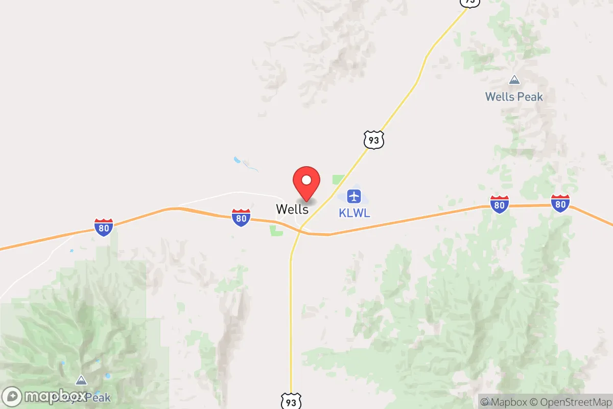
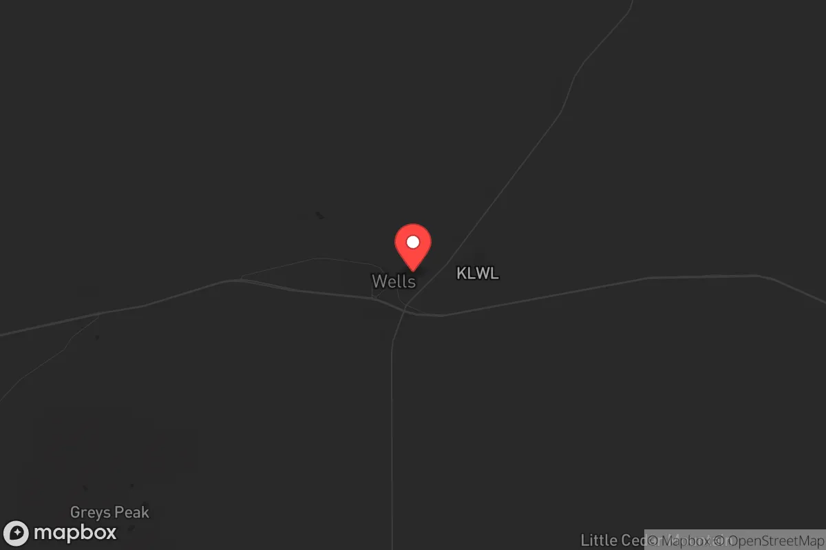
Strategic Assessment of Wells, NV
Workable tactical position. Some exposure to population density or targets, but generally defensible in a crisis.
What does the Strategic Assessment tell us?
Our Strategic Assessment grades tactical survivability of an area. Major population centers, military targets, fallout zones, natural disasters, and border exposure all drive risk — lower exposure means a more defensible position in a crisis.
This is heavily inspired by Joel Skousen's Strategic Relocation book. Highly recommended you checkout the book ($)What does this tell us?
Our Strategic Assessment grades tactical survivability of an area. Major population centers, military targets, fallout zones, natural disasters, and border exposure all drive risk — lower exposure means a more defensible position in a crisis.
This is heavily inspired by Joel Skousen's Strategic Relocation book. Highly recommended you checkout the book ($)Strategic Pillars

Key Distances
Regional Safe Places
Below is our recommended "safe zones" in Nevada and the surrounding area based on our strategic heuristics. For most people, it's unrealistic to live in a “safe zone” full-time due to work, family or other personal reasons. They tend to be more rural. However, many of these areas are perfect for second homes and retreat properties that double as a vacation home or even a short-term rental.
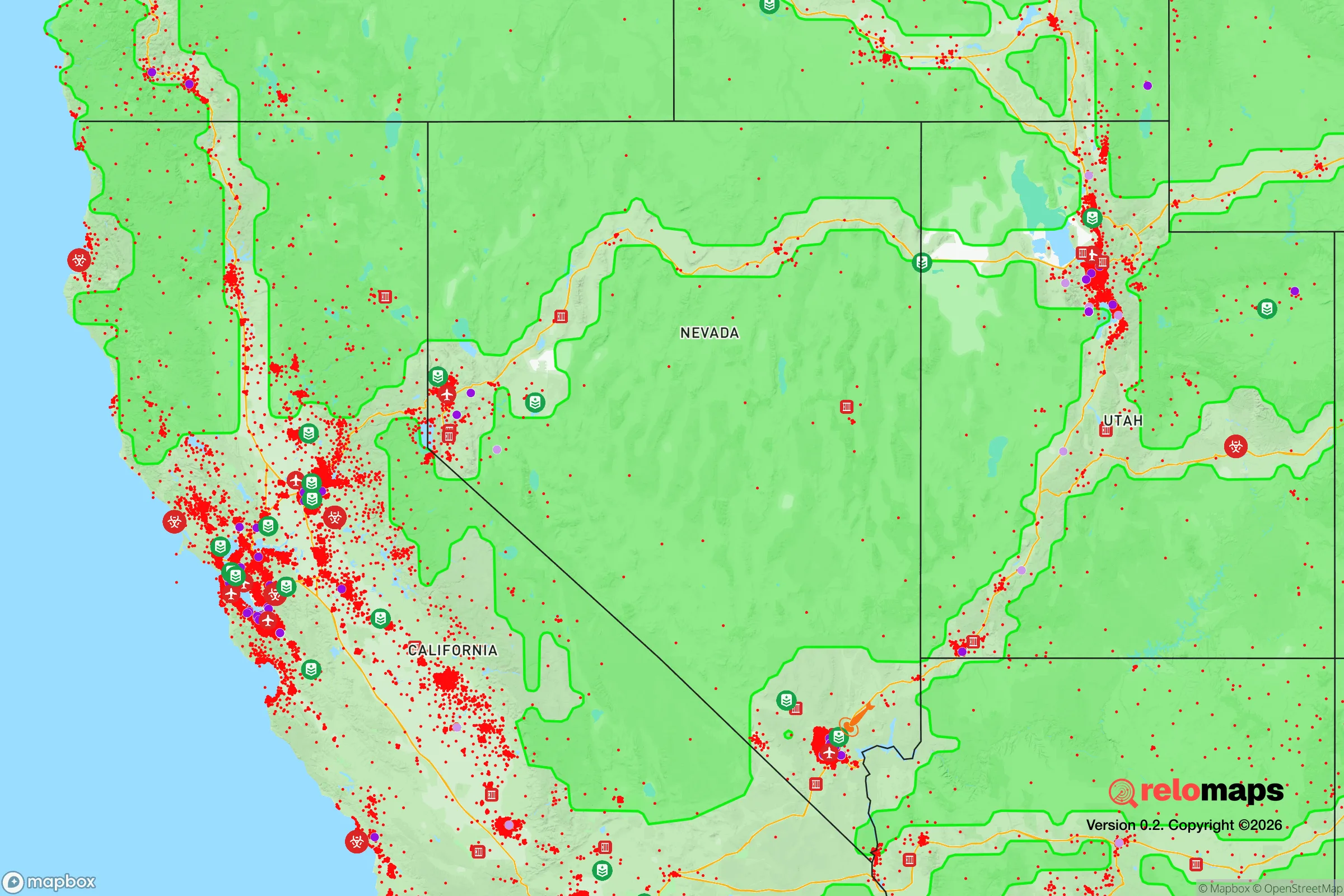
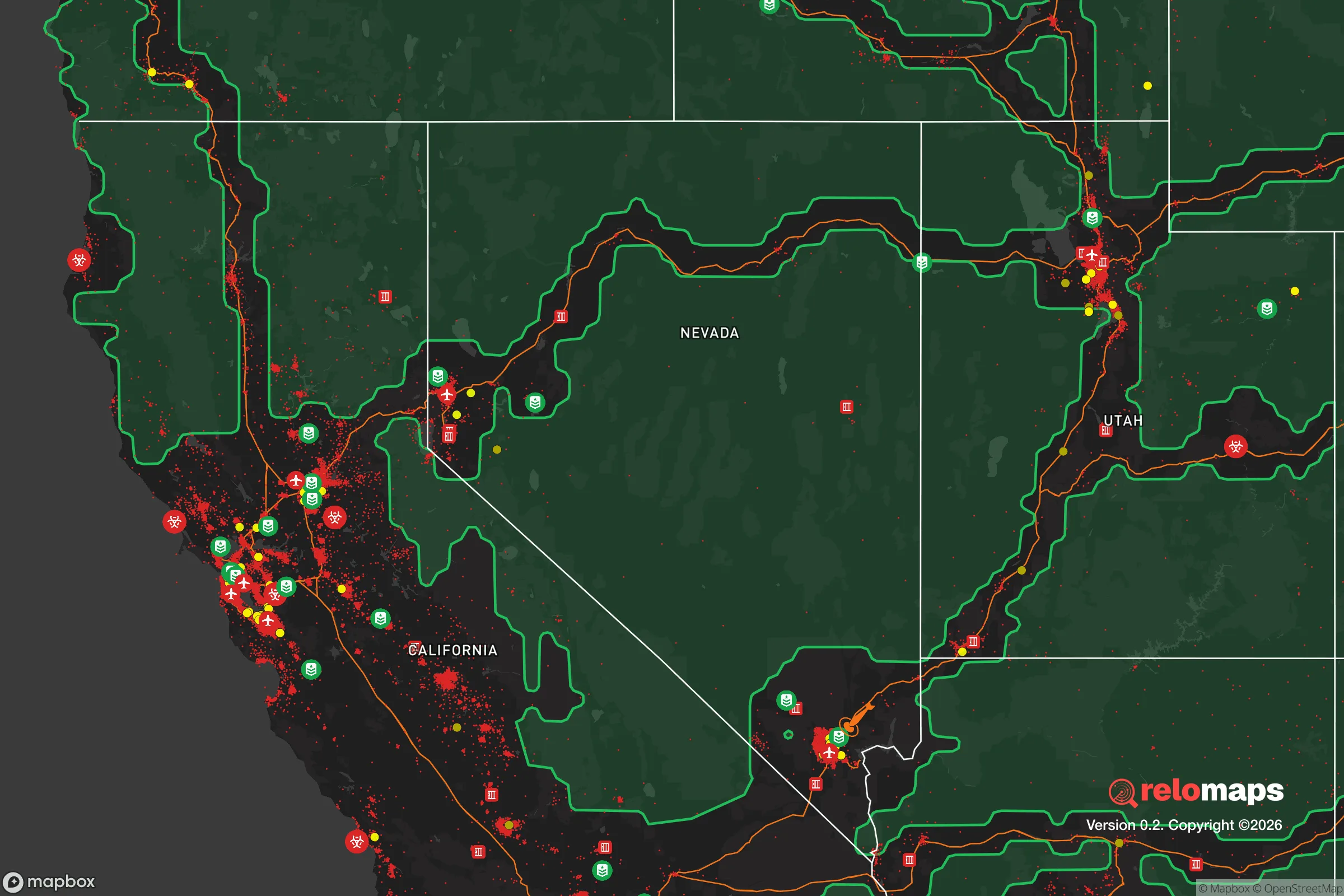
Important Note: For informational purposes only. This does not mean nothing bad ever happens in the green zones. Please use common sense. This is based on public data and modeled with AI. We tried to take a conservative approach but mistakes happen. We update this regularly as new information becomes available.
Solar Generator Recommendations
Backup power matters more here than in safer locations. We've picked three solar generators across budgets and capacity tiers — start with the budget unit if you only need a few essentials, or step up if you want to run a fridge and HVAC for days at a time.

Jackery Portable Power Station Explorer 300
Budget OptionPower on the Go: Weighing only 11 lbs, it's convenient to set up and store with book-sized foldable solar panels

BLUETTI Portable Power Station AC180
Designed for both indoor and outdoor scenarios, AC180 is highly capable as it has a robost capacity and continuous output power.

EF ECOFLOW DELTA Pro Ultra Power Station
Upgraded PickEcoFlow DELTA Pro Ultra is a whole-home energy system designed to grow with your family. Integrated with the Smart Home Panel 2, it scales to meet your evolving energy needs — keeping your home powered, intelligent, and secure through every stage of life.
We earn a commission, at no additional cost to you.
Strategic Assessment Analysis
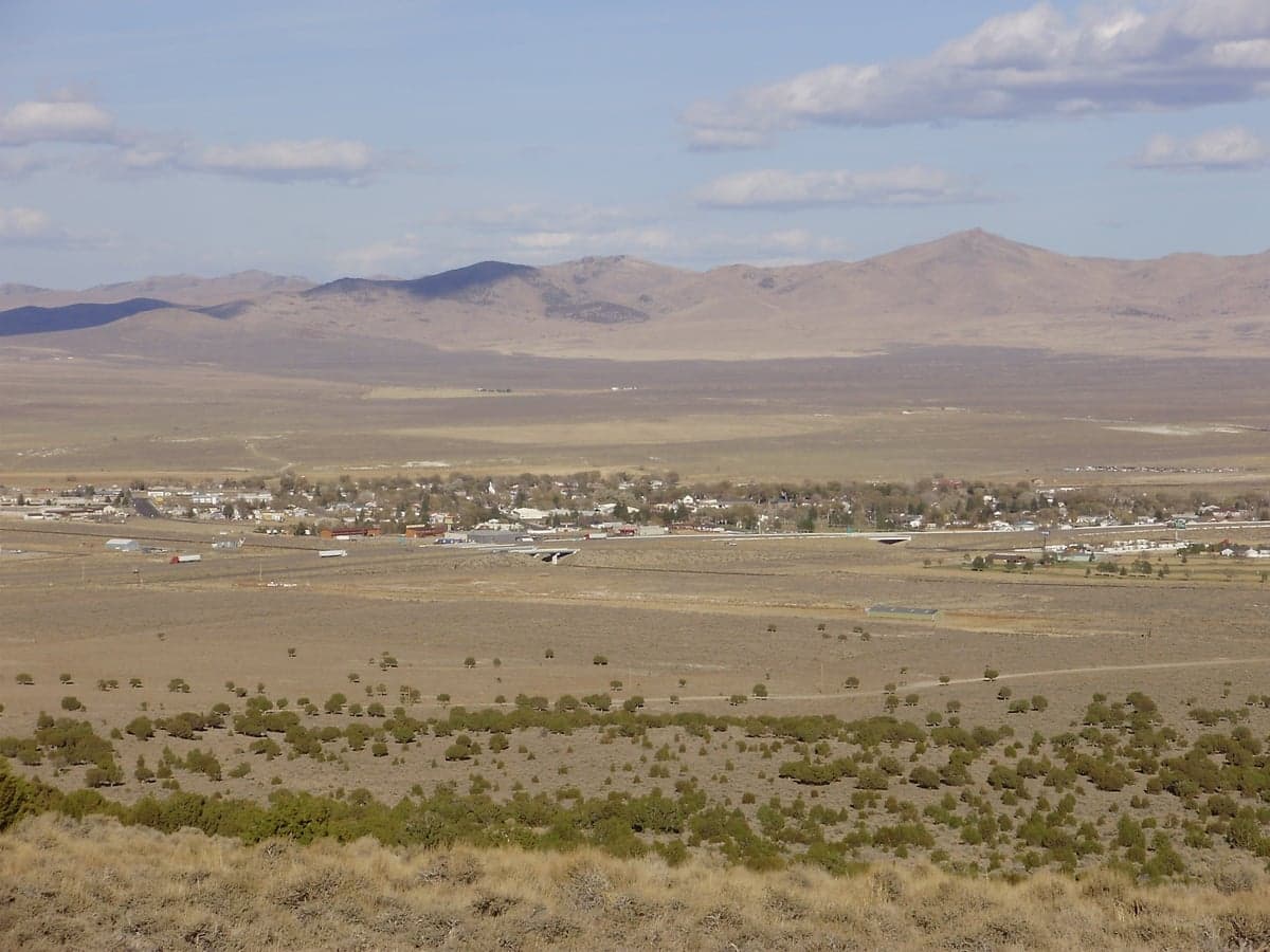
Wells, Nevada, sits as a strategic outlier in the Great Basin, offering a combination of geographic isolation and critical infrastructure that makes it a serious contender for those prioritizing long-term resilience. With a population hovering around 1,200, this former railroad town along I-80 is far enough from major population centers to avoid the immediate fallout of a cascading collapse, yet connected enough to allow for supply runs or evacuation if needed. For the prepper or survivalist looking at the broader picture of civic unrest, supply chain disruptions, or even larger-scale disasters, Wells provides a low-profile base with high survivability potential, provided you understand its specific advantages and liabilities.
Geographic position and natural advantages for long-term survival
Wells occupies a unique niche at the intersection of the Humboldt River and the Ruby Mountains, giving it access to water and high-altitude terrain that many other Nevada towns lack. The Humboldt River, while not a raging torrent, provides a reliable surface water source that can be filtered or diverted for irrigation and livestock, a critical asset if municipal systems fail. The nearby Ruby Mountains and East Humboldt Range offer defensible high ground, with elevations exceeding 11,000 feet, where a retreat cabin or cache could be established for a secondary fallback position. The town itself sits at 5,630 feet, which means winters are cold and snowy, but that same climate discourages casual migration from warmer, more desperate regions during a crisis. The surrounding landscape is open sagebrush steppe, offering long sightlines and limited cover for any approaching threat, which works in favor of a prepared defender. Wells is also roughly 50 miles from the Utah border, providing a potential corridor to the more heavily forested and water-rich Wasatch Front if a full relocation becomes necessary, though that area carries its own population-density risks.
Risks, exposures, and proximity to fallout-relevant landmarks
The most significant risk for Wells is its proximity to I-80, the major east-west interstate that connects San Francisco to the East Coast. In a mass evacuation scenario or during widespread civil unrest, I-80 could become a chokepoint of desperate traffic, looting, and violence. Wells sits directly on that corridor, meaning any large-scale movement of people from the West Coast would pass within a mile of the town. The railroad line running parallel to the highway is a double-edged sword: it could be used for supply transport if the rail network remains functional, but it also makes Wells a potential target for those seeking to control critical infrastructure. Additionally, the town is about 90 miles from the Nevada National Security Site (formerly the Nevada Test Site), where nuclear testing occurred until 1992. While no active testing is happening, the site still handles hazardous materials and could be a target for sabotage or accident. The nearby Tooele Army Depot in Utah, roughly 120 miles away, stores chemical munitions and conventional explosives, adding another layer of risk if a conflict or terrorist event targets military logistics. On the plus side, Wells is far from any major metropolitan area—Reno is 230 miles west, Salt Lake City 180 miles east—so the immediate fallout from a nuclear detonation in a city would not directly threaten the town, though prevailing winds could carry radioactive particles depending on the season.
Practical resilience for a relocator: food, water, energy, and defensibility
For a relocator serious about self-sufficiency, Wells offers a mixed bag. Water is the primary concern: the Humboldt River is seasonal and can run low in drought years, so a well-drilled property with a hand pump or solar-powered pump is non-negotiable. The local water table is generally accessible at depths of 50 to 200 feet, but drilling costs can run $15,000 to $30,000 depending on location. Rainwater catchment is possible, but annual precipitation is only about 10 inches, so it should be treated as a supplement, not a primary source. Food production is limited by the short growing season—roughly 90 frost-free days—but cold-hardy crops like potatoes, carrots, and kale can be grown, and the surrounding rangeland supports cattle and sheep ranching. Establishing relationships with local ranchers for meat, dairy, or barter goods before a crisis is a smart move. Energy is less of a concern: Nevada receives over 300 days of sun per year, making solar panels a reliable investment. Wind is also consistent in the basin, so a small wind turbine could provide backup power during winter overcast. Defensibility is moderate: the town is compact, with a grid layout that makes it easy to establish checkpoints on the main roads, but the surrounding terrain is open, meaning a determined group could approach from multiple directions. A better strategy is to secure a property on the outskirts with a clear field of fire and a secondary escape route into the Ruby Mountains. The local population is small and largely self-reliant, which reduces the risk of internal collapse, but it also means there is no large community to fall back on for mutual aid—you will need to build your own network or operate independently.
The overall strategic picture for Wells is one of calculated trade-offs. It is not a fortress, nor is it a food basket, but it offers a defensible position with access to water, high ground, and a low population density that minimizes the risk of being caught in a mass casualty event or urban collapse. The I-80 corridor is a liability that cannot be ignored, but it also provides a means of egress if the situation deteriorates beyond local control. For the conservative-minded individual or family looking to step off the grid without stepping into a wasteland, Wells represents a viable option—provided you arrive with your own water infrastructure, a solid food storage plan, and a clear understanding that isolation cuts both ways. It is a place to ride out the storm, not to thrive in luxury, and that honesty is its greatest strength.
* Values derived from national, state, county, city and local statistics and may differ in a specific area. Last updated: 2026-04-30T05:57:21.000Z
Narrative content on this page is AI-generated and may contain mistakes. Verify any details that matter before acting on them.
ReloMaps may earn a commission from affiliate links at no extra cost to you.