
Photo: Wikipedia
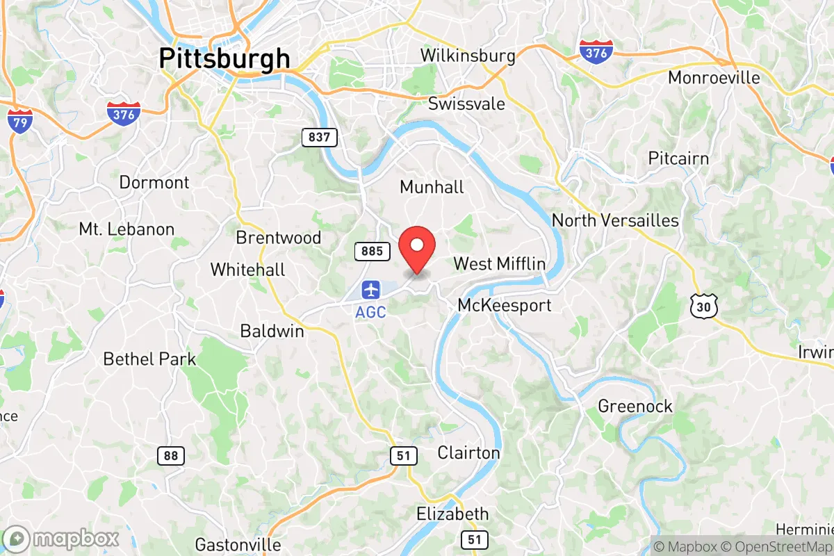
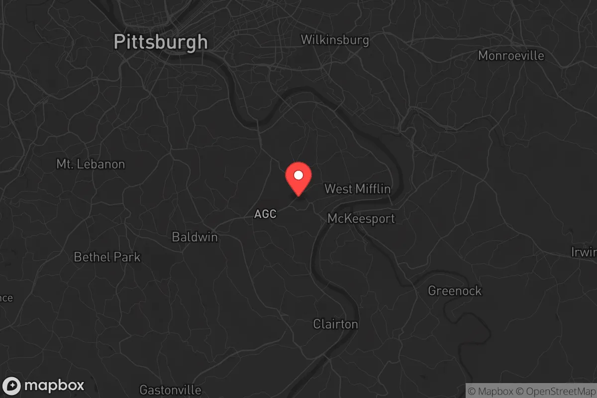
Strategic Assessment of West Mifflin, PA
Meaningful friction. Expect exposure to either population pressure, blast zones, or natural disaster risk. Consider buying a retreat property.
What does the Strategic Assessment tell us?
Our Strategic Assessment grades tactical survivability of an area. Major population centers, military targets, fallout zones, natural disasters, and border exposure all drive risk — lower exposure means a more defensible position in a crisis.
This is heavily inspired by Joel Skousen's Strategic Relocation book. Highly recommended you checkout the book ($)What does this tell us?
Our Strategic Assessment grades tactical survivability of an area. Major population centers, military targets, fallout zones, natural disasters, and border exposure all drive risk — lower exposure means a more defensible position in a crisis.
This is heavily inspired by Joel Skousen's Strategic Relocation book. Highly recommended you checkout the book ($)Strategic Pillars

Key Distances
Regional Safe Places
Below is our recommended "safe zones" in Pennsylvania and the surrounding area based on our strategic heuristics. For most people, it's unrealistic to live in a “safe zone” full-time due to work, family or other personal reasons. They tend to be more rural. However, many of these areas are perfect for second homes and retreat properties that double as a vacation home or even a short-term rental.


Important Note: For informational purposes only. This does not mean nothing bad ever happens in the green zones. Please use common sense. This is based on public data and modeled with AI. We tried to take a conservative approach but mistakes happen. We update this regularly as new information becomes available.
Solar Generator Recommendations
Backup power matters more here than in safer locations. We've picked three solar generators across budgets and capacity tiers — start with the budget unit if you only need a few essentials, or step up if you want to run a fridge and HVAC for days at a time.

Jackery Portable Power Station Explorer 300
Budget OptionPower on the Go: Weighing only 11 lbs, it's convenient to set up and store with book-sized foldable solar panels

BLUETTI Portable Power Station AC180
Designed for both indoor and outdoor scenarios, AC180 is highly capable as it has a robost capacity and continuous output power.

EF ECOFLOW DELTA Pro Ultra Power Station
Upgraded PickEcoFlow DELTA Pro Ultra is a whole-home energy system designed to grow with your family. Integrated with the Smart Home Panel 2, it scales to meet your evolving energy needs — keeping your home powered, intelligent, and secure through every stage of life.
We earn a commission, at no additional cost to you.
Strategic Assessment Analysis
West Mifflin, Pennsylvania, sits in a precarious but potentially advantageous position for those serious about strategic relocation. Located just 10 miles southeast of downtown Pittsburgh, this borough of roughly 20,000 people offers a mix of suburban stability and industrial history, but its real value lies in how it balances proximity to a major city with access to the rugged terrain of the Appalachian foothills. For the prepper or survivalist, West Mifflin presents a calculated trade-off: you get the economic and logistical benefits of being near a regional hub, but you must also accept the risks that come with that proximity, especially in a world where civic unrest, supply chain collapse, or a mass casualty event could turn any major metro into a liability.
Geographic position and natural advantages for long-term security
West Mifflin’s location along the Monongahela River gives it a critical natural resource: a reliable, large-volume water source. In a grid-down scenario or during a prolonged disaster, surface water access is non-negotiable, and the Monongahela is a major navigable river that feeds into the Ohio River system. The surrounding terrain is rolling hills and wooded valleys, part of the Allegheny Plateau, which provides natural cover and defensible positions compared to flat, open farmland. The borough itself sits on elevated ground relative to the river, reducing flood risk for most residential areas, though low-lying zones near the water remain vulnerable. The region’s temperate climate means four distinct seasons, with cold winters that can be harsh but also act as a natural barrier to movement and a check on pest-borne diseases. The soil in the area is a mix of clay and loam, workable for small-scale gardening if amended, and the surrounding forests offer hardwood for fuel, construction, and wildlife for hunting. For a relocator, the key advantage is that West Mifflin is not a sprawling, flat suburb—it’s a compact, hilly community with natural chokepoints and escape routes into the less-populated counties to the east and south, like Fayette and Somerset.
Risks, exposures, and proximity to fallout-relevant landmarks
The biggest strategic downside to West Mifflin is its proximity to high-value targets and potential fallout zones. Pittsburgh is a major industrial, transportation, and energy hub, with multiple bridges, tunnels, and chemical plants that could be primary or secondary targets in a conflict or terrorist event. The borough itself is within the blast and fallout radius of several critical infrastructure sites. Most notably, West Mifflin is home to the Clairton Coke Works, one of the largest coke production facilities in the world, located just across the Monongahela River. This plant processes coal into coke for steelmaking and releases a steady stream of industrial emissions, but in a disaster scenario, it could become a catastrophic hazard—either through accidental explosion, targeted attack, or simply failing and releasing toxic clouds. The nearby U.S. Steel Edgar Thomson Plant in Braddock and the Irvin Plant in West Mifflin itself are additional industrial sites that could become liabilities. For the prepper, living within a few miles of these facilities means you must have a plan for rapid evacuation or shelter-in-place with HEPA filtration and sealed rooms. Additionally, the borough is within 20 miles of the Pittsburgh International Airport, a potential military logistics hub, and the Bettis Atomic Power Laboratory in West Mifflin, a naval nuclear propulsion facility. While Bettis is a low-profile site, any nuclear-related facility is a psychological and practical risk in a world of asymmetric threats. The dense highway network—Interstate 376, Route 51, and the Parkway East—means that in a mass evacuation event, West Mifflin’s roads will clog quickly, turning the borough into a trap rather than a sanctuary.
Practical resilience for a relocator: food, water, energy, and defensibility
For the individual or family looking to establish a resilient household in West Mifflin, the practical picture is mixed but workable with preparation. Water is the strongest asset: the Monongahela River is a year-round, high-volume source, but it requires treatment—filtration, boiling, or chemical purification—due to industrial runoff and agricultural contamination upstream. A well is uncommon in the borough’s denser neighborhoods, but properties on the eastern edge or in adjacent communities like Jefferson Hills or Elizabeth Township may have private wells. Food security is moderate. The area has a growing season from April to October, and community gardens exist, but the soil quality in the immediate borough is poor due to decades of industrial activity. Raised beds with imported soil are the practical solution. Local farmers’ markets and the proximity to rural Allegheny County farms provide some buffer, but a serious prepper should plan for at least a six-month stored supply. Energy resilience is a challenge. West Mifflin is fully dependent on the grid, and while natural gas is common for heating, a prolonged outage would leave most homes cold. Solar is viable—the region gets about 160 sunny days per year, below the national average but sufficient for a modest off-grid system with battery storage. Wood stoves are a smart addition, given the surrounding forests. Defensibility is the weakest point. West Mifflin is a suburban borough with a typical street grid, not a rural homestead with a long driveway and sightlines. Your neighbors are close, and in a collapse scenario, you cannot control your perimeter. The best strategy is to choose a home on a cul-de-sac, near a greenbelt or wooded ravine, with a single access point. The borough’s police force is small—around 30 officers—and would be overwhelmed in a major event. Mutual aid from Allegheny County Sheriff’s office is possible but slow. For the serious prepper, West Mifflin is a base of operations, not a final redoubt. It works if you have a secondary bug-out location in the deeper rural areas of Somerset or Bedford counties, within a two-hour drive.
The overall strategic picture for West Mifflin is that of a calculated compromise. It offers the economic stability of a Pittsburgh suburb—jobs, healthcare, schools—while sitting on the edge of the Appalachian wilderness that provides escape routes and natural resources. The risks are real: industrial hazards, proximity to a major city, and a suburban layout that is hard to defend. But for the conservative-minded relocator who values community, local governance, and the ability to blend in while preparing, West Mifflin is a viable option. It is not a survivalist paradise, but it is a place where a prepared family can weather moderate disruptions and have a plan for the worst. The key is to treat it as a forward operating base, not a fortress, and to invest in mobility, water purification, and a network of trusted neighbors who share your outlook. In a world where the state of the country is uncertain, West Mifflin gives you a foothold near resources without being trapped in the urban core. That alone makes it worth a serious look.
* Values derived from national, state, county, city and local statistics and may differ in a specific area. Last updated: 2026-04-24T12:03:21.000Z
Narrative content on this page is AI-generated and may contain mistakes. Verify any details that matter before acting on them.
ReloMaps may earn a commission from affiliate links at no extra cost to you.