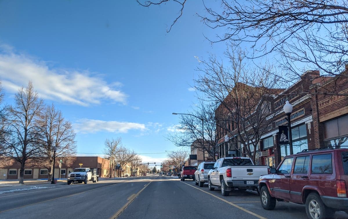
Photo: Wikipedia
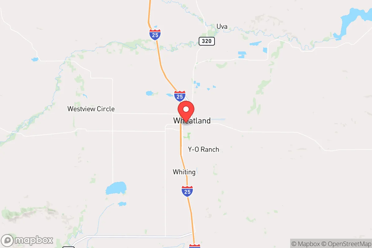
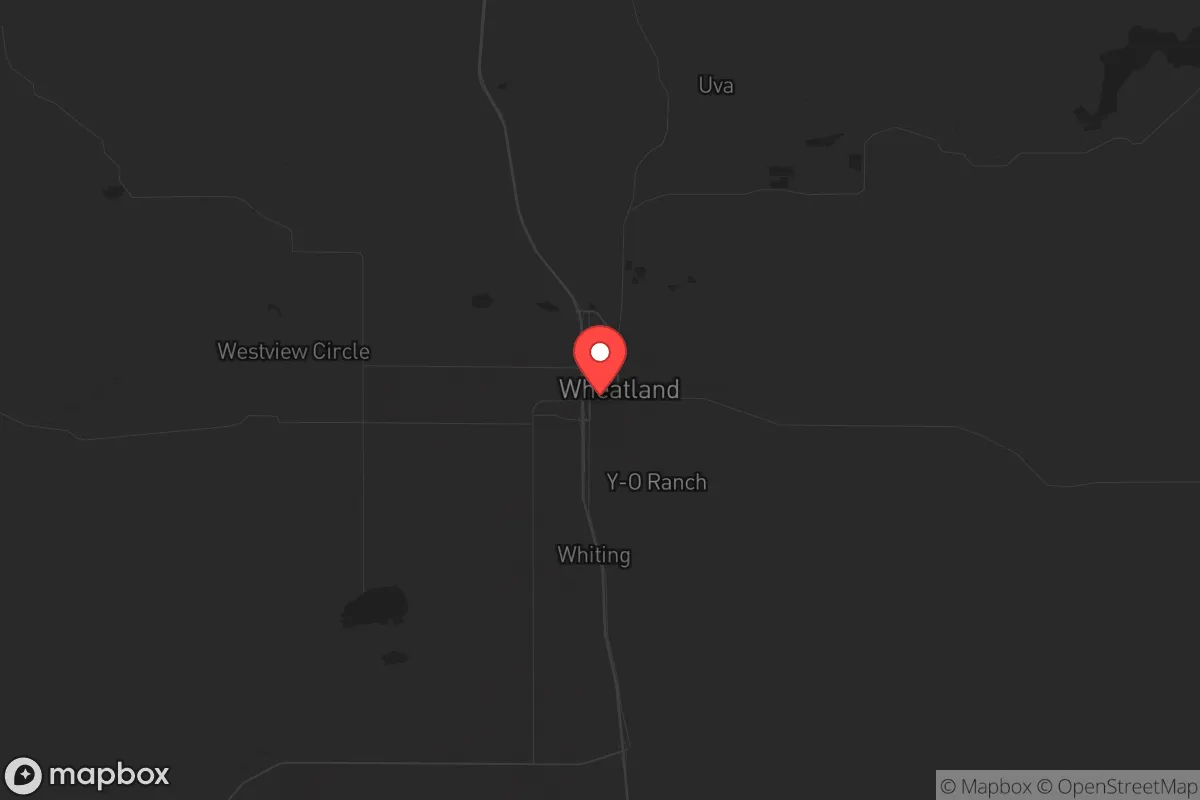
Strategic Assessment of Wheatland, WY
Strong survivability profile. Good buffer from population centers, with manageable environmental and tactical risks.
What does the Strategic Assessment tell us?
Our Strategic Assessment grades tactical survivability of an area. Major population centers, military targets, fallout zones, natural disasters, and border exposure all drive risk — lower exposure means a more defensible position in a crisis.
This is heavily inspired by Joel Skousen's Strategic Relocation book. Highly recommended you checkout the book ($)What does this tell us?
Our Strategic Assessment grades tactical survivability of an area. Major population centers, military targets, fallout zones, natural disasters, and border exposure all drive risk — lower exposure means a more defensible position in a crisis.
This is heavily inspired by Joel Skousen's Strategic Relocation book. Highly recommended you checkout the book ($)Strategic Pillars

Key Distances
Regional Safe Places
Below is our recommended "safe zones" in Wyoming and the surrounding area based on our strategic heuristics. For most people, it's unrealistic to live in a “safe zone” full-time due to work, family or other personal reasons. They tend to be more rural. However, many of these areas are perfect for second homes and retreat properties that double as a vacation home or even a short-term rental.
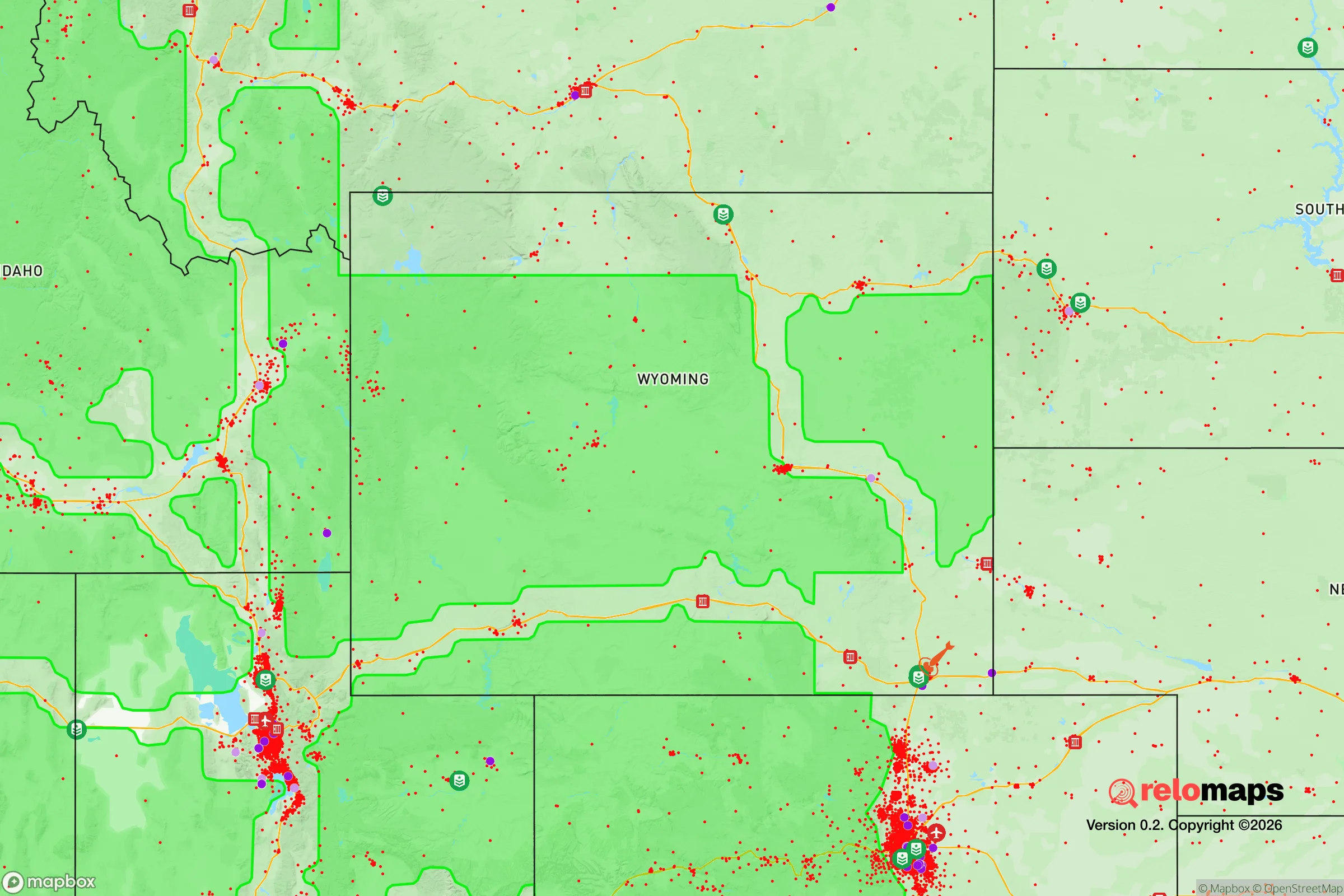
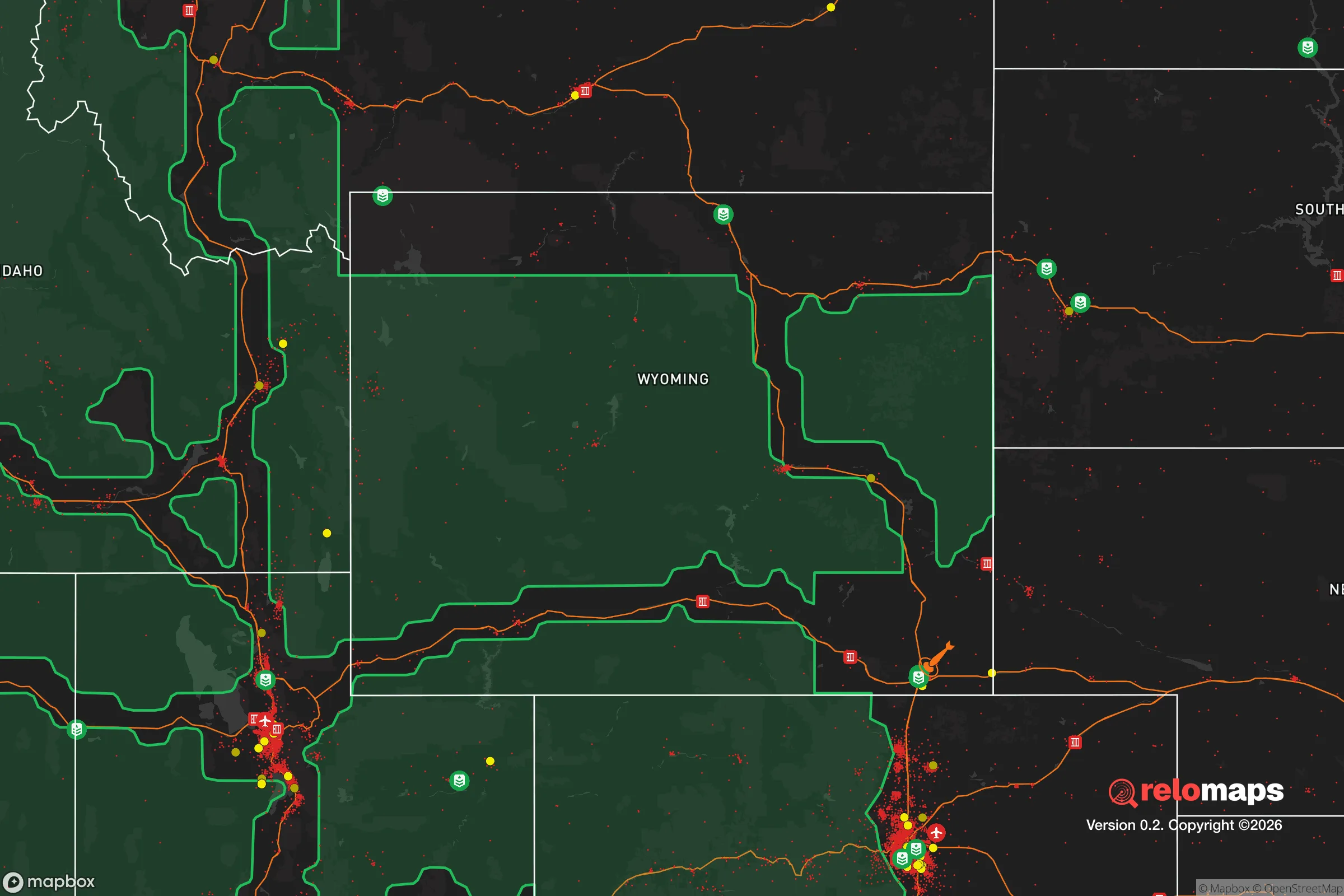
Important Note: For informational purposes only. This does not mean nothing bad ever happens in the green zones. Please use common sense. This is based on public data and modeled with AI. We tried to take a conservative approach but mistakes happen. We update this regularly as new information becomes available.
Solar Generator Recommendations
Backup power matters more here than in safer locations. We've picked three solar generators across budgets and capacity tiers — start with the budget unit if you only need a few essentials, or step up if you want to run a fridge and HVAC for days at a time.

Jackery Portable Power Station Explorer 300
Budget OptionPower on the Go: Weighing only 11 lbs, it's convenient to set up and store with book-sized foldable solar panels

BLUETTI Portable Power Station AC180
Designed for both indoor and outdoor scenarios, AC180 is highly capable as it has a robost capacity and continuous output power.

EF ECOFLOW DELTA Pro Ultra Power Station
Upgraded PickEcoFlow DELTA Pro Ultra is a whole-home energy system designed to grow with your family. Integrated with the Smart Home Panel 2, it scales to meet your evolving energy needs — keeping your home powered, intelligent, and secure through every stage of life.
We earn a commission, at no additional cost to you.
Strategic Assessment Analysis
Wheatland, Wyoming, sits in a strategic sweet spot that few relocation analysts fully appreciate: it is far enough from the Front Range urban corridor to avoid the blast radii and fallout plumes of Cheyenne (70 miles east) and Denver (120 miles south), yet close enough to access those cities’ medical and supply hubs if conditions permit. The town’s position along the North Platte River, combined with its low population density (roughly 3,600 residents in the town, with Platte County under 9,000), makes it a defensible, resource-rich pocket in a state that consistently ranks among the most politically stable and constitutionally protective in the union. For a relocator thinking in terms of decades, not months, Wheatland offers a rare combination of isolation and logistical reach.
Geographic position and natural advantages for long-term security
Wheatland’s geography is its primary asset. The town sits on the high plains at 4,800 feet, with the Laramie Range rising to the west and the Medicine Bow National Forest within a 45-minute drive. This positioning provides natural barriers against large-scale movement—anyone approaching from the east or south must cross open, exposed terrain that offers little cover. The North Platte River runs through the county, providing a reliable surface water source that is rare in the arid West. The area’s groundwater is also plentiful, with the High Plains Aquifer underlying much of the region. For a prepper, this means you are not dependent on a single municipal supply; private wells are common and legally protected in Wyoming. The climate is semi-arid, with cold winters and hot summers, but the growing season (roughly 120 days) is sufficient for cold-hardy crops like potatoes, carrots, and grains. The surrounding ranchland—primarily cattle and hay—means that local food production is already established, and land prices remain affordable compared to Colorado or Montana. A 40-acre parcel with water rights can still be found under $200,000, which is a fraction of what similar land costs in the Front Range exurbs.
Risks, exposures, and proximity to fallout-relevant landmarks
No location is without risk, and Wheatland has specific exposures that a strategic relocator must weigh. The most significant is the presence of the Laramie River Station, a coal-fired power plant about 20 miles west of town. While the plant provides local energy and jobs, it is a potential target for sabotage or grid-down scenarios. The plant’s coal ash ponds also pose a long-term environmental risk if neglected. Additionally, the Union Pacific rail line runs through Platte County, carrying hazardous materials between the Powder River Basin and the rest of the country. A derailment or attack on that line could release toxic chemicals or disrupt supply chains. On the positive side, Wheatland is not near any nuclear power plants (the closest is Fort Calhoun in Nebraska, over 300 miles east), and it is well outside the fallout zones of any major military installations. F.E. Warren Air Force Base in Cheyenne (ICBM silos) is a concern, but prevailing winds blow east, meaning fallout from a strike on Warren would travel toward Nebraska, not Wyoming. The town’s distance from Denver and Cheyenne also means it is unlikely to see refugee flows from a major urban disaster—the open plains and limited road network (primarily I-25 and US-26) act as natural chokepoints that can be monitored or controlled.
Practical resilience for a relocator: food, water, energy, and defensibility
For a single individual or family looking to establish a resilient homestead, Wheatland offers a workable baseline. Water is the strongest asset: the North Platte River flows year-round, and the local irrigation districts have senior water rights that predate most municipal systems. A well-drilling permit in Platte County costs under $200, and the average well depth is 150-300 feet, producing 10-30 gallons per minute. Food security is supported by the county’s agricultural base—there are multiple feed stores, a local grain elevator, and a farmers’ market that operates from June through October. The town has a small but functional grocery store (Ridley’s), and the surrounding ranches sell beef and lamb directly. For long-term storage, the dry climate reduces spoilage risk. Energy resilience is mixed: the grid is served by Rocky Mountain Power, which has a history of outages during winter storms. However, Wyoming has some of the most permissive solar and wind regulations in the country, and off-grid systems are legal without bureaucratic hurdles. A 5kW solar array with battery storage can be installed for under $15,000, and the area averages 260 sunny days per year. Defensibility is where Wheatland truly shines. The town is laid out on a grid with wide streets and clear sightlines. The surrounding terrain is flat to gently rolling, meaning any approach is visible from miles away. The local sheriff’s office is well-funded (Platte County has a low crime rate and a tax base supported by agriculture and energy), and Wyoming’s constitutional carry law means that armed self-defense is legally straightforward. The nearest National Guard unit is in Cheyenne, but for day-to-day security, the community is tight-knit and self-reliant—neighbors know each other, and the “live and let live” ethos of rural Wyoming discourages outside interference.
The overall strategic picture for Wheatland is one of moderate risk with high reward for those who plan ahead. It is not a bug-out location for a weekend—it is a place to build a life that can withstand the shocks of the next decade. The town’s isolation is both its strength and its limitation: you will need to stockpile medical supplies, ammunition, and specialized equipment because the nearest major hospital is 70 miles away in Cheyenne. But for a relocator who values freedom, water, and defensible space over convenience, Wheatland represents one of the better options in the Intermountain West. The political climate is overwhelmingly conservative (Platte County voted 80% for Trump in 2020), the tax burden is low (no state income tax, low property taxes), and the culture is one of mutual aid rather than government dependency. If you are looking for a place to ride out the storm—whatever form it takes—Wheatland deserves a serious look.
* Values derived from national, state, county, city and local statistics and may differ in a specific area. Last updated: 2026-04-21T11:40:03.000Z
Narrative content on this page is AI-generated and may contain mistakes. Verify any details that matter before acting on them.
ReloMaps may earn a commission from affiliate links at no extra cost to you.