Photo: Wikipedia
Strategic Assessment of Worland, WY
Strong survivability profile. Good buffer from population centers, with manageable environmental and tactical risks.
What does the Strategic Assessment tell us?
Our Strategic Assessment grades tactical survivability of an area. Major population centers, military targets, fallout zones, natural disasters, and border exposure all drive risk — lower exposure means a more defensible position in a crisis.
This is heavily inspired by Joel Skousen's Strategic Relocation book. Highly recommended you checkout the book ($)What does this tell us?
Our Strategic Assessment grades tactical survivability of an area. Major population centers, military targets, fallout zones, natural disasters, and border exposure all drive risk — lower exposure means a more defensible position in a crisis.
This is heavily inspired by Joel Skousen's Strategic Relocation book. Highly recommended you checkout the book ($)Strategic Pillars

Key Distances
Regional Safe Places
Below is our recommended "safe zones" in Wyoming and the surrounding area based on our strategic heuristics. For most people, it's unrealistic to live in a “safe zone” full-time due to work, family or other personal reasons. They tend to be more rural. However, many of these areas are perfect for second homes and retreat properties that double as a vacation home or even a short-term rental.
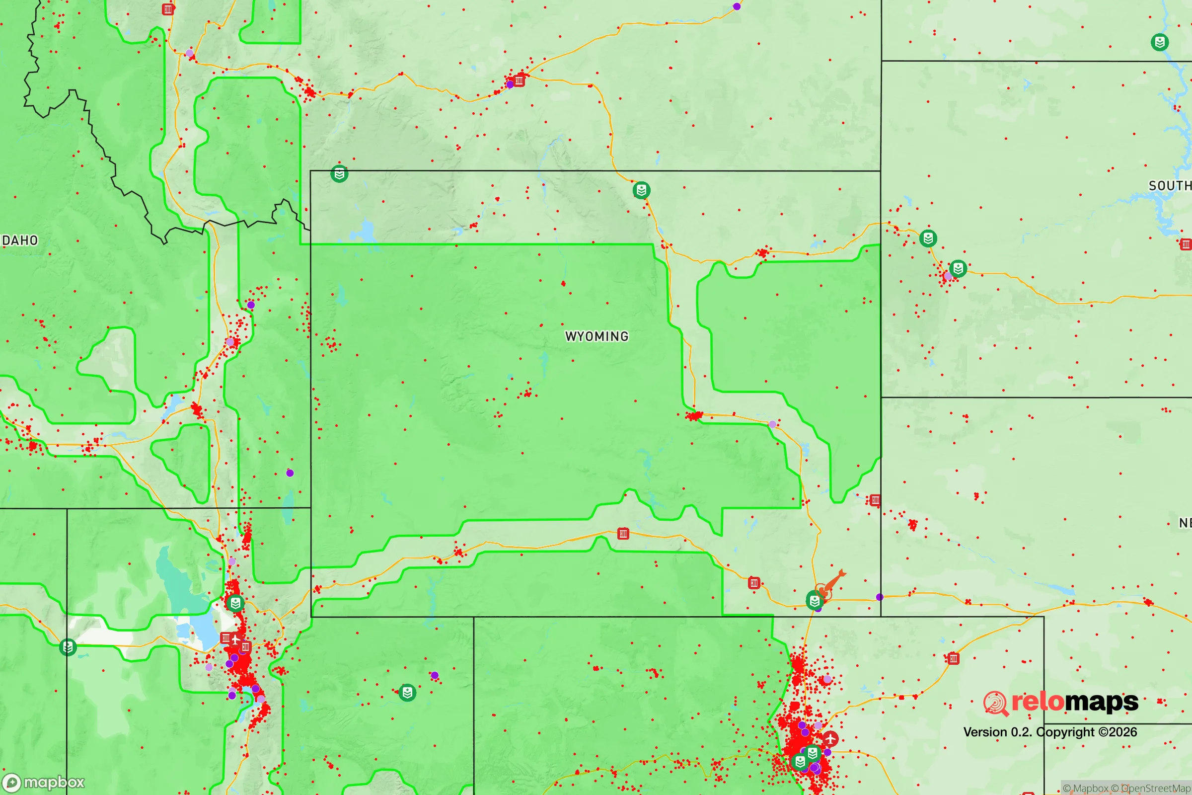
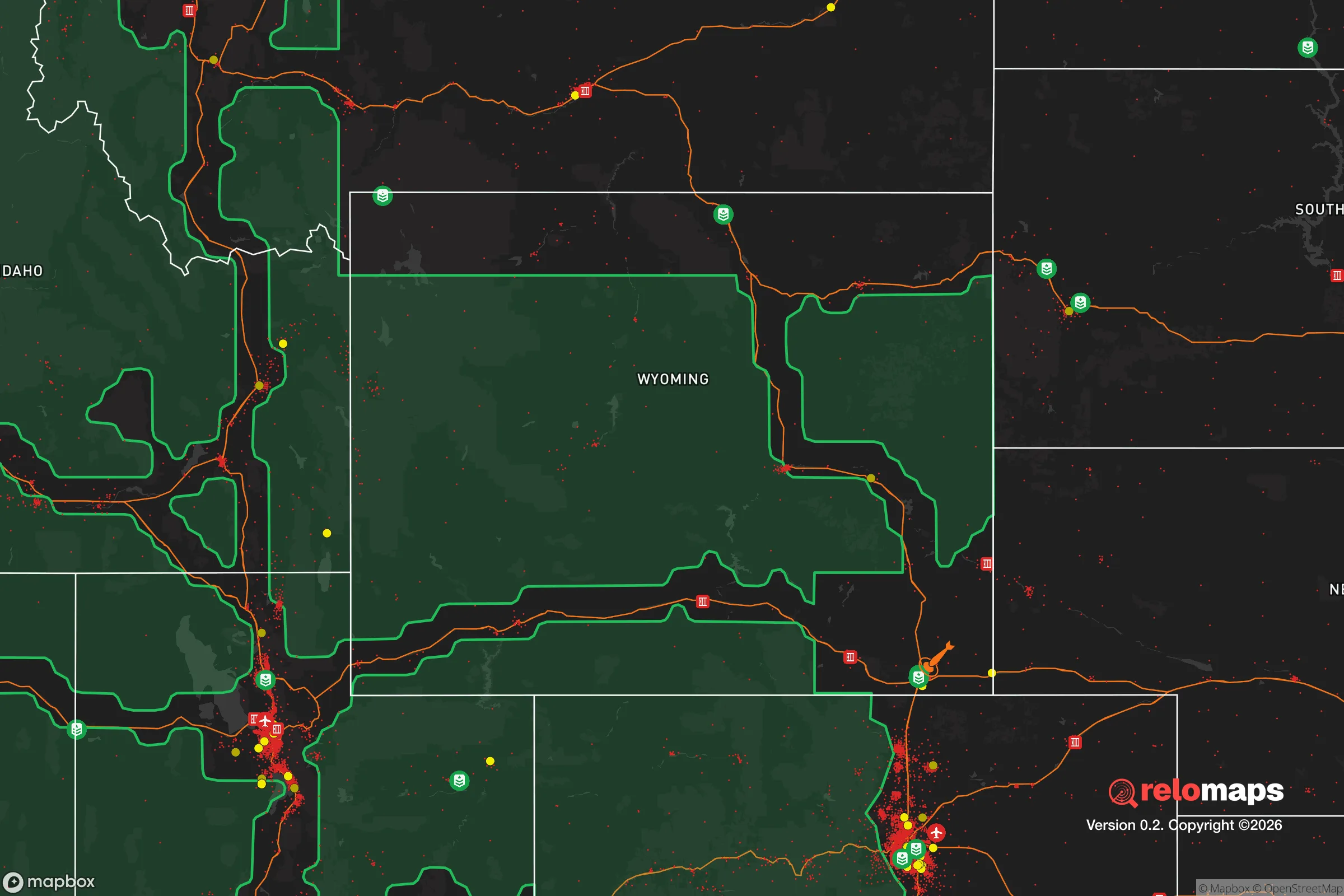
Important Note: For informational purposes only. This does not mean nothing bad ever happens in the green zones. Please use common sense. This is based on public data and modeled with AI. We tried to take a conservative approach but mistakes happen. We update this regularly as new information becomes available.
Solar Generator Recommendations
Backup power matters more here than in safer locations. We've picked three solar generators across budgets and capacity tiers — start with the budget unit if you only need a few essentials, or step up if you want to run a fridge and HVAC for days at a time.

Jackery Portable Power Station Explorer 300
Budget OptionPower on the Go: Weighing only 11 lbs, it's convenient to set up and store with book-sized foldable solar panels

BLUETTI Portable Power Station AC180
Designed for both indoor and outdoor scenarios, AC180 is highly capable as it has a robost capacity and continuous output power.

EF ECOFLOW DELTA Pro Ultra Power Station
Upgraded PickEcoFlow DELTA Pro Ultra is a whole-home energy system designed to grow with your family. Integrated with the Smart Home Panel 2, it scales to meet your evolving energy needs — keeping your home powered, intelligent, and secure through every stage of life.
We earn a commission, at no additional cost to you.
Strategic Assessment Analysis
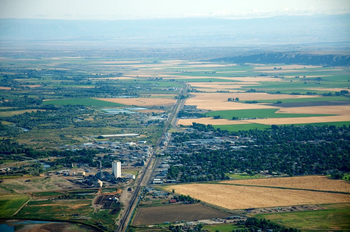
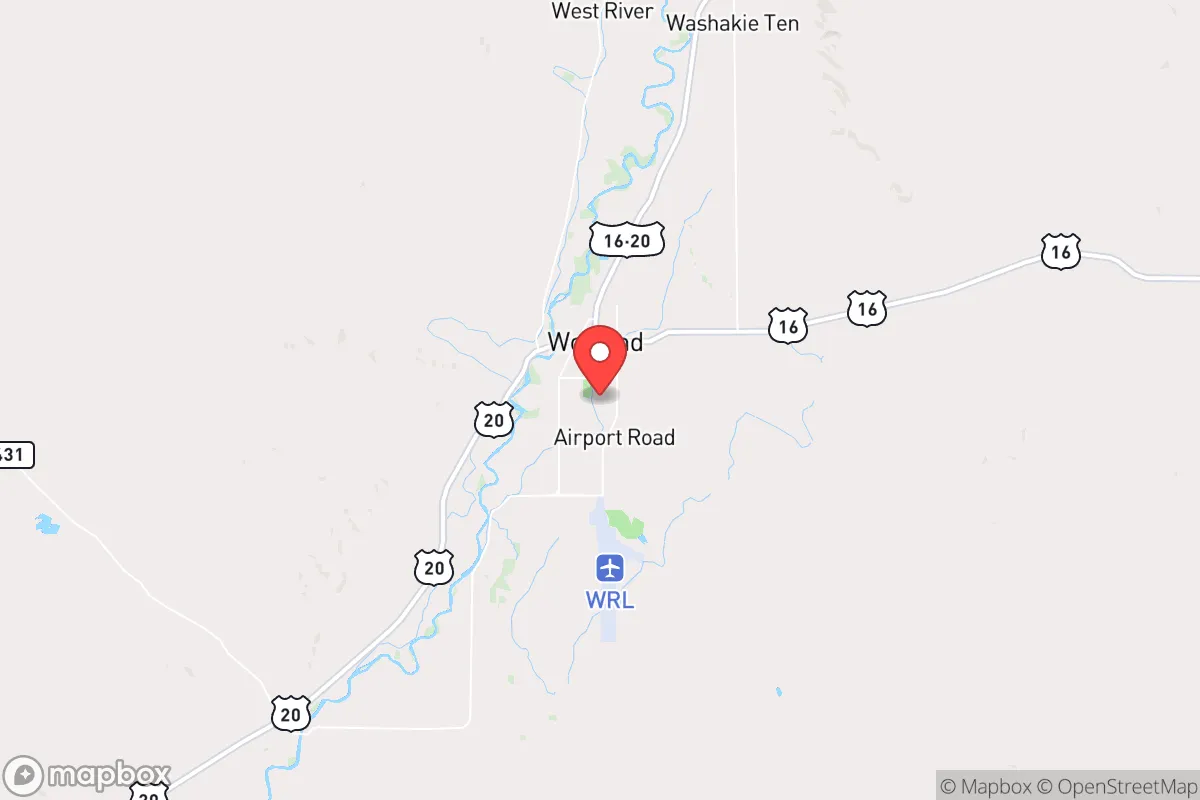
Worland, Wyoming, offers a compelling strategic position for those prioritizing resilience and self-sufficiency, sitting in the Big Horn Basin roughly 100 miles from any significant population center. Its isolation from major interstates and cities like Billings or Casper provides a natural buffer against the cascading effects of civic unrest or mass casualty events, while the surrounding agricultural land and access to the Big Horn River create a foundation for long-term sustainability. For a relocator with a prepper mindset, Worland represents a low-profile, defensible location that trades convenience for security in a world of increasing uncertainty.
Geographic position and natural advantages for long-term security
Worland’s location in the Big Horn Basin is defined by natural barriers that enhance its strategic value. The Big Horn Mountains to the east and the Absaroka Range to the west create a bowl-like geography that limits easy access, funneling traffic through a few key routes like US-20 and WY-431. This chokepoint effect means any large-scale movement of people or goods into the area can be monitored or controlled, a critical advantage during widespread unrest. The basin itself sits at roughly 4,000 feet elevation, with a semi-arid climate that reduces the risk of flooding or storm-related infrastructure failures common in coastal or riverine zones. The Big Horn River runs directly through town, providing a reliable surface water source that can be treated or diverted for irrigation, and the area’s groundwater aquifers are generally abundant—a key factor when municipal systems might fail. The surrounding ranchlands and irrigated fields (primarily alfalfa, sugar beets, and barley) mean local food production is already established, reducing dependence on long supply chains that are vulnerable to disruption. For a relocator, this geography offers a rare combination of natural defense, water security, and agricultural potential that few other rural towns in the West can match.
Risks, exposures, and proximity to fallout-relevant landmarks
While Worland’s isolation is a strength, it is not without exposure to risks that a survivalist must weigh. The town sits roughly 80 miles from the Yellowstone Caldera, a supervolcano that, in a worst-case eruption, could blanket the region in ash and disrupt air travel, water supplies, and agriculture for years. However, the prevailing winds typically carry ash eastward, and the Big Horn Basin’s geography may offer some shelter from the heaviest deposits. More immediate concerns include the town’s proximity to the Wind River Indian Reservation (about 30 miles south), which has experienced periodic civil unrest and resource disputes that could spill over into Worland during a collapse scenario. The nearest major military installation is F.E. Warren Air Force Base in Cheyenne (over 200 miles away), which is a potential target in a conflict but far enough to avoid direct fallout. The town itself has no nuclear power plants or major industrial hazards, but the nearby oil and gas fields (including the Madden Deep Unit) could become targets for sabotage or attract unwanted attention during energy shortages. The biggest risk is the town’s reliance on a single major highway (US-20) for resupply; a bridge failure or blockage near Thermopolis could isolate Worland for weeks. For a relocator, these risks are manageable with proper planning—stockpiling supplies, diversifying water sources, and maintaining a low profile—but they require honest assessment rather than blind optimism.
Practical resilience for a relocator: food, water, energy, and defensibility
Worland’s practical resilience hinges on its existing infrastructure and the ability to adapt it for self-sufficiency. The Big Horn River provides a year-round water source that can be accessed with a simple pump or gravity-fed system, and the town’s municipal water comes from deep wells that are less vulnerable to surface contamination. For food, the surrounding agricultural base means local farmers’ markets, co-ops, and direct-from-ranch meat are available even in normal times; a relocator with land can tap into irrigation districts to grow crops, and the short growing season (about 120 frost-free days) is suitable for cold-hardy vegetables, grains, and hay. Energy is a mixed bag: Worland is served by Rocky Mountain Power, with grid reliability that is average for rural Wyoming, but the area has significant wind and solar potential—the basin averages over 200 sunny days per year, and small-scale wind turbines can supplement solar panels during winter. Natural gas is available in town, but a prepper should plan for off-grid heating via wood or propane, as the grid is vulnerable to winter storms that can knock out power for days. Defensibility is strong due to the town’s layout: it’s compact (roughly 5,000 residents), with a few main roads that can be barricaded or monitored, and the surrounding open country offers clear sightlines. The local sheriff’s office and a small police force provide baseline security, but in a prolonged crisis, community cohesion will matter more—and Worland’s small-town culture, with a strong ranching and Mormon influence, tends toward self-reliance and mutual aid. For a relocator, the key is to secure a property with its own well, south-facing solar exposure, and enough acreage for a garden and small livestock; this is achievable here at prices far below those in Colorado or Montana.
The overall strategic picture for Worland is one of calculated trade-offs: it offers genuine resilience through isolation, water access, and agricultural potential, but demands that a relocator accept a slower pace of life, harsh winters, and the need to build local relationships for long-term security. It is not a bug-out location for a weekend prepper—it’s a place to put down roots, establish a sustainable homestead, and wait out the storms that are coming for the rest of the country. For those willing to invest the time and effort, Worland provides a rare combination of natural defense and practical resources that few other towns in the lower 48 can match, all while staying under the radar of the chaos that will inevitably engulf the coasts and major cities. The question is not whether this area can survive—it’s whether you can adapt to its demands before the window closes.
* Values derived from national, state, county, city and local statistics and may differ in a specific area. Last updated: 2026-04-21T11:31:26.000Z
Narrative content on this page is AI-generated and may contain mistakes. Verify any details that matter before acting on them.
ReloMaps may earn a commission from affiliate links at no extra cost to you.