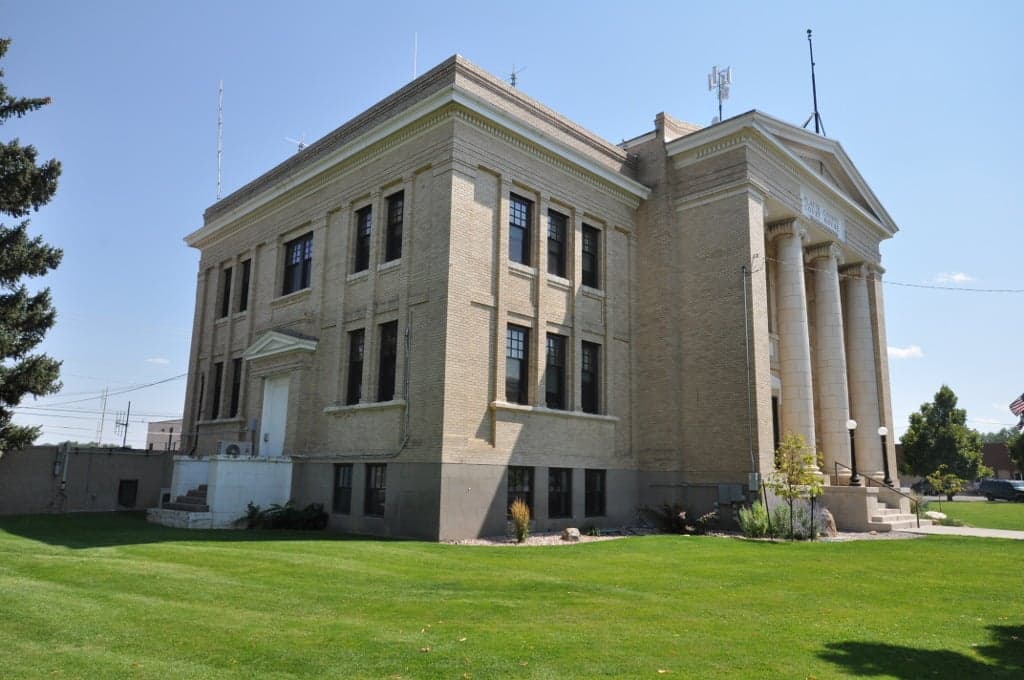
Photo: Wikipedia
Strategic Assessment of Platte County
Deep buffer from population centers and strategic targets. Low natural disaster risk and minimal exposure to border or coastal threats.
What does the Strategic Assessment tell us?
Our Strategic Assessment grades tactical survivability of an area. Major population centers, military targets, fallout zones, natural disasters, and border exposure all drive risk — lower exposure means a more defensible position in a crisis.
This is heavily inspired by Joel Skousen's Strategic Relocation book. Highly recommended you checkout the book ($)What does this tell us?
Our Strategic Assessment grades tactical survivability of an area. Major population centers, military targets, fallout zones, natural disasters, and border exposure all drive risk — lower exposure means a more defensible position in a crisis.
This is heavily inspired by Joel Skousen's Strategic Relocation book. Highly recommended you checkout the book ($)Strategic Pillars

Key Distances
Strategic Assessment Analysis
Platte County, Wyoming, occupies a strategic sweet spot in the American West that resilience-minded relocators should study closely. Its position roughly 80 miles north of Cheyenne and 100 miles southeast of Casper places it within a day’s drive of major Front Range cities like Denver and Colorado Springs, yet far enough from those population centers to avoid their immediate fallout risks and congestion. The county’s low population density—roughly 8,500 residents spread across 2,100 square miles—combined with its agricultural backbone and access to the North Platte River corridor gives it a baseline resilience that many more crowded or arid counties lack. For a single individual or family weighing disaster readiness alongside daily livability, Platte County offers a rare combination of remoteness and functional connectivity.
Geographic position and natural advantages for long-term security
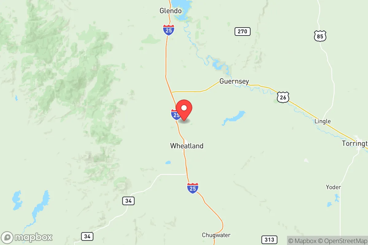
Platte County sits in the High Plains region of southeastern Wyoming, where the North Platte River cuts a fertile valley through otherwise semi-arid grasslands. The county seat, Wheatland, anchors the population along the Interstate 25 corridor, while smaller communities like Chugwater and Guernsey dot the rural landscape. This geography provides several natural advantages: the North Platte River and its tributaries offer a reliable surface water source—critical in a state where water rights are fiercely contested—and the surrounding plains support cattle ranching and dryland wheat farming. The Laramie Range rises to the west, offering a natural barrier that buffers the county from the worst of Wyoming’s winter winds while also providing timber and wildlife resources. For a relocator, the key takeaway is that Platte County sits in a zone where water is relatively abundant compared to much of the Intermountain West, and the agricultural land base means local food production is not just theoretical but ongoing.
Risk exposure, fallout proximity, and man-made hazards to consider
No resilience assessment is honest without weighing the risks, and Platte County has several that demand attention. The most immediate concern is its proximity to F.E. Warren Air Force Base near Cheyenne, roughly 70 miles south, which houses a significant portion of America’s intercontinental ballistic missile (ICBM) force. While the base itself is a potential target in a major conflict, the missile silos are dispersed across a wide area of southeastern Wyoming and northern Colorado, meaning Platte County lies within the broader strategic footprint of the U.S. nuclear deterrent. Additionally, the county sits within 150 miles of the Rocky Mountain Arsenal site near Denver (now a wildlife refuge but historically a chemical weapons manufacturing facility) and the Platte River corridor that runs through Denver’s urban-industrial complex. On the natural hazard side, the region experiences occasional severe winter storms, tornadoes (though less frequent than in the Great Plains proper), and drought cycles that can stress agricultural operations. The county’s low population density and lack of major industrial targets—no refineries, no major ports, no large-scale manufacturing—actually work in its favor here, as the most likely man-made risks are secondary fallout from strikes on Cheyenne or Denver rather than direct targeting.
Practical resilience for a relocator: food, water, energy, and defensibility
For someone serious about self-sufficiency, Platte County offers a workable foundation with some important caveats. Food production is the county’s strongest suit: the North Platte Valley supports irrigated alfalfa, corn, and small grains, while cattle ranching dominates the uplands. Wheatland hosts a regional agricultural supply chain, and local farmers’ markets operate seasonally. A relocator with acreage could reasonably establish a kitchen garden and small livestock operation, though the short growing season (roughly 120 frost-free days) limits what can be grown. Water access is better than in most of Wyoming: the North Platte River flows year-round, and groundwater is available via wells in the alluvial aquifer, though new well permits are subject to state oversight and senior water rights holders take priority during drought. Energy resilience is mixed: the county is served by Rocky Mountain Power (a PacifiCorp subsidiary) with grid electricity from coal and natural gas plants, plus some wind generation. Off-grid solar is viable given the region’s 260+ sunny days per year, but winter snow accumulation and short daylight hours require battery storage and backup generation. Defensibility is where Platte County shines: the dispersed settlement pattern, long sightlines across open plains, and limited road access points (primarily I-25 and a handful of state highways) make it relatively easy to monitor and control movement. The county’s sheriff’s office is professional but small, so community self-reliance is the norm rather than the exception. For a family, the trade-off is that medical care is limited to Wheatland’s small hospital (Platte County Memorial) with serious emergencies requiring a 90-minute drive to Cheyenne or Casper.
The overall strategic picture for Platte County is one of moderate-to-strong resilience with clear trade-offs. It avoids the worst fallout risks of the Front Range urban corridor while retaining access to its economic and medical resources. Its agricultural base and water availability give it a genuine food-security advantage over most of the Mountain West. The downsides—proximity to ICBM infrastructure, limited medical capacity, harsh winters—are real but manageable for a prepared relocator. For the conservative-leaning individual or family looking to balance self-sufficiency with practical livability, Platte County represents a defensible middle ground: remote enough to matter, connected enough to function, and grounded in a working landscape that has sustained people for over a century.

* Values derived from national, state, county, city and local statistics and may differ in a specific area. Last updated: 2026-08-08T12:04:02.000Z
Narrative content on this page is AI-generated and may contain mistakes. Verify any details that matter before acting on them.
ReloMaps may earn a commission from affiliate links at no extra cost to you.

