
Photo: Wikipedia
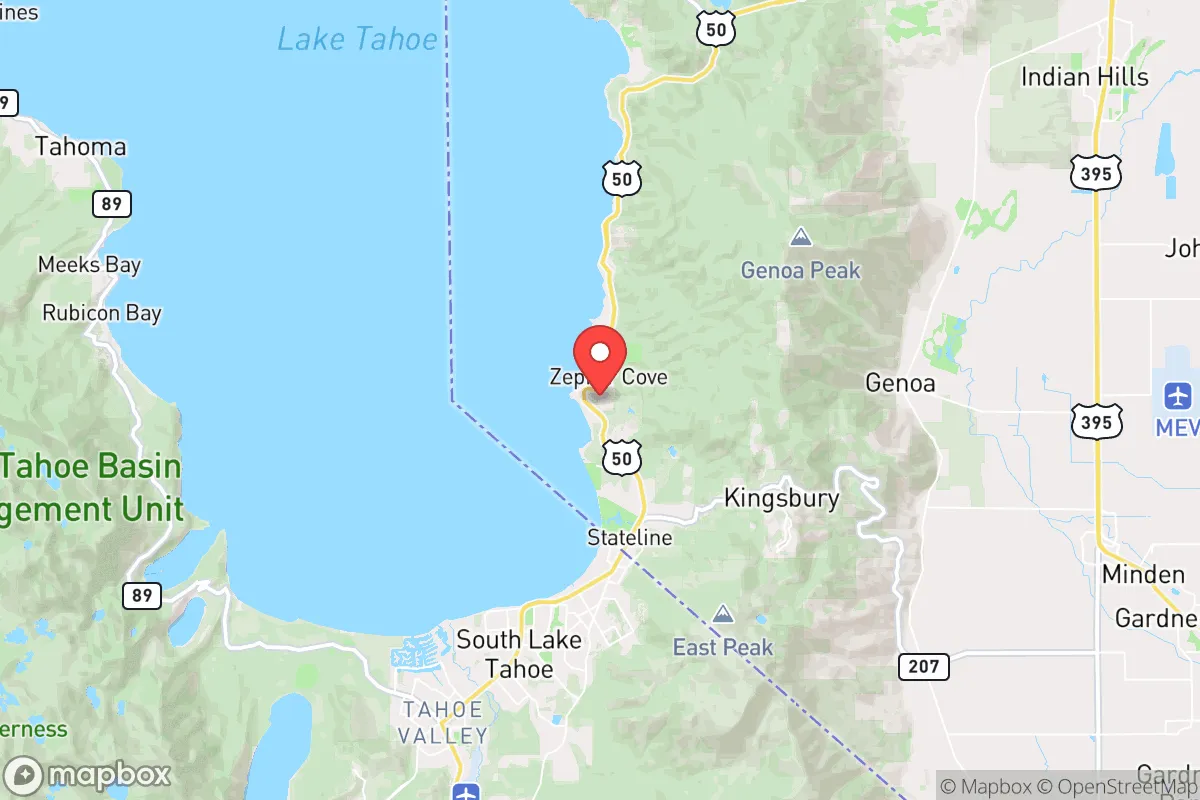
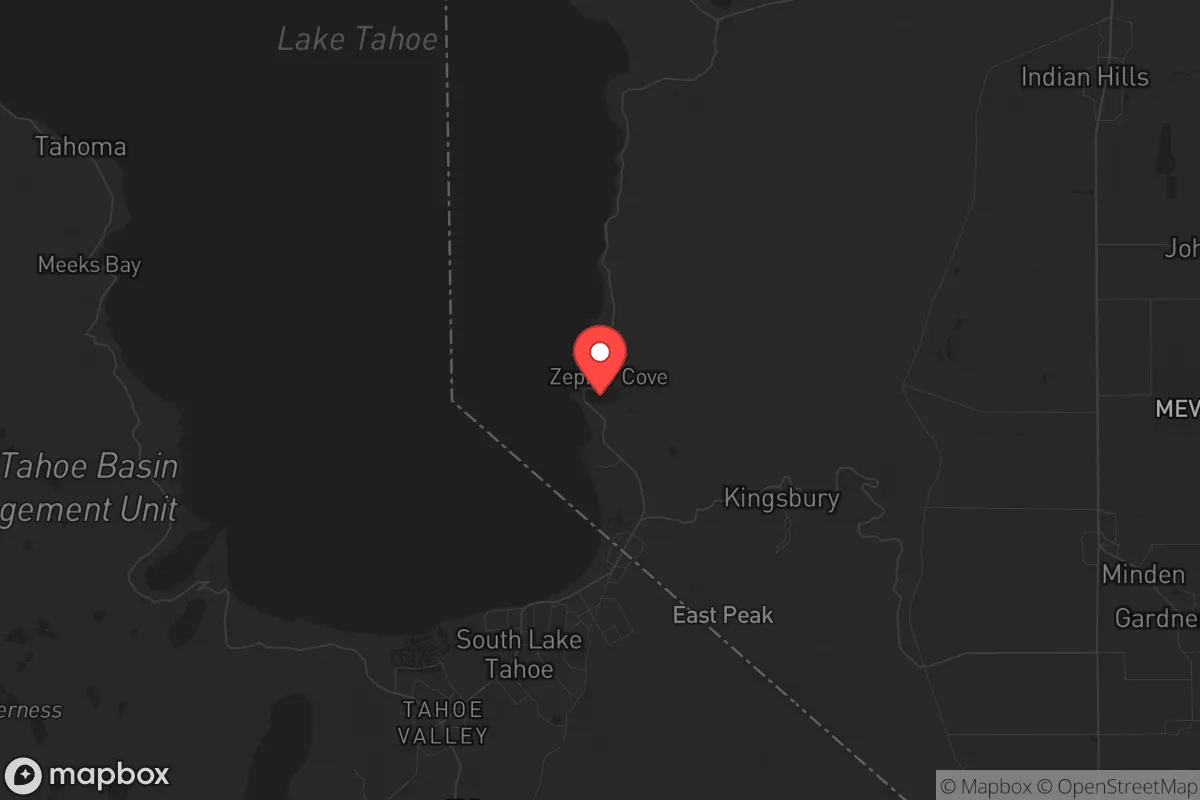
Strategic Assessment of Zephyr Cove, NV
Strong survivability profile. Good buffer from population centers, with manageable environmental and tactical risks.
What does the Strategic Assessment tell us?
Our Strategic Assessment grades tactical survivability of an area. Major population centers, military targets, fallout zones, natural disasters, and border exposure all drive risk — lower exposure means a more defensible position in a crisis.
This is heavily inspired by Joel Skousen's Strategic Relocation book. Highly recommended you checkout the book ($)What does this tell us?
Our Strategic Assessment grades tactical survivability of an area. Major population centers, military targets, fallout zones, natural disasters, and border exposure all drive risk — lower exposure means a more defensible position in a crisis.
This is heavily inspired by Joel Skousen's Strategic Relocation book. Highly recommended you checkout the book ($)Strategic Pillars

Key Distances
Regional Safe Places
Below is our recommended "safe zones" in Nevada and the surrounding area based on our strategic heuristics. For most people, it's unrealistic to live in a “safe zone” full-time due to work, family or other personal reasons. They tend to be more rural. However, many of these areas are perfect for second homes and retreat properties that double as a vacation home or even a short-term rental.
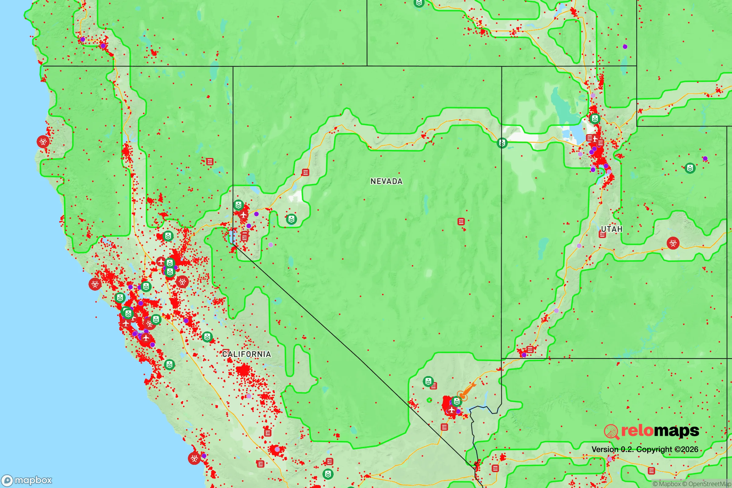
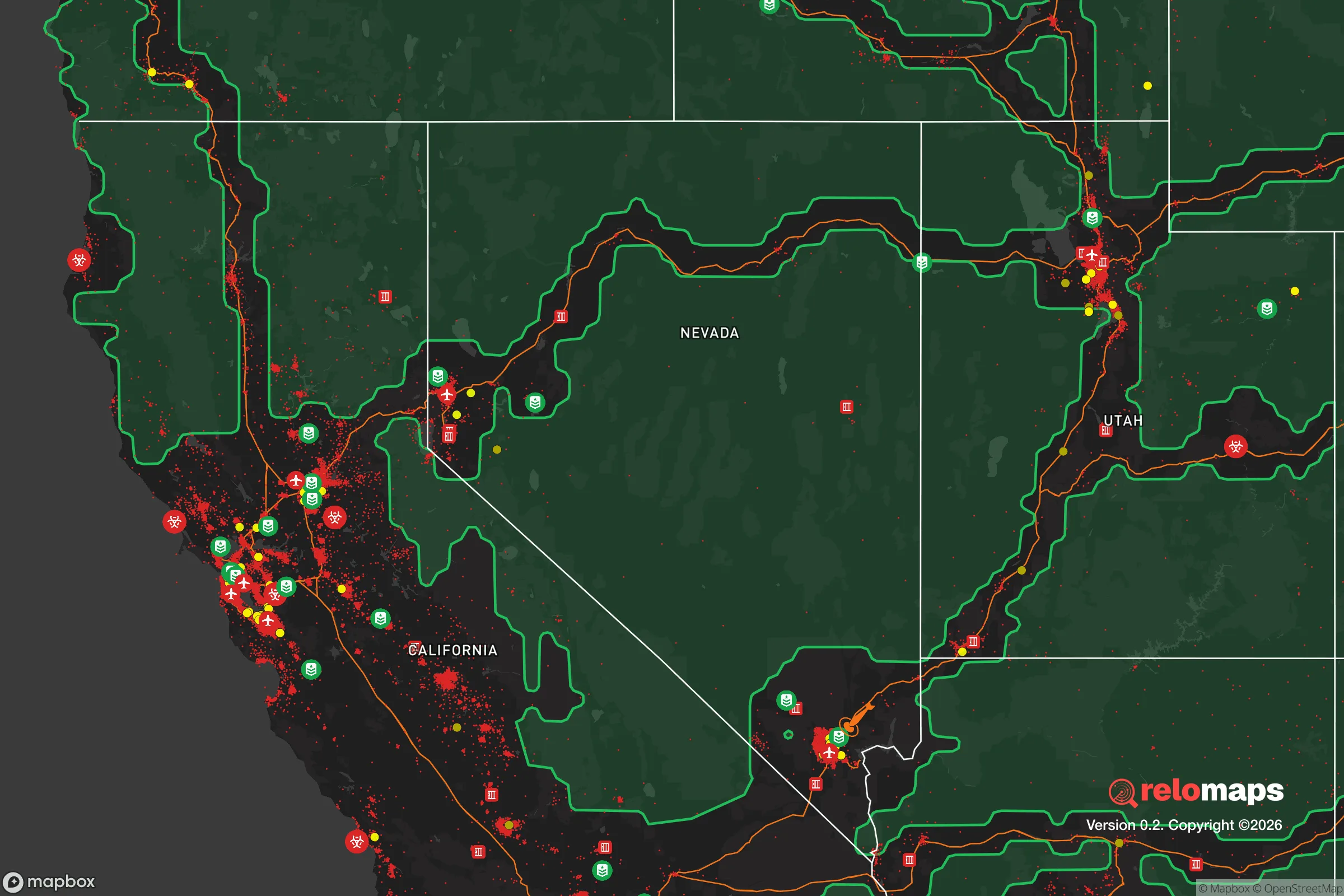
Important Note: For informational purposes only. This does not mean nothing bad ever happens in the green zones. Please use common sense. This is based on public data and modeled with AI. We tried to take a conservative approach but mistakes happen. We update this regularly as new information becomes available.
Solar Generator Recommendations
Backup power matters more here than in safer locations. We've picked three solar generators across budgets and capacity tiers — start with the budget unit if you only need a few essentials, or step up if you want to run a fridge and HVAC for days at a time.

Jackery Portable Power Station Explorer 300
Budget OptionPower on the Go: Weighing only 11 lbs, it's convenient to set up and store with book-sized foldable solar panels

BLUETTI Portable Power Station AC180
Designed for both indoor and outdoor scenarios, AC180 is highly capable as it has a robost capacity and continuous output power.

EF ECOFLOW DELTA Pro Ultra Power Station
Upgraded PickEcoFlow DELTA Pro Ultra is a whole-home energy system designed to grow with your family. Integrated with the Smart Home Panel 2, it scales to meet your evolving energy needs — keeping your home powered, intelligent, and secure through every stage of life.
We earn a commission, at no additional cost to you.
Strategic Assessment Analysis
Zephyr Cove, Nevada, sits on the eastern shore of Lake Tahoe, roughly 10 miles from the Nevada-California state line and about 60 miles southwest of Reno. Its primary strategic advantage is geographic isolation—the area is bounded by the lake to the west and the Carson Range to the east, creating a natural choke point that limits access to a single main road (US-50) through the Sierra Nevada. This makes it a defensible position for those prioritizing escape from urban collapse, but the same isolation creates significant supply chain vulnerabilities. For a conservative-leaning relocator concerned with civic unrest or mass casualty events, Zephyr Cove offers a buffer from the chaos of major metro areas like Sacramento (120 miles west) or the San Francisco Bay Area (200 miles west), but it is not a self-sufficient fortress.
Geographic position and natural advantages for long-term survival
Zephyr Cove’s location on Lake Tahoe provides an immediate, high-quality freshwater source—the lake holds roughly 39 trillion gallons of water, enough to sustain a small population indefinitely if properly managed. The surrounding Sierra Nevada terrain offers elevation (the town sits at 6,200 feet), which complicates any large-scale ground movement from lower-elevation population centers. The area’s forested slopes and granite outcroppings provide natural cover and multiple retreat routes into the Desolation Wilderness or Toiyabe National Forest. However, the same geography that makes it defensible also makes it a dead end: US-50 is the only paved route in and out, and it’s prone to closure from snow, rock slides, or vehicle accidents. In a crisis, this road would become a single-point failure—any blockage would trap residents or force them into treacherous off-road travel. The elevation also means harsh winters with heavy snowfall (averaging 150-200 inches annually), which can cut off resupply for weeks and strain unprepared households.
Risks, exposures, and proximity to fallout-relevant landmarks
The most significant risk for Zephyr Cove is its proximity to the Lake Tahoe Basin’s tourism economy, which draws millions of visitors annually—many from high-risk urban areas like Los Angeles, San Francisco, and Sacramento. During a mass casualty event or civil unrest, these tourists would become stranded, competing for limited resources and potentially overwhelming local infrastructure. The area is also within 60 miles of the Nevada National Security Site (formerly the Nevada Test Site), which, while largely decommissioned, still houses sensitive nuclear-related facilities. A detonation or accident there could produce fallout patterns that, depending on wind direction, might affect the Tahoe Basin. Additionally, the nearby Carson City (20 miles east) and Reno (60 miles northeast) are regional hubs with their own vulnerabilities—Reno’s airport and I-80 corridor are prime targets for disruption. For a prepper, the lack of multiple egress routes is a critical weakness: if US-50 is compromised, the only alternative is a slow, exposed trek over Luther Pass (CA-89) or through the Pony Express route, both of which are impassable in winter without specialized vehicles.
Practical resilience for a relocator: food, water, energy, and defensibility
Water is Zephyr Cove’s strongest asset—Lake Tahoe is drinkable with minimal filtration, and the area’s numerous streams and springs (like those feeding the Upper Truckee River) provide redundancy. However, food security is a major concern. The local economy is almost entirely tourism-dependent, with no significant agricultural production within 30 miles. The nearest major grocery distribution centers are in Carson City or Reno, both of which would be strained or cut off during a crisis. Residents would need to stockpile at least 3-6 months of non-perishable food, plus seeds for high-altitude gardening (short growing season, typically June to September). Energy is a mixed bag: the area is off the main power grid for some rural parcels, but most homes rely on NV Energy, which is vulnerable to wildfire-related outages. Solar panels are viable (the area gets 250+ sunny days annually), but battery storage is essential for winter months when snow cover reduces output. Defensibility is moderate—the town’s layout is scattered along the lake shore, with few natural chokepoints for perimeter security. A small, tight-knit community (population roughly 1,500 year-round) could organize mutual defense, but the influx of seasonal residents and tourists makes trust difficult. For a single individual or family, a remote cabin with a private well, off-grid solar, and a defensible perimeter (e.g., on a dead-end road with limited sight lines) would be ideal, but such properties are rare and expensive (median home price in 2025 was around $1.2 million).
The overall strategic picture for Zephyr Cove is one of high potential but high risk. It offers a defensible, water-rich refuge for those who can afford the entry cost and are willing to accept the isolation and supply chain fragility. For a conservative prepper, the area’s distance from major urban centers is a plus, but the single-road access and tourism dependency are critical vulnerabilities that require extensive advance preparation—stockpiling, off-grid infrastructure, and a solid community network. It is not a bug-out location for the unprepared; it is a long-term homestead for those who can secure resources before a crisis hits. If you can manage the winters and the cost, Zephyr Cove provides a rare combination of natural barriers and freshwater that few other locations in the western U.S. can match. But if you’re looking for a place that can sustain itself without external support, you’ll need to bring your own resilience—because the area won’t provide it for you.
* Values derived from national, state, county, city and local statistics and may differ in a specific area. Last updated: 2026-04-23T04:13:43.000Z
Narrative content on this page is AI-generated and may contain mistakes. Verify any details that matter before acting on them.
ReloMaps may earn a commission from affiliate links at no extra cost to you.