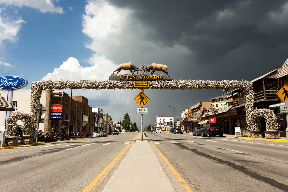

Photo: Wikipedia
Strategic Assessment of Afton, WY
Strong survivability profile. Good buffer from population centers, with manageable environmental and tactical risks.
What does the Strategic Assessment tell us?
Our Strategic Assessment grades tactical survivability of an area. Major population centers, military targets, fallout zones, natural disasters, and border exposure all drive risk — lower exposure means a more defensible position in a crisis.
This is heavily inspired by Joel Skousen's Strategic Relocation book. Highly recommended you checkout the book ($)What does this tell us?
Our Strategic Assessment grades tactical survivability of an area. Major population centers, military targets, fallout zones, natural disasters, and border exposure all drive risk — lower exposure means a more defensible position in a crisis.
This is heavily inspired by Joel Skousen's Strategic Relocation book. Highly recommended you checkout the book ($)Strategic Pillars

Key Distances
Regional Safe Places
Below is our recommended "safe zones" in Wyoming and the surrounding area based on our strategic heuristics. For most people, it's unrealistic to live in a “safe zone” full-time due to work, family or other personal reasons. They tend to be more rural. However, many of these areas are perfect for second homes and retreat properties that double as a vacation home or even a short-term rental.
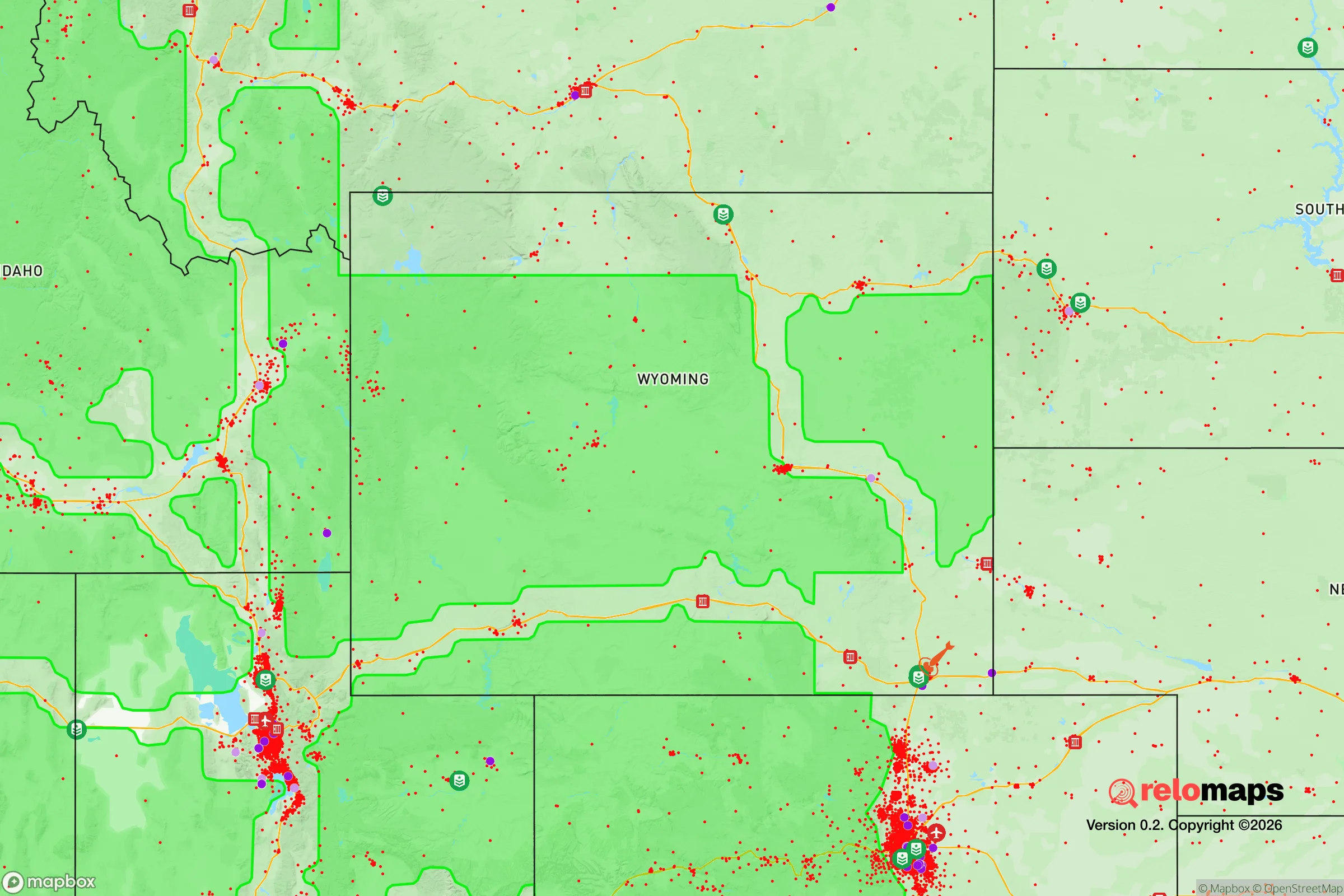
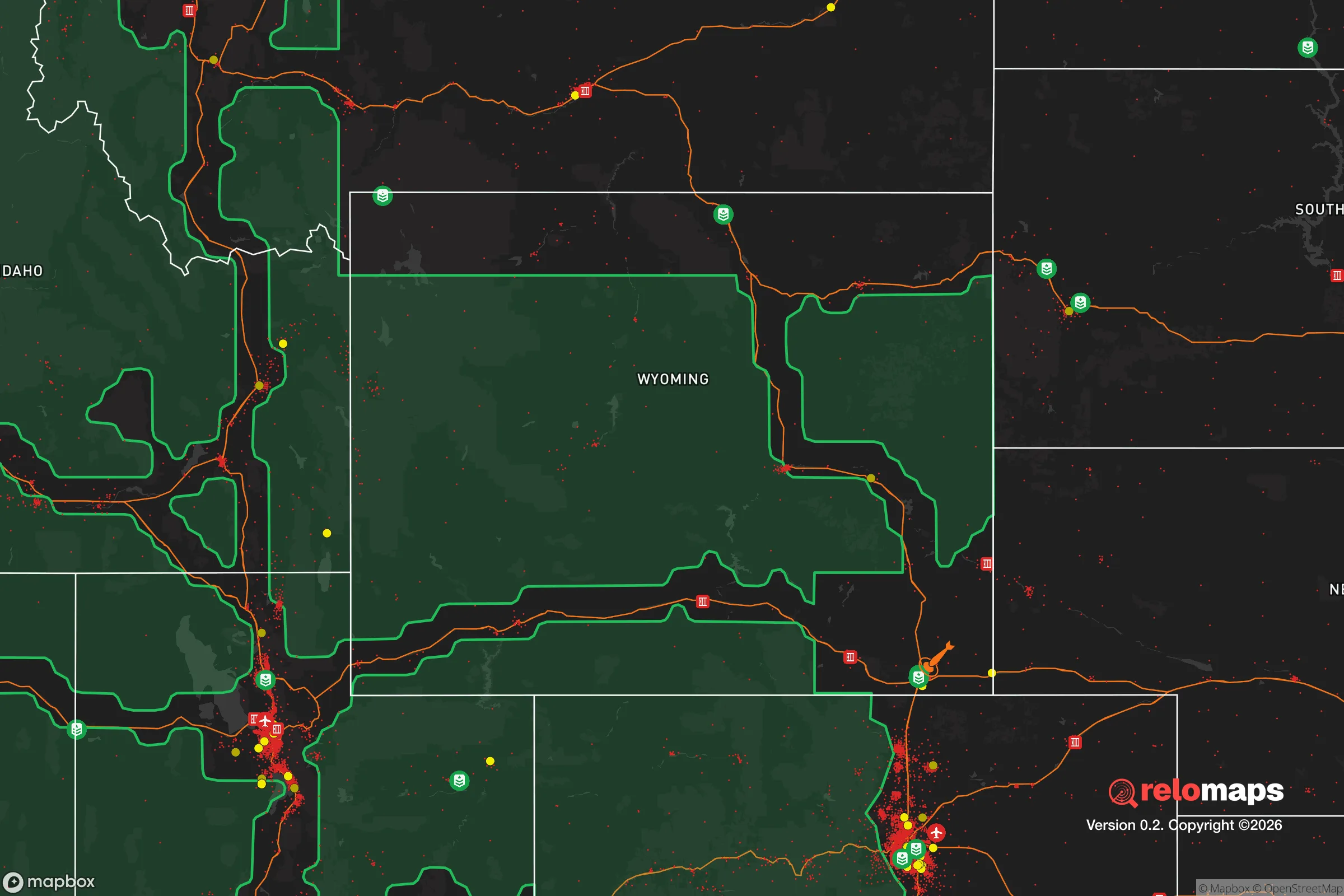
Important Note: For informational purposes only. This does not mean nothing bad ever happens in the green zones. Please use common sense. This is based on public data and modeled with AI. We tried to take a conservative approach but mistakes happen. We update this regularly as new information becomes available.
Solar Generator Recommendations
Backup power matters more here than in safer locations. We've picked three solar generators across budgets and capacity tiers — start with the budget unit if you only need a few essentials, or step up if you want to run a fridge and HVAC for days at a time.

Jackery Portable Power Station Explorer 300
Budget OptionPower on the Go: Weighing only 11 lbs, it's convenient to set up and store with book-sized foldable solar panels

BLUETTI Portable Power Station AC180
Designed for both indoor and outdoor scenarios, AC180 is highly capable as it has a robost capacity and continuous output power.

EF ECOFLOW DELTA Pro Ultra Power Station
Upgraded PickEcoFlow DELTA Pro Ultra is a whole-home energy system designed to grow with your family. Integrated with the Smart Home Panel 2, it scales to meet your evolving energy needs — keeping your home powered, intelligent, and secure through every stage of life.
We earn a commission, at no additional cost to you.
Strategic Assessment Analysis
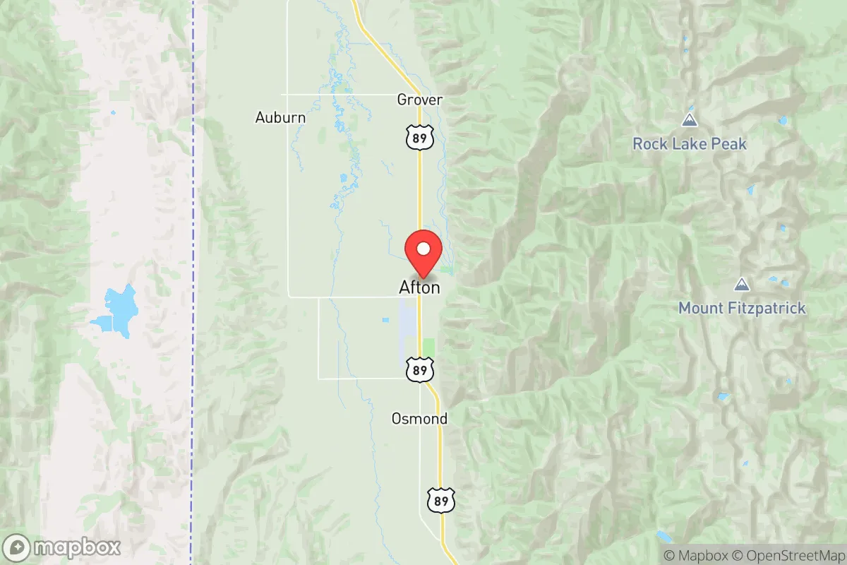
Afton, Wyoming, sits in a narrow valley at the intersection of US-89 and US-30, roughly 60 miles south of Jackson Hole and 30 miles north of the Utah border. For a relocator with a prepper mindset, this location offers a compelling mix of isolation and accessibility—far enough from major population centers to avoid the immediate chaos of a collapse, but close enough to supply routes and regional infrastructure to sustain a long-term retreat. The town’s population hovers around 2,000, and the surrounding Star Valley is known for its tight-knit, largely conservative community, which aligns with a self-reliant, low-trust worldview. The key strategic advantage here is geographic buffering: Afton is shielded by the Salt River Range to the east and the Caribou-Targhee National Forest to the west, creating natural chokepoints that slow movement and filter threats.
Geographic position and natural advantages for a retreat
Afton’s position in Star Valley is a defensive asset. The valley floor sits at roughly 6,200 feet, with the surrounding peaks rising to over 10,000 feet, meaning any approach from the east or west requires crossing mountain passes that are impassable in winter and easily monitored in summer. The town itself is laid out along a single main corridor, US-89, which runs north-south through the valley. This linear layout means that a small group could effectively control access points at the north and south ends of the valley with minimal manpower. The nearest city of any size is Idaho Falls, Idaho, about 90 miles northwest—close enough for supply runs but far enough that a major disaster there wouldn’t directly threaten Afton. The area’s water resources are abundant: the Salt River runs through town, and numerous springs and creeks feed into it from the surrounding mountains. For a relocator, this means you’re not dependent on municipal water systems that could fail in a crisis. The local climate is cold—winters average 10–20°F with heavy snow—but this also acts as a natural deterrent to unprepared migrants or transient populations. The growing season is short (about 90 days), but the valley’s soil is fertile enough for subsistence gardening, and the surrounding forests offer timber for fuel and construction.
Risks, exposures, and proximity to fallout-relevant landmarks
The primary risk for Afton is its proximity to Yellowstone National Park, roughly 100 miles to the north. A supervolcano eruption or major seismic event at Yellowstone would devastate the region, but the probability of such an event in a human lifetime is extremely low—USGS estimates put the annual chance at 1 in 730,000. More immediate concerns are the town’s reliance on a single road (US-89) for resupply and evacuation. If that road is blocked by a landslide, avalanche, or civil unrest, Afton becomes a dead end. The nearest interstate is I-15, about 70 miles west in Idaho, which means any large-scale evacuation or military movement would funnel through that corridor, potentially creating bottlenecks. There are no major military bases, nuclear power plants, or chemical facilities within 100 miles, which is a positive for fallout avoidance. The closest significant target would be the Idaho National Laboratory near Idaho Falls, about 90 miles northwest—a potential target for a coordinated attack, but far enough that fallout would be diluted by the time it reached Afton. The town’s elevation and mountain shielding also provide some protection against airborne contaminants. For a relocator worried about civil unrest, Afton’s isolation works in your favor: the nearest city with a population over 50,000 is Idaho Falls, and the nearest major metro (Salt Lake City) is 250 miles south. Mass casualty events or riots in those cities are unlikely to spill over into Star Valley due to the distance and terrain.
Practical resilience for a relocator: food, water, energy, and defensibility
Food security in Afton is moderate. The valley has several small farms and ranches, and the local grocery store (Broulim’s) stocks basic supplies, but it’s not a major agricultural hub. For long-term self-sufficiency, you’d need to establish your own garden and possibly raise livestock—chickens, goats, or cattle are common in the area. The short growing season limits crop variety, but cold-hardy vegetables like potatoes, carrots, and kale do well. Hunting and fishing are viable: the surrounding national forests are home to elk, deer, and moose, and the Salt River has cutthroat trout. Water is abundant and generally clean, but you should plan for a backup filtration system—surface water can be contaminated by wildlife or upstream activity. The town’s water supply comes from wells and springs, so a private well on your property is ideal. Energy resilience is a weak point. The local grid is served by Rocky Mountain Power, and outages are common during winter storms. Solar is feasible but limited by heavy snow cover in winter; a propane or diesel generator with a large fuel cache is a better bet. Wood heat is the most reliable option, and the surrounding forests provide ample fuel—but you’ll need a chainsaw and a good supply of dry wood. Defensibility is strong due to the terrain. The valley’s narrow shape means you can monitor all approaches from a central position. The local population is armed and self-reliant—Wyoming has some of the most permissive gun laws in the country, and concealed carry is common. The Star Valley Sheriff’s Office has about 10 deputies for the entire county, so in a crisis, you’re largely on your own. That’s a feature, not a bug, for a prepper.
The overall strategic picture for Afton is one of high potential with clear trade-offs. It’s not a perfect retreat—the single road access and harsh winters are real vulnerabilities—but for a relocator who values isolation, natural barriers, and a like-minded community, it’s one of the stronger options in the Intermountain West. The key is to arrive prepared: stockpile supplies for at least six months, invest in off-grid energy and water systems, and build relationships with neighbors before a crisis hits. The area’s conservative culture and low population density mean you won’t face the same social friction you might in a more liberal or crowded retreat. If you’re looking for a place to ride out the coming instability with a reasonable chance of maintaining autonomy, Afton deserves a serious look. Just don’t expect to be comfortable—expect to be ready.
* Values derived from national, state, county, city and local statistics and may differ in a specific area. Last updated: 2026-04-21T11:29:27.000Z
Narrative content on this page is AI-generated and may contain mistakes. Verify any details that matter before acting on them.
ReloMaps may earn a commission from affiliate links at no extra cost to you.