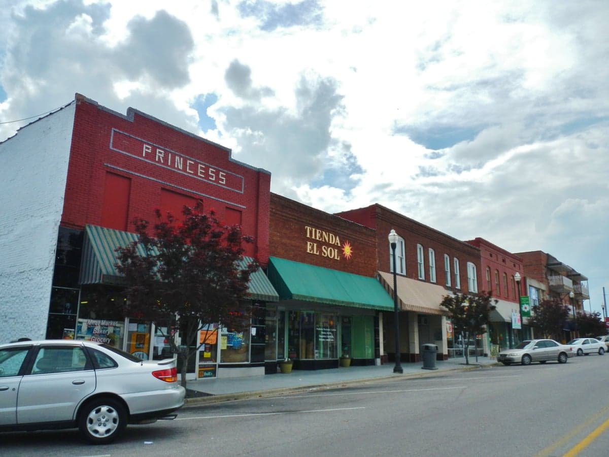
Photo: Wikipedia
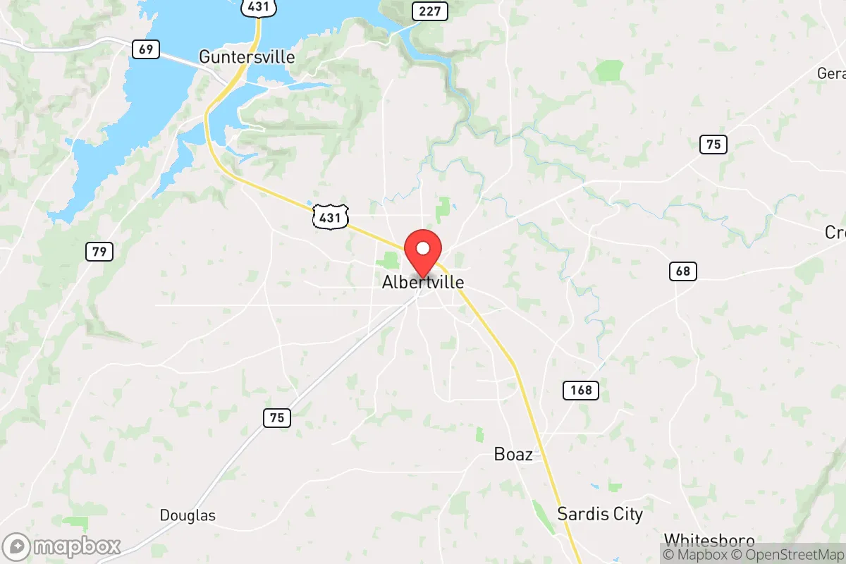
Strategic Assessment of Albertville, AL
Workable tactical position. Some exposure to population density or targets, but generally defensible in a crisis.
What does the Strategic Assessment tell us?
Our Strategic Assessment grades tactical survivability of an area. Major population centers, military targets, fallout zones, natural disasters, and border exposure all drive risk — lower exposure means a more defensible position in a crisis.
This is heavily inspired by Joel Skousen's Strategic Relocation book. Highly recommended you checkout the book ($)What does this tell us?
Our Strategic Assessment grades tactical survivability of an area. Major population centers, military targets, fallout zones, natural disasters, and border exposure all drive risk — lower exposure means a more defensible position in a crisis.
This is heavily inspired by Joel Skousen's Strategic Relocation book. Highly recommended you checkout the book ($)Strategic Pillars

Key Distances
Regional Safe Places
Below is our recommended "safe zones" in Alabama and the surrounding area based on our strategic heuristics. For most people, it's unrealistic to live in a “safe zone” full-time due to work, family or other personal reasons. They tend to be more rural. However, many of these areas are perfect for second homes and retreat properties that double as a vacation home or even a short-term rental.
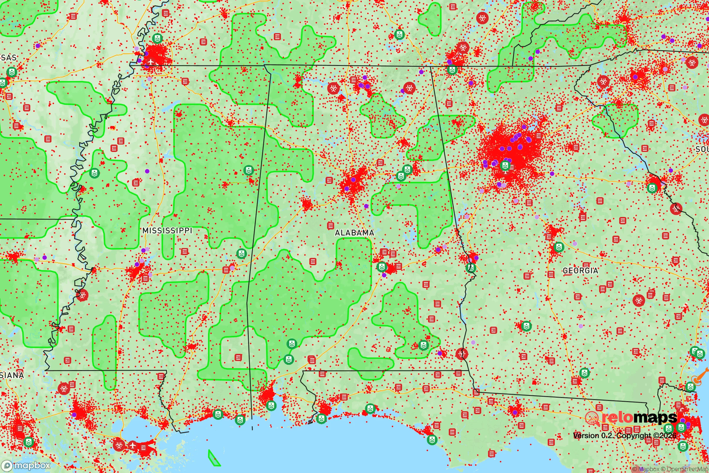
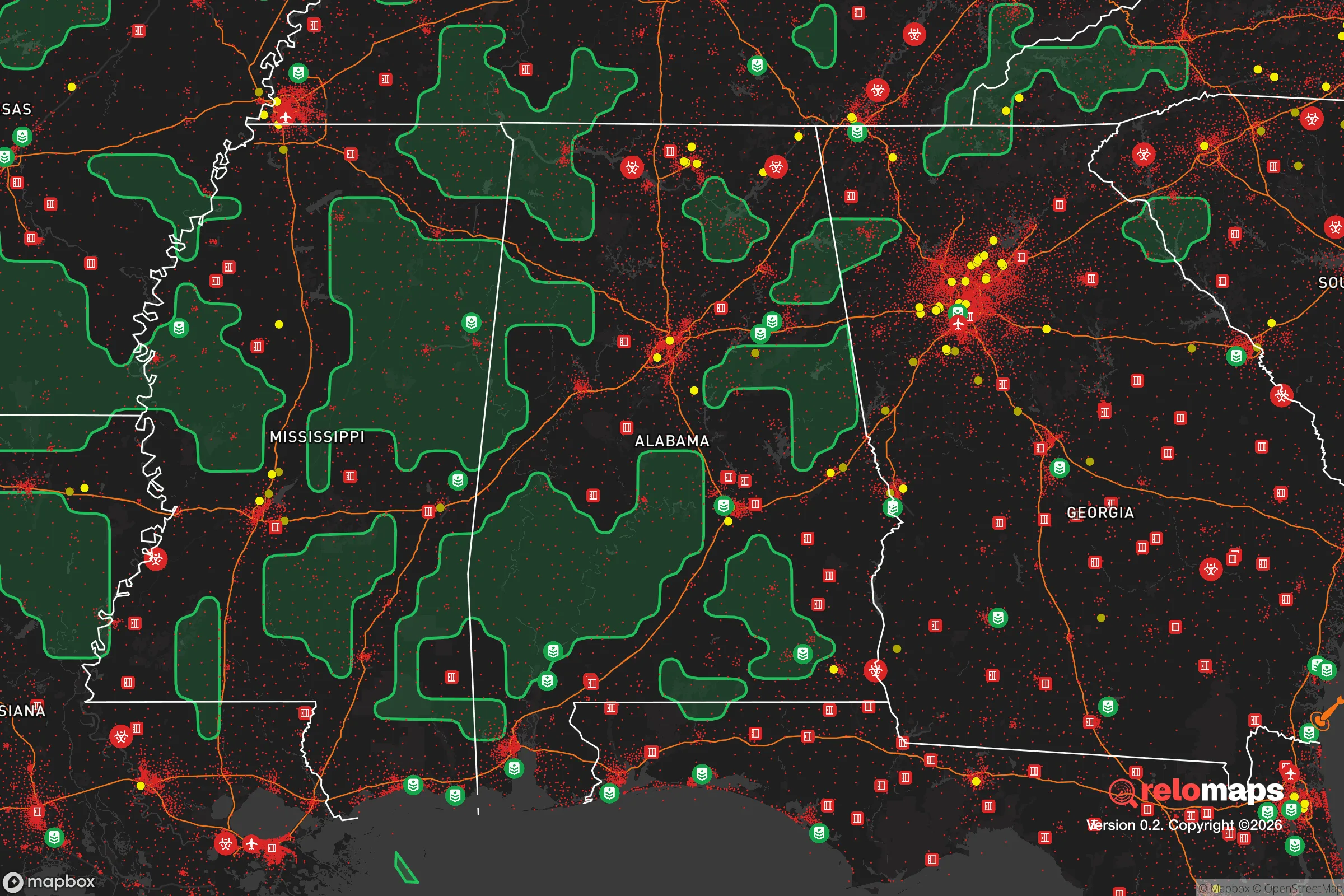
Important Note: For informational purposes only. This does not mean nothing bad ever happens in the green zones. Please use common sense. This is based on public data and modeled with AI. We tried to take a conservative approach but mistakes happen. We update this regularly as new information becomes available.
Solar Generator Recommendations
Backup power matters more here than in safer locations. We've picked three solar generators across budgets and capacity tiers — start with the budget unit if you only need a few essentials, or step up if you want to run a fridge and HVAC for days at a time.

Jackery Portable Power Station Explorer 300
Budget OptionPower on the Go: Weighing only 11 lbs, it's convenient to set up and store with book-sized foldable solar panels

BLUETTI Portable Power Station AC180
Designed for both indoor and outdoor scenarios, AC180 is highly capable as it has a robost capacity and continuous output power.

EF ECOFLOW DELTA Pro Ultra Power Station
Upgraded PickEcoFlow DELTA Pro Ultra is a whole-home energy system designed to grow with your family. Integrated with the Smart Home Panel 2, it scales to meet your evolving energy needs — keeping your home powered, intelligent, and secure through every stage of life.
We earn a commission, at no additional cost to you.
Strategic Assessment Analysis
Albertville, Alabama, occupies a strategic sweet spot in the northeastern corner of the state, offering a blend of geographic isolation and practical self-sufficiency that appeals to those planning for long-term resilience. Situated roughly 30 miles from Guntersville and 50 miles from Huntsville, the town sits far enough from major population centers to avoid the immediate fallout of a civic collapse, yet close enough to access critical supply chains in a stable environment. The area’s position on the southern edge of the Appalachian foothills provides natural terrain advantages, while its agricultural and manufacturing base gives it a tangible economic anchor that many purely suburban towns lack. For a relocator prioritizing preparedness, Albertville presents a credible base of operations—not a fortress, but a defensible, resource-rich community with a conservative cultural foundation.
Geographic position and natural advantages for long-term stability
Albertville’s location in Marshall County places it within a region defined by rolling hills, limestone geology, and abundant surface water. The town sits near the headwaters of the Tennessee River system, with the nearby Guntersville Lake and the Tennessee River providing both a freshwater reservoir and a natural barrier to east-west movement. The surrounding terrain—mixed hardwood forests, pastureland, and scattered ridges—offers multiple avenues for retreat, concealment, and small-scale agriculture. The area’s elevation, averaging around 1,000 feet, reduces flood risk compared to low-lying Gulf Coast communities, while the moderate climate supports year-round gardening and livestock grazing. Critically, Albertville is not situated on any major fault line, and its inland position shields it from hurricane storm surge, though tornadoes remain a seasonal concern. The local soil, primarily sandy loam over limestone, drains well and supports a wide range of crops, from corn and soybeans to fruit trees and root vegetables. For a prepper, this means the land itself can sustain a family with modest inputs—something that cannot be said for many suburban subdivisions in the Southeast.
Risks, exposures, and proximity to fallout-relevant landmarks
No location is without vulnerabilities, and Albertville’s primary risk stems from its proximity to Huntsville, a major aerospace and defense hub that hosts Redstone Arsenal, the U.S. Army’s missile and space command. In a scenario involving a national-scale emergency—whether from EMP, cyberattack, or conventional conflict—Huntsville would be a high-priority target. Albertville lies roughly 50 miles southeast of the arsenal, placing it outside the immediate blast or fallout zone for most plausible scenarios, but within the zone of secondary effects: refugee flow, supply chain disruption, and potential military checkpoints on major highways like U.S. 431 and Alabama 75. The town itself has no significant military or industrial targets, though the nearby Guntersville Dam on the Tennessee River could be a point of concern for water control and power generation. Tornado risk is real—Marshall County sits in the Dixie Alley corridor—but the terrain’s hills and valleys provide some natural shielding. Flooding is limited to low-lying areas near creeks and the river. The biggest practical risk for a relocator is the possibility of being caught in a mass evacuation from Huntsville or Birmingham, both of which are within a two-hour drive. Albertville’s best defense is its relative obscurity: it is not a named target, and its population of roughly 22,000 means it can absorb a modest influx without immediate collapse.
Practical resilience: food, water, energy, and defensibility
For a relocator focused on day-to-day survival, Albertville offers several concrete advantages. Water is the first priority: the town’s municipal supply comes from groundwater wells and the Tennessee River system, but private wells are common in the surrounding rural areas, and the water table is generally high. Rainwater collection is viable, with annual precipitation averaging 55 inches. For food, the local agricultural base is a major asset. Marshall County is a top producer of poultry in Alabama, with several processing plants in the area, and small-scale farming is culturally embedded. The Albertville Farmers Market operates year-round, and the surrounding countryside has ample acreage for gardens, orchards, and livestock. The local climate supports a 200-day growing season, allowing for multiple harvests of staple crops. Energy resilience is mixed: the grid is served by the Tennessee Valley Authority (TVA), which has a relatively robust infrastructure, but rural areas are prone to outages during storms. Solar panels are a viable supplement, and the area’s moderate cloud cover still allows for decent generation. Propane and wood heat are common in rural homes, and the surrounding forests provide abundant firewood. Defensibility is moderate. The town itself is laid out along a ridge, with natural chokepoints on the main roads. The surrounding hills and hollows offer numerous positions for observation and retreat. For a family or individual, the key is to secure property with a reliable water source, southern exposure for solar, and at least 5–10 acres of usable land for food production. The local culture is heavily gun-friendly, with multiple shooting ranges and a strong hunting tradition, which means a relocator will not stand out for being armed. The Marshall County Sheriff’s Office and Albertville Police Department are professional but understaffed, so self-reliance is the norm.
The overall strategic picture for Albertville is one of moderate but genuine resilience. It is not a remote mountain redoubt—it is a working-class Southern town with a functional economy, decent infrastructure, and a population that largely shares a conservative, self-sufficient worldview. The biggest threat is not direct attack but the secondary effects of a collapse in Huntsville or Birmingham: refugees, supply shortages, and potential civil unrest. A relocator who arrives with a plan—secure land, a well, a garden, and a network of like-minded neighbors—will find Albertville a viable base for weathering the storm. The town’s manufacturing base (including a large carpet mill and several automotive parts suppliers) provides a fallback for barter and employment if the economy holds. Its location on the edge of the Appalachian foothills offers natural cover and resources. Albertville is not a bug-out location for the ultra-wealthy; it is a practical, affordable option for the serious prepper who wants to be part of a community that still values hard work, self-reliance, and neighborly trust. In a world where those qualities are increasingly rare, that alone makes it worth a hard look.
* Values derived from national, state, county, city and local statistics and may differ in a specific area. Last updated: 2026-04-19T18:41:35.000Z
Narrative content on this page is AI-generated and may contain mistakes. Verify any details that matter before acting on them.
ReloMaps may earn a commission from affiliate links at no extra cost to you.