Photo: Wikipedia
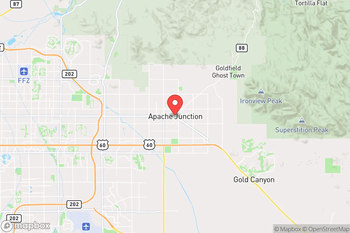
Strategic Assessment of Apache Junction, AZ
Multiple tactical vulnerabilities. Population density, target proximity, or disaster risk are likely compounding. A retreat property and exit planning is required.
What does the Strategic Assessment tell us?
Our Strategic Assessment grades tactical survivability of an area. Major population centers, military targets, fallout zones, natural disasters, and border exposure all drive risk — lower exposure means a more defensible position in a crisis.
This is heavily inspired by Joel Skousen's Strategic Relocation book. Highly recommended you checkout the book ($)What does this tell us?
Our Strategic Assessment grades tactical survivability of an area. Major population centers, military targets, fallout zones, natural disasters, and border exposure all drive risk — lower exposure means a more defensible position in a crisis.
This is heavily inspired by Joel Skousen's Strategic Relocation book. Highly recommended you checkout the book ($)Strategic Pillars

Key Distances
Regional Safe Places
Below is our recommended "safe zones" in Arizona and the surrounding area based on our strategic heuristics. For most people, it's unrealistic to live in a “safe zone” full-time due to work, family or other personal reasons. They tend to be more rural. However, many of these areas are perfect for second homes and retreat properties that double as a vacation home or even a short-term rental.
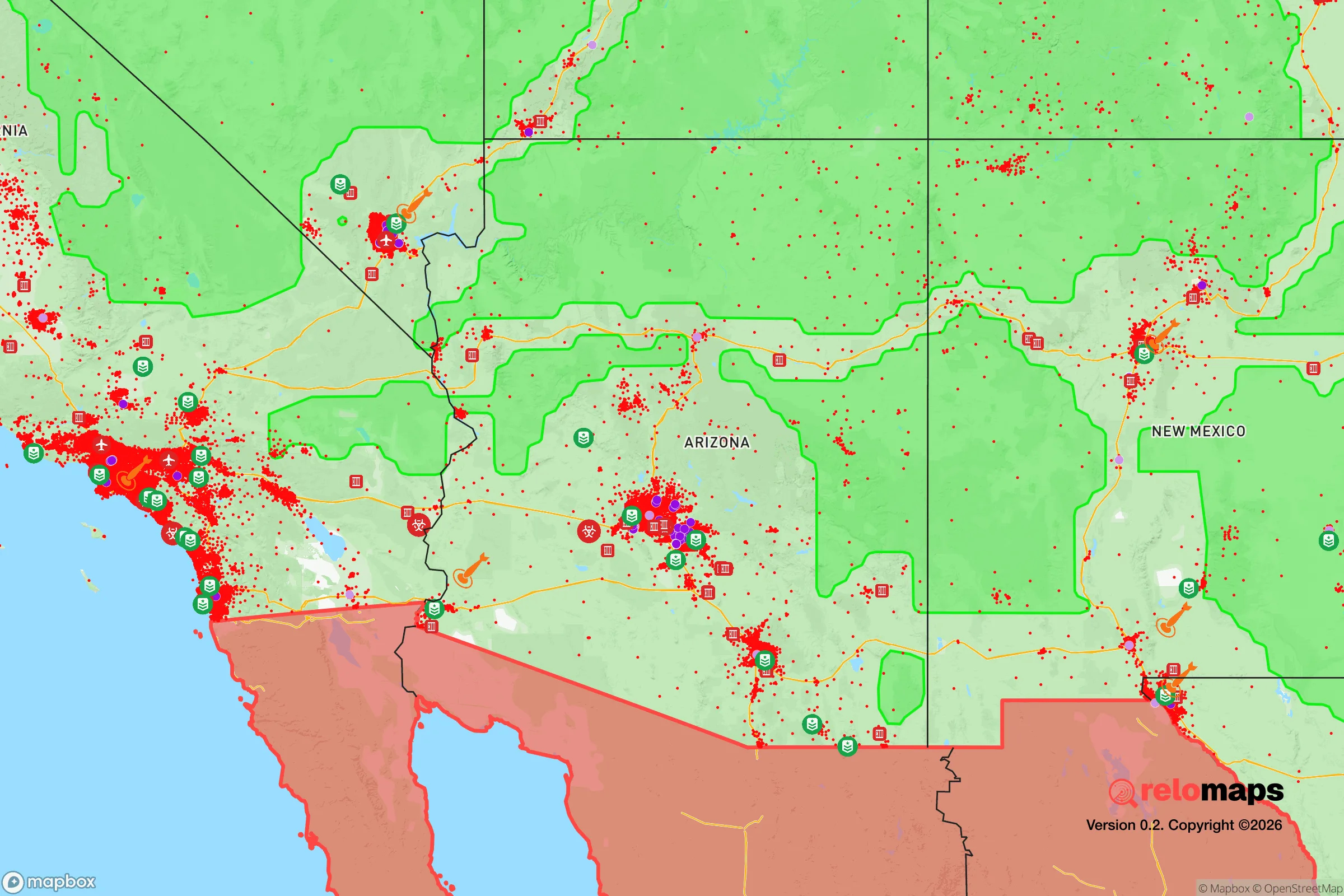
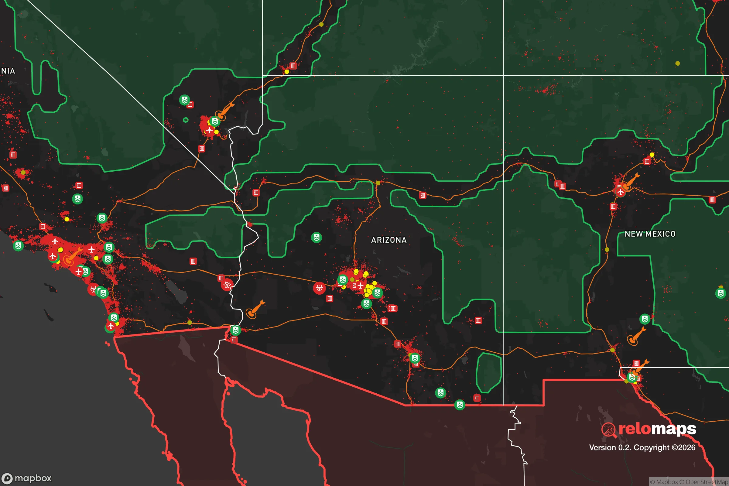
Important Note: For informational purposes only. This does not mean nothing bad ever happens in the green zones. Please use common sense. This is based on public data and modeled with AI. We tried to take a conservative approach but mistakes happen. We update this regularly as new information becomes available.
Solar Generator Recommendations
Backup power matters more here than in safer locations. We've picked three solar generators across budgets and capacity tiers — start with the budget unit if you only need a few essentials, or step up if you want to run a fridge and HVAC for days at a time.

Jackery Portable Power Station Explorer 300
Budget OptionPower on the Go: Weighing only 11 lbs, it's convenient to set up and store with book-sized foldable solar panels

BLUETTI Portable Power Station AC180
Designed for both indoor and outdoor scenarios, AC180 is highly capable as it has a robost capacity and continuous output power.

EF ECOFLOW DELTA Pro Ultra Power Station
Upgraded PickEcoFlow DELTA Pro Ultra is a whole-home energy system designed to grow with your family. Integrated with the Smart Home Panel 2, it scales to meet your evolving energy needs — keeping your home powered, intelligent, and secure through every stage of life.
We earn a commission, at no additional cost to you.
Strategic Assessment Analysis
Apache Junction sits at a strategic crossroads where the Sonoran Desert meets the Superstition Mountains, offering a resilience profile that balances proximity to metro Phoenix with genuine escape routes into some of the most rugged terrain in the lower 48. For a relocator thinking about civic unrest, supply chain disruptions, or natural disasters, this area provides a unique blend of access to urban resources and a defensible, low-density footprint that many other Sun Belt suburbs simply cannot match. The key is understanding that Apache Junction is not a standalone fortress—it is a forward operating base with a solid rear area in the Tonto National Forest.
Geographic position and natural advantages for long-term security
Apache Junction’s location at the base of the Superstition Mountains gives it a natural barrier to the east, which is a genuine tactical advantage. Unlike flat, sprawling suburbs where every direction is equally exposed, this town has a hard boundary of federal land and mountain wilderness that limits approach vectors from the east and northeast. The Tonto National Forest, at nearly 3 million acres, provides a massive buffer zone and a potential retreat area if conditions in the valley deteriorate. To the west and south, the town connects to the greater Phoenix metro via US-60 and State Route 88, but those corridors are chokepoints—easily monitored and, in a worst-case scenario, defensible. The area’s elevation, around 1,700 feet, keeps summer temperatures several degrees cooler than central Phoenix, reducing heat-related stress on water and power systems. The natural drainage from the Superstitions also means that groundwater recharge is better here than in the flat desert basins to the west, though it is still arid country that demands serious water planning.
Risks, exposures, and proximity to fallout-relevant landmarks
The most significant risk for Apache Junction is its proximity to the Phoenix metropolitan area, a population center of roughly 5 million people that would be a primary target for any large-scale disruption—whether economic collapse, civil unrest, or a coordinated attack. Apache Junction is about 40 miles east of downtown Phoenix, which puts it outside the immediate blast radius of a nuclear detonation at the city center, but well within the fallout plume zone depending on wind direction. The area is also downwind of Luke Air Force Base to the west, a potential military target, and within 100 miles of the Palo Verde Nuclear Generating Station, the largest nuclear power plant in the country by output. A catastrophic failure at Palo Verde—whether from sabotage, earthquake, or grid collapse—would put Apache Junction in a hazardous zone. On the natural disaster front, the region faces extreme heat, flash flooding in the washes during monsoon season, and the ever-present risk of wildfire in the adjacent national forest. The 2019 Woodbury Fire burned over 123,000 acres in the Superstitions and came within a few miles of residential areas, demonstrating that the mountain buffer can also become a fire corridor. For the prepper, these risks are manageable with proper planning, but they are real and should not be dismissed.
Practical resilience for a relocator: food, water, energy, and defensibility
Water is the single most critical factor for long-term survival in Apache Junction, and the situation is mixed. The town relies on a combination of groundwater and surface water from the Salt River Project, which is vulnerable to prolonged drought and interstate compact disputes. The area is not on the Central Arizona Project canal, so it does not have direct access to Colorado River water—a significant vulnerability if the SRP system is compromised. However, the proximity to the Superstitions means that private wells can tap into deeper aquifers, and there are numerous springs and seeps in the mountains for those willing to pack water out. Rainwater harvesting is legal and practical, with the area averaging about 10 inches of rain per year, mostly during the monsoon. Food resilience is limited by the desert climate; small-scale gardening is possible with shade structures and drip irrigation, but large-scale food production is not realistic. The town has a few grocery stores and a Walmart, but supply chains here are thin compared to Phoenix proper—a disruption would empty shelves quickly. Energy is a bright spot: Arizona has net metering and abundant solar insolation, making off-grid solar a viable option. Many homes in the area already have solar panels, and battery storage is becoming common. Defensibility is moderate. The town’s layout is a mix of suburban subdivisions and rural acreage, with the latter offering better standoff distance and multiple egress routes into the mountains. The Pinal County Sheriff’s Office has a substation in Apache Junction, but response times in the outlying areas can be 20-30 minutes, which means self-reliance is not optional—it is the baseline expectation.
The overall strategic picture for Apache Junction is one of calculated trade-offs. It offers genuine escape routes, a hard eastern boundary, and a climate that supports solar energy and water harvesting, but it sits close enough to a major metropolitan target that a relocator must plan for the fallout—both literal and figurative—of a Phoenix collapse. For the conservative-minded prepper who wants to be within striking distance of urban resources but not trapped in them, Apache Junction is a viable option if you secure your water supply, invest in solar with battery backup, and establish a network of trusted neighbors in the rural pockets east of the Superstition Freeway. It is not a bug-out location for the apocalypse—it is a place to build a resilient life that can withstand the shocks of a declining empire, provided you treat the desert with the respect it demands and never assume the government will be there to help when things go sideways.
* Values derived from national, state, county, city and local statistics and may differ in a specific area. Last updated: 2026-04-19T19:46:50.000Z
Narrative content on this page is AI-generated and may contain mistakes. Verify any details that matter before acting on them.
ReloMaps may earn a commission from affiliate links at no extra cost to you.