Photo: Wikipedia
Strategic Assessment of Miller County
Workable tactical position. Some exposure to population density or targets, but generally defensible in a crisis.
What does the Strategic Assessment tell us?
Our Strategic Assessment grades tactical survivability of an area. Major population centers, military targets, fallout zones, natural disasters, and border exposure all drive risk — lower exposure means a more defensible position in a crisis.
This is heavily inspired by Joel Skousen's Strategic Relocation book. Highly recommended you checkout the book ($)What does this tell us?
Our Strategic Assessment grades tactical survivability of an area. Major population centers, military targets, fallout zones, natural disasters, and border exposure all drive risk — lower exposure means a more defensible position in a crisis.
This is heavily inspired by Joel Skousen's Strategic Relocation book. Highly recommended you checkout the book ($)Strategic Pillars

Key Distances
Strategic Assessment Analysis
Miller County, Arkansas, offers a strategic relocation option for those prioritizing resilience and self-sufficiency, balancing rural accessibility with proximity to regional infrastructure. Located in the far southwestern corner of the state, the county is anchored by the city of Texarkana, which straddles the Texas-Arkansas border and provides a unique blend of small-town stability and cross-state resources. For a conservative-leaning audience focused on disaster readiness, Miller County’s position away from major metropolitan hubs like Dallas or Little Rock—yet within a few hours’ drive—makes it a practical choice for those seeking a buffer zone without complete isolation.
Geographic position and natural advantages for self-sufficiency
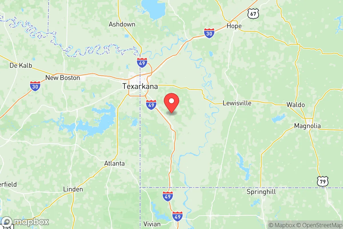
Miller County sits in the Piney Woods ecoregion, characterized by rolling hills, dense forests, and abundant waterways that support long-term sustainability. The Red River forms the county’s southern border, offering a reliable water source for irrigation and emergency use, while the Sulphur River and numerous creeks provide secondary options. The area’s clay-loam soils are suitable for small-scale farming, and the moderate climate—with mild winters and long growing seasons—allows for year-round food production. Texarkana itself is a regional trade hub, but the surrounding unincorporated areas, such as Garland and Doddridge, offer the kind of low-density living that appeals to those seeking defensible property. The county’s elevation, averaging around 300 feet, minimizes flood risks compared to low-lying Delta regions, though low-lying areas near the Red River require attention during heavy rains.
Risks, exposures, and proximity to fallout-relevant landmarks
While Miller County avoids the direct fallout zones of major metropolitan targets, its location introduces specific man-made risks that a relocator must weigh. The county lies roughly 150 miles from the Dallas-Fort Worth metroplex, a high-value target in a major conflict scenario, and about 200 miles from the Houston refinery corridor, which includes the nation’s largest concentration of petrochemical infrastructure. Fallout patterns from a strike on either city could theoretically reach Miller County depending on wind direction, though the distance provides a meaningful buffer. More immediate concerns include the nearby Red River Army Depot, located just across the border in Bowie County, Texas—a major ammunition and vehicle storage facility that could be a secondary target. Additionally, the Union Pacific rail line running through Texarkana transports hazardous materials, including crude oil and chemicals, posing a derailment risk. Natural hazards are less severe: the region experiences occasional tornadoes (typically EF1-EF2 strength) and flash flooding, but it lies outside the highest-risk tornado alley and hurricane surge zones. The county’s wildfire risk is moderate, with dry-season grass fires being the primary concern in rural areas.
Practical resilience for a relocator: food, water, energy, and defensibility
For those serious about self-sufficiency, Miller County offers a workable baseline. Water access is strong: the Red River provides a surface water source, and groundwater is available via private wells at depths of 50-150 feet, with yields sufficient for household and garden use. Municipal water in Texarkana comes from the Millwood Lake and Lake Wright Patman reservoirs, both of which have held steady through recent droughts. Food production is feasible: the county has a history of small-scale agriculture, with local farmers markets in Texarkana and roadside stands in rural areas offering seasonal produce. Deer and wild turkey are abundant for hunting, and the Red River supports catfish and bass fishing. For energy, the grid is served by Southwestern Electric Power Company (SWEPCO), which relies on a mix of natural gas, coal, and renewables; however, outages during ice storms or summer storms are common, making solar panels with battery backup a wise investment. Propane is widely available for off-grid heating and cooking. Defensibility varies by location: properties in the unincorporated areas east of Texarkana, near the community of Fouke, offer larger acreage (5-20 acres common), natural tree cover, and limited road access, which aids security. In contrast, suburban subdivisions around Texarkana provide less privacy and more neighbors, though they benefit from quicker emergency response. The county’s gun-friendly culture and strong Second Amendment support align with a preparedness mindset, and local law enforcement in rural areas is generally responsive but spread thin—sheriff’s office coverage can mean 20-30 minute response times in outlying zones.
The overall strategic picture for Miller County is one of moderate resilience with clear trade-offs. Its geographic distance from primary target cities like Dallas and Houston reduces fallout risk, while the Red River and local agriculture support basic self-sufficiency. The presence of the Red River Army Depot and rail lines introduces man-made hazards that require awareness but not alarm. For a relocator willing to invest in well water, solar power, and a defensible rural property—particularly in the eastern or southern parts of the county—Miller County provides a viable base for long-term preparedness. It is not a remote bunker location, but it offers a practical middle ground for those who want to stay connected to regional resources while maintaining a buffer from the vulnerabilities of urban centers.

* Values derived from national, state, county, city and local statistics and may differ in a specific area. Last updated: 2026-08-08T19:11:00.000Z
Narrative content on this page is AI-generated and may contain mistakes. Verify any details that matter before acting on them.
ReloMaps may earn a commission from affiliate links at no extra cost to you.

