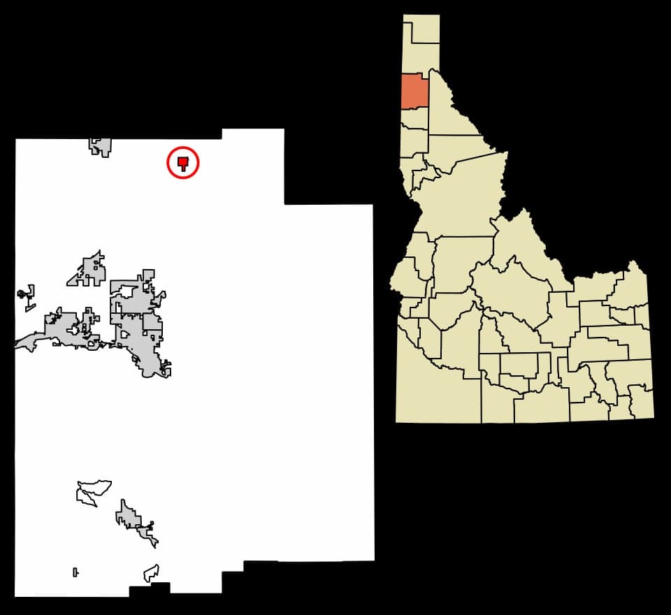
Photo: Wikipedia
Strategic Assessment of Athol, ID
Workable tactical position. Some exposure to population density or targets, but generally defensible in a crisis.
What does the Strategic Assessment tell us?
Our Strategic Assessment grades tactical survivability of an area. Major population centers, military targets, fallout zones, natural disasters, and border exposure all drive risk — lower exposure means a more defensible position in a crisis.
This is heavily inspired by Joel Skousen's Strategic Relocation book. Highly recommended you checkout the book ($)What does this tell us?
Our Strategic Assessment grades tactical survivability of an area. Major population centers, military targets, fallout zones, natural disasters, and border exposure all drive risk — lower exposure means a more defensible position in a crisis.
This is heavily inspired by Joel Skousen's Strategic Relocation book. Highly recommended you checkout the book ($)Strategic Pillars

Key Distances
Regional Safe Places
Below is our recommended "safe zones" in Idaho and the surrounding area based on our strategic heuristics. For most people, it's unrealistic to live in a “safe zone” full-time due to work, family or other personal reasons. They tend to be more rural. However, many of these areas are perfect for second homes and retreat properties that double as a vacation home or even a short-term rental.
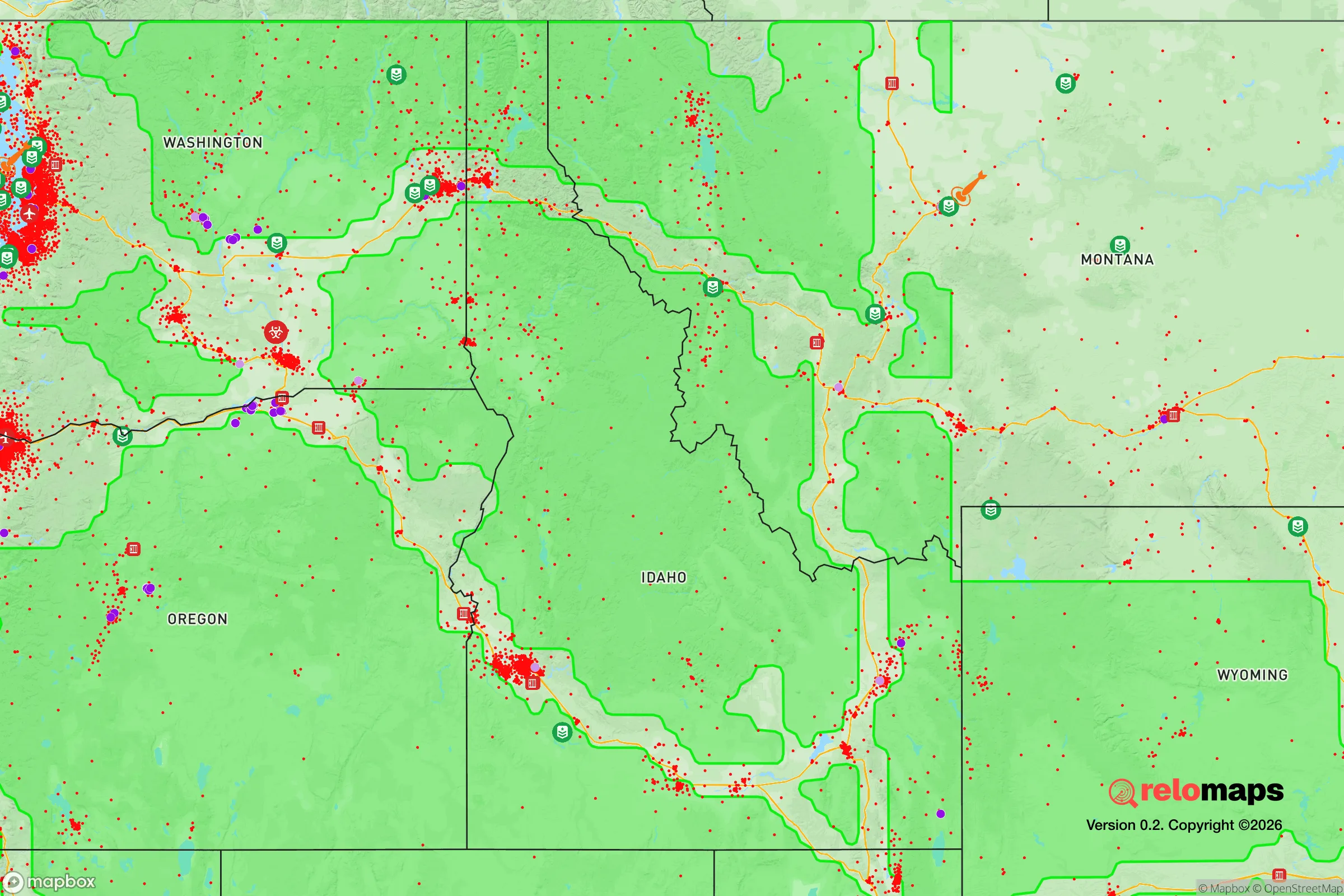
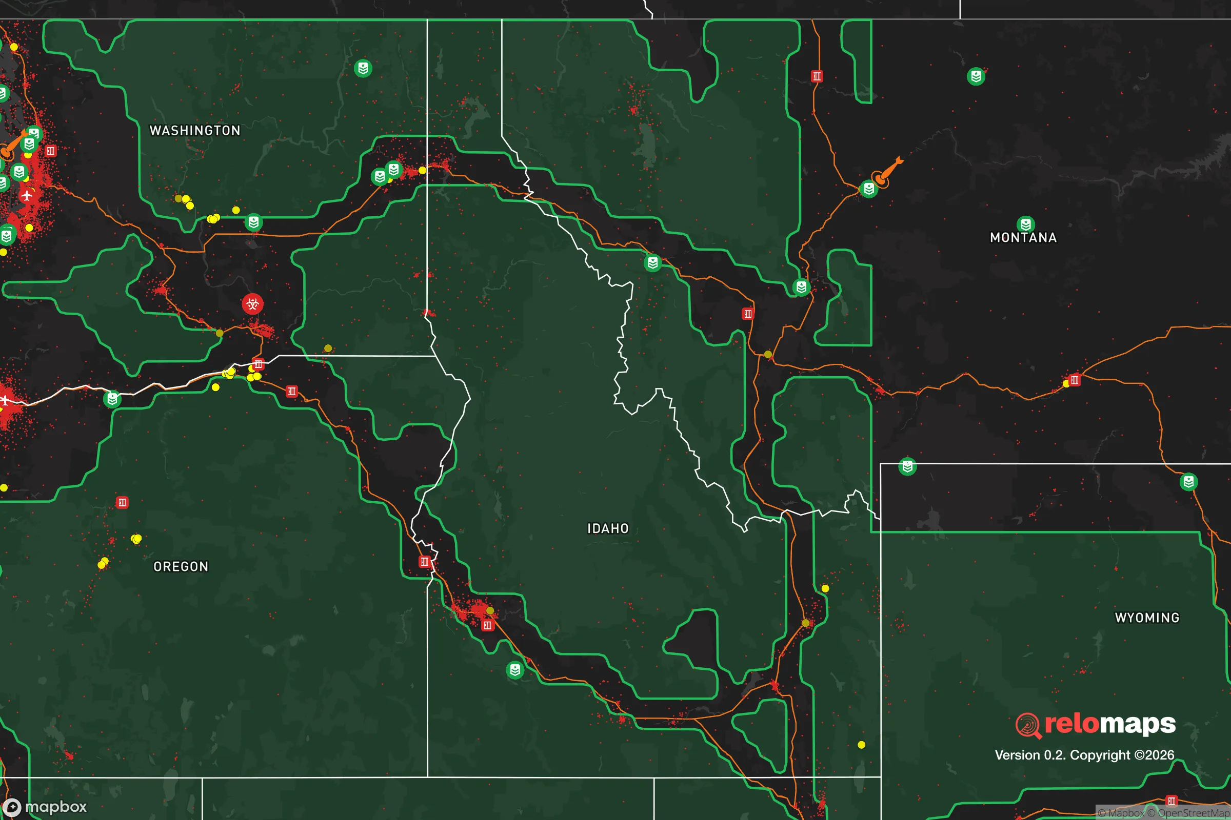


Important Note: For informational purposes only. This does not mean nothing bad ever happens in the green zones. Please use common sense. This is based on public data and modeled with AI. We tried to take a conservative approach but mistakes happen. We update this regularly as new information becomes available.
Solar Generator Recommendations
Backup power matters more here than in safer locations. We've picked three solar generators across budgets and capacity tiers — start with the budget unit if you only need a few essentials, or step up if you want to run a fridge and HVAC for days at a time.

Jackery Portable Power Station Explorer 300
Budget OptionPower on the Go: Weighing only 11 lbs, it's convenient to set up and store with book-sized foldable solar panels

BLUETTI Portable Power Station AC180
Designed for both indoor and outdoor scenarios, AC180 is highly capable as it has a robost capacity and continuous output power.

EF ECOFLOW DELTA Pro Ultra Power Station
Upgraded PickEcoFlow DELTA Pro Ultra is a whole-home energy system designed to grow with your family. Integrated with the Smart Home Panel 2, it scales to meet your evolving energy needs — keeping your home powered, intelligent, and secure through every stage of life.
We earn a commission, at no additional cost to you.
Strategic Assessment Analysis
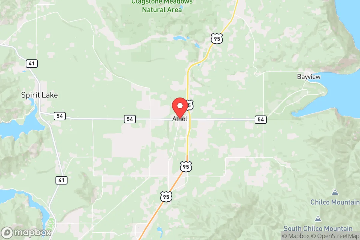
Athol, Idaho, occupies a strategic position in the northern Idaho panhandle that offers a compelling blend of isolation and accessibility for those prioritizing resilience and self-sufficiency. Located roughly 30 miles north of Coeur d'Alene and 15 miles south of the Canadian border, this small community sits at the edge of the Selkirk and Cabinet mountain ranges, providing a natural buffer from the denser population centers to the south. For a relocator thinking seriously about disaster readiness, Athol's geography presents a foundation of relative security, though it is not without its own set of risks and trade-offs that demand careful consideration.
Geographic position and natural advantages for self-sufficiency
Athol's primary strategic asset is its location within the Priest River watershed, a region characterized by abundant freshwater resources, dense forests, and relatively low population density. The area sits at an elevation of approximately 2,400 feet, which places it above the valley floor fog and inversion layers common to Coeur d'Alene and Post Falls, yet below the high-mountain snowpack that can isolate communities like Sandpoint or Bonners Ferry. This elevation moderates extreme weather while still providing a reliable snowmelt-driven water supply. The surrounding Kaniksu National Forest and Farragut State Park offer extensive public lands for foraging, hunting, and timber resources, all within a 15-minute drive. For a family seeking to establish a homestead, the area's growing season (roughly 100-120 frost-free days) is short but workable for cold-hardy crops like potatoes, kale, and root vegetables, and the region's volcanic-derived soils in the Rathdrum Prairie are among the most fertile in the state. The proximity to Lake Pend Oreille (20 miles east) and Priest Lake (30 miles north) provides additional freshwater reserves and fish protein, though these lakes are also recreational magnets that draw seasonal crowds, which can be a double-edged sword for those seeking low-profile living.
Risks, exposures, and proximity to fallout-relevant landmarks
While Athol's rural character offers a degree of insulation, it is not immune to significant man-made and natural risks. The most pressing concern for a disaster-readiness audience is the area's proximity to Fairchild Air Force Base, located roughly 60 miles south near Spokane. Fairchild is home to the 92nd Air Refueling Wing and is a designated nuclear-capable installation, housing KC-135 Stratotankers and supporting B-52 operations. In a major conflict scenario, this base is a high-priority target, and Athol lies within the plausible fallout plume zone for a ground burst targeting Fairchild, depending on prevailing westerly winds. The prevailing wind direction in the region is from the southwest, which would carry fallout northeast toward the Coeur d'Alene area and into the panhandle, potentially affecting Athol within hours. Additionally, the BNSF Railway mainline running through Athol carries hazardous materials, including crude oil from the Bakken fields and chlorine gas, creating a localized derailment risk. On the natural hazard side, the region is in Seismic Zone 2, with the Newport Fault running roughly 20 miles east. A major quake (6.5+ magnitude) could disrupt the single primary evacuation route—US Highway 95—which is already prone to winter closures and summer wildfire traffic. Wildfire risk is moderate but real: the 2015 Kootenai Complex Fire burned over 20,000 acres within 10 miles of Athol, and the 2021 Boulder Fire threatened structures near the town. The area's heavy timber and dry summer conditions create a WUI (wildland-urban interface) hazard that demands proactive defensible space management.
Practical resilience for a relocator: food, water, energy, and defensibility
For a family or individual serious about self-sufficiency, Athol offers a mixed but workable baseline. Water is the strongest asset: the region's aquifer is part of the Spokane Valley-Rathdrum Prairie Aquifer, one of the most productive in the nation, with most rural properties accessing groundwater via private wells at depths of 100-300 feet. Well yields are generally excellent (10-50 gallons per minute), and the water is naturally soft and low in minerals. Surface water from the Priest River and nearby creeks is also accessible, though treatment for giardia and other pathogens is necessary. Food production is feasible but requires effort: the short growing season limits staple crops, but the area supports excellent pasture for livestock (cattle, goats, sheep) and the surrounding forests provide abundant wild game (deer, elk, black bear, and turkey). The Farragut State Park and Priest Lake areas offer fishing, though pressure from recreational anglers can reduce yields. Local food infrastructure is limited—the nearest year-round grocery store with bulk goods is in Rathdrum (12 miles south), and the Athol Market is a small convenience store. For long-term storage, a dedicated pantry or root cellar is essential. Energy is a vulnerability: the grid is served by Avista Utilities, which has experienced outages from winter storms (ice, heavy snow) and summer wildfire pre-emptive shutoffs. Solar potential is moderate—the region averages 160-180 sunny days per year, less than the Intermountain West but workable with a properly sized off-grid system. Wood heating is the most practical backup, with abundant firewood available on public lands for a nominal permit fee. Defensibility is a mixed picture: Athol's layout is a linear strip along Highway 95, with most homes set back on 1-5 acre lots. The terrain is rolling to hilly, with good sightlines from elevated properties, but the highway itself is a vulnerability—it's the only north-south route, and a roadblock or accident could isolate the town. The community is small (population ~750) and tight-knit, with a strong culture of mutual aid among long-term residents, but newcomers should invest in building relationships before a crisis. The Kootenai County Sheriff's Office has a substation in Athol, but response times in a widespread event could be hours.
The overall strategic picture for Athol is one of moderate resilience with specific, manageable vulnerabilities. Its geographic isolation from major population centers (Spokane is 50 miles south, Coeur d'Alene 30 miles south) provides a buffer against urban cascading failures, but the proximity to Fairchild AFB and the BNSF rail line introduces man-made risks that cannot be ignored. For a relocator willing to invest in off-grid water, solar, and wood heat, and who is prepared to manage wildfire risk through defensible space and a go-bag, Athol offers a defensible, resource-rich base. The key trade-off is between the area's natural advantages—abundant water, timber, and game—and its exposure to a single-point-of-failure transportation corridor and a high-value military target within fallout range. For those who prioritize a low-profile, self-sufficient lifestyle in a region that is not yet overrun by preppers, Athol represents a solid, if not perfect, choice. The smart move is to buy property with a well, a south-facing slope for solar, and at least 5 acres for buffer, and to establish a network with neighbors before the first crisis hits.

* Values derived from national, state, county, city and local statistics and may differ in a specific area. Last updated: 2026-07-31T01:56:42.000Z
Narrative content on this page is AI-generated and may contain mistakes. Verify any details that matter before acting on them.
ReloMaps may earn a commission from affiliate links at no extra cost to you.

