Photo: Wikipedia
Strategic Assessment of Attleboro, MA
Multiple tactical vulnerabilities. Population density, target proximity, or disaster risk are likely compounding. A retreat property and exit planning is required.
What does the Strategic Assessment tell us?
Our Strategic Assessment grades tactical survivability of an area. Major population centers, military targets, fallout zones, natural disasters, and border exposure all drive risk — lower exposure means a more defensible position in a crisis.
This is heavily inspired by Joel Skousen's Strategic Relocation book. Highly recommended you checkout the book ($)What does this tell us?
Our Strategic Assessment grades tactical survivability of an area. Major population centers, military targets, fallout zones, natural disasters, and border exposure all drive risk — lower exposure means a more defensible position in a crisis.
This is heavily inspired by Joel Skousen's Strategic Relocation book. Highly recommended you checkout the book ($)Strategic Pillars

Key Distances
Regional Safe Places
Below is our recommended "safe zones" in Massachusetts and the surrounding area based on our strategic heuristics. For most people, it's unrealistic to live in a “safe zone” full-time due to work, family or other personal reasons. They tend to be more rural. However, many of these areas are perfect for second homes and retreat properties that double as a vacation home or even a short-term rental.


Important Note: For informational purposes only. This does not mean nothing bad ever happens in the green zones. Please use common sense. This is based on public data and modeled with AI. We tried to take a conservative approach but mistakes happen. We update this regularly as new information becomes available.
Solar Generator Recommendations
Backup power matters more here than in safer locations. We've picked three solar generators across budgets and capacity tiers — start with the budget unit if you only need a few essentials, or step up if you want to run a fridge and HVAC for days at a time.

Jackery Portable Power Station Explorer 300
Budget OptionPower on the Go: Weighing only 11 lbs, it's convenient to set up and store with book-sized foldable solar panels

BLUETTI Portable Power Station AC180
Designed for both indoor and outdoor scenarios, AC180 is highly capable as it has a robost capacity and continuous output power.

EF ECOFLOW DELTA Pro Ultra Power Station
Upgraded PickEcoFlow DELTA Pro Ultra is a whole-home energy system designed to grow with your family. Integrated with the Smart Home Panel 2, it scales to meet your evolving energy needs — keeping your home powered, intelligent, and secure through every stage of life.
We earn a commission, at no additional cost to you.
Strategic Assessment Analysis
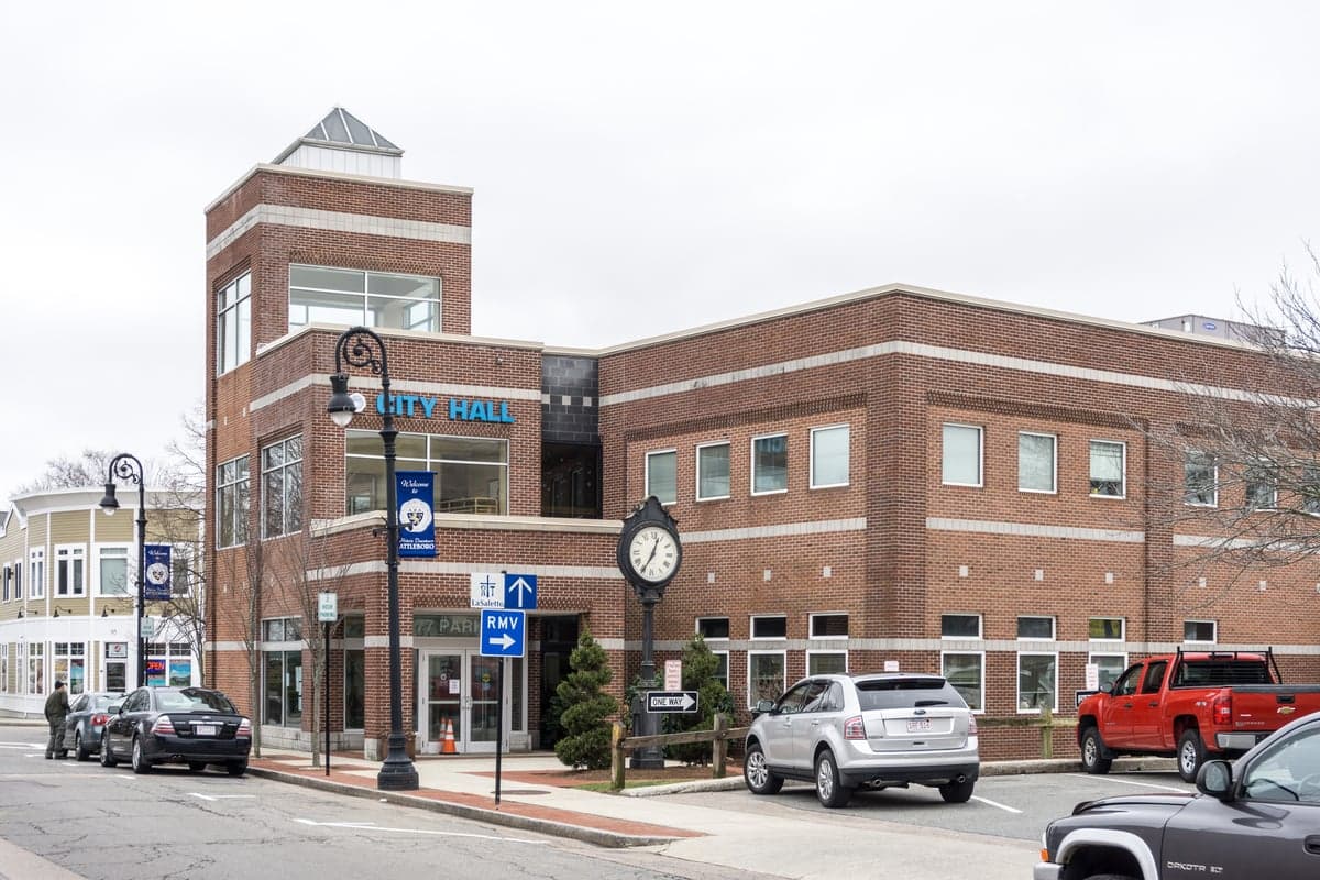
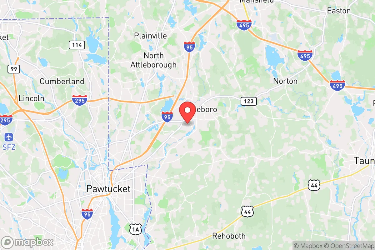
Attleboro, Massachusetts, sits in a precarious strategic position that demands careful consideration for anyone prioritizing long-term resilience. Its location along the I-95 corridor places it within a 30- to 45-minute drive of Providence, Rhode Island, and about an hour from Boston, offering economic access but also exposing residents to the cascading risks of major urban centers. For a relocator with a survivalist mindset, Attleboro’s advantages—like its access to water resources and a relatively robust local infrastructure—are tempered by its proximity to high-value targets and population-density risks that could turn the area into a chokepoint during a crisis.
Geographic position and natural advantages for long-term survival
Attleboro sits in Bristol County, roughly 15 miles from the Rhode Island border, with the Ten Mile River and Bungay River running through the city. These waterways provide a modest but reliable freshwater source for filtration and small-scale agriculture, a critical asset in a grid-down scenario. The surrounding landscape is a mix of suburban development and forested patches, with the nearby Hockomock Swamp—a 16,000-acre wetland complex—offering both a natural barrier and a potential foraging ground. The area’s elevation is generally low, averaging around 120 feet, which reduces exposure to wind damage but increases flood risk near the rivers. For a prepper, the presence of state parks like the 1,200-acre Wrentham State Forest to the north provides a buffer zone for retreat, though it’s not remote enough to be defensible against organized groups. The region’s temperate climate supports year-round gardening, with a growing season of roughly 150 days, but the harsh New England winters demand robust heating and food storage plans. Attleboro’s position on the Boston-Providence rail line and I-95 makes it a transit hub, which is a double-edged sword: it’s easy to resupply in normal times, but during a collapse, those same arteries become vectors for looting and refugee flows.
Risks, exposures, and proximity to fallout-relevant landmarks
The most glaring vulnerability for Attleboro is its proximity to high-value civilian and military infrastructure. The city lies roughly 20 miles from the Quonset Point Naval Air Station in Rhode Island and 30 miles from the Hanscom Air Force Base near Bedford, MA—both potential targets in a conflict scenario. The nearby Pilgrim Nuclear Power Station in Plymouth, about 40 miles east, is a decommissioned plant but still houses spent fuel, posing a long-term contamination risk if damaged by a natural disaster or attack. Closer to home, the I-95 and I-495 interchange just north of Attleboro is a critical logistics node that could become a bottleneck during an evacuation, drawing crowds and creating a target for civil unrest. The city’s population density of roughly 1,700 people per square mile means that a localized event—like a chemical spill from the many industrial parks along the corridor—could quickly overwhelm local resources. Attleboro’s reliance on the Massachusetts Water Resources Authority for its drinking supply is another weak point; a disruption to that system would force residents to rely on the rivers, which are vulnerable to upstream contamination from urban runoff or industrial accidents. For a conservative prepper, the area’s integration into the Boston metroplex means that any large-scale event—whether economic collapse, pandemic, or civil conflict—will ripple through Attleboro within hours, not days.
Practical resilience for a relocator: food, water, energy, and defensibility
For a single individual or family looking to hunker down, Attleboro offers a mixed bag. The city has a few local farms—like the 100-acre Briggs Farm on the outskirts—that could serve as barter hubs, but most food is trucked in from distribution centers in Providence and Boston, meaning a supply chain disruption would empty grocery shelves within 48 hours. Water resilience is better: the Ten Mile River flows year-round, and with a good filter (like a Berkey or Sawyer system), a household can secure drinking water. However, the river’s proximity to industrial zones and residential runoff means boiling or chemical treatment is non-negotiable. Energy-wise, Attleboro is on the National Grid, which is prone to outages during nor’easters; solar panels with battery backup are a wise investment, but the area’s frequent cloud cover reduces solar yield by about 30% compared to the Southwest. Defensibility is the weakest link. The city’s layout—dense residential neighborhoods with limited choke points—makes it hard to secure a single property against a determined group. The best bet is a home on the northern or western edges, near the Wrentham State Forest, where you can establish a retreat with a clear line of sight to approach routes. Community resilience is low: Attleboro’s population is transient, with many commuting to Boston or Providence, so neighborly bonds are weaker than in rural towns. A relocator would need to invest in a strong personal network or join a local preparedness group, like the Bristol County Preppers Network, which has a small but active presence.
The overall strategic picture for Attleboro is one of calculated risk. It’s not a survivalist haven—the proximity to major cities and infrastructure targets is a serious liability, and the population density makes long-term isolation nearly impossible. But for someone who needs to stay within commuting distance of work or family in the Northeast, it’s a workable base if you’re willing to invest in layered defenses, redundant water and power systems, and a solid bug-out plan for the first 72 hours of a crisis. The key is to treat Attleboro as a staging ground, not a final redoubt. Have a secondary location—perhaps a cabin in the Berkshires or northern New Hampshire—ready for a full-scale collapse. In the meantime, the city’s access to rivers, forested edges, and a small but committed prepper community gives you a fighting chance, provided you stay vigilant and avoid the trap of complacency that comes with suburban comfort.
* Values derived from national, state, county, city and local statistics and may differ in a specific area. Last updated: 2026-05-01T11:28:13.000Z
Narrative content on this page is AI-generated and may contain mistakes. Verify any details that matter before acting on them.
ReloMaps may earn a commission from affiliate links at no extra cost to you.