

Photo: Wikipedia
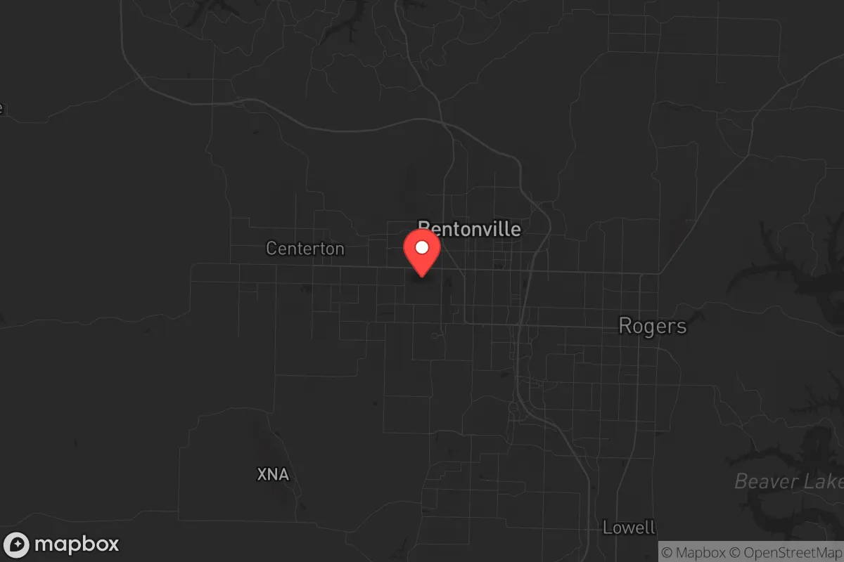
Strategic Assessment of Bentonville, AR
Workable tactical position. Some exposure to population density or targets, but generally defensible in a crisis.
What does the Strategic Assessment tell us?
Our Strategic Assessment grades tactical survivability of an area. Major population centers, military targets, fallout zones, natural disasters, and border exposure all drive risk — lower exposure means a more defensible position in a crisis.
This is heavily inspired by Joel Skousen's Strategic Relocation book. Highly recommended you checkout the book ($)What does this tell us?
Our Strategic Assessment grades tactical survivability of an area. Major population centers, military targets, fallout zones, natural disasters, and border exposure all drive risk — lower exposure means a more defensible position in a crisis.
This is heavily inspired by Joel Skousen's Strategic Relocation book. Highly recommended you checkout the book ($)Strategic Pillars

Key Distances
Regional Safe Places
Below is our recommended "safe zones" in Arkansas and the surrounding area based on our strategic heuristics. For most people, it's unrealistic to live in a “safe zone” full-time due to work, family or other personal reasons. They tend to be more rural. However, many of these areas are perfect for second homes and retreat properties that double as a vacation home or even a short-term rental.


Important Note: For informational purposes only. This does not mean nothing bad ever happens in the green zones. Please use common sense. This is based on public data and modeled with AI. We tried to take a conservative approach but mistakes happen. We update this regularly as new information becomes available.
Solar Generator Recommendations
Backup power matters more here than in safer locations. We've picked three solar generators across budgets and capacity tiers — start with the budget unit if you only need a few essentials, or step up if you want to run a fridge and HVAC for days at a time.

Jackery Portable Power Station Explorer 300
Budget OptionPower on the Go: Weighing only 11 lbs, it's convenient to set up and store with book-sized foldable solar panels

BLUETTI Portable Power Station AC180
Designed for both indoor and outdoor scenarios, AC180 is highly capable as it has a robost capacity and continuous output power.

EF ECOFLOW DELTA Pro Ultra Power Station
Upgraded PickEcoFlow DELTA Pro Ultra is a whole-home energy system designed to grow with your family. Integrated with the Smart Home Panel 2, it scales to meet your evolving energy needs — keeping your home powered, intelligent, and secure through every stage of life.
We earn a commission, at no additional cost to you.
Strategic Assessment Analysis
Bentonville, Arkansas, presents a compelling but nuanced strategic relocation option for those prioritizing resilience and preparedness. Its position in the far northwestern corner of the state, nestled in the Ozark Mountains, offers a blend of geographic insulation and economic vitality that is rare in the modern landscape. While the area is not a remote bunker, its distance from major coastal population centers and its location within a region known for natural resources and lower population density make it a serious candidate for those seeking a more secure base of operations in an uncertain future.
Geographic position and natural advantages for long-term security
Bentonville’s primary strategic asset is its location. Situated roughly 60 miles from the Missouri border and 80 miles from Oklahoma, it sits at the heart of the Ozark Plateau, a region characterized by rugged terrain, abundant freshwater springs, and a climate that supports year-round agriculture. The area’s elevation—averaging over 1,200 feet—provides a natural buffer against the flooding and storm surge risks that plague coastal and riverine cities. The underlying geology is karst limestone, which means numerous caves and natural shelters exist in the surrounding countryside, offering potential for secure storage or temporary refuge. The region’s history of self-reliance, dating back to the frontier era, is still reflected in the local culture, where hunting, fishing, and gardening are common skills. For a relocator, this means the land itself provides a foundation for subsistence that many other parts of the country lack. The nearby Buffalo National River and the vast Ozark National Forest offer thousands of square miles of undeveloped land, providing both a buffer and a resource base for those who know how to use it.
Risks, exposures, and proximity to fallout-relevant landmarks
No location is without vulnerabilities, and Bentonville has several that demand honest assessment. The most immediate concern is its proximity to the Walmart corporate headquarters and the associated economic and logistical hub. While this drives the local economy, it also makes Bentonville a potential target for civil unrest or targeted disruption. The area’s rapid growth—population has nearly doubled since 2010—has introduced a more transient, less rooted population, which can erode community cohesion during a crisis. Additionally, the region is within a few hundred miles of several potential fallout-relevant landmarks. The Arkansas Nuclear One power plant near Russellville, about 150 miles southeast, is a concern for a radiological release scenario. The Fort Chaffee military base near Fort Smith, 80 miles south, and the Little Rock Air Force Base, 180 miles southeast, are potential targets in a conflict. While Bentonville is not in a primary blast zone for any of these, prevailing wind patterns could carry fallout from a nuclear incident at Arkansas Nuclear One or a strike on Little Rock. The area is also in a moderate seismic zone—the New Madrid Seismic Zone is 200 miles east—and while a major quake is unlikely, it could disrupt supply chains and infrastructure. The biggest practical risk is the area’s dependence on a single major highway, I-49, for north-south movement. A major event could choke this artery, isolating the town from external resupply.
Practical resilience for a relocator: food, water, energy, and defensibility
For the individual or family looking to build a resilient lifestyle, Bentonville offers a strong foundation. Water is abundant. The region receives over 45 inches of rainfall annually, and the Ozark aquifer system provides clean, deep groundwater. Many rural properties have access to springs or shallow wells, reducing dependence on municipal systems. The local climate supports a long growing season (roughly 200 frost-free days), and the hilly terrain is ideal for terraced gardens, orchards, and livestock. The area has a strong local food movement, with farmers’ markets and a growing network of homesteaders. For energy, the region is served by Southwestern Electric Power Company (SWEPCO), which relies on a mix of coal, natural gas, and nuclear. However, the mountainous terrain makes solar power viable, and many off-grid properties already use solar arrays with battery backup. Wood is plentiful for heating, and the local culture of woodstove use is well-established. Defensibility is a mixed picture. The town itself is a suburban sprawl with limited chokepoints, but the surrounding countryside offers numerous properties with natural defensibility—homes set back from roads, with clear fields of fire and access to multiple egress routes. The local gun culture is strong, with a high rate of firearm ownership and a legal environment that supports the right to keep and bear arms. The Benton County Sheriff’s Office is professional, but response times in rural areas can be 20-30 minutes. For a relocator, the key is to buy land outside the city limits, preferably with a well, a septic system, and a southern slope for solar gain. The area’s strong community of like-minded individuals—many drawn by the same strategic calculus—means you can find neighbors who share your preparedness mindset.
The overall strategic picture for Bentonville is one of calculated opportunity. It is not a remote survivalist retreat, but it is a functioning, economically robust town with access to the natural resources and community infrastructure needed to weather a range of disruptions. The risks—proximity to a corporate target, moderate seismic activity, and distance from military fallout zones—are real but manageable with proper planning. For the conservative relocator who values self-reliance, community, and a lower cost of living, Bentonville offers a rare combination: a place where you can build a modern life while maintaining the ability to step back into a more resilient, self-sufficient existence when the world demands it. The key is to buy land with water and defensibility, integrate into the local network of homesteaders and preppers, and keep a low profile. Done right, Bentonville can be a solid anchor in an uncertain future.
* Values derived from national, state, county, city and local statistics and may differ in a specific area. Last updated: 2026-04-29T02:30:17.000Z
Narrative content on this page is AI-generated and may contain mistakes. Verify any details that matter before acting on them.
ReloMaps may earn a commission from affiliate links at no extra cost to you.