

Strategic Assessment of Braintree Town, MA
Multiple tactical vulnerabilities. Population density, target proximity, or disaster risk are likely compounding. A retreat property and exit planning is required.
What does the Strategic Assessment tell us?
Our Strategic Assessment grades tactical survivability of an area. Major population centers, military targets, fallout zones, natural disasters, and border exposure all drive risk — lower exposure means a more defensible position in a crisis.
This is heavily inspired by Joel Skousen's Strategic Relocation book. Highly recommended you checkout the book ($)What does this tell us?
Our Strategic Assessment grades tactical survivability of an area. Major population centers, military targets, fallout zones, natural disasters, and border exposure all drive risk — lower exposure means a more defensible position in a crisis.
This is heavily inspired by Joel Skousen's Strategic Relocation book. Highly recommended you checkout the book ($)Strategic Pillars

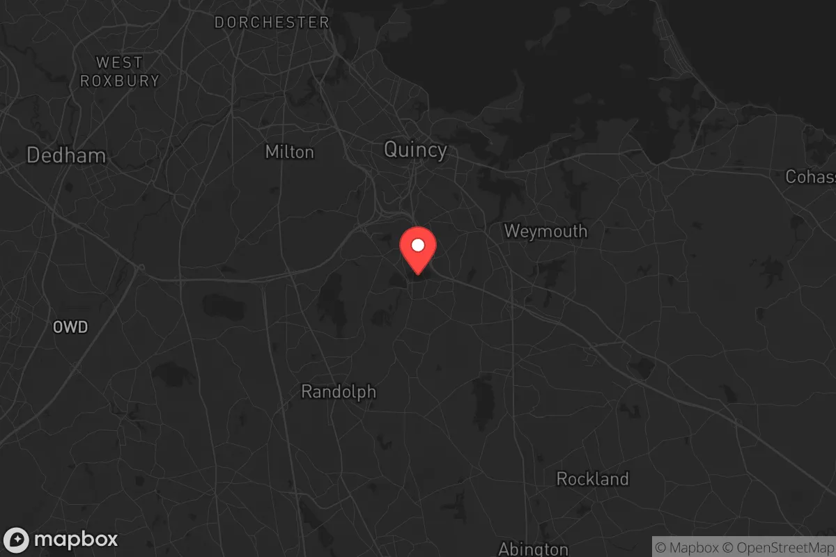
Key Distances
Regional Safe Places
Below is our recommended "safe zones" in Massachusetts and the surrounding area based on our strategic heuristics. For most people, it's unrealistic to live in a “safe zone” full-time due to work, family or other personal reasons. They tend to be more rural. However, many of these areas are perfect for second homes and retreat properties that double as a vacation home or even a short-term rental.


Important Note: For informational purposes only. This does not mean nothing bad ever happens in the green zones. Please use common sense. This is based on public data and modeled with AI. We tried to take a conservative approach but mistakes happen. We update this regularly as new information becomes available.
Solar Generator Recommendations
Backup power matters more here than in safer locations. We've picked three solar generators across budgets and capacity tiers — start with the budget unit if you only need a few essentials, or step up if you want to run a fridge and HVAC for days at a time.

Jackery Portable Power Station Explorer 300
Budget OptionPower on the Go: Weighing only 11 lbs, it's convenient to set up and store with book-sized foldable solar panels

BLUETTI Portable Power Station AC180
Designed for both indoor and outdoor scenarios, AC180 is highly capable as it has a robost capacity and continuous output power.

EF ECOFLOW DELTA Pro Ultra Power Station
Upgraded PickEcoFlow DELTA Pro Ultra is a whole-home energy system designed to grow with your family. Integrated with the Smart Home Panel 2, it scales to meet your evolving energy needs — keeping your home powered, intelligent, and secure through every stage of life.
We earn a commission, at no additional cost to you.
Strategic Assessment Analysis
Braintree Town, Massachusetts, presents a complex strategic picture for the conservative-minded relocator focused on resilience. Its primary advantage—proximity to Boston and the economic engine of the Northeast—is simultaneously its greatest liability in a crisis scenario. The town sits roughly 10 miles south of Boston, placing it within the immediate fallout zone of any major metropolitan disruption, whether from civil unrest, a mass casualty event, or a larger geopolitical incident. For those prioritizing long-term survival and self-sufficiency, Braintree’s location demands a sober assessment of trade-offs: it offers robust infrastructure and economic opportunity in stable times, but its density, reliance on external supply chains, and proximity to high-value targets make it a high-risk area when the system falters.
Geographic position and natural advantages for a prepper
Braintree’s geography is a mixed bag. It sits on the coastal plain of the South Shore, with the Fore River and Monatiquot River providing some natural water access, though these are tidal and brackish, limiting their utility for potable water without significant treatment. The town is largely suburban, with a mix of older neighborhoods and newer developments, but it lacks the deep forest cover or rugged terrain that aids in concealment or off-grid living. The Blue Hills Reservation, a 7,000-acre state park, lies just to the west, offering some wooded buffer and potential for foraging or hunting, but it’s a heavily trafficked public space that would become a contested resource in a collapse. Elevation is modest—the highest point is around 200 feet—so there’s no natural defensive high ground. The coast is a double-edged sword: it provides access to marine resources (fishing, tidal foraging) but also exposes the area to storm surges and sea-level rise, which are real concerns for long-term infrastructure stability. For a relocator, the key natural advantage is the proximity to the Blue Hills and the coast, but neither offers the kind of remote, defensible position a serious prepper would seek.
Risks, exposures, and proximity to fallout-relevant landmarks
The most glaring risk for Braintree is its location within the Boston metropolitan area. The town is directly adjacent to the Massachusetts Bay Transportation Authority (MBTA) Red Line, which terminates at Braintree station, making it a transit hub that would be a focal point for evacuation or unrest. Braintree is roughly 10 miles from Boston’s Logan International Airport, a high-value target for any kinetic event, and about 12 miles from the Boston Seaport District, which houses major financial and government infrastructure. The town itself hosts several large commercial centers, including the South Shore Plaza mall, which would become a looting magnet during civil unrest. Additionally, Braintree is within the 50-mile radius of the Pilgrim Nuclear Power Station in Plymouth, which, while decommissioned, still holds spent fuel on site—a potential radiological hazard if compromised. The Fore River is also home to the former Quincy Shipyard, now a site for offshore wind energy construction, which could be a target for sabotage or protest. For a conservative relocator concerned with mass casualty events, the density of the Boston metro means that any biological or chemical incident would spread rapidly through the population, and Braintree’s position on major highways (I-93, Route 3, and the Expressway) makes it a choke point for both escape and congestion. In a worst-case scenario, the town’s 37,000 residents would be competing with millions of others for the same limited routes out of the city.
Practical resilience for a relocator: food, water, energy, and defensibility
For a relocator looking to establish a resilient household, Braintree’s practical assets are limited. The town’s water supply comes from the Massachusetts Water Resources Authority (MWRA), which draws from the Quabbin Reservoir—a centralized system that is vulnerable to contamination or disruption. There are no significant private wells or natural springs within the town limits, meaning a long-term water shortage would require rainwater collection or hauling from the Blue Hills, which is not a sustainable solution for a family. Food security is equally challenging: Braintree has no agricultural land to speak of, and the few community gardens are small and unlikely to meet caloric needs. The town’s grocery stores (Stop & Shop, Shaw’s, Market Basket) are dependent on just-in-time delivery, and shelves would empty within 48 hours of a crisis. Energy infrastructure is typical for the region—grid-tied electricity with natural gas heating—and there is no local renewable energy production of note. Solar panels are possible but would require battery storage to be useful during grid outages, which are common in New England winter storms. Defensibility is poor: Braintree is a dense suburban grid with no natural barriers, and its police force (about 70 officers) would be overwhelmed in a widespread event. The town’s location on the MBTA line and major highways means it would be a transit corridor for displaced populations, increasing the risk of property crime and home invasion. For a relocator, the best practical step would be to establish a secure, fortified home with a deep pantry, a well-stocked medical kit, and a plan for rapid evacuation to a more rural secondary location—Braintree itself is not a place to hunker down long-term.
The overall strategic picture for Braintree Town is one of calculated risk. It offers excellent economic opportunity and access to world-class medical care (Beth Israel Deaconess Hospital–Milton is nearby) during stable times, which is a legitimate consideration for a relocator with a family or health concerns. However, for the conservative prepper who prioritizes self-reliance, low profile, and distance from population centers, Braintree falls short. The town’s density, reliance on centralized infrastructure, and proximity to Boston’s high-value targets make it a high-risk location for any scenario involving civil unrest, mass casualty events, or systemic collapse. A relocator would be better served by looking further south or west, into the more rural towns of Plymouth County or Worcester County, where land is cheaper, water is more accessible, and the population density drops off sharply. If Braintree is chosen for job or family reasons, the strategy must be one of active preparation: a go-bag, a bug-out vehicle, and a pre-identified retreat location at least 50 miles away, ideally in a low-population area with its own water source and defensible terrain. In short, Braintree is a place to live, not a place to survive.
* Values derived from national, state, county, city and local statistics and may differ in a specific area. Last updated: 2026-05-01T07:00:10.000Z
Narrative content on this page is AI-generated and may contain mistakes. Verify any details that matter before acting on them.
ReloMaps may earn a commission from affiliate links at no extra cost to you.