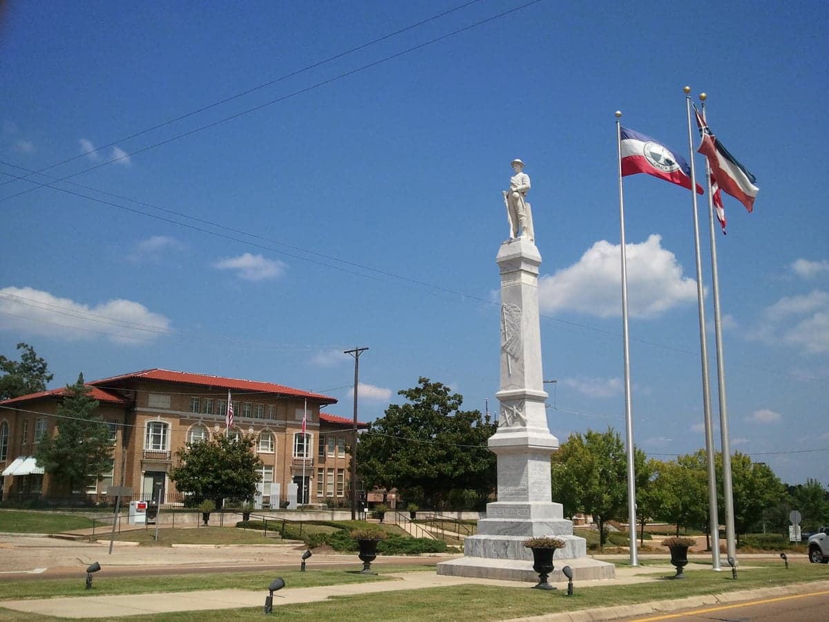
Photo: Wikipedia
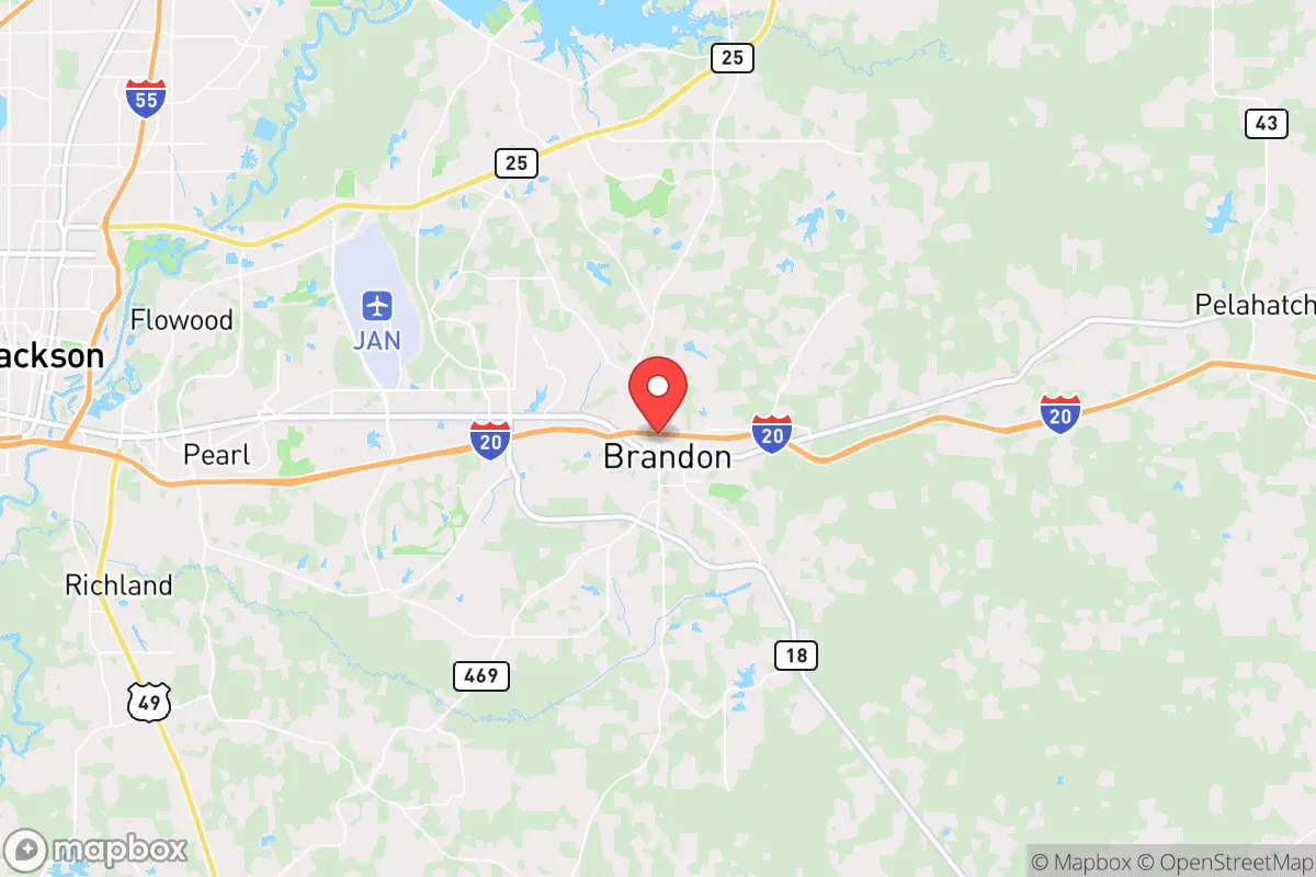
Strategic Assessment of Brandon, MS
Workable tactical position. Some exposure to population density or targets, but generally defensible in a crisis.
What does the Strategic Assessment tell us?
Our Strategic Assessment grades tactical survivability of an area. Major population centers, military targets, fallout zones, natural disasters, and border exposure all drive risk — lower exposure means a more defensible position in a crisis.
This is heavily inspired by Joel Skousen's Strategic Relocation book. Highly recommended you checkout the book ($)What does this tell us?
Our Strategic Assessment grades tactical survivability of an area. Major population centers, military targets, fallout zones, natural disasters, and border exposure all drive risk — lower exposure means a more defensible position in a crisis.
This is heavily inspired by Joel Skousen's Strategic Relocation book. Highly recommended you checkout the book ($)Strategic Pillars

Key Distances
Regional Safe Places
Below is our recommended "safe zones" in Mississippi and the surrounding area based on our strategic heuristics. For most people, it's unrealistic to live in a “safe zone” full-time due to work, family or other personal reasons. They tend to be more rural. However, many of these areas are perfect for second homes and retreat properties that double as a vacation home or even a short-term rental.
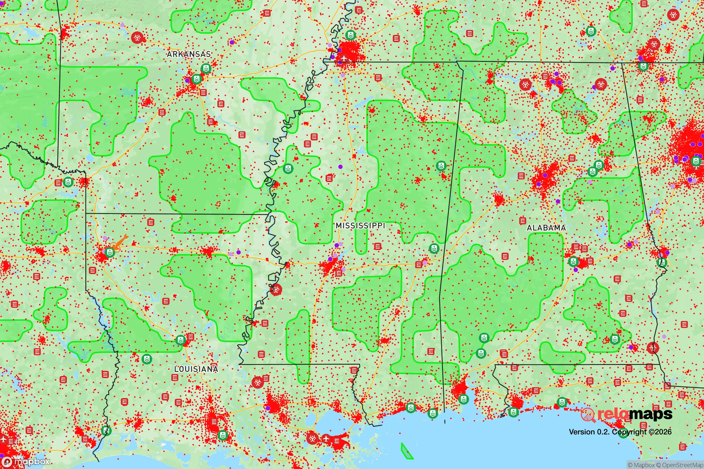
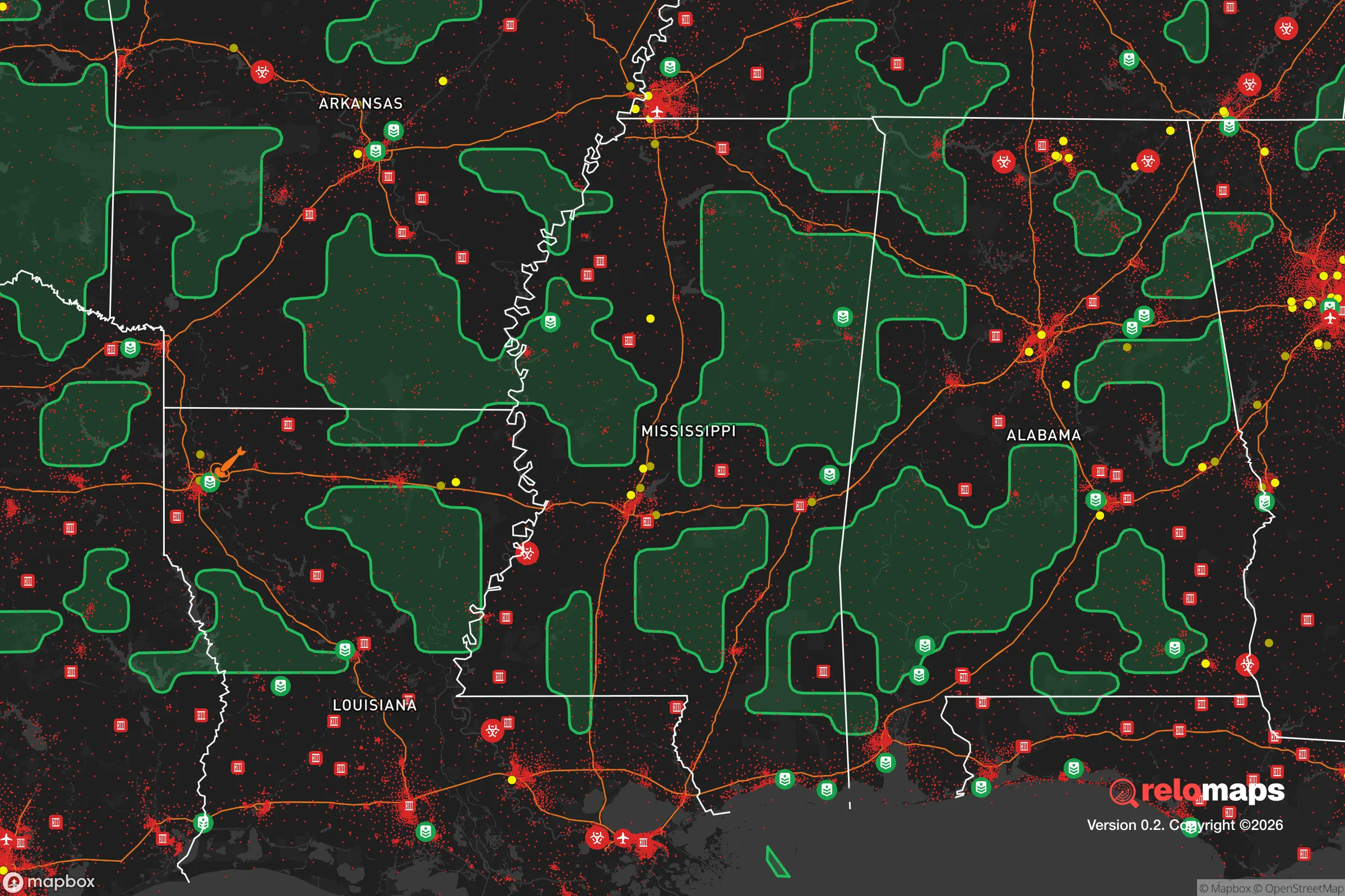
Important Note: For informational purposes only. This does not mean nothing bad ever happens in the green zones. Please use common sense. This is based on public data and modeled with AI. We tried to take a conservative approach but mistakes happen. We update this regularly as new information becomes available.
Solar Generator Recommendations
Backup power matters more here than in safer locations. We've picked three solar generators across budgets and capacity tiers — start with the budget unit if you only need a few essentials, or step up if you want to run a fridge and HVAC for days at a time.

Jackery Portable Power Station Explorer 300
Budget OptionPower on the Go: Weighing only 11 lbs, it's convenient to set up and store with book-sized foldable solar panels

BLUETTI Portable Power Station AC180
Designed for both indoor and outdoor scenarios, AC180 is highly capable as it has a robost capacity and continuous output power.

EF ECOFLOW DELTA Pro Ultra Power Station
Upgraded PickEcoFlow DELTA Pro Ultra is a whole-home energy system designed to grow with your family. Integrated with the Smart Home Panel 2, it scales to meet your evolving energy needs — keeping your home powered, intelligent, and secure through every stage of life.
We earn a commission, at no additional cost to you.
Strategic Assessment Analysis
Brandon, Mississippi, offers a strategic balance of proximity to regional infrastructure and a degree of separation from the most acute risks of a major metropolitan collapse, making it a viable consideration for those prioritizing resilience. Located just east of Jackson, the state capital and largest city, Brandon sits in a position that allows access to essential services and supply chains while maintaining a buffer from the immediate fallout of urban unrest, grid failure, or a mass casualty event. The area’s relative stability, rooted in a conservative social fabric and lower population density compared to the Jackson metro core, provides a foundation for long-term preparedness planning.
Geographic position and natural advantages for long-term stability
Brandon’s location in Rankin County places it on the eastern edge of the Jackson metropolitan area, a geography that offers several natural advantages. The Pearl River runs to the west, creating a natural barrier between Brandon and the densest parts of Jackson, which can slow the spread of civil unrest or disease vectors during a crisis. The terrain is gently rolling, with ample hardwood forests and agricultural land within a 30-minute drive, providing options for hunting, foraging, and small-scale farming if supply chains falter. The region sits outside the highest-risk zones for hurricanes—unlike the Gulf Coast—and is not prone to earthquakes, wildfires, or frequent tornado outbreaks, though severe thunderstorms and occasional tornadoes do occur. The climate supports year-round growing seasons, a critical factor for food security. Water resources are plentiful, with the Pearl River and numerous smaller creeks and reservoirs (like the Ross Barnett Reservoir, about 20 minutes north) offering redundancy for potable water if municipal systems fail. For a relocator, this means you are not dependent on a single water source or a fragile grid connection—wells and rainwater catchment are viable long-term options.
Risks, exposures, and proximity to fallout-relevant landmarks
The primary strategic risk for Brandon is its proximity to Jackson, a city that has experienced significant population decline, infrastructure decay, and periodic civil unrest. Jackson’s water system has already failed multiple times in recent years, and its crime rates are among the highest in the region. In a mass casualty event or widespread civic breakdown, Jackson could become a source of refugees, looting parties, or disease vectors moving east along Interstate 20 and Highway 80. Brandon sits roughly 15 miles from downtown Jackson, which is close enough that you will hear gunfire and see smoke on a bad night, but far enough that you can establish a defensible perimeter if you choose a property on the eastern or southern edges of town. The city itself is not a primary target for nuclear or EMP attack—no major military bases, ports, or strategic industrial complexes are nearby—but the Jackson-Medgar Wiley Evers International Airport and the University of Mississippi Medical Center are potential secondary targets for a sophisticated adversary. The nearby Nissan Canton plant (about 20 miles north) and the Entergy nuclear plant at Grand Gulf (about 60 miles southwest) are industrial risks; a catastrophic failure at Grand Gulf could affect downwind areas, though prevailing winds typically carry fallout east or northeast, away from Brandon. The biggest exposure is social: Brandon’s growth has attracted newcomers from across the country, and while the community remains conservative, the influx has increased traffic and strained local services. In a collapse scenario, the town’s relative prosperity could make it a target for desperate populations from Jackson and surrounding rural areas.
Practical resilience for a relocator: food, water, energy, and defensibility
For a relocator serious about preparedness, Brandon offers a workable but not ideal baseline. Food security is achievable: the area has multiple farmers’ markets, a strong local hunting culture (deer, turkey, small game), and soil that supports vegetable gardens and fruit trees (pecans, figs, persimmons). The Mississippi State University Extension Service in Rankin County provides resources for small-scale agriculture, and there are several local farms that sell directly to consumers. However, the town itself is suburban—most homes sit on quarter-acre to half-acre lots, which limits large-scale food production. You will need to secure land outside the city limits for serious self-sufficiency. Water is less of a concern: the Pearl River is accessible, but you must treat it due to agricultural runoff and upstream sewage. Many older homes in the area have wells, and new construction can include well and septic systems. The municipal water supply is treated but has experienced boil-water advisories after heavy rains. For energy, Brandon is served by Entergy Mississippi, which has a mixed reliability record—outages after storms can last 12 to 48 hours. Solar is viable, with ample sun exposure, but net metering policies are not as favorable as in some western states. Backup generators are common among prepared residents. Defensibility is the weakest point for most suburban properties. Brandon’s layout is typical of a Southern bedroom community: cul-de-sacs, open floor plans, and large windows. A home on a corner lot or near a main road is a liability. The best options are properties on the eastern edge of town, near the Rankin County line, where lots are larger and roads are fewer. The Rankin County Sheriff’s Office is well-funded and professional, but in a widespread crisis, response times will stretch to hours or longer. You should plan to be your own first responder. The community itself is a mixed bag: many residents are church-going, family-oriented, and armed, which creates a natural neighborhood watch. But the rapid growth has introduced some transient populations, so vetting neighbors is wise.
The overall strategic picture for Brandon is one of moderate resilience with clear trade-offs. It is not a remote bug-out location—it is a suburban town with a direct highway connection to a struggling major city. That connection is both a vulnerability and an asset: you can access Jackson’s hospitals, supply chains, and transportation hubs when things are stable, but you must have a plan to seal off that route when they are not. For a conservative-leaning individual or family who wants to stay within driving distance of work, schools, and medical care while maintaining a credible preparedness posture, Brandon works. The key is to buy on the eastern fringe, invest in water and power independence, and build relationships with like-minded neighbors before the crisis arrives. The area’s natural resources, conservative culture, and distance from the worst of Jackson’s dysfunction give it a solid B+ grade for strategic relocation—but only if you treat it as a base of operations, not a fortress.
* Values derived from national, state, county, city and local statistics and may differ in a specific area. Last updated: 2026-04-30T21:52:56.000Z
Narrative content on this page is AI-generated and may contain mistakes. Verify any details that matter before acting on them.
ReloMaps may earn a commission from affiliate links at no extra cost to you.