Photo: Wikipedia
Strategic Assessment of Buckhannon, WV
Meaningful friction. Expect exposure to either population pressure, blast zones, or natural disaster risk. Consider buying a retreat property.
What does the Strategic Assessment tell us?
Our Strategic Assessment grades tactical survivability of an area. Major population centers, military targets, fallout zones, natural disasters, and border exposure all drive risk — lower exposure means a more defensible position in a crisis.
This is heavily inspired by Joel Skousen's Strategic Relocation book. Highly recommended you checkout the book ($)What does this tell us?
Our Strategic Assessment grades tactical survivability of an area. Major population centers, military targets, fallout zones, natural disasters, and border exposure all drive risk — lower exposure means a more defensible position in a crisis.
This is heavily inspired by Joel Skousen's Strategic Relocation book. Highly recommended you checkout the book ($)Strategic Pillars

Key Distances
Regional Safe Places
Below is our recommended "safe zones" in West Virginia and the surrounding area based on our strategic heuristics. For most people, it's unrealistic to live in a “safe zone” full-time due to work, family or other personal reasons. They tend to be more rural. However, many of these areas are perfect for second homes and retreat properties that double as a vacation home or even a short-term rental.


Important Note: For informational purposes only. This does not mean nothing bad ever happens in the green zones. Please use common sense. This is based on public data and modeled with AI. We tried to take a conservative approach but mistakes happen. We update this regularly as new information becomes available.
Solar Generator Recommendations
Backup power matters more here than in safer locations. We've picked three solar generators across budgets and capacity tiers — start with the budget unit if you only need a few essentials, or step up if you want to run a fridge and HVAC for days at a time.

Jackery Portable Power Station Explorer 300
Budget OptionPower on the Go: Weighing only 11 lbs, it's convenient to set up and store with book-sized foldable solar panels

BLUETTI Portable Power Station AC180
Designed for both indoor and outdoor scenarios, AC180 is highly capable as it has a robost capacity and continuous output power.

EF ECOFLOW DELTA Pro Ultra Power Station
Upgraded PickEcoFlow DELTA Pro Ultra is a whole-home energy system designed to grow with your family. Integrated with the Smart Home Panel 2, it scales to meet your evolving energy needs — keeping your home powered, intelligent, and secure through every stage of life.
We earn a commission, at no additional cost to you.
Strategic Assessment Analysis
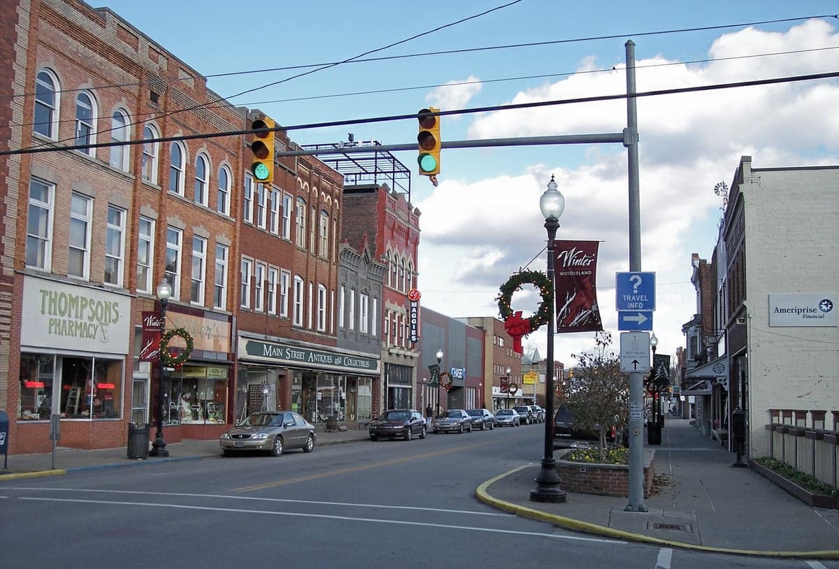
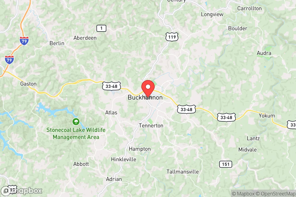
Buckhannon, West Virginia, offers a compelling mix of geographic isolation and practical self-sufficiency that appeals to those planning for long-term resilience. Nestled in the Appalachian foothills of Upshur County, this town of roughly 5,600 people sits far enough from major metropolitan targets to reduce fallout risks, yet remains connected enough for supply runs and medical access. Its position along the Buckhannon River, surrounded by the Monongahela National Forest, provides natural barriers and resources that make it a serious contender for a strategic relocation, especially for those prioritizing preparedness over convenience.
Geographic position and natural advantages for long-term security
Buckhannon’s location is its strongest asset for a survivalist mindset. The town is roughly 90 miles south of Pittsburgh and 120 miles west of Washington, D.C., placing it outside the immediate blast and fallout zones of those high-value targets. The surrounding terrain—steep ridges, dense hardwood forests, and narrow valleys—creates natural chokepoints that would slow any large-scale movement, whether from civil unrest or disaster refugees. The area sits in the Allegheny Plateau, with elevations ranging from 1,400 to 2,500 feet, which offers cooler summers and a longer growing season than deeper mountain valleys. The Buckhannon River, a tributary of the Tygart Valley River, provides a reliable surface water source, though it’s not large enough to attract industrial traffic. For a relocator, this means defensible ground with multiple escape routes via secondary roads like US-33 and US-119, which connect to smaller towns like Elkins and Weston without funneling through major interstates. The Monongahela National Forest, just east of town, offers over 900,000 acres of public land for foraging, hunting, and off-grid retreats, though legal access and land ownership need careful vetting.
Risks, exposures, and proximity to fallout-relevant landmarks
No location is immune to risks, and Buckhannon has its share. The most immediate concern is the proximity to the Clarksburg FBI Center and the National Radio Astronomy Observatory in Green Bank, both about 60 miles away. While not nuclear targets, these facilities could draw secondary attention during a national crisis, such as cyberattacks or targeted sabotage. The Morgantown area, home to West Virginia University and a major medical complex, is 50 miles north and could become a refugee magnet during a pandemic or economic collapse. More critically, the Buckhannon River is prone to flash flooding after heavy rains, as seen in the 1985 floods that damaged parts of the town. The region also sits in a moderate seismic zone, though earthquakes are rare. For fallout concerns, the prevailing winds from the west-northwest mean that a strike on Pittsburgh or Washington, D.C., would carry radioactive particles away from Buckhannon in most scenarios, but a strike on the Ohio River Valley industrial corridor (e.g., the Piketon uranium enrichment plant, 150 miles west) could pose a drift risk. The town’s water treatment plant and power grid are aging, with Upshur County’s infrastructure rated as “fair” by state assessments, meaning a prolonged outage could strain resources. The local hospital, St. Joseph’s, is a critical access facility with limited trauma capabilities, so serious injuries would require a 45-minute drive to Morgantown or a 90-minute drive to Charleston.
Practical resilience for a relocator: food, water, energy, and defensibility
For someone serious about self-reliance, Buckhannon offers a workable baseline. Water access is above average: the Buckhannon River and numerous creeks (e.g., Sand Run, Turkey Run) provide year-round flow, but all surface water requires filtration due to agricultural runoff and upstream septic systems. Well drilling is common in rural Upshur County, with depths averaging 150–300 feet and yields of 5–15 gallons per minute—enough for a household with storage. Food production is feasible: the growing season runs from mid-April to mid-October, with fertile valley soils suitable for corn, beans, squash, and root vegetables. Local farmers’ markets operate seasonally, and the Upshur County Cooperative Extension offers soil testing and seed-sharing programs. For protein, deer hunting is abundant (West Virginia has one of the highest deer densities in the East), and small game like squirrel and rabbit are plentiful. Fishing in the Buckhannon River yields smallmouth bass and trout, though pressure is moderate. Energy resilience is a weak point: the grid is served by FirstEnergy, with frequent outages during winter storms (ice storms are common). Solar potential is moderate—about 4.2 peak sun hours per day—but tree cover in the valleys limits rooftop yield. Wood heating is the most reliable backup, with firewood permits available from the Monongahela National Forest for $20 per cord. Defensibility is good: the town’s layout, with a compact downtown and scattered rural homesteads, means a relocator can choose a property with clear sightlines and limited road access. The local sheriff’s office is small (about 15 deputies for the county), so community watch and personal security measures are expected. Gun laws are favorable: West Virginia is a constitutional carry state, and no permit is needed for open or concealed carry for residents 21 and older. The nearest gun ranges are in Elkins (15 miles) and Weston (10 miles).
Overall, Buckhannon presents a solid strategic option for a relocator who values distance from major targets, natural resources, and a low-profile lifestyle. It’s not a fortress—the aging infrastructure, flood risk, and limited medical access require serious planning—but it offers a realistic balance of isolation and accessibility. For a conservative-leaning individual or family looking to weather civic unrest or national disruptions, this area provides a defensible base with room to grow food, store water, and build community ties without drawing attention. The key is to secure land with a reliable water source and a southern slope for solar, and to establish relationships with local farmers and tradespeople before any crisis hits. Buckhannon won’t make headlines, but that’s exactly the point.
* Values derived from national, state, county, city and local statistics and may differ in a specific area. Last updated: 2026-05-01T15:24:29.000Z
Narrative content on this page is AI-generated and may contain mistakes. Verify any details that matter before acting on them.
ReloMaps may earn a commission from affiliate links at no extra cost to you.