
Photo: Wikipedia
Strategic Assessment of Buena Vista, CO
Workable tactical position. Some exposure to population density or targets, but generally defensible in a crisis.
What does the Strategic Assessment tell us?
Our Strategic Assessment grades tactical survivability of an area. Major population centers, military targets, fallout zones, natural disasters, and border exposure all drive risk — lower exposure means a more defensible position in a crisis.
This is heavily inspired by Joel Skousen's Strategic Relocation book. Highly recommended you checkout the book ($)What does this tell us?
Our Strategic Assessment grades tactical survivability of an area. Major population centers, military targets, fallout zones, natural disasters, and border exposure all drive risk — lower exposure means a more defensible position in a crisis.
This is heavily inspired by Joel Skousen's Strategic Relocation book. Highly recommended you checkout the book ($)Strategic Pillars

Key Distances
Regional Safe Places
Below is our recommended "safe zones" in Colorado and the surrounding area based on our strategic heuristics. For most people, it's unrealistic to live in a “safe zone” full-time due to work, family or other personal reasons. They tend to be more rural. However, many of these areas are perfect for second homes and retreat properties that double as a vacation home or even a short-term rental.


Important Note: For informational purposes only. This does not mean nothing bad ever happens in the green zones. Please use common sense. This is based on public data and modeled with AI. We tried to take a conservative approach but mistakes happen. We update this regularly as new information becomes available.
Solar Generator Recommendations
Backup power matters more here than in safer locations. We've picked three solar generators across budgets and capacity tiers — start with the budget unit if you only need a few essentials, or step up if you want to run a fridge and HVAC for days at a time.

Jackery Portable Power Station Explorer 300
Budget OptionPower on the Go: Weighing only 11 lbs, it's convenient to set up and store with book-sized foldable solar panels

BLUETTI Portable Power Station AC180
Designed for both indoor and outdoor scenarios, AC180 is highly capable as it has a robost capacity and continuous output power.

EF ECOFLOW DELTA Pro Ultra Power Station
Upgraded PickEcoFlow DELTA Pro Ultra is a whole-home energy system designed to grow with your family. Integrated with the Smart Home Panel 2, it scales to meet your evolving energy needs — keeping your home powered, intelligent, and secure through every stage of life.
We earn a commission, at no additional cost to you.
Strategic Assessment Analysis
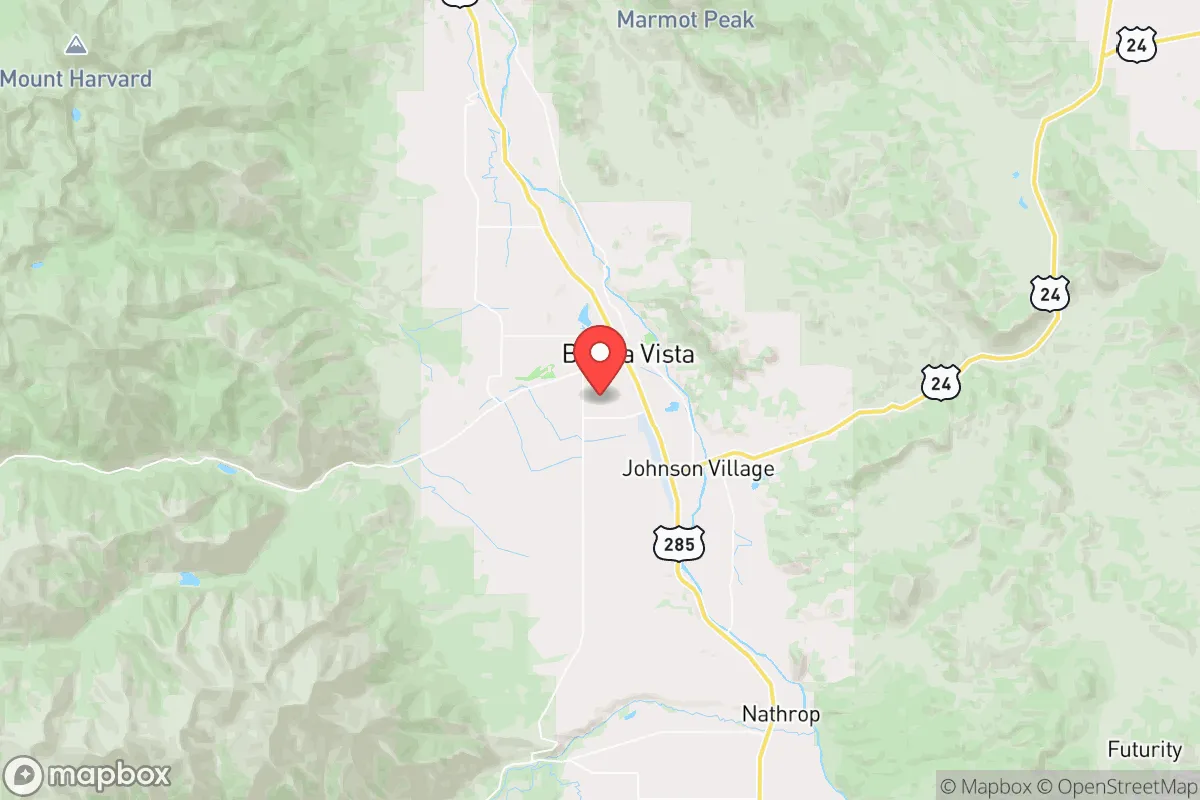
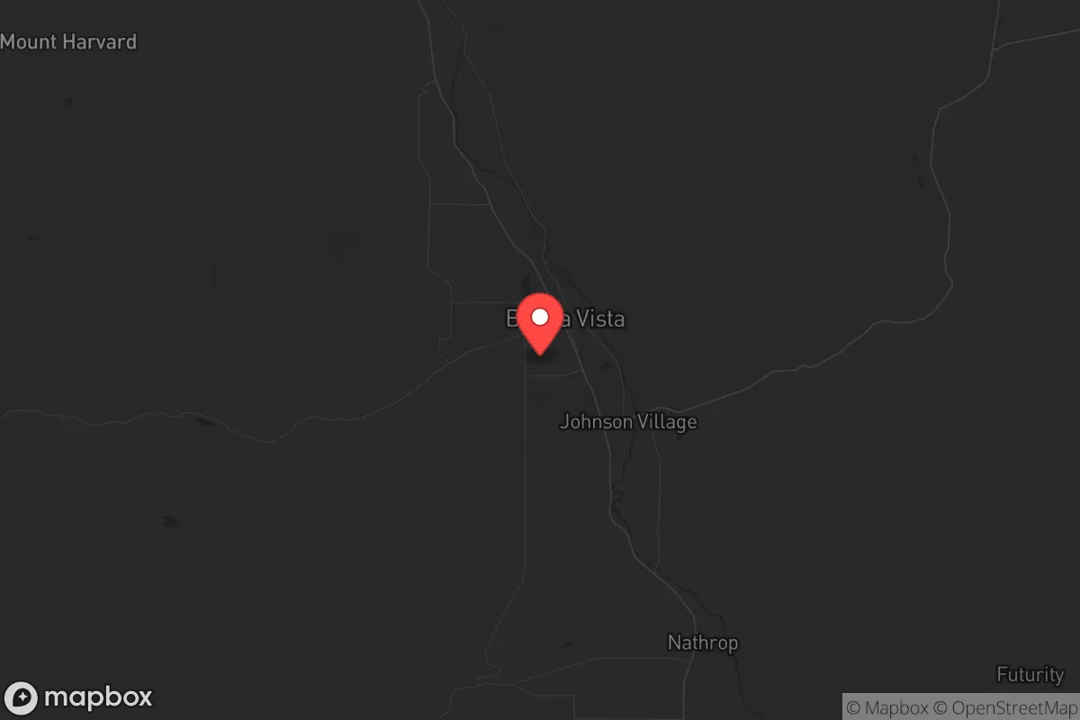
Buena Vista, Colorado, offers a compelling strategic position for those prioritizing resilience and self-sufficiency, sitting at the northern edge of the Upper Arkansas River Valley with the Sawatch Range to the west and the Mosquito Range to the east. This location provides natural barriers against large-scale population movement, while the town itself—population roughly 2,900—remains small enough to avoid the logistical vulnerabilities of urban centers yet large enough to maintain basic infrastructure. For a relocator concerned with civic unrest, mass casualty events, or cascading disasters, Buena Vista’s combination of altitude, water access, and relative isolation from major metropolitan fallout zones makes it a serious candidate for a long-term base of operations.
Geographic position and natural advantages for long-term security
Buena Vista sits at roughly 7,900 feet elevation in a high mountain valley, flanked by the Collegiate Peaks to the west and the Mosquito Range to the east. This geography creates a natural funnel for movement—anyone approaching from the Front Range must cross either Trout Creek Pass (9,346 feet) or Cottonwood Pass (12,126 feet), both of which are easily monitored and, in a crisis, defensible chokepoints. The Arkansas River runs directly through town, providing a reliable surface water source that is less likely to be contaminated by upstream industrial activity compared to rivers near Denver or Colorado Springs. The surrounding national forest land—San Isabel National Forest to the west and Pike National Forest to the east—offers ample room for dispersed camping, hunting, and foraging, though note that much of this land is public and subject to federal management. The area’s cold winters (average January low around 10°F) act as a natural population filter; those unprepared for sustained subfreezing temperatures will not linger, which reduces the risk of transient pressure during a collapse scenario.
Risks, exposures, and proximity to fallout-relevant landmarks
Buena Vista’s primary strategic weakness is its proximity to Colorado’s Front Range urban corridor. Denver is roughly 100 miles east-northeast via US-24 and I-70—a drive that, under normal conditions, takes about two hours. In a mass evacuation event, that corridor would become a parking lot, but the real concern is the potential for refugees to filter west over the passes. Leadville (30 miles north) and Salida (20 miles south) are the nearest population centers of comparable size, but neither poses a direct threat; the larger risk is from Colorado Springs (120 miles southeast) and Denver itself. The area is also within 150 miles of the United States Air Force Academy and Peterson Space Force Base near Colorado Springs, which could become secondary targets in a conflict scenario. Wildfire risk is moderate but real—the 2018 Hayden Pass Fire burned 16,000 acres just south of town, and the 2020 Decker Fire threatened the area. Flooding from the Arkansas River is a lower-probability event, but heavy snowmelt years can cause localized issues. No nuclear power plants exist within 200 miles, and the nearest major military installation (Fort Carson) is 130 miles away, reducing the likelihood of direct kinetic targeting.
Practical resilience for a relocator: food, water, energy, and defensibility
Water is Buena Vista’s strongest asset. The Arkansas River flows year-round, and the town’s municipal water comes from a combination of surface and groundwater sources. For a relocator, securing a property with a well or direct river access is feasible—many rural parcels outside town limits have exempt wells. The growing season is short (roughly 60–90 frost-free days), but high-altitude gardening is possible with cold frames and hoop houses; potatoes, root vegetables, and hardy greens perform well. Local agriculture is limited, but the Arkansas Valley below Salida has more productive farmland, and a 30-minute drive south opens up better growing conditions. Energy resilience is mixed: the local grid is served by Xcel Energy, which has a history of outages during winter storms, but solar potential is excellent—Buena Vista averages over 300 sunny days per year, and off-grid solar with battery storage is a viable option. Propane is widely available for heating and cooking, and wood-burning stoves are common in older homes. Defensibility is good for a small group: the valley floor is open, but the surrounding hillsides offer observation points, and the limited road access (primarily US-24 and CO-306) means that a small, organized community could effectively control ingress. The nearest hospital is Heart of the Rockies Regional Medical Center in Salida (20 miles), which is a Level IV trauma center—adequate for routine emergencies but not for mass casualty events. For serious medical needs, evacuation to Colorado Springs or Denver would be required, which is a vulnerability.
The overall strategic picture for Buena Vista is one of moderate-to-high resilience with clear trade-offs. It offers excellent natural water, defensible terrain, and isolation from the worst of Front Range chaos, but it is not a fortress—the passes can be crossed, the winters are harsh, and the local economy is heavily dependent on tourism and second-home owners, which could collapse in a prolonged crisis. For a single individual or family willing to invest in off-grid energy, food storage, and winter preparedness, Buena Vista provides a solid base with room to expand. The key is to secure a property with water rights, a defensible position, and enough land for subsistence agriculture—and to build relationships with the existing community before things go sideways. This is not a bug-out location for a weekend; it is a long-term homesteading play that rewards preparation and patience.
* Values derived from national, state, county, city and local statistics and may differ in a specific area. Last updated: 2026-05-11T22:22:42.000Z
Narrative content on this page is AI-generated and may contain mistakes. Verify any details that matter before acting on them.
ReloMaps may earn a commission from affiliate links at no extra cost to you.