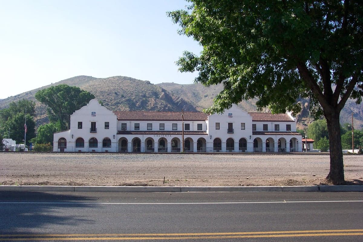
Photo: Wikipedia
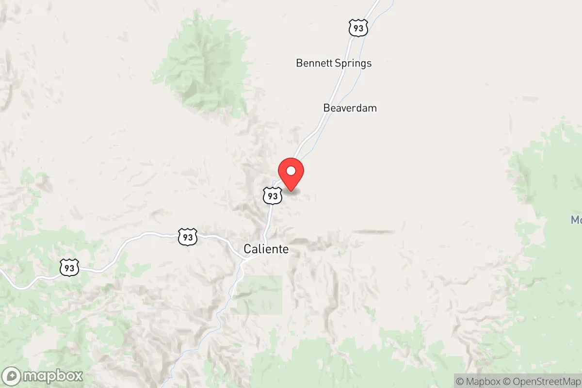
Strategic Assessment of Caliente, NV
Strong survivability profile. Good buffer from population centers, with manageable environmental and tactical risks.
What does the Strategic Assessment tell us?
Our Strategic Assessment grades tactical survivability of an area. Major population centers, military targets, fallout zones, natural disasters, and border exposure all drive risk — lower exposure means a more defensible position in a crisis.
This is heavily inspired by Joel Skousen's Strategic Relocation book. Highly recommended you checkout the book ($)What does this tell us?
Our Strategic Assessment grades tactical survivability of an area. Major population centers, military targets, fallout zones, natural disasters, and border exposure all drive risk — lower exposure means a more defensible position in a crisis.
This is heavily inspired by Joel Skousen's Strategic Relocation book. Highly recommended you checkout the book ($)Strategic Pillars

Key Distances
Regional Safe Places
Below is our recommended "safe zones" in Nevada and the surrounding area based on our strategic heuristics. For most people, it's unrealistic to live in a “safe zone” full-time due to work, family or other personal reasons. They tend to be more rural. However, many of these areas are perfect for second homes and retreat properties that double as a vacation home or even a short-term rental.
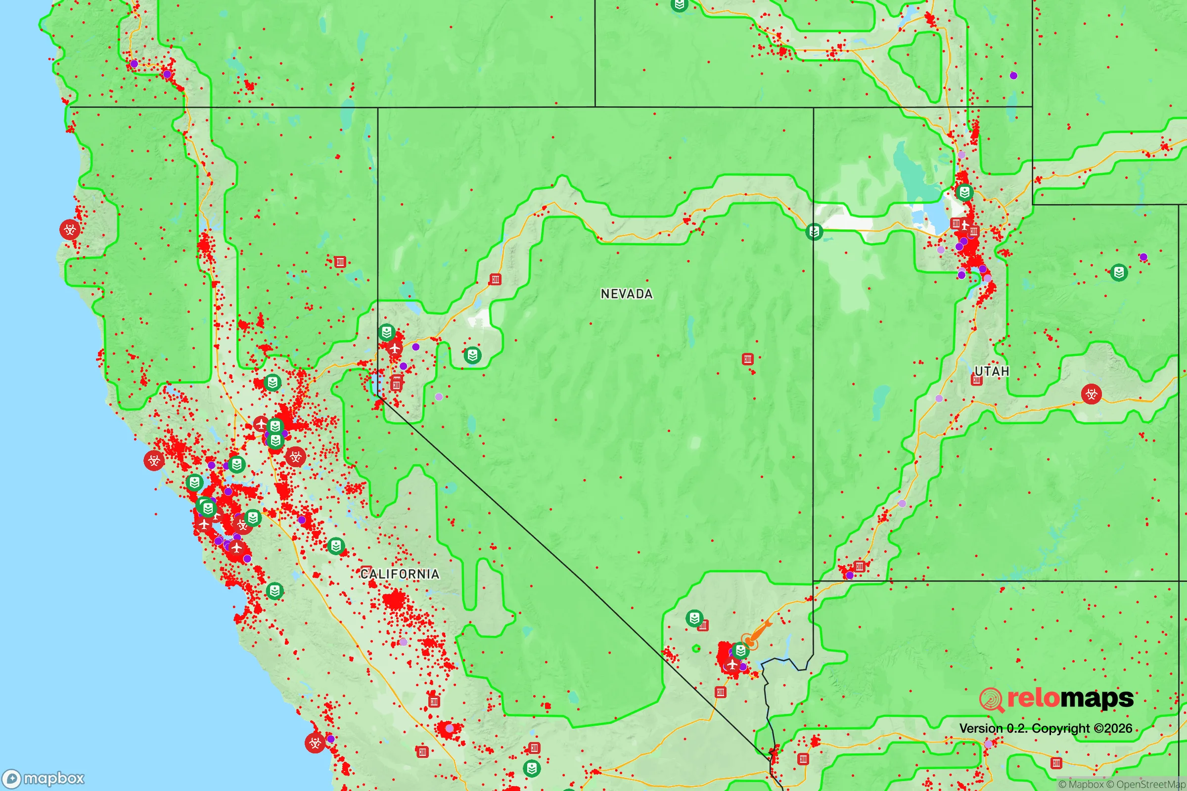
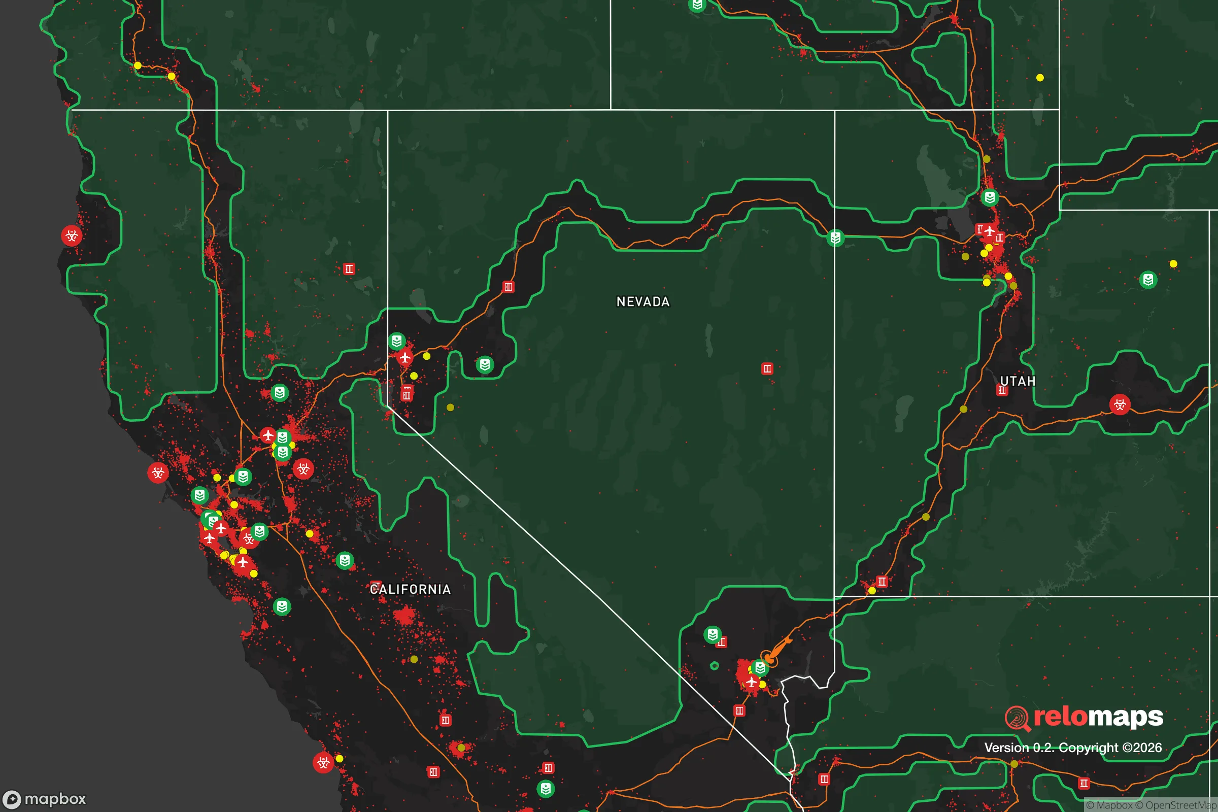
Important Note: For informational purposes only. This does not mean nothing bad ever happens in the green zones. Please use common sense. This is based on public data and modeled with AI. We tried to take a conservative approach but mistakes happen. We update this regularly as new information becomes available.
Solar Generator Recommendations
Backup power matters more here than in safer locations. We've picked three solar generators across budgets and capacity tiers — start with the budget unit if you only need a few essentials, or step up if you want to run a fridge and HVAC for days at a time.

Jackery Portable Power Station Explorer 300
Budget OptionPower on the Go: Weighing only 11 lbs, it's convenient to set up and store with book-sized foldable solar panels

BLUETTI Portable Power Station AC180
Designed for both indoor and outdoor scenarios, AC180 is highly capable as it has a robost capacity and continuous output power.

EF ECOFLOW DELTA Pro Ultra Power Station
Upgraded PickEcoFlow DELTA Pro Ultra is a whole-home energy system designed to grow with your family. Integrated with the Smart Home Panel 2, it scales to meet your evolving energy needs — keeping your home powered, intelligent, and secure through every stage of life.
We earn a commission, at no additional cost to you.
Strategic Assessment Analysis
Caliente, Nevada, sits in a remote valley along the Union Pacific Railroad and U.S. Route 93, roughly 90 miles northeast of Las Vegas and 60 miles from the Nevada Test Site. Its strategic value for a survivalist or prepper lies in its extreme isolation, low population density (under 1,000 residents), and access to the Meadow Valley Wash watershed, which provides a rare perennial water source in the Great Basin. The town's location at the junction of two major rail and highway corridors offers a logistical advantage for resupply or evacuation, while its distance from major population centers reduces exposure to cascading failures from urban collapse. For a conservative-leaning relocator concerned with civic unrest, mass casualty events, and federal overreach, Caliente presents a defensible, low-profile base with significant natural buffers.
Geographic position and natural advantages for long-term survival
Caliente's geography is defined by the Meadow Valley Wash, a canyon system that funnels water from the Clover Mountains south toward the Colorado River. This water source is the town's single most critical asset—unlike most of southern Nevada, which relies on the Colorado River via the Las Vegas Valley, Caliente draws from local springs and groundwater. The surrounding landscape is rugged, with the Delamar Mountains to the east and the Highland Range to the west, creating natural chokepoints for any approach. The town sits at 4,400 feet elevation, which moderates summer temperatures compared to Las Vegas (typically 10-15°F cooler) and provides a longer growing season than higher Great Basin towns. The Bureau of Land Management administers roughly 85% of the land in Lincoln County, meaning a relocator can legally access vast tracts for hunting, foraging, and off-grid construction without trespassing on private property. The area's low precipitation (under 10 inches annually) is a constraint, but the wash system and local springs mitigate this for those who secure water rights or develop catchment systems.
Risks, exposures, and proximity to fallout-relevant landmarks
The most significant risk for Caliente is its proximity to the Nevada National Security Site (formerly the Nevada Test Site), roughly 60 miles southwest as the crow flies. While the site's above-ground testing ended in 1962, the area remains a federal nuclear complex with ongoing subcritical experiments and waste storage. A major accident or deliberate attack on the site could produce fallout that reaches Caliente within hours, depending on wind patterns. The town is also 90 miles from Las Vegas, which is a prime target for civil unrest, EMP attacks, or infrastructure collapse due to its dependence on the Hoover Dam and the Colorado River. Interstate 15, the main artery connecting Las Vegas to Salt Lake City, runs 40 miles west of Caliente, meaning refugee flows from a Las Vegas collapse could push through the area via U.S. 93. The Union Pacific main line through Caliente carries hazardous materials, including nuclear waste shipments from the test site to the Waste Isolation Pilot Plant in New Mexico. A derailment or sabotage event could contaminate the Meadow Valley Wash watershed. Seismic risk is moderate—the area sits near the Intermountain Seismic Belt, and a major quake on the Wasatch Fault could disrupt rail and highway access for weeks.
Practical resilience for a relocator: food, water, energy, and defensibility
Water is the linchpin of any survival strategy in Caliente. The Meadow Valley Wash provides surface flow for most of the year, but it's intermittent during drought years. A relocator should plan on drilling a well (typical depth 200-400 feet) or securing a water right from the local irrigation district. The town's municipal water comes from springs in the Clover Mountains, but a grid-down scenario would require backup pumping—solar-powered well pumps are a viable option given the area's 300+ sunny days per year. Food production is limited by the short growing season (May to September) and alkaline soils, but raised beds with imported topsoil can yield vegetables, and the surrounding BLM land supports mule deer, quail, and rabbits for protein. The Caliente area has no industrial agriculture, so a relocator should plan for a combination of gardening, hunting, and stockpiling. Energy is straightforward: the area has excellent solar insolation, and off-grid solar with battery storage is the standard for remote homes. Propane delivery is available from Las Vegas, but a backup wood stove is wise given winter lows that can drop below 0°F. Defensibility is strong—the town has only two paved roads in and out (U.S. 93 north to Pioche and south to the I-15 junction), and the canyon terrain creates natural observation points. The local population is small and largely self-reliant, with a culture of mutual aid among ranchers and miners. The Lincoln County Sheriff's Office has a substation in Caliente, but response times to outlying properties can exceed 30 minutes, so personal security measures—fencing, dogs, and a well-stocked armory—are prudent.
The overall strategic picture for Caliente is one of trade-offs. Its isolation and water access make it a strong candidate for a long-term retreat, especially for someone who values distance from federal control and urban chaos. The proximity to the Nevada Test Site and the Las Vegas refugee corridor are real liabilities, but they can be managed with proper planning—fallout shelters, air filtration, and early warning systems. The town's rail and highway connections are a double-edged sword: they provide resupply options but also attract unwanted traffic during a collapse. For a conservative relocator who wants to be off the grid, out of the blast zone, and within striking distance of public lands for hunting and foraging, Caliente offers a viable, if austere, option. It's not a place for the unprepared or the faint of heart, but for those willing to invest in water infrastructure, solar power, and community relationships, it provides a defensible foothold in a region that will likely remain sparsely populated and strategically irrelevant to the major power struggles of the coming decades.
* Values derived from national, state, county, city and local statistics and may differ in a specific area. Last updated: 2026-05-03T20:32:23.000Z
Narrative content on this page is AI-generated and may contain mistakes. Verify any details that matter before acting on them.
ReloMaps may earn a commission from affiliate links at no extra cost to you.