Photo: Wikipedia
Strategic Assessment of Humboldt County
Workable tactical position. Some exposure to population density or targets, but generally defensible in a crisis.
What does the Strategic Assessment tell us?
Our Strategic Assessment grades tactical survivability of an area. Major population centers, military targets, fallout zones, natural disasters, and border exposure all drive risk — lower exposure means a more defensible position in a crisis.
This is heavily inspired by Joel Skousen's Strategic Relocation book. Highly recommended you checkout the book ($)What does this tell us?
Our Strategic Assessment grades tactical survivability of an area. Major population centers, military targets, fallout zones, natural disasters, and border exposure all drive risk — lower exposure means a more defensible position in a crisis.
This is heavily inspired by Joel Skousen's Strategic Relocation book. Highly recommended you checkout the book ($)Strategic Pillars

Key Distances
Strategic Assessment Analysis
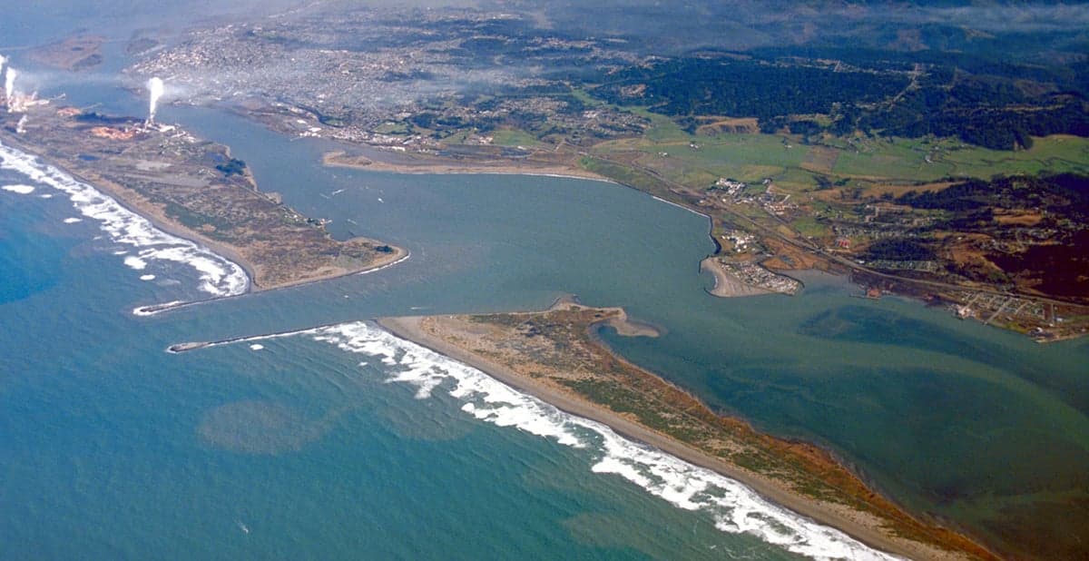
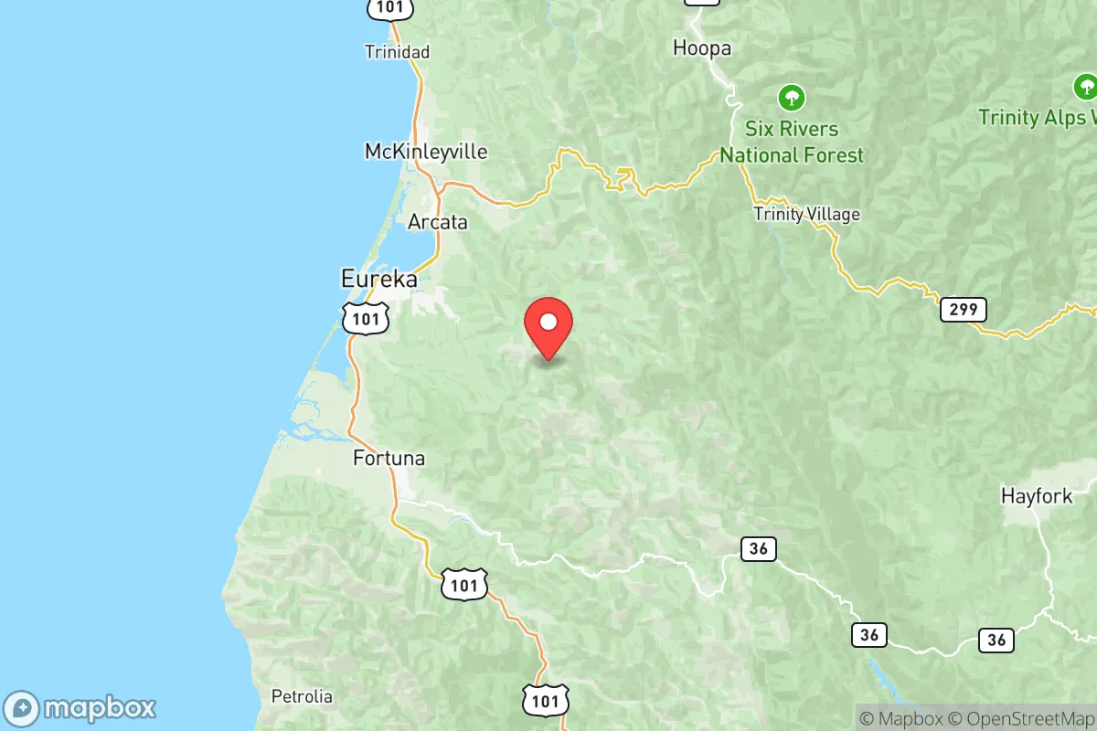
Humboldt County offers a compelling strategic position for those prioritizing resilience and self-sufficiency, balancing genuine geographic advantages with real-world risks that demand clear-eyed assessment. Located roughly 250 miles north of San Francisco and 100 miles south of the Oregon border, this coastal region of Northern California provides a mix of isolation, natural resources, and infrastructure that makes it a serious contender for relocation-minded individuals and families. The county's population of roughly 136,000 is spread across a rugged landscape of redwood forests, mountains, and a 110-mile coastline, with the primary population centers being Eureka (the county seat, ~27,000), Arcata (~18,000), and the smaller inland communities of Fortuna and McKinleyville.
Geographic position and natural advantages for long-term resilience
Humboldt County's primary strategic asset is its physical separation from major metropolitan areas and critical infrastructure targets. The region is bounded by the Pacific Ocean to the west and the Klamath Mountains to the east, with only two major highway corridors connecting it to the rest of California: US-101 running north-south along the coast, and State Route 299 heading east toward Redding and Interstate 5. This limited road access is a double-edged sword—it restricts outside threats but also complicates evacuation or supply delivery. The county sits far from any major military installations (the nearest is the Coast Guard Air Station in Arcata, a small facility), large refineries, or major ports of strategic significance. The Port of Humboldt Bay in Eureka handles modest commercial shipping but is not a high-value target compared to the Port of Oakland or the refineries in the San Francisco Bay Area. For a reader thinking about fallout risks, Humboldt's distance from the Bay Area's refinery corridor (roughly 250 miles) and the absence of major nuclear power plants within 200 miles (the closest is Diablo Canyon, over 300 miles south) provide a meaningful buffer against blast zones and immediate fallout plumes from those sites. The region's mountainous terrain and prevailing westerly winds off the Pacific also help disperse airborne contaminants, though this is not a guarantee.
Risks, exposures, and proximity to fallout-relevant landmarks
No strategic assessment is honest without acknowledging Humboldt County's significant natural and man-made exposures. The region sits in the Cascadia Subduction Zone, capable of generating a magnitude 9.0+ earthquake and a subsequent tsunami that would devastate low-lying coastal areas. The tsunami inundation zone includes much of Eureka's waterfront, the Arcata bottoms, and the communities of Samoa and Fields Landing. A Cascadia event would likely destroy the two highway corridors (US-101 and SR-299) through landslides and bridge failures, effectively isolating the county for weeks or months. Wildfire risk is moderate but real, particularly in the inland, forested areas east of the coastal fog belt—the 2020 Six Rivers Lightning Complex fires burned over 200,000 acres in and around Humboldt County. For a relocator, the key man-made risk is the proximity to the Humboldt Bay Power Plant, a natural gas-fired facility in Eureka that is not a nuclear site but could be a target in a broader conflict. More concerning is the county's location relative to the Pacific Northwest's critical infrastructure: the Bonneville Power Administration's high-voltage transmission lines run through the region, and the Port of Coos Bay (Oregon) and the Columbia River shipping channel are roughly 200 miles north. While not immediate fallout dangers, these assets could draw secondary effects in a major conflict. The county also has a modest but present drug trade and rural crime issue, with the Humboldt County Sheriff's Office reporting property crime rates above the national average—something to factor into defensibility planning.
Practical resilience for a relocator: food, water, energy, and defensibility
Humboldt County's practical resilience is where the analysis gets interesting for a self-sufficiency-minded reader. Water availability is excellent: the region receives 40-60 inches of annual rainfall, with numerous rivers (the Eel, Mad, Klamath, and Trinity) providing surface water. Groundwater is generally accessible in the alluvial valleys, though coastal communities rely on municipal systems that could fail in a quake. Food resilience is strong but localized: the county has a robust agricultural sector in the Eel River Valley and around Ferndale, with dairy, beef cattle, and vegetable farming. The commercial fishing fleet in Eureka and Trinidad provides access to salmon, crab, and groundfish. However, the growing season is short and cool due to coastal fog, limiting staple crop production—most grains and legumes would need to be imported. Energy is a mixed picture: the county has significant hydroelectric generation from the Trinity River dams (part of the Central Valley Project), but the grid is vulnerable to seismic disruption. Solar potential is moderate—coastal areas get 4-5 peak sun hours daily, while inland valleys like Willow Creek get 5-6. Wood heating is common and practical given the forested landscape. Defensibility is the county's strongest suit: the rugged terrain, limited road access, and dispersed population make it difficult for any outside force to control. The inland communities of Orleans, Hoopa, and Willow Creek are particularly defensible due to their location in narrow valleys with single road access. However, the same terrain makes it easy for small groups to isolate themselves, and the county's history of marijuana cultivation has created a culture of rural privacy and armed property defense that a relocator should understand but not romanticize.
The overall strategic picture for Humboldt County is one of genuine opportunity tempered by real vulnerability. For a family or individual willing to invest in earthquake-resistant construction, maintain a year's worth of food and medical supplies, and develop relationships with local growers and fishermen, the region offers a rare combination of isolation, natural resources, and community resilience. The key trade-off is between the county's distance from major targets and its exposure to a catastrophic natural event—the Cascadia earthquake is not a question of if but when. A relocator should also consider the social and economic realities: the county has a poverty rate around 20%, limited healthcare infrastructure (the main hospital is St. Joseph Hospital in Eureka, with a Level III trauma center), and a housing market that has become increasingly expensive due to remote work migration. The best strategic approach is to target the inland valleys—places like Fortuna, Rio Dell, or the Garberville area—which offer better defensibility and growing conditions than the immediate coast, while still being within an hour of Eureka's services. Humboldt County is not a bug-out location; it is a place to build a life that is already resilient, with the understanding that no location is perfect and that preparation, not geography, is the ultimate determinant of security.

* Values derived from national, state, county, city and local statistics and may differ in a specific area. Last updated: 2026-09-08T18:54:06.000Z
Narrative content on this page is AI-generated and may contain mistakes. Verify any details that matter before acting on them.
ReloMaps may earn a commission from affiliate links at no extra cost to you.

