Photo: Wikipedia
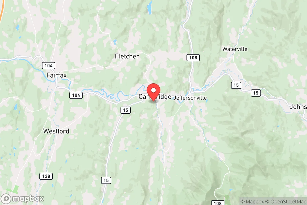
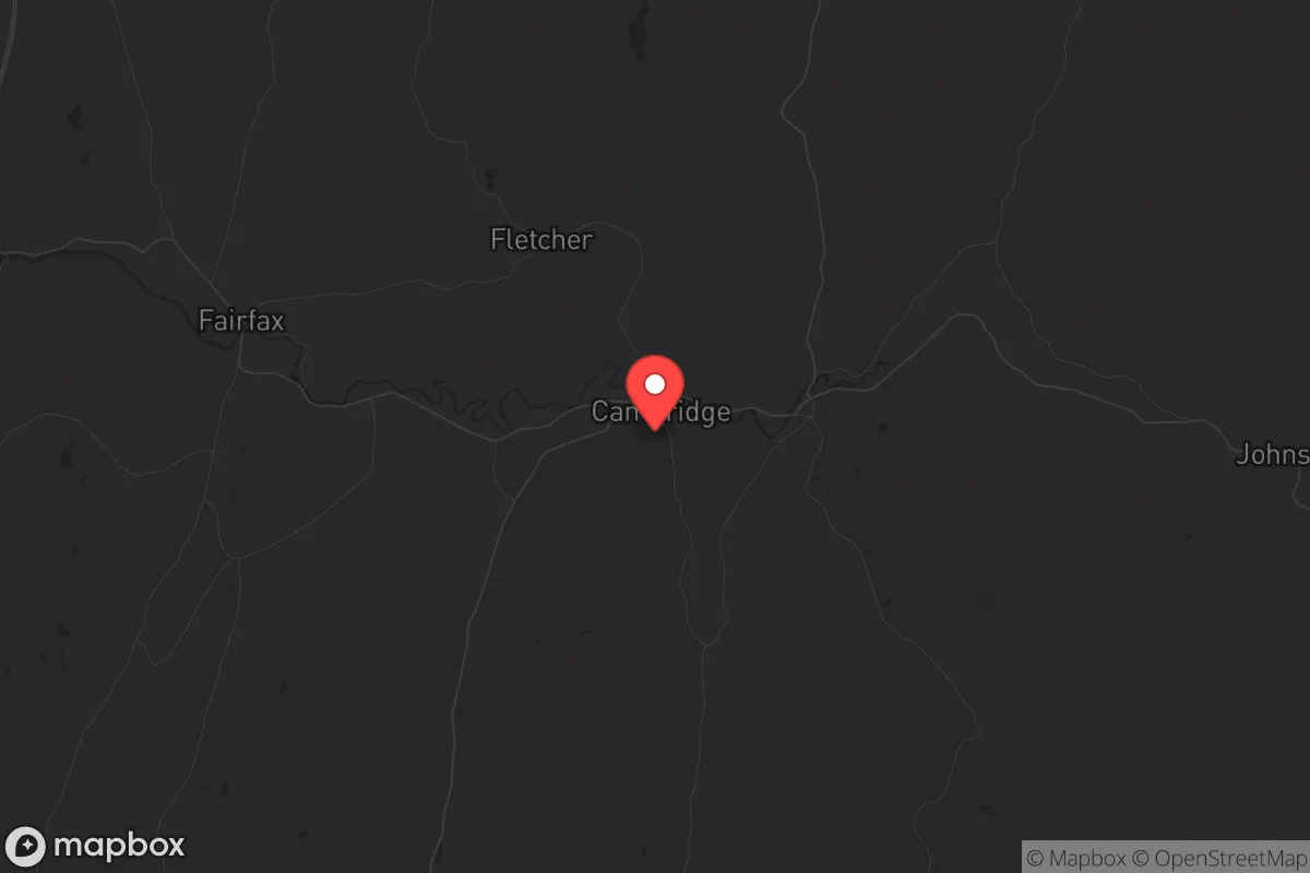
Strategic Assessment of Cambridge, VT
Meaningful friction. Expect exposure to either population pressure, blast zones, or natural disaster risk. Consider buying a retreat property.
What does the Strategic Assessment tell us?
Our Strategic Assessment grades tactical survivability of an area. Major population centers, military targets, fallout zones, natural disasters, and border exposure all drive risk — lower exposure means a more defensible position in a crisis.
This is heavily inspired by Joel Skousen's Strategic Relocation book. Highly recommended you checkout the book ($)What does this tell us?
Our Strategic Assessment grades tactical survivability of an area. Major population centers, military targets, fallout zones, natural disasters, and border exposure all drive risk — lower exposure means a more defensible position in a crisis.
This is heavily inspired by Joel Skousen's Strategic Relocation book. Highly recommended you checkout the book ($)Strategic Pillars

Key Distances
Regional Safe Places
Below is our recommended "safe zones" in Vermont and the surrounding area based on our strategic heuristics. For most people, it's unrealistic to live in a “safe zone” full-time due to work, family or other personal reasons. They tend to be more rural. However, many of these areas are perfect for second homes and retreat properties that double as a vacation home or even a short-term rental.


Important Note: For informational purposes only. This does not mean nothing bad ever happens in the green zones. Please use common sense. This is based on public data and modeled with AI. We tried to take a conservative approach but mistakes happen. We update this regularly as new information becomes available.
Solar Generator Recommendations
Backup power matters more here than in safer locations. We've picked three solar generators across budgets and capacity tiers — start with the budget unit if you only need a few essentials, or step up if you want to run a fridge and HVAC for days at a time.

Jackery Portable Power Station Explorer 300
Budget OptionPower on the Go: Weighing only 11 lbs, it's convenient to set up and store with book-sized foldable solar panels

BLUETTI Portable Power Station AC180
Designed for both indoor and outdoor scenarios, AC180 is highly capable as it has a robost capacity and continuous output power.

EF ECOFLOW DELTA Pro Ultra Power Station
Upgraded PickEcoFlow DELTA Pro Ultra is a whole-home energy system designed to grow with your family. Integrated with the Smart Home Panel 2, it scales to meet your evolving energy needs — keeping your home powered, intelligent, and secure through every stage of life.
We earn a commission, at no additional cost to you.
Strategic Assessment Analysis
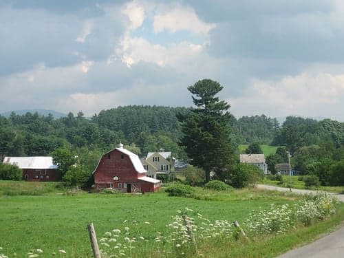
Cambridge, Vermont, offers a compelling strategic position for those prioritizing resilience and self-sufficiency, but it is not without significant trade-offs. Nestled in Lamoille County, this small town of roughly 3,900 residents sits at the intersection of Route 15 and Route 108, providing a balance of relative seclusion and practical access to essential resources. Its location in the Green Mountains, roughly 30 miles from the Canadian border, places it far from the immediate blast zones of major population centers like Burlington (35 miles southwest) or Montreal (60 miles north), yet close enough to monitor regional developments. For a conservative-leaning relocator concerned with civic unrest, supply chain disruptions, or natural disasters, Cambridge presents a mixed bag: strong natural defenses and a tight-knit community, but real vulnerabilities tied to its proximity to tourist corridors and limited local infrastructure.
Geographic position and natural advantages for long-term security
Cambridge’s geography is its primary strategic asset. The town sits in a valley carved by the Lamoille River, flanked by the Green Mountains to the west and the Worcester Range to the east. This topography creates natural chokepoints along the main roads—Route 108 through Smugglers’ Notch and Route 15 along the river—which could be monitored or controlled if needed. The surrounding forests and hills offer ample cover and resources for those with backcountry skills. The area’s elevation (roughly 500–1,000 feet) provides a modest defensive height advantage over the Champlain Valley to the west, while the cold winters (average January lows around 10°F) act as a natural barrier to unprepared transient populations. The Lamoille River itself is a reliable water source, though its flow is seasonal and subject to spring flooding. The nearby Mount Mansfield State Forest and the Green Mountain National Forest (a 30-minute drive south) offer vast tracts of public land for foraging, hunting, and timber, though legal restrictions apply. For a prepper, the key takeaway is that Cambridge’s remote feel is real—it’s not a suburb of anything—but its location on a state highway means it’s not truly off the grid.
Risks, exposures, and proximity to fallout-relevant landmarks
The most glaring vulnerability for Cambridge is its proximity to high-traffic tourist destinations. Smugglers’ Notch Resort, a major ski and summer destination, sits just 5 miles north of the village center. During peak seasons, Route 108 becomes a congested corridor of out-of-state vehicles, which could become a liability during an evacuation or civil unrest scenario. The resort itself is a potential target for looting or mass casualty events if regional stability collapses. Additionally, the town is within 35 miles of the Vermont Yankee nuclear plant (decommissioned but still storing spent fuel) in Vernon, and roughly 60 miles from the Seabrook Station nuclear plant in New Hampshire. While neither is an immediate blast danger, prevailing winds from the west could carry fallout toward Cambridge in a worst-case accident or attack. The nearby Burlington International Airport (35 miles southwest) is a potential staging area for federal response or, conversely, a target for disruption. The Lamoille River valley also funnels weather systems, making the area prone to flash flooding and ice jams—the 2023 floods caused significant damage to roads and bridges in the region. For a survivalist, these risks are manageable with proper planning, but they underscore that Cambridge is not a fortress—it’s a rural town with real exposure to regional instability.
Practical resilience for a relocator: food, water, energy, and defensibility
Cambridge’s practical resilience hinges on local resources and community networks. The town has a small but functional agricultural base: several working farms (dairy, maple syrup, and vegetable operations) within a 10-mile radius, plus the Cambridge Farmers’ Market (seasonal). However, the town’s grocery options are limited to a single small market (Cambridge Village Market) and a few convenience stores. For serious food security, a relocator would need to establish their own garden, livestock, or a bulk supply chain from larger towns like Morrisville (8 miles east) or Stowe (12 miles south). Water is abundant from the Lamoille River and numerous streams, but treatment and storage are essential—municipal water is available only in the village center, and well water quality varies. Energy infrastructure is a weak point: the grid is served by Green Mountain Power, which has a mixed reliability record during winter storms. Solar potential is moderate (roughly 4.5 peak sun hours per day), but heavy tree cover and snow load reduce efficiency. Wood heat is the most practical backup, with ample firewood available from local forests. Defensibility is decent but not ideal: the village layout is compact, with a few choke points on roads, but the surrounding hills offer numerous approach routes for determined actors. The local law enforcement presence is minimal (Lamolle County Sheriff’s Office and Vermont State Police, with response times of 20–40 minutes), so community self-reliance is critical. The town’s population is predominantly white (95%) and politically mixed—Lamolle County voted +6 for Trump in 2020, suggesting a conservative-leaning but not monolithic community. For a prepper, the key is to build relationships with neighbors early; the area’s “live and let live” culture can be an asset, but it also means no one will come to your aid if you isolate yourself.
Overall, Cambridge, VT, is a viable but not ideal relocation target for a survivalist or conservative-leaning individual or family. Its strengths—natural barriers, water access, a small but functional community, and distance from major urban centers—are real. Its weaknesses—tourist traffic, limited local food and energy infrastructure, and exposure to regional hazards like flooding and nuclear storage—require deliberate mitigation. The town is best suited for someone who is already self-sufficient (gardening, wood heat, water filtration, and basic medical skills) and willing to invest in off-grid upgrades. For those seeking a true redoubt, areas deeper in the Northeast Kingdom (e.g., Island Pond or Canaan) offer more isolation and fewer tourist pressures. But for a relocator who wants a balance of access to resources (healthcare in Burlington, supplies in Stowe) and a defensible rural base, Cambridge is a solid B-tier option—provided you come prepared, not expecting the town to save you. The strategic calculus is simple: the mountains and river give you a fighting chance, but the roads and tourists are your biggest liabilities. Plan accordingly.
* Values derived from national, state, county, city and local statistics and may differ in a specific area. Last updated: 2026-04-30T13:05:00.000Z
Narrative content on this page is AI-generated and may contain mistakes. Verify any details that matter before acting on them.
ReloMaps may earn a commission from affiliate links at no extra cost to you.