
Photo: Wikipedia
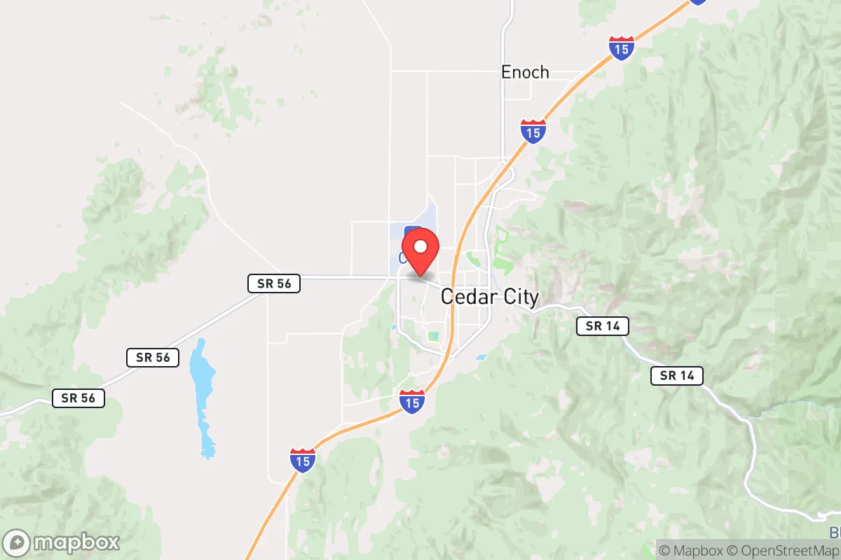
Strategic Assessment of Cedar City, UT
Workable tactical position. Some exposure to population density or targets, but generally defensible in a crisis.
What does the Strategic Assessment tell us?
Our Strategic Assessment grades tactical survivability of an area. Major population centers, military targets, fallout zones, natural disasters, and border exposure all drive risk — lower exposure means a more defensible position in a crisis.
This is heavily inspired by Joel Skousen's Strategic Relocation book. Highly recommended you checkout the book ($)What does this tell us?
Our Strategic Assessment grades tactical survivability of an area. Major population centers, military targets, fallout zones, natural disasters, and border exposure all drive risk — lower exposure means a more defensible position in a crisis.
This is heavily inspired by Joel Skousen's Strategic Relocation book. Highly recommended you checkout the book ($)Strategic Pillars

Key Distances
Regional Safe Places
Below is our recommended "safe zones" in Utah and the surrounding area based on our strategic heuristics. For most people, it's unrealistic to live in a “safe zone” full-time due to work, family or other personal reasons. They tend to be more rural. However, many of these areas are perfect for second homes and retreat properties that double as a vacation home or even a short-term rental.


Important Note: For informational purposes only. This does not mean nothing bad ever happens in the green zones. Please use common sense. This is based on public data and modeled with AI. We tried to take a conservative approach but mistakes happen. We update this regularly as new information becomes available.
Solar Generator Recommendations
Backup power matters more here than in safer locations. We've picked three solar generators across budgets and capacity tiers — start with the budget unit if you only need a few essentials, or step up if you want to run a fridge and HVAC for days at a time.

Jackery Portable Power Station Explorer 300
Budget OptionPower on the Go: Weighing only 11 lbs, it's convenient to set up and store with book-sized foldable solar panels

BLUETTI Portable Power Station AC180
Designed for both indoor and outdoor scenarios, AC180 is highly capable as it has a robost capacity and continuous output power.

EF ECOFLOW DELTA Pro Ultra Power Station
Upgraded PickEcoFlow DELTA Pro Ultra is a whole-home energy system designed to grow with your family. Integrated with the Smart Home Panel 2, it scales to meet your evolving energy needs — keeping your home powered, intelligent, and secure through every stage of life.
We earn a commission, at no additional cost to you.
Strategic Assessment Analysis
Cedar City, Utah, occupies a strategic position that balances relative isolation with practical accessibility, making it a serious contender for those prioritizing long-term resilience and preparedness. Nestled in the high desert of Iron County, this community of roughly 35,000 sits at the crossroads of Interstate 15 and Utah State Route 14, offering a controlled corridor to the broader Intermountain West without the choke points and population density of the Wasatch Front. For a relocator with a conservative, survivalist mindset, Cedar City’s geographic advantages, resource access, and distance from major fallout targets create a compelling case for a relocation that prioritizes self-sufficiency and security in an increasingly uncertain national landscape.
Geographic position and natural advantages for long-term security
Cedar City’s location is defined by its position on the Colorado Plateau, at an elevation of roughly 5,800 feet, which provides a natural buffer against many low-elevation hazards. The city is flanked by the Markagunt Plateau to the east and the Escalante Desert to the west, creating a defensible terrain with multiple egress routes into the surrounding national forests and BLM lands. This geography offers a significant advantage: the ability to retreat into sparsely populated high country if civic order degrades in the valleys. The area’s water resources are a critical asset. The city draws from the Cedar City Valley aquifer and the nearby Ash Creek and Coal Creek watersheds, which are fed by snowmelt from the 10,000-foot peaks of the Markagunt. While the region is arid—averaging only 12 inches of precipitation annually—the presence of perennial streams and the potential for rainwater catchment make it more viable than many desert locations. The local climate, with cold winters and mild summers, also reduces the risk of heat-related infrastructure failures that plague lower-elevation cities. For a prepper, this means a lower probability of catastrophic wildfire compared to the Sierra Nevada foothills, and a lower risk of hurricane or flood damage than coastal or riverine areas. The surrounding national forests—Dixie and Fishlake—provide a vast, low-population buffer zone that can serve as a fallback area for hunting, foraging, and timber resources if supply chains collapse.
Risks, exposures, and proximity to fallout-relevant landmarks
No location is without vulnerabilities, and Cedar City’s strategic picture includes several exposures that a serious relocator must weigh. The most significant risk is its proximity to the Nevada Test Site and the potential for nuclear fallout patterns. Cedar City lies approximately 150 miles northeast of the test site, placing it within the downwind zone for certain wind patterns. While this is not a direct target risk—the city is far from major strategic assets like Hill Air Force Base or the Tooele Army Depot—a major nuclear exchange could deposit fallout in the region within hours. The prevailing winds in the area are from the southwest, meaning a detonation in the Las Vegas area or at the test site could push contamination toward Cedar City. Additionally, the city is within 50 miles of the Intermountain Power Project in Delta, a coal-fired plant that could be a secondary target. The I-15 corridor itself is a double-edged sword: it provides supply access but also a route for refugees fleeing the Las Vegas or Los Angeles basins in a collapse scenario. The city’s population is small, but it is the largest urban center in southern Utah outside of St. George, which means it could become a staging point for displaced populations. The risk of civil unrest is lower than in major metros, but the city’s reliance on a single major highway for resupply makes it vulnerable to blockade or disruption. Earthquake risk is moderate, with the Hurricane Fault zone running roughly 30 miles to the west, but the area has not experienced a major seismic event in recorded history.
Practical resilience for a relocator: food, water, energy, and defensibility
For a relocator focused on practical self-sufficiency, Cedar City offers a mix of strengths and limitations. The local food system is anchored by the region’s agricultural heritage—Iron County has a history of livestock grazing and hay production, and the nearby Parowan Valley supports some dryland farming. However, the growing season is short (roughly 100–120 frost-free days), limiting the range of crops that can be reliably grown without greenhouses. The city’s water supply is the most critical factor. The Cedar City Valley aquifer is being drawn down at a rate that exceeds natural recharge, and the city has implemented conservation measures. A relocator should plan for private well access or rainwater storage; properties on the east side of the valley, closer to the Coal Creek drainage, have better groundwater potential. Energy resilience is a strong point. The region has abundant solar potential—over 300 sunny days per year—and the local utility, Rocky Mountain Power, has a relatively stable grid. Off-grid solar setups are feasible, and the area’s low humidity reduces panel degradation. Natural gas is available in the city, but rural properties often rely on propane. Defensibility is aided by the terrain: the city is ringed by hills and canyons that provide natural observation points and chokepoints. The local law enforcement presence is modest—the Cedar City Police Department has about 40 officers—but the community has a strong culture of self-reliance and firearm ownership, which aligns with a prepper mindset. The Southern Utah University campus provides a potential community hub for mutual aid, but also a concentration of population that could become a liability in a crisis. For a family, the school system is functional but not exceptional; the real value is in the low crime rate and the ability to build a network of like-minded neighbors.
The overall strategic picture for Cedar City is one of a high-altitude redoubt with real trade-offs. It offers a defensible position, access to water and energy resources, and a buffer from the chaos of the coastal megacities, but it is not a fortress. The risks from fallout patterns, the I-15 refugee corridor, and the aquifer’s long-term sustainability require a relocator to plan for contingencies—stockpiling supplies, securing off-grid water, and building community ties before a crisis. For a conservative-leaning individual or family looking to step off the grid without stepping into the wilderness, Cedar City represents a balanced option: close enough to civilization for supply runs and medical care, but far enough to avoid the worst of the coming storms. The key is to move early, secure a property with water rights, and treat the city as a base camp rather than a final destination. In a world where the status quo is eroding, Cedar City’s combination of isolation, resources, and community culture makes it a location worth serious consideration.
* Values derived from national, state, county, city and local statistics and may differ in a specific area. Last updated: 2026-04-21T13:04:19.000Z
Narrative content on this page is AI-generated and may contain mistakes. Verify any details that matter before acting on them.
ReloMaps may earn a commission from affiliate links at no extra cost to you.