Photo: Wikipedia
Strategic Assessment of Cheverly, MD
Multiple tactical vulnerabilities. Population density, target proximity, or disaster risk are likely compounding. A retreat property and exit planning is required.
What does the Strategic Assessment tell us?
Our Strategic Assessment grades tactical survivability of an area. Major population centers, military targets, fallout zones, natural disasters, and border exposure all drive risk — lower exposure means a more defensible position in a crisis.
This is heavily inspired by Joel Skousen's Strategic Relocation book. Highly recommended you checkout the book ($)What does this tell us?
Our Strategic Assessment grades tactical survivability of an area. Major population centers, military targets, fallout zones, natural disasters, and border exposure all drive risk — lower exposure means a more defensible position in a crisis.
This is heavily inspired by Joel Skousen's Strategic Relocation book. Highly recommended you checkout the book ($)Strategic Pillars

Key Distances
Regional Safe Places
Below is our recommended "safe zones" in Maryland and the surrounding area based on our strategic heuristics. For most people, it's unrealistic to live in a “safe zone” full-time due to work, family or other personal reasons. They tend to be more rural. However, many of these areas are perfect for second homes and retreat properties that double as a vacation home or even a short-term rental.


Important Note: For informational purposes only. This does not mean nothing bad ever happens in the green zones. Please use common sense. This is based on public data and modeled with AI. We tried to take a conservative approach but mistakes happen. We update this regularly as new information becomes available.
Solar Generator Recommendations
Backup power matters more here than in safer locations. We've picked three solar generators across budgets and capacity tiers — start with the budget unit if you only need a few essentials, or step up if you want to run a fridge and HVAC for days at a time.

Jackery Portable Power Station Explorer 300
Budget OptionPower on the Go: Weighing only 11 lbs, it's convenient to set up and store with book-sized foldable solar panels

BLUETTI Portable Power Station AC180
Designed for both indoor and outdoor scenarios, AC180 is highly capable as it has a robost capacity and continuous output power.

EF ECOFLOW DELTA Pro Ultra Power Station
Upgraded PickEcoFlow DELTA Pro Ultra is a whole-home energy system designed to grow with your family. Integrated with the Smart Home Panel 2, it scales to meet your evolving energy needs — keeping your home powered, intelligent, and secure through every stage of life.
We earn a commission, at no additional cost to you.
Strategic Assessment Analysis
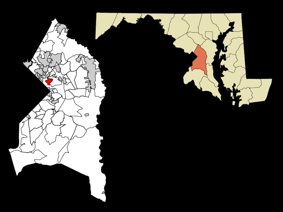
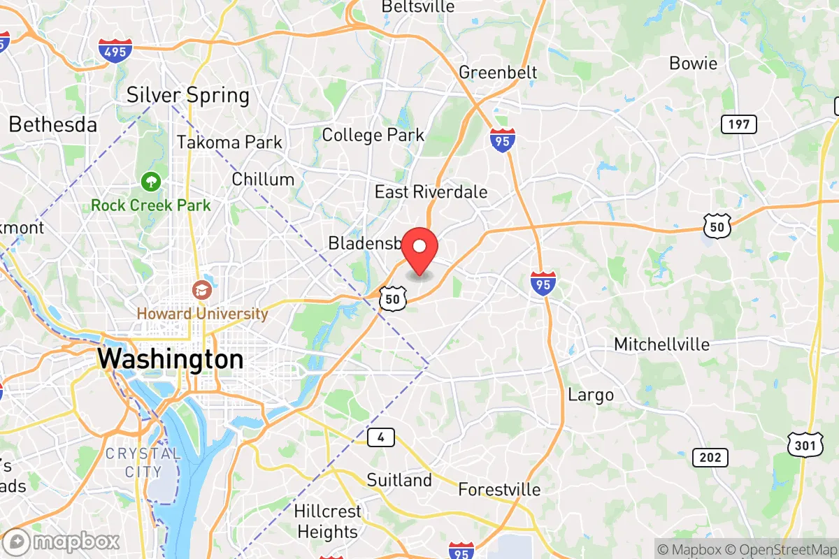
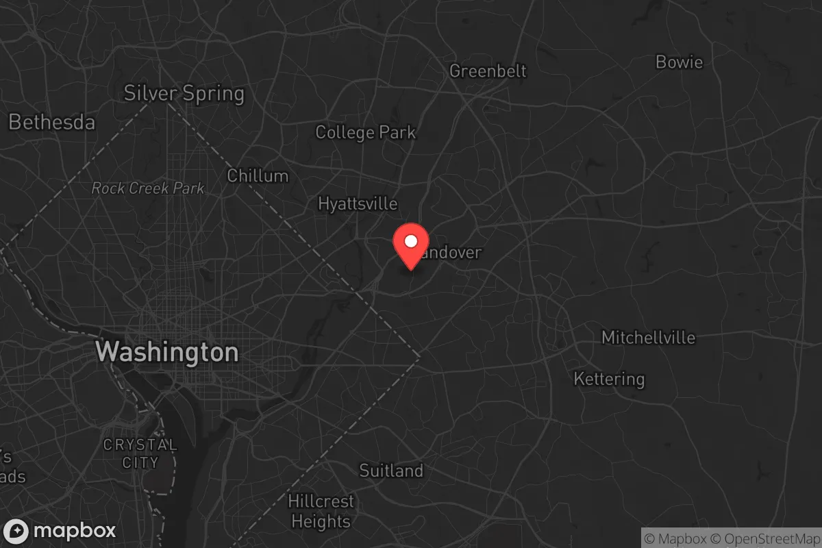
Cheverly, Maryland, presents a complex strategic picture for the conservative prepper: it offers genuine resilience advantages in its mature tree canopy, walkable grid, and strong community fabric, but these are directly offset by its position within the Washington, D.C., metropolitan blast and fallout zone. The town’s location—just 8 miles from the U.S. Capitol and 4 miles from Joint Base Andrews—places it inside a high-priority target ring for any major conflict or mass casualty event targeting federal assets. For a relocator prioritizing long-term survival and civic stability, Cheverly is a study in contradictions: a defensible, neighborly enclave that sits squarely in the path of a regional catastrophe.
Geographic position and natural advantages for a prepper
Cheverly’s geography is a double-edged sword. On the plus side, the town was deliberately designed as a “garden suburb” in the 1910s, with over 40% of its land area covered by mature hardwood forest. This canopy provides natural camouflage from aerial observation, reduces heat signature, and offers a modest buffer against small-arms noise. The town sits on a gentle ridge between the Anacostia River and the Northwest Branch of the Patuxent River, giving it decent drainage and slightly elevated ground relative to the surrounding floodplains. The street grid is intentionally non-linear—curving roads and cul-de-sacs break sight lines and slow vehicular approach, which is a passive defensive feature. The town’s 1.3 square miles contain roughly 5,000 residents, yielding a population density that is low enough to avoid the worst of urban chaos but high enough to sustain mutual-aid networks. The presence of the Cheverly Community Garden and numerous private vegetable plots means some local food production capacity exists, though it is far from self-sufficient.
Risks, exposures, and proximity to fallout-relevant landmarks
The negatives are severe and cannot be glossed over. Cheverly lies within the 50-psi blast overpressure ring for a ground burst on the National Mall, meaning a single 300-kiloton nuclear detonation would level most structures in town and produce lethal thermal radiation. Even a smaller yield or a dirty bomb at Joint Base Andrews—home to Air Force One and the 89th Airlift Wing—would put Cheverly in the immediate fallout plume for prevailing westerly winds. The town is also bracketed by major roadways: the Baltimore-Washington Parkway (MD 295) runs along its western edge, and U.S. Route 50 is two miles north. In a mass evacuation scenario, these arteries become instant parking lots or chokepoints. The nearby Washington D.C. Metro system’s Cheverly station is a transit node that, in a crisis, could funnel panicked crowds into the neighborhood. Additionally, the town is within 10 miles of the Indian Head Naval Surface Warfare Center (a known chemical weapons disposal site) and the Beltsville Agricultural Research Center (which holds select-agent pathogens). Any accident or attack at these facilities would compound the fallout risk.
Practical resilience for a relocator: food, water, energy, and defensibility
For a relocator willing to accept the proximity risks, Cheverly offers some practical prepping advantages. Water access is above average: the town is served by the Washington Suburban Sanitary Commission (WSSC), which draws from the Potomac River, but every home has a yard where rain barrels can be installed—annual rainfall is 43 inches, well-distributed year-round. The shallow water table means hand-dug wells are feasible on larger lots, though permits are required. Energy resilience is moderate: the grid is underground in many older sections, reducing storm-related outages, but there is no natural gas network in parts of town, so propane tanks or solar panels are necessary for off-grid cooking. The tree canopy, while good for concealment, creates shading that limits solar panel efficiency—rooftop arrays on south-facing slopes are the best option. Defensibility is the town’s strongest card: the street layout creates natural chokepoints, and the town has a volunteer fire department and a community emergency response team (CERT) that drills regularly. The Cheverly Civic Association maintains a neighborhood watch with radio communications. However, the town’s small police force (contracted from Prince George’s County) would be overwhelmed in a regional crisis. The biggest practical gap is food storage: there are no bulk food co-ops or major grocery stores within walking distance—the nearest Safeway is 1.5 miles away on a busy road. A relocator would need to stockpile at least three months of supplies, as resupply would be unreliable during any prolonged disruption.
The overall strategic picture for Cheverly is one of calculated risk. For a single individual or family who values community cohesion, walkable neighborhoods, and a defensible layout, the town offers a rare blend of suburban quiet and prepper-ready infrastructure. But the calculus changes dramatically if the threat scenario involves a major power’s attack on D.C. or a large-scale terrorist event targeting federal assets. In that case, Cheverly’s proximity to ground zero makes it a high-risk zone where survival depends on early warning and immediate evacuation—not on hunkering down. The prudent relocator would treat Cheverly as a secondary bug-out location, not a primary retreat. Have a vehicle pre-positioned with a go-bag, maintain a relationship with a rural property in western Maryland or West Virginia, and keep a low profile in town. The neighbors are friendly, the trees are thick, and the grid is walkable—but the shadow of the Capitol dome is never more than a few miles away.
* Values derived from national, state, county, city and local statistics and may differ in a specific area. Last updated: 2026-04-22T00:25:24.000Z
Narrative content on this page is AI-generated and may contain mistakes. Verify any details that matter before acting on them.
ReloMaps may earn a commission from affiliate links at no extra cost to you.