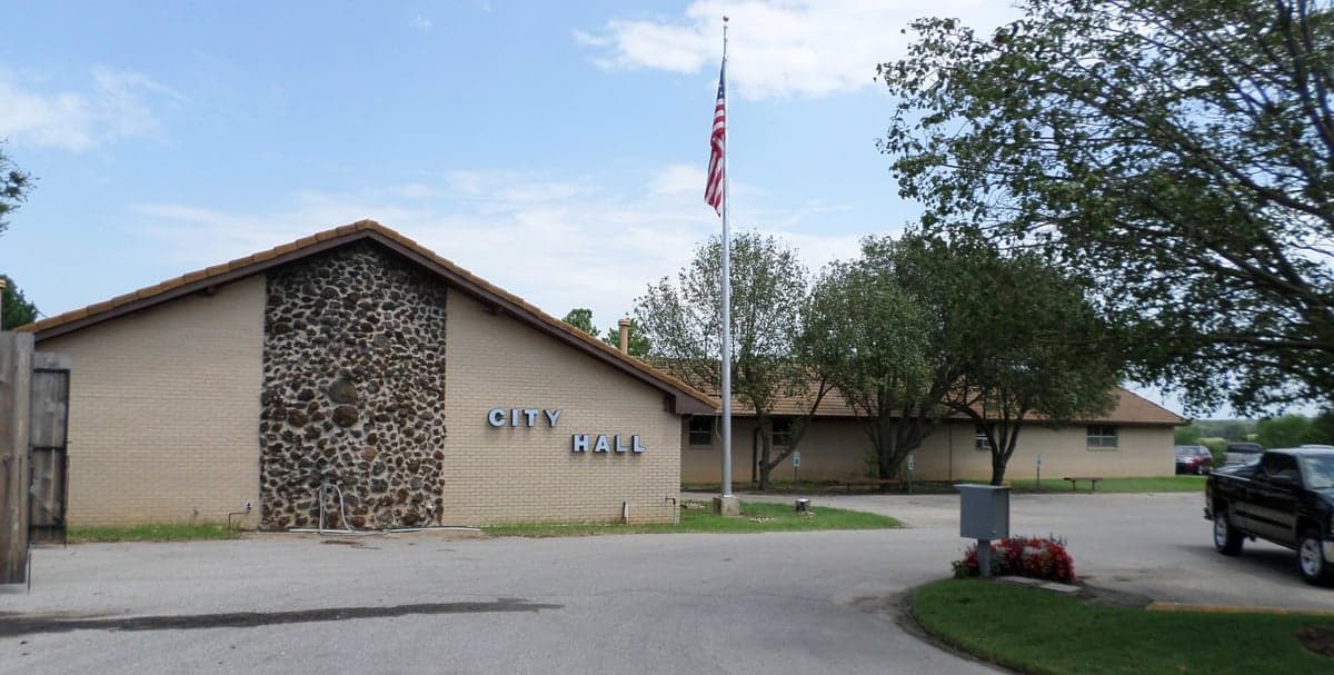
Photo: Wikipedia
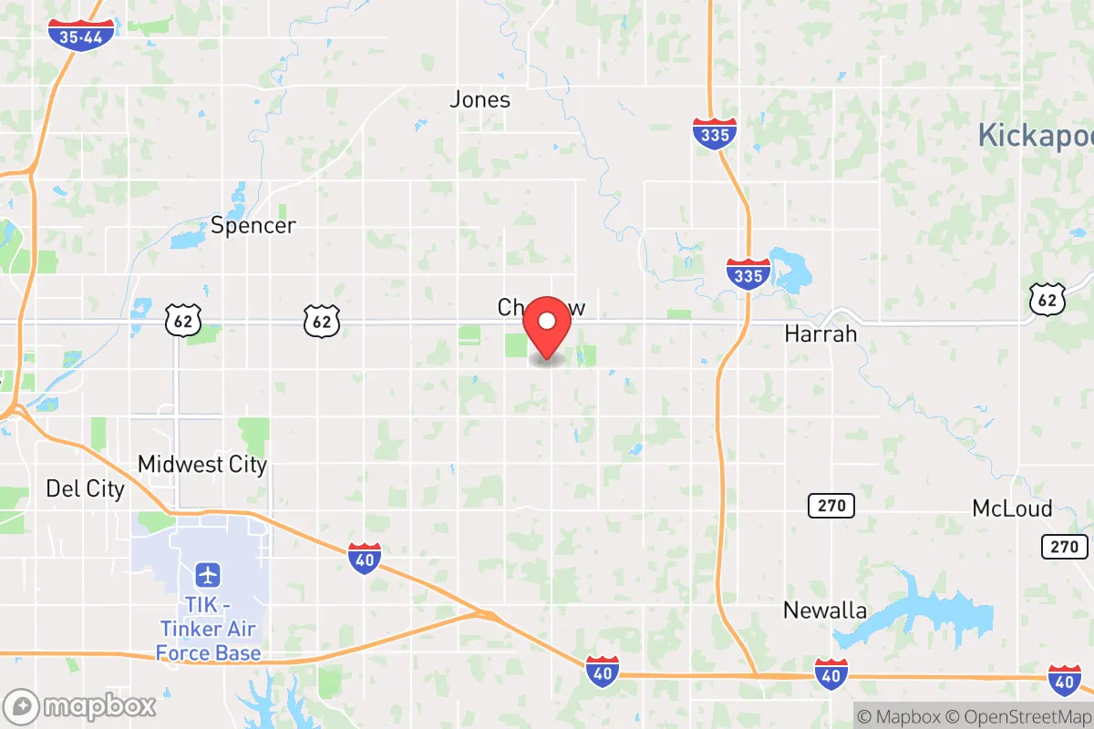
Strategic Assessment of Choctaw, OK
Meaningful friction. Expect exposure to either population pressure, blast zones, or natural disaster risk. Consider buying a retreat property.
What does the Strategic Assessment tell us?
Our Strategic Assessment grades tactical survivability of an area. Major population centers, military targets, fallout zones, natural disasters, and border exposure all drive risk — lower exposure means a more defensible position in a crisis.
This is heavily inspired by Joel Skousen's Strategic Relocation book. Highly recommended you checkout the book ($)What does this tell us?
Our Strategic Assessment grades tactical survivability of an area. Major population centers, military targets, fallout zones, natural disasters, and border exposure all drive risk — lower exposure means a more defensible position in a crisis.
This is heavily inspired by Joel Skousen's Strategic Relocation book. Highly recommended you checkout the book ($)Strategic Pillars

Key Distances
Regional Safe Places
Below is our recommended "safe zones" in Oklahoma and the surrounding area based on our strategic heuristics. For most people, it's unrealistic to live in a “safe zone” full-time due to work, family or other personal reasons. They tend to be more rural. However, many of these areas are perfect for second homes and retreat properties that double as a vacation home or even a short-term rental.
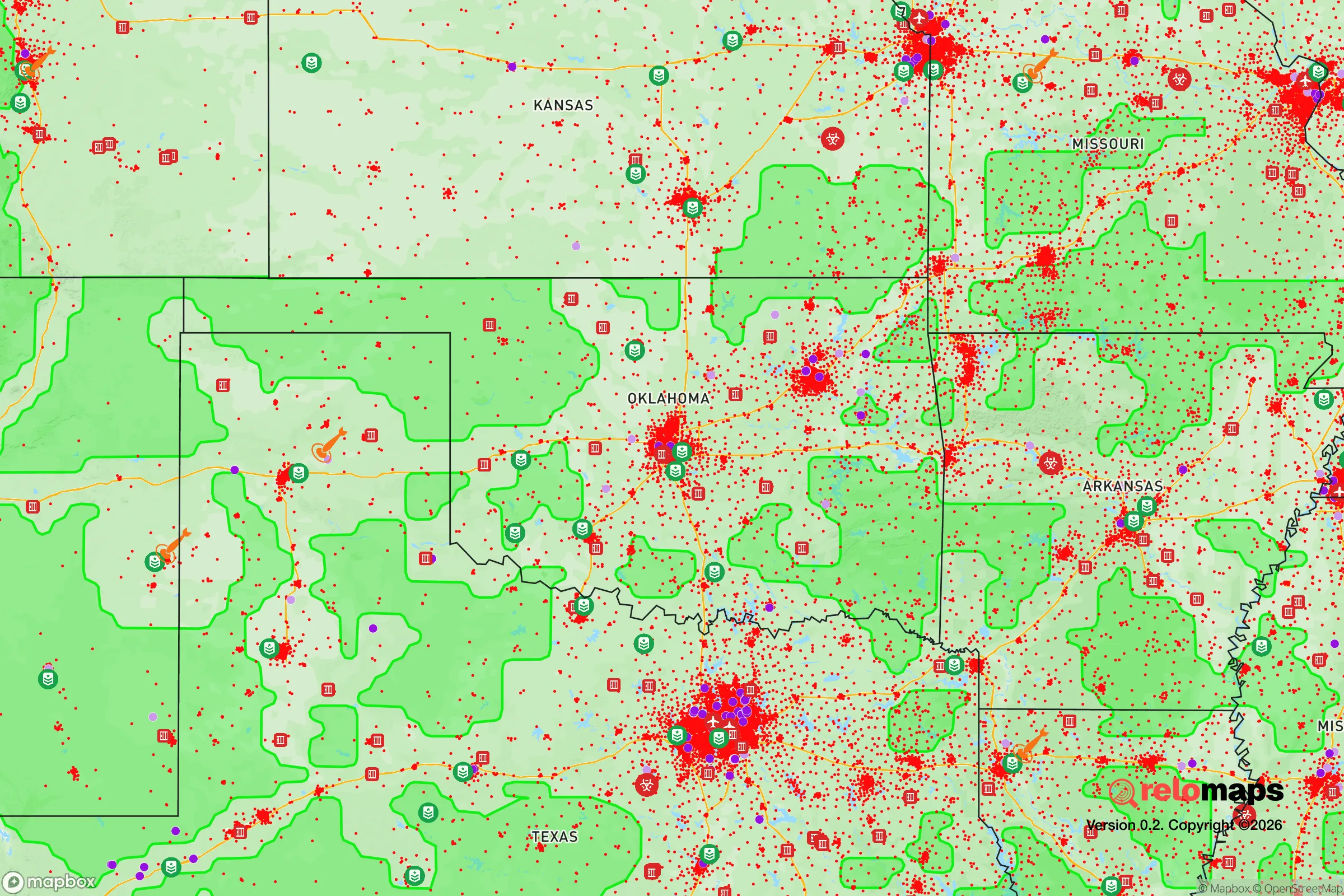
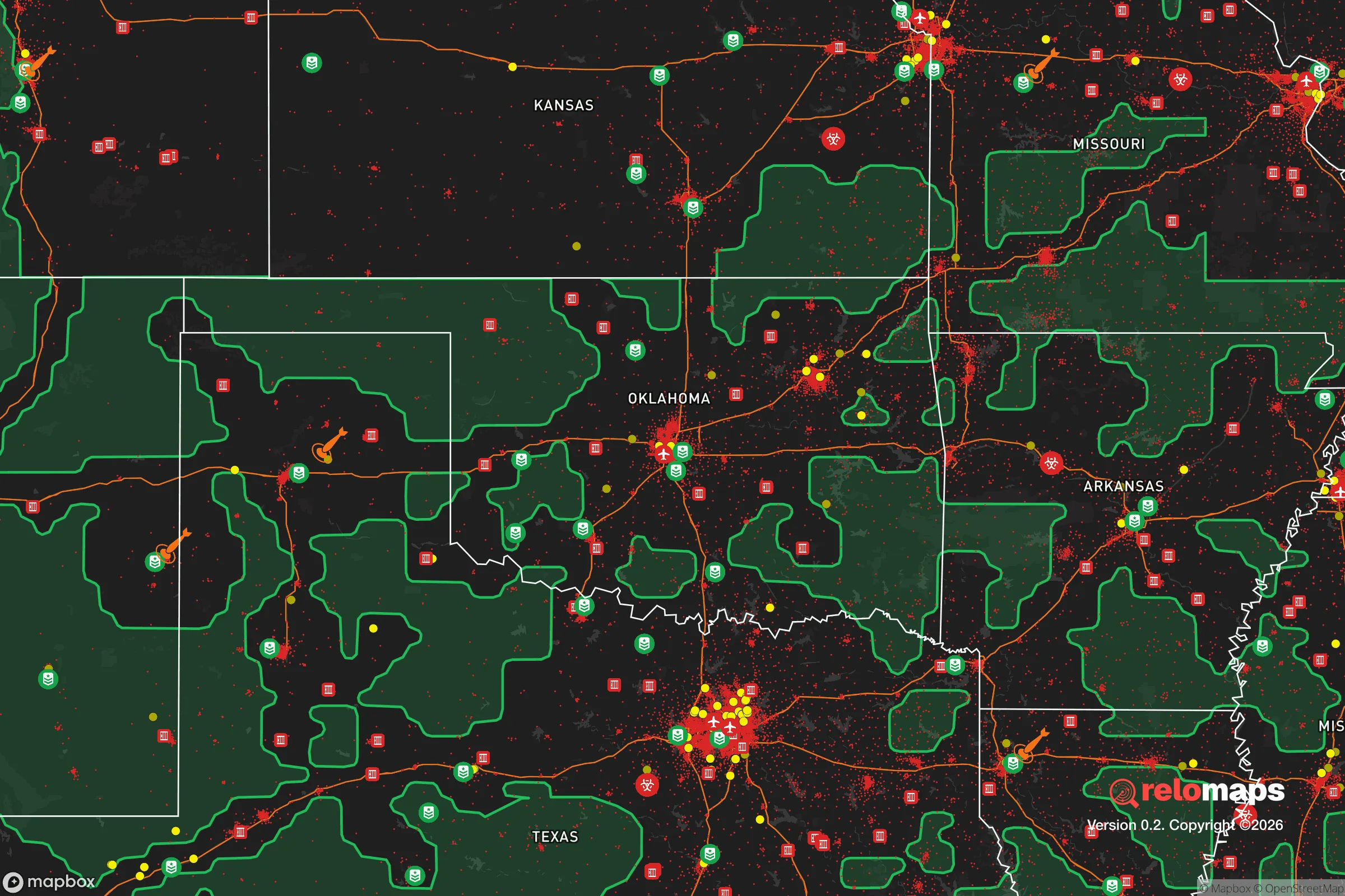
Important Note: For informational purposes only. This does not mean nothing bad ever happens in the green zones. Please use common sense. This is based on public data and modeled with AI. We tried to take a conservative approach but mistakes happen. We update this regularly as new information becomes available.
Solar Generator Recommendations
Backup power matters more here than in safer locations. We've picked three solar generators across budgets and capacity tiers — start with the budget unit if you only need a few essentials, or step up if you want to run a fridge and HVAC for days at a time.

Jackery Portable Power Station Explorer 300
Budget OptionPower on the Go: Weighing only 11 lbs, it's convenient to set up and store with book-sized foldable solar panels

BLUETTI Portable Power Station AC180
Designed for both indoor and outdoor scenarios, AC180 is highly capable as it has a robost capacity and continuous output power.

EF ECOFLOW DELTA Pro Ultra Power Station
Upgraded PickEcoFlow DELTA Pro Ultra is a whole-home energy system designed to grow with your family. Integrated with the Smart Home Panel 2, it scales to meet your evolving energy needs — keeping your home powered, intelligent, and secure through every stage of life.
We earn a commission, at no additional cost to you.
Strategic Assessment Analysis
Choctaw, Oklahoma, sits in a strategic sweet spot that preppers and survivalists should take seriously: close enough to Oklahoma City for supply runs and employment, but far enough east to avoid the worst of a metropolitan collapse or a major event targeting the capital. The town’s position along the North Canadian River corridor and its rural-agricultural character give it a resilience profile that’s hard to beat in central Oklahoma. For someone looking to ride out civic unrest, mass casualty events, or natural disasters, Choctaw offers a blend of defensible space, water access, and low-key anonymity that many suburban enclaves lack.
Geographic position and natural advantages for long-term survival
Choctaw’s location roughly 15 miles east of downtown Oklahoma City places it outside the immediate blast radius of any hypothetical strike on Tinker Air Force Base or the state capitol, yet still within a day’s drive of multiple supply and trade routes. The town sits on the edge of the Cross Timbers ecoregion, a transition zone between prairie and forest that provides natural cover, firewood, and game. The North Canadian River and its tributaries—like Choctaw Creek—offer surface water sources that can be filtered or boiled, a critical advantage in a grid-down scenario where municipal water may fail. The area’s rolling terrain and scattered woodlots create natural chokepoints and defensible positions, especially on the eastern side toward Harrah and the rural stretches of Pottawatomie County. Choctaw’s elevation averages around 1,100 feet, which is modest but enough to avoid the worst flash flooding that plagues low-lying parts of the metro. The local soil is a mix of sandy loam and clay, suitable for gardening if amended, and the growing season runs roughly from April to October—long enough for serious food production.
Risks, exposures, and proximity to fallout-relevant landmarks
The biggest liability for Choctaw is its proximity to Tinker Air Force Base, about 10 miles southwest as the crow flies. In a major conflict or terrorist event, Tinker is a high-value target—it’s a major maintenance and logistics hub for the U.S. Air Force. A ground burst at Tinker would put Choctaw in the moderate-to-heavy fallout zone, depending on wind direction. That’s a sobering reality, but it’s also a risk that can be mitigated with a well-stocked shelter, potassium iodide, and a plan to bug out east toward the Ouachita Mountains if warning time allows. The other concern is the proximity to Interstate 40 and the Union Pacific rail line that runs through the southern edge of town. Both are chokepoints for mass evacuation and could become targets for sabotage or civil unrest. On the plus side, Choctaw is far enough from the urban core that you won’t see the worst of the looting and gang activity that would likely hit OKC proper. The town’s population is just over 12,000, which means it’s small enough to maintain social cohesion but large enough to have a basic police and fire presence. The biggest natural risk is tornadoes—Choctaw sits in the heart of Tornado Alley, and the May 2013 Moore tornado was a grim reminder of what can happen. But the area’s flat-to-rolling terrain also means you can build a storm shelter or safe room without breaking the bank, and many homes already have them.
Practical resilience for a relocator: food, water, energy, and defensibility
For someone serious about self-sufficiency, Choctaw checks several boxes. Water is the first concern, and the North Canadian River provides a year-round surface source, though it’s silty and requires treatment. The local water table is shallow in many areas—wells can be drilled to 100–200 feet for decent yield, and many rural properties already have them. Rainwater catchment is viable, with annual precipitation averaging 36 inches, mostly concentrated in spring and fall. For food, the surrounding farmland grows wheat, corn, and soybeans, and there are several small-scale livestock operations within a 10-mile radius. The Choctaw Farmers Market runs seasonally, but for long-term resilience, you’d want to establish your own garden and possibly a few chickens or goats. Energy is a mixed bag: OG&E provides grid power, but outages are common during ice storms and tornado season. Solar is viable—the area gets about 5.5 peak sun hours per day—and many rural properties have space for a ground-mount array. Propane is widely available for backup heating and cooking. Defensibility is where Choctaw shines compared to a typical suburb. The town’s layout is a mix of older neighborhoods with mature trees and newer subdivisions on larger lots. The eastern and northern edges are rural, with acreages and dirt roads that make it easy to control access. The local sheriff’s office is responsive, but in a SHTF scenario, you’re largely on your own—which is exactly the mindset you want. The community is heavily conservative and gun-friendly, with a strong hunting culture. You won’t get sideways glances for having a rifle rack in your truck or a stack of firewood in the yard.
The overall strategic picture for Choctaw is one of calculated risk. It’s not a remote mountain redoubt, and it’s not a bunker in the desert. What it offers is a middle ground: a place where you can live a normal life, work in the city, and still have a realistic shot at riding out a crisis if you prepare properly. The key is to treat Choctaw as a base camp, not a fortress. Stockpile supplies, harden your home, build a shelter, and have a bug-out route east to the Ouachitas or south to the Arbuckle Mountains if things go truly sideways. For a conservative-leaning relocator who wants to stay connected to the economy but not be trapped in a urban kill box, Choctaw is a solid, under-the-radar choice. Just don’t ignore the Tinker factor—and make sure your fallout plan is as solid as your tornado plan.
* Values derived from national, state, county, city and local statistics and may differ in a specific area. Last updated: 2026-04-21T11:17:08.000Z
Narrative content on this page is AI-generated and may contain mistakes. Verify any details that matter before acting on them.
ReloMaps may earn a commission from affiliate links at no extra cost to you.