 Popular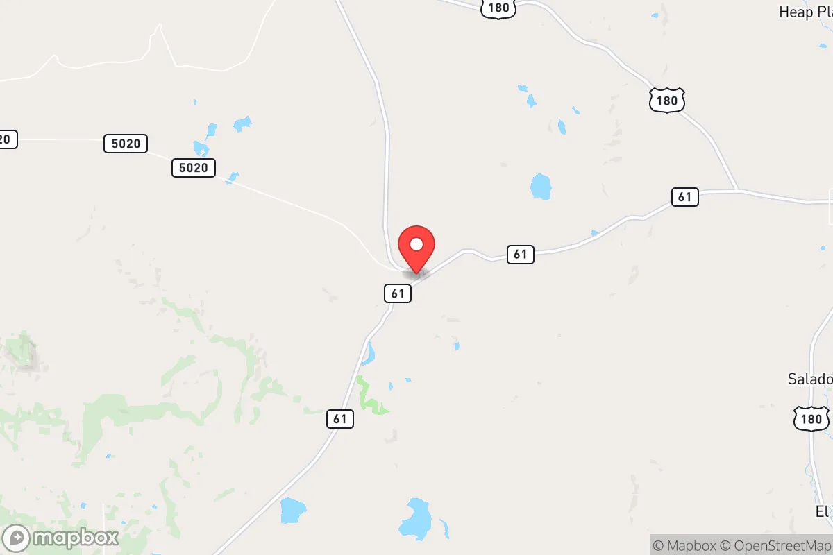
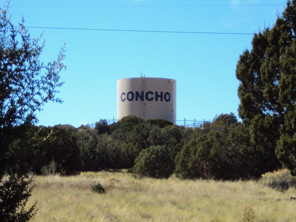
Photo: Wikipedia
Strategic Assessment of Concho, AZ
Strong survivability profile. Good buffer from population centers, with manageable environmental and tactical risks.
What does the Strategic Assessment tell us?
Our Strategic Assessment grades tactical survivability of an area. Major population centers, military targets, fallout zones, natural disasters, and border exposure all drive risk — lower exposure means a more defensible position in a crisis.
This is heavily inspired by Joel Skousen's Strategic Relocation book. Highly recommended you checkout the book ($)What does this tell us?
Our Strategic Assessment grades tactical survivability of an area. Major population centers, military targets, fallout zones, natural disasters, and border exposure all drive risk — lower exposure means a more defensible position in a crisis.
This is heavily inspired by Joel Skousen's Strategic Relocation book. Highly recommended you checkout the book ($)Strategic Pillars

Key Distances
Regional Safe Places
Below is our recommended "safe zones" in Arizona and the surrounding area based on our strategic heuristics. For most people, it's unrealistic to live in a “safe zone” full-time due to work, family or other personal reasons. They tend to be more rural. However, many of these areas are perfect for second homes and retreat properties that double as a vacation home or even a short-term rental.
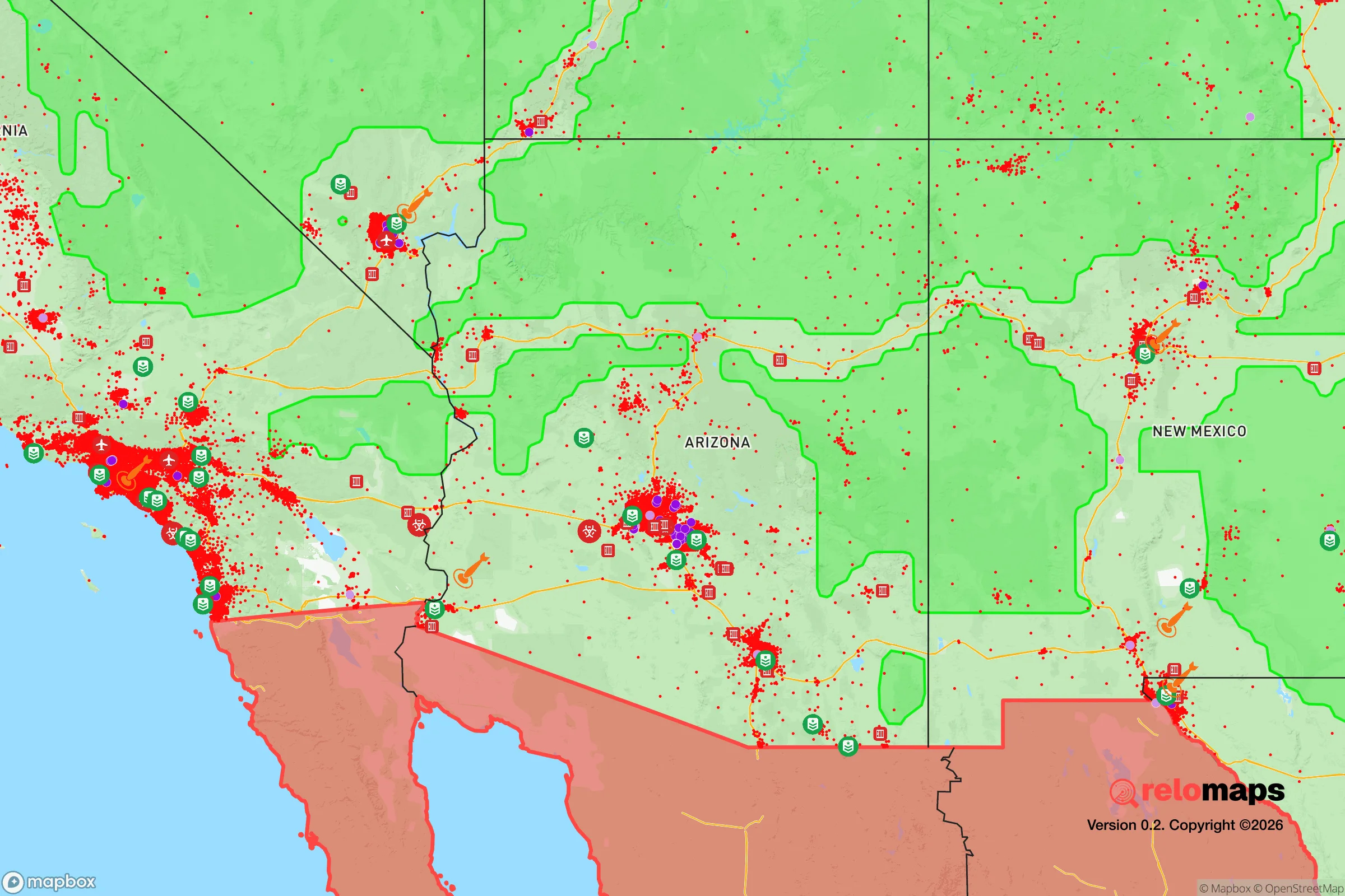
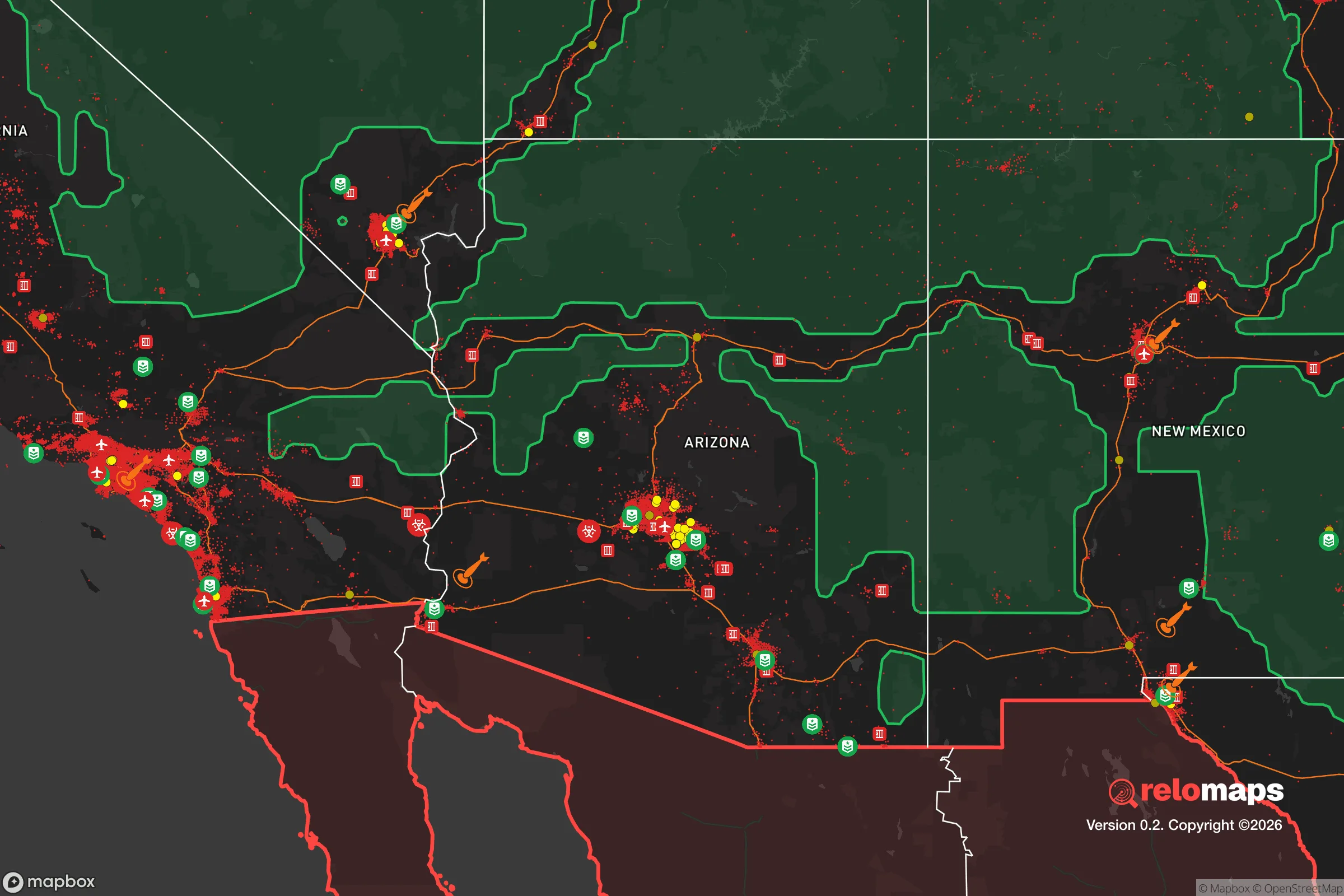


Important Note: For informational purposes only. This does not mean nothing bad ever happens in the green zones. Please use common sense. This is based on public data and modeled with AI. We tried to take a conservative approach but mistakes happen. We update this regularly as new information becomes available.
Solar Generator Recommendations
Backup power matters more here than in safer locations. We've picked three solar generators across budgets and capacity tiers — start with the budget unit if you only need a few essentials, or step up if you want to run a fridge and HVAC for days at a time.

Jackery Portable Power Station Explorer 300
Budget OptionPower on the Go: Weighing only 11 lbs, it's convenient to set up and store with book-sized foldable solar panels

BLUETTI Portable Power Station AC180
Designed for both indoor and outdoor scenarios, AC180 is highly capable as it has a robost capacity and continuous output power.

EF ECOFLOW DELTA Pro Ultra Power Station
Upgraded PickEcoFlow DELTA Pro Ultra is a whole-home energy system designed to grow with your family. Integrated with the Smart Home Panel 2, it scales to meet your evolving energy needs — keeping your home powered, intelligent, and secure through every stage of life.
We earn a commission, at no additional cost to you.
Strategic Assessment Analysis
Concho, Arizona, sits in a strategic pocket of the High Desert that offers genuine resilience advantages for those prioritizing self-sufficiency and disaster preparedness, but it demands clear-eyed trade-offs. Located roughly 20 miles east of St. Johns in Apache County, this unincorporated community of fewer than 200 year-round residents occupies a remote, high-elevation plateau (around 5,800 feet) that naturally buffers it from many of the risks plaguing denser population centers. Its isolation from major metropolitan areas—over 200 miles from Phoenix and 150 miles from Albuquerque—provides a meaningful buffer against cascading urban failures, while its position along U.S. Route 180 offers a single, reliable corridor for supply access without making it a natural thoroughfare for mass evacuation traffic.
Geographic position and natural advantages for long-term survival
Concho’s location in east-central Arizona places it in a zone of relative geologic and climatic stability. The area sits well away from active seismic fault lines—the nearest significant fault systems are the St. Johns fault zone roughly 30 miles east and the more active Mogollon Rim faults 60 miles southwest—meaning earthquake risk is low compared to much of the western U.S. The elevation moderates summer temperatures, with average highs in the 80s°F rather than the triple digits common in Phoenix or Tucson, reducing heat-related infrastructure strain and water evaporation rates. Winter brings snow, but accumulations are manageable (typically 10-15 inches annually) and provide a natural water source when captured. The region’s volcanic history is ancient; the nearest Holocene-age volcanic field, the Springerville Volcanic Field, is about 40 miles south and considered dormant, not an active threat. For a relocator, the land itself is stable, the climate is livable without heavy energy inputs, and the low population density (Apache County averages about 6 people per square mile) means competition for resources during a crisis would be minimal compared to suburban or urban settings.
Risks, exposures, and proximity to fallout-relevant landmarks
No location is risk-free, and Concho’s remote character brings specific vulnerabilities. The single biggest exposure is wildfire: the surrounding pinyon-juniper woodlands and grasslands are fire-adapted ecosystems, and the area has seen increasing fire frequency with drought cycles. The 2020 Baca Fire burned roughly 5,000 acres within 15 miles of Concho, and while no structures were lost, it demonstrated how quickly a wind-driven fire could threaten the community. Residents must maintain defensible space and have an evacuation plan—there is no municipal fire department; Apache County Fire District covers the area with volunteer crews and limited equipment. Water scarcity is the second critical risk. Concho relies entirely on groundwater from the Coconino and Supai aquifers, and while wells in the area generally produce adequate yields (10-30 gallons per minute at typical depths of 300-600 feet), prolonged drought or aquifer depletion from agricultural use in the Little Colorado River basin could lower water tables over time. There is no surface water source within the community; the nearest perennial stream is the Little Colorado River, 15 miles north, which is often dry or heavily silted.
Regarding man-made risks, Concho’s distance from major infrastructure targets is a double-edged sword. The community is over 200 miles from any active commercial nuclear power plant (Palo Verde near Phoenix is the closest), placing it well outside the 50-mile emergency planning zone for fallout exposure from a reactor accident. However, it sits roughly 100 miles east of the Barry M. Goldwater Range and 120 miles from the White Sands Missile Range in New Mexico—both active military testing areas. A worst-case accident involving a nuclear weapon component at either range could produce localized fallout, but prevailing winds from the west-southwest would carry material away from Concho in most scenarios. More concerning is the community’s proximity to Interstate 40, a major transcontinental freight corridor, about 40 miles north. A hazardous materials spill or terrorist attack on that route could disrupt supply chains, but the distance and terrain (the Mogollon Rim) provide a natural barrier. For a relocator, the key takeaway is that Concho is far enough from high-value targets to avoid direct blast or fire effects from a conventional or nuclear strike on Phoenix or Albuquerque, but not so remote that it escapes all secondary effects like supply disruption or refugee movement along Highway 180.
Practical resilience for a relocator: food, water, energy, and defensibility
For someone serious about self-sufficiency, Concho offers a workable baseline with significant room for improvement. Water is the linchpin: a private well is essential, and a backup hand pump or solar-powered pump is strongly recommended given the area’s unreliable grid power during winter storms. Average annual precipitation is only 12 inches, so rainwater catchment from a 1,000-square-foot roof yields roughly 7,500 gallons per year—enough for basic household use but not for irrigation. A 5,000-gallon storage tank is a minimum for a family of four to cover a 90-day drought or grid outage. Food production is limited by the short growing season (last frost mid-May, first frost early October) and alkaline soil, but cold-hardy crops like potatoes, carrots, kale, and beans do well with raised beds and compost amendment. The area supports free-range poultry and small livestock; goats are common for milk and brush control. Local hunting for mule deer and elk is permitted with a tag, and the Apache-Sitgreaves National Forest, 20 miles south, provides additional foraging and hunting access.
Energy resilience is straightforward: the area averages 280 sunny days per year, making solar photovoltaic systems highly effective. Off-grid solar setups with battery storage are common among existing residents, and the local utility (Arizona Public Service) offers net metering for grid-tied systems. A propane backup generator is advisable for winter weeks when snow cover reduces solar yield. Defensibility is a mixed picture. Concho’s layout is scattered—homes on 1- to 10-acre lots with significant open space between them—which makes perimeter security difficult but also means a threat is unlikely to affect multiple properties simultaneously. The community is tight-knit; a neighborhood watch or mutual-aid network is feasible but not formally organized. The nearest law enforcement is the Apache County Sheriff’s Office substation in St. Johns, 20 minutes away, so response times in a crisis would be slow. For a relocator, the practical advice is to invest in on-site water storage, a solar array with battery backup, a propane generator, and a secure food storage system before worrying about perimeter defenses. The biggest threat is not human intrusion but the slow erosion of supply chains during a regional emergency.
Concho’s medical access is limited: the nearest hospital is the 25-bed Sage Memorial Hospital in Ganado, 60 miles northwest, or the larger facilities in Show Low (80 miles west). A serious injury or illness requires a 90-minute drive to a trauma center. Telemedicine and a well-stocked first-aid kit are non-negotiable. For daily life, the St. Johns grocery store (a Bashas’) is 20 minutes away, but a deep pantry with a 6-month supply of staples is the standard for serious preppers in the area. The community has no pharmacy, hardware store, or fuel station—those are in St. Johns. This isolation is the core trade-off: you gain security from urban risks but lose convenience and emergency services.
Overall, Concho presents a viable but demanding resilience profile. Its geographic isolation, low population density, stable geology, and solar-rich climate make it a strong candidate for a relocator willing to invest in water independence and off-grid energy. The risks—wildfire, water scarcity, long emergency response times, and limited local infrastructure—are manageable with planning but not trivial. For a family or individual who values self-reliance and is prepared to be their own first responder, Concho offers a defensible, low-profile base in a region that is unlikely to be a primary target in any widespread disaster scenario. The key is to arrive with a plan, not just a dream: drill a well, install solar, build a pantry, and get to know your neighbors before the crisis hits.

* Values derived from national, state, county, city and local statistics and may differ in a specific area. Last updated: 2026-10-01T19:19:08.000Z
Narrative content on this page is AI-generated and may contain mistakes. Verify any details that matter before acting on them.
ReloMaps may earn a commission from affiliate links at no extra cost to you.

