
Photo: Wikipedia
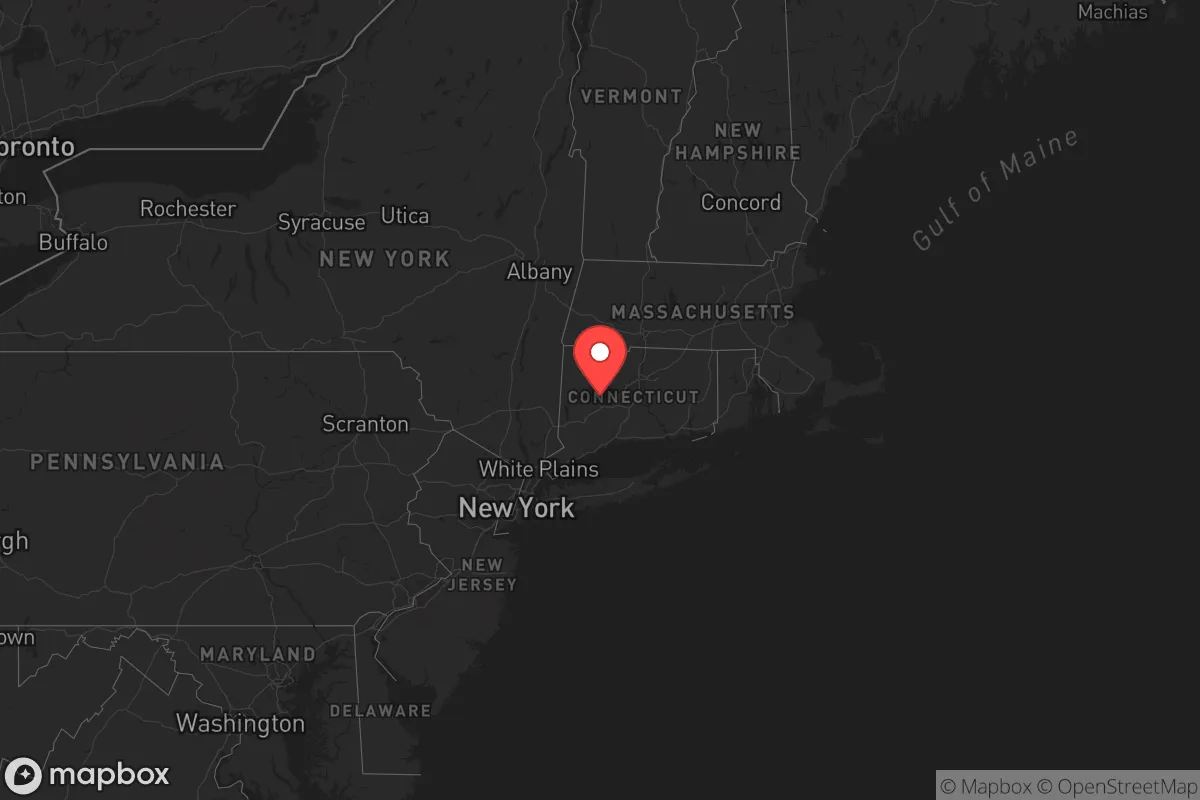
Strategic Assessment of Connecticut
High tactical risk. This location is likely close to major population centers, strategic targets, or sits in a high-disaster corridor. A retreat property and careful exit planning is required.
What does the Strategic Assessment tell us?
Our Strategic Assessment grades tactical survivability of an area. Major population centers, military targets, fallout zones, natural disasters, and border exposure all drive risk — lower exposure means a more defensible position in a crisis.
This is heavily inspired by Joel Skousen's Strategic Relocation book. Highly recommended you checkout the book ($)What does this tell us?
Our Strategic Assessment grades tactical survivability of an area. Major population centers, military targets, fallout zones, natural disasters, and border exposure all drive risk — lower exposure means a more defensible position in a crisis.
This is heavily inspired by Joel Skousen's Strategic Relocation book. Highly recommended you checkout the book ($)Regional Safe Places
Below is our recommended "safe zones" in Connecticut and the surrounding area based on our strategic heuristics. For most people, it's unrealistic to live in a “safe zone” full-time due to work, family or other personal reasons. They tend to be more rural. However, many of these areas are perfect for second homes and retreat properties that double as a vacation home or even a short-term rental.


Important Note: For informational purposes only. This does not mean nothing bad ever happens in the green zones. Please use common sense. This is based on public data and modeled with AI. We tried to take a conservative approach but mistakes happen. We update this regularly as new information becomes available.
Solar Generator Recommendations
Backup power matters more here than in safer locations. We've picked three solar generators across budgets and capacity tiers — start with the budget unit if you only need a few essentials, or step up if you want to run a fridge and HVAC for days at a time.

Jackery Portable Power Station Explorer 300
Budget OptionPower on the Go: Weighing only 11 lbs, it's convenient to set up and store with book-sized foldable solar panels

BLUETTI Portable Power Station AC180
Designed for both indoor and outdoor scenarios, AC180 is highly capable as it has a robost capacity and continuous output power.

EF ECOFLOW DELTA Pro Ultra Power Station
Upgraded PickEcoFlow DELTA Pro Ultra is a whole-home energy system designed to grow with your family. Integrated with the Smart Home Panel 2, it scales to meet your evolving energy needs — keeping your home powered, intelligent, and secure through every stage of life.
We earn a commission, at no additional cost to you.
Strategic Assessment Analysis
Connecticut offers a unique blend of strategic advantages and significant vulnerabilities for those prioritizing long-term resilience and self-sufficiency. Its position in the Northeast corridor places it within a two-hour drive of New York City and Boston, but also within the shadow of major population centers and critical infrastructure that could become liabilities during widespread unrest or disaster. For a conservative-minded relocator focused on preparedness, Connecticut’s dense population, high cost of living, and proximity to coastal threats require careful scrutiny, though its rural pockets and strong local governance offer some defensive potential.
Geographic position and natural advantages for long-term survival
Connecticut’s geography is a double-edged sword. The state’s interior, particularly the Litchfield Hills and the Quiet Corner (around towns like Woodstock and Pomfret), provides rolling terrain, abundant hardwood forests, and numerous small rivers and streams that offer reliable freshwater sources. The Connecticut River Valley runs north-south, creating a natural corridor that could be used for movement or defensive positioning. The state’s moderate climate—with four distinct seasons and no extreme drought or flood risks—supports subsistence farming and hunting, with white-tailed deer and wild turkey common. However, the entire coastline, from Stamford to New London, is vulnerable to storm surges and sea-level rise, and the Long Island Sound is a major shipping lane that could become a target or chokepoint during a crisis. The state’s small size—just 110 miles long and 70 miles wide—means no location is more than 60 miles from a major population center, limiting true isolation.
Risks, exposures, and proximity to fallout-relevant landmarks
Connecticut’s strategic liabilities are concentrated in its southern and eastern regions. The Millstone Nuclear Power Station in Waterford, a two-unit plant on the coast, is a primary fallout concern; a catastrophic event or targeted attack could render large swaths of southeastern Connecticut uninhabitable for decades. The New Haven and Bridgeport port complexes handle significant petroleum and chemical shipments, making them potential targets for sabotage or collateral damage during civil unrest. The state is also crisscrossed by major highways—I-95, I-84, I-91—that could become evacuation or supply routes, but also chokepoints for refugees fleeing New York City or Boston. Proximity to West Point (just across the border in New York) and the Naval Submarine Base New London in Groton means military activity could draw attention or resources, but also offers a potential security buffer if the chain of command holds. For a prepper, the risk of being caught between coastal chaos and inland congestion is real; the state’s population density of 739 people per square mile (third-highest in the nation) means that even rural areas are never far from neighbors who may not share your preparedness mindset.
Practical resilience for a relocator: food, water, energy, and defensibility
For those willing to invest, Connecticut offers workable but not ideal conditions for self-sufficiency. Water availability is a strong point: the state has over 3,000 lakes and ponds, plus the Connecticut River and its tributaries, but most surface water requires filtration due to agricultural runoff and industrial legacy contamination. Private wells are common in rural areas, but drilling costs are high (often $10,000–$20,000). Food production is feasible but limited by rocky soil and a short growing season (April to October). Small-scale farming is viable in the Litchfield Hills and the eastern highlands, but large-scale agriculture is rare; the state imports 90% of its food. Energy resilience is a mixed bag: Connecticut has high electricity costs (often 50% above national average) and an aging grid prone to storm outages. Solar is viable, but net metering policies are less favorable than in sunnier states. Wood heating is common in rural homes, and the state’s forests provide ample fuel, but air quality regulations may restrict burning during emergencies. Defensibility is challenging due to the state’s small size and dense road network. Properties in the Northwest Hills (around Norfolk and Cornwall) offer the best natural barriers—steep terrain, narrow roads, and limited access points—but even these areas are within 30 minutes of a town of 10,000+ people. The state’s strong gun laws (including an assault weapons ban and magazine capacity limits) may hinder self-defense options for relocators, though private ownership remains common in rural areas.
Overall, Connecticut is a high-risk, moderate-reward option for the strategic relocator. Its strengths—reliable water, moderate climate, and defensible terrain in the northwest—are offset by its small size, high population density, and proximity to multiple fallout-relevant targets like nuclear plants and ports. For a single individual or family willing to invest in off-grid infrastructure and maintain a low profile, the Litchfield Hills or Quiet Corner could serve as a temporary retreat, but the state’s lack of true isolation and vulnerability to coastal and infrastructure threats make it a poor long-term survival destination compared to the interior Northeast or Appalachia. If you’re considering Connecticut, focus on the northwest quadrant (west of the Connecticut River, north of Danbury) and plan for a scenario where you may need to relocate further inland within 48 hours of a major event. The state’s strong local governance and community networks can be an asset, but only if you’re prepared to navigate a densely populated environment where everyone else is also thinking about the same limited resources.
Top 10 Cities by Strategic Assessment in Connecticut


* Values derived from national, state, county, city and local statistics and may differ in a specific area. Last updated: 2026-04-18T00:20:00.000Z
Narrative content on this page is AI-generated and may contain mistakes. Verify any details that matter before acting on them.
ReloMaps may earn a commission from affiliate links at no extra cost to you.