Photo: Wikipedia
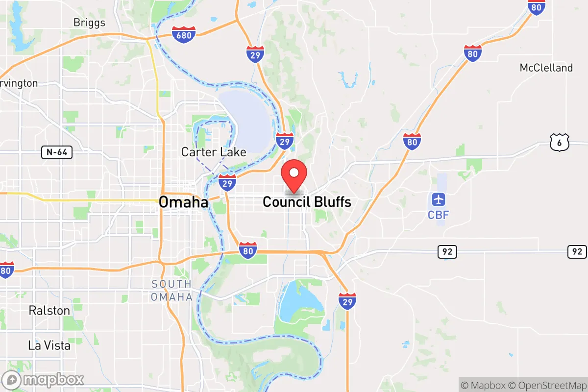
Strategic Assessment of Council Bluffs, IA
Multiple tactical vulnerabilities. Population density, target proximity, or disaster risk are likely compounding. A retreat property and exit planning is required.
What does the Strategic Assessment tell us?
Our Strategic Assessment grades tactical survivability of an area. Major population centers, military targets, fallout zones, natural disasters, and border exposure all drive risk — lower exposure means a more defensible position in a crisis.
This is heavily inspired by Joel Skousen's Strategic Relocation book. Highly recommended you checkout the book ($)What does this tell us?
Our Strategic Assessment grades tactical survivability of an area. Major population centers, military targets, fallout zones, natural disasters, and border exposure all drive risk — lower exposure means a more defensible position in a crisis.
This is heavily inspired by Joel Skousen's Strategic Relocation book. Highly recommended you checkout the book ($)Strategic Pillars

Key Distances
Regional Safe Places
Below is our recommended "safe zones" in Iowa and the surrounding area based on our strategic heuristics. For most people, it's unrealistic to live in a “safe zone” full-time due to work, family or other personal reasons. They tend to be more rural. However, many of these areas are perfect for second homes and retreat properties that double as a vacation home or even a short-term rental.


Important Note: For informational purposes only. This does not mean nothing bad ever happens in the green zones. Please use common sense. This is based on public data and modeled with AI. We tried to take a conservative approach but mistakes happen. We update this regularly as new information becomes available.
Solar Generator Recommendations
Backup power matters more here than in safer locations. We've picked three solar generators across budgets and capacity tiers — start with the budget unit if you only need a few essentials, or step up if you want to run a fridge and HVAC for days at a time.

Jackery Portable Power Station Explorer 300
Budget OptionPower on the Go: Weighing only 11 lbs, it's convenient to set up and store with book-sized foldable solar panels

BLUETTI Portable Power Station AC180
Designed for both indoor and outdoor scenarios, AC180 is highly capable as it has a robost capacity and continuous output power.

EF ECOFLOW DELTA Pro Ultra Power Station
Upgraded PickEcoFlow DELTA Pro Ultra is a whole-home energy system designed to grow with your family. Integrated with the Smart Home Panel 2, it scales to meet your evolving energy needs — keeping your home powered, intelligent, and secure through every stage of life.
We earn a commission, at no additional cost to you.
Strategic Assessment Analysis
Council Bluffs, Iowa, sits in a strategic sweet spot that few relocators fully appreciate: it offers the logistical advantages of being a regional transportation hub while remaining far enough from the major population centers to avoid the worst of cascading collapse scenarios. The city’s position along the Missouri River, its direct access to Interstate 29 and Interstate 80, and its proximity to Omaha, Nebraska (just across the river) give it a resilience profile that leans heavily on mobility and supply-chain access—critical factors when you’re thinking about post-disaster movement or resource acquisition. For a conservative-leaning prepper or survivalist, Council Bluffs isn’t a bug-out destination in itself, but it’s a strong candidate for a staging area or a long-term hold if you understand its vulnerabilities and play to its strengths.
Geographic position and natural advantages for long-term survival
Council Bluffs sits on the eastern edge of the Loess Hills, a unique geological formation that provides natural elevation, drainage, and defensible terrain—rare in the flat Midwest. The hills run north-south for about 200 miles, offering ridgelines that can serve as observation points, escape routes, or fallback positions if the river valley becomes compromised. The Missouri River itself is a double-edged sword: it provides a reliable water source and fertile bottomland for agriculture, but it also floods regularly. The city’s flood-control infrastructure (levees, reservoirs, and the Papio-Missouri River Natural Resources District) is well-maintained, but any serious breakdown in maintenance or a major seismic event could turn the river into a liability. The Loess Hills, however, give you the option to move upslope quickly—within a 15-minute drive you can be on ridgelines with clear views of the valley, which is a significant tactical advantage for anyone thinking about perimeter security or early warning.
Risks, exposures, and proximity to fallout-relevant landmarks
The biggest strategic downside of Council Bluffs is its proximity to Omaha, a major metropolitan area of roughly 1 million people. In a mass-casualty event, civil unrest, or a pandemic scenario, Omaha’s population could surge westward across the bridges, overwhelming local resources. The city is also within 50 miles of the Strategic Air Command & Aerospace Museum (a former nuclear missile base) and the Offutt Air Force Base, which houses U.S. Strategic Command. That makes Council Bluffs a potential secondary target in a nuclear exchange or a high-value asset in a cyberattack on military infrastructure. Additionally, the Union Pacific Railroad’s Bailey Yard—the largest rail yard in the world—is just north in North Platte, but Council Bluffs itself is a major rail hub for BNSF and Union Pacific lines. A derailment or sabotage of hazardous materials (ammonia, chlorine, crude oil) could contaminate the river or the air for miles. On the natural disaster front, the region is prone to severe thunderstorms, tornadoes (Iowa averages 50+ per year), and the aforementioned river flooding. The 2019 Missouri River floods caused over $1 billion in damage in the region, and climate models suggest more intense precipitation events going forward. For a prepper, the takeaway is that Council Bluffs is not a remote sanctuary—it’s a buffer zone that requires active monitoring and a plan to move further west or into the hills if things go sideways.
Practical resilience for a relocator: food, water, energy, and defensibility
On the practical side, Council Bluffs has several resilience factors that make it worth considering. Water access is excellent: the Missouri River is a massive, year-round source, and the city’s water treatment plant draws from it directly. In a grid-down scenario, you’d need filtration or boiling capability, but the raw supply is there. The Loess Hills also have numerous small springs and creeks, though they’re seasonal. Food production potential is high: Pottawattamie County is agricultural, with corn, soybeans, and livestock operations. The city itself has a growing number of community gardens and farmers’ markets, but for a serious prepper, the real value is in the surrounding rural areas where you can buy small acreage (prices are still reasonable—$5,000–$10,000 per acre for undeveloped land). Energy infrastructure is robust: the city is served by MidAmerican Energy, which operates coal, natural gas, and wind generation. The nearby Fort Calhoun nuclear plant (across the river in Nebraska) was decommissioned in 2016, removing one major fallout risk, but the grid is still tied to the larger MISO network, which could be vulnerable to cyberattacks or EMP. Solar and wind potential is good—Iowa ranks second in the U.S. for wind energy—so off-grid setups are feasible. Defensibility is mixed: the city itself is a typical Midwestern grid layout, which is hard to secure. But the Loess Hills offer natural chokepoints and high ground. A small group could hold a ridgeline property with good visibility and limited access roads. The local gun culture is strong (Iowa is a shall-issue state for permits, and constitutional carry passed in 2021), so you won’t stand out as an armed household. The biggest practical weakness is medical infrastructure: the city has CHI Health Mercy Hospital and a few clinics, but for trauma or specialized care, you’re looking at Omaha’s hospitals, which could be overwhelmed or inaccessible in a crisis. Stockpiling antibiotics, trauma kits, and having a telemedicine plan is essential.
Overall, Council Bluffs presents a nuanced strategic picture. It’s not a remote redoubt—you’re still within a day’s drive of major population centers and military targets. But for a relocator who wants to stay connected to supply chains and job opportunities while maintaining a prepper mindset, it offers a workable balance. The key is to treat it as a base of operations rather than a final destination: buy property in the Loess Hills, establish a secondary water and food cache, and have a bug-out route west toward the Nebraska Sandhills or the Black Hills if the SHTF. The local political climate leans conservative (Pottawattamie County went +18 for Trump in 2020), and the community is generally self-reliant and neighborly—valuable traits when you’re building a network. If you’re willing to put in the work on situational awareness and redundancy, Council Bluffs can be a solid anchor point in a volatile world. Just don’t get comfortable enough to ignore the warning signs from across the river.
* Values derived from national, state, county, city and local statistics and may differ in a specific area. Last updated: 2026-04-19T07:15:31.000Z
Narrative content on this page is AI-generated and may contain mistakes. Verify any details that matter before acting on them.
ReloMaps may earn a commission from affiliate links at no extra cost to you.