Photo: Wikipedia
Strategic Assessment of Cut Bank, MT
Workable tactical position. Some exposure to population density or targets, but generally defensible in a crisis.
What does the Strategic Assessment tell us?
Our Strategic Assessment grades tactical survivability of an area. Major population centers, military targets, fallout zones, natural disasters, and border exposure all drive risk — lower exposure means a more defensible position in a crisis.
This is heavily inspired by Joel Skousen's Strategic Relocation book. Highly recommended you checkout the book ($)What does this tell us?
Our Strategic Assessment grades tactical survivability of an area. Major population centers, military targets, fallout zones, natural disasters, and border exposure all drive risk — lower exposure means a more defensible position in a crisis.
This is heavily inspired by Joel Skousen's Strategic Relocation book. Highly recommended you checkout the book ($)Strategic Pillars

Key Distances
Regional Safe Places
Below is our recommended "safe zones" in Montana and the surrounding area based on our strategic heuristics. For most people, it's unrealistic to live in a “safe zone” full-time due to work, family or other personal reasons. They tend to be more rural. However, many of these areas are perfect for second homes and retreat properties that double as a vacation home or even a short-term rental.
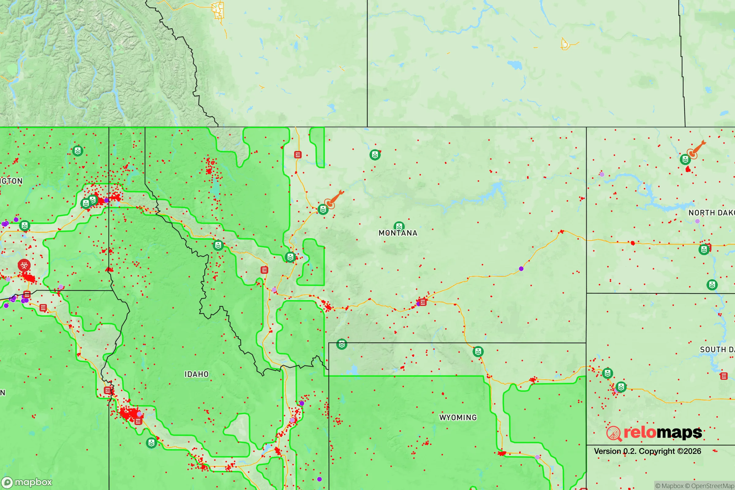

Important Note: For informational purposes only. This does not mean nothing bad ever happens in the green zones. Please use common sense. This is based on public data and modeled with AI. We tried to take a conservative approach but mistakes happen. We update this regularly as new information becomes available.
Solar Generator Recommendations
Backup power matters more here than in safer locations. We've picked three solar generators across budgets and capacity tiers — start with the budget unit if you only need a few essentials, or step up if you want to run a fridge and HVAC for days at a time.

Jackery Portable Power Station Explorer 300
Budget OptionPower on the Go: Weighing only 11 lbs, it's convenient to set up and store with book-sized foldable solar panels

BLUETTI Portable Power Station AC180
Designed for both indoor and outdoor scenarios, AC180 is highly capable as it has a robost capacity and continuous output power.

EF ECOFLOW DELTA Pro Ultra Power Station
Upgraded PickEcoFlow DELTA Pro Ultra is a whole-home energy system designed to grow with your family. Integrated with the Smart Home Panel 2, it scales to meet your evolving energy needs — keeping your home powered, intelligent, and secure through every stage of life.
We earn a commission, at no additional cost to you.
Strategic Assessment Analysis
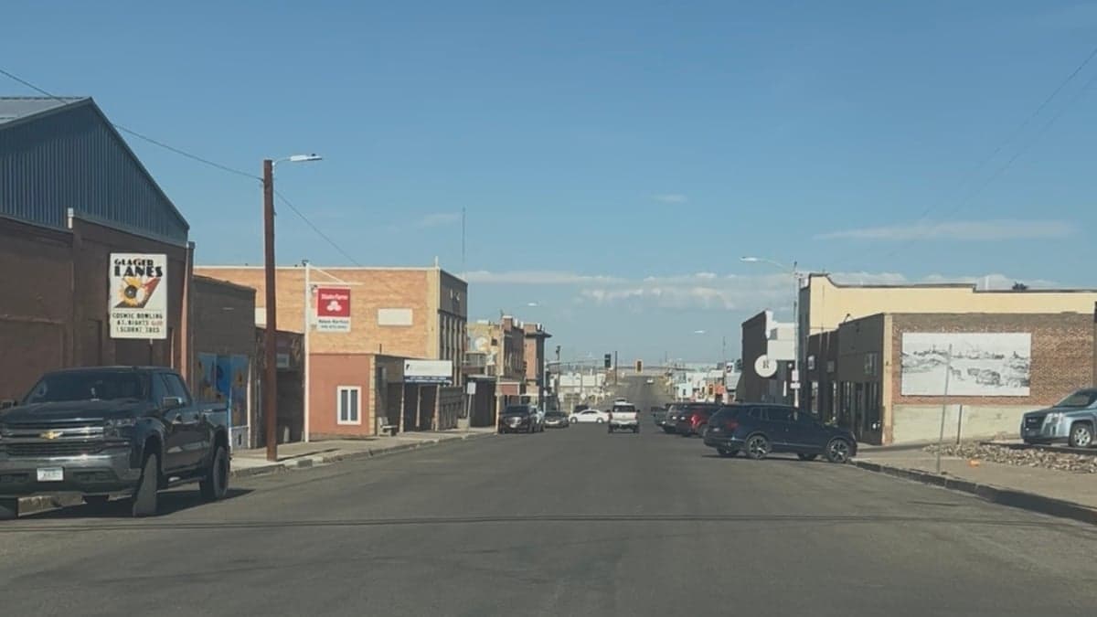
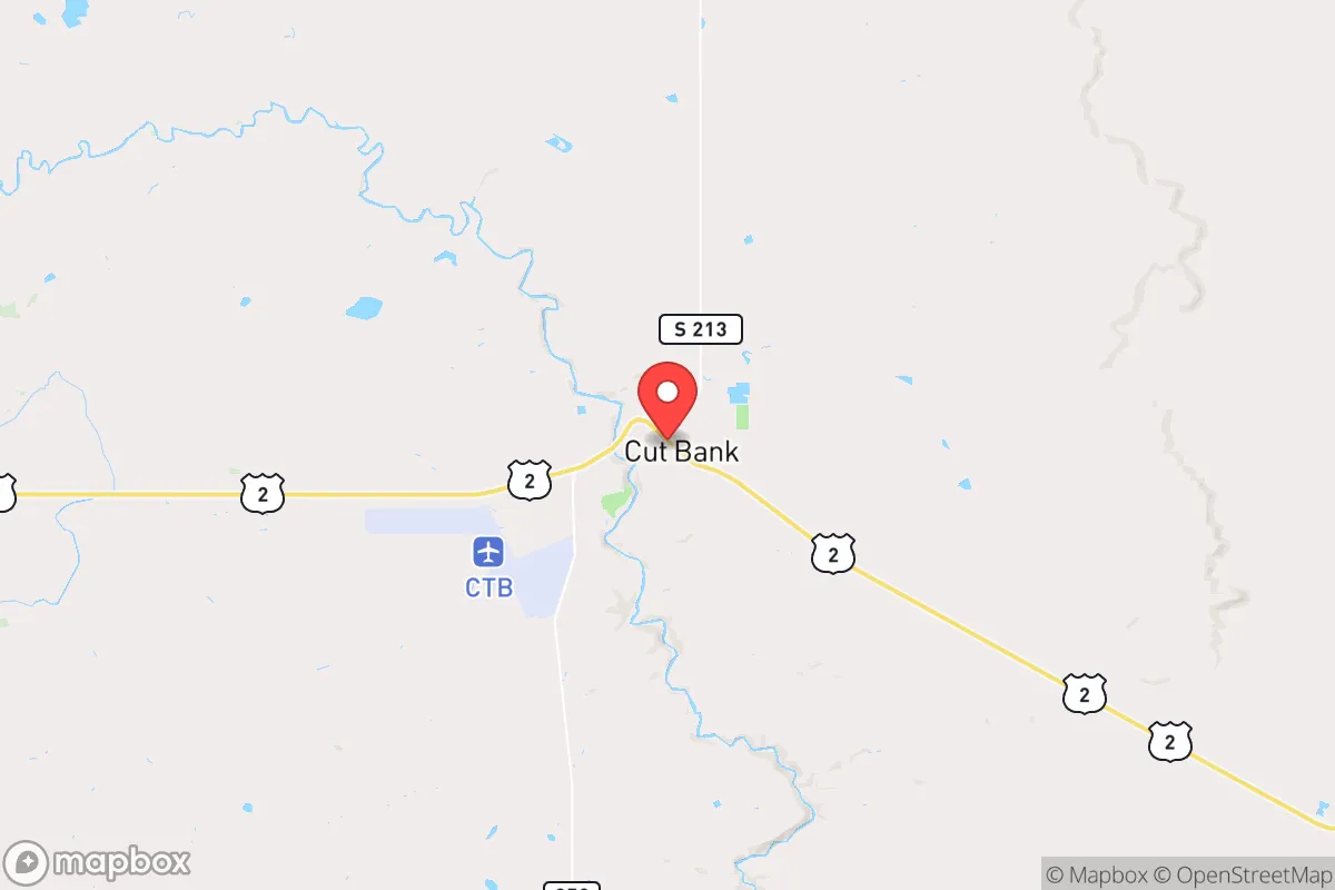
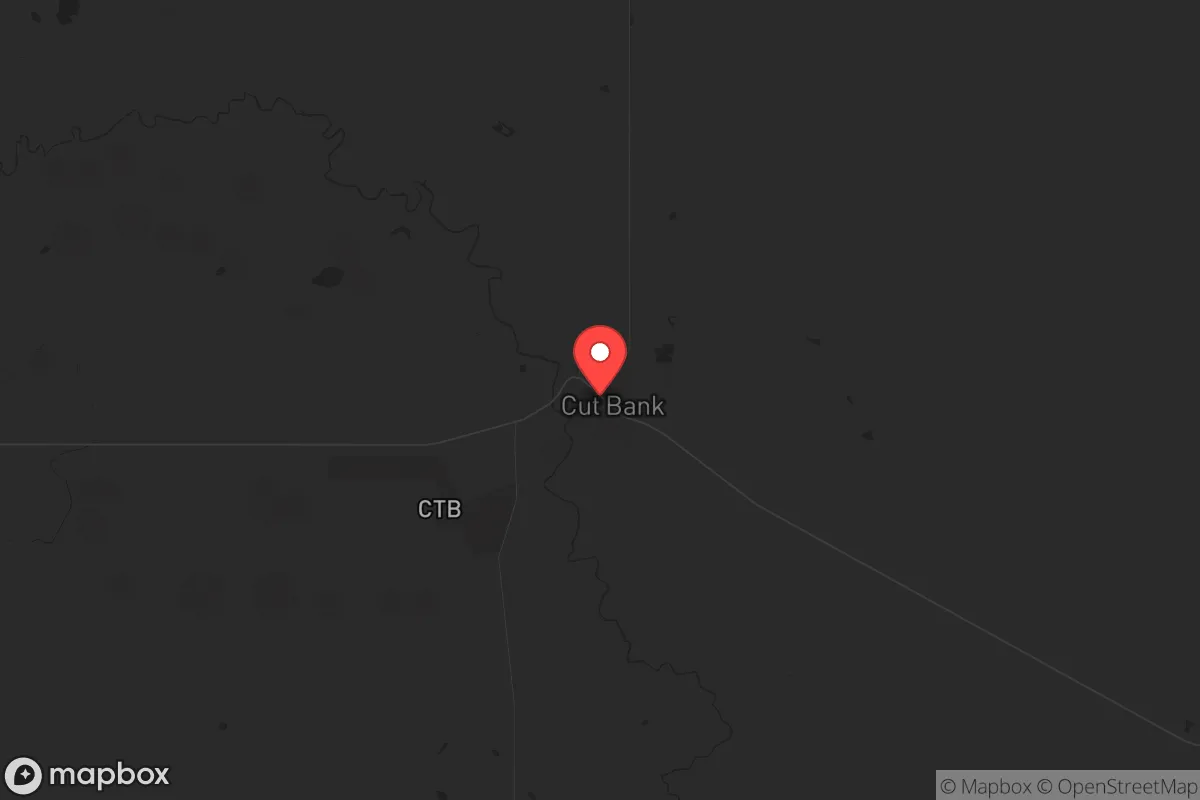
Cut Bank, Montana, sits as one of the most strategically resilient small towns in the lower 48, offering a rare combination of geographic isolation, natural resource abundance, and low population density that makes it a serious contender for anyone thinking long-term about security and self-sufficiency. Located just 25 miles south of the Canadian border along the Hi-Line, this town of roughly 3,000 people is far enough from any major population center to avoid the immediate chaos of a collapse event, yet close enough to the Glacier Park region and the Rocky Mountain Front to access critical water, timber, and game. For the conservative prepper or survivalist looking to plant roots in a place where the grid is thin and the neighbors are few, Cut Bank presents a compelling—if austere—option.
Geographic isolation and natural buffer zones
Cut Bank’s primary strategic advantage is its position on the eastern slope of the Rocky Mountains, where the Great Plains meet the foothills. This places it in a natural buffer zone: to the west, the rugged terrain of the Lewis and Clark National Forest and Glacier National Park create a formidable barrier against any large-scale movement from the Pacific coast or the I-5 corridor. To the east, hundreds of miles of sparsely populated prairie stretch toward the Missouri River breaks, offering no easy approach for organized threats. The town itself sits at the confluence of the Cut Bank Creek and the Marias River, providing a reliable freshwater source that is not dependent on municipal infrastructure. The surrounding area is dominated by wheat fields, cattle ranches, and federal land, meaning that a relocator with a few acres can achieve a degree of operational security that is simply impossible in suburban or exurban settings. The nearest city of any size is Great Falls, 120 miles southeast, and the closest major metro is Calgary, Alberta, 180 miles north—across an international border that could become a chokepoint in a crisis. This isolation is not just a comfort; it is a tactical reality that makes Cut Bank a hard target for any external pressure.
Risks, exposures, and proximity to fallout-relevant landmarks
No location is without vulnerabilities, and Cut Bank has a few that a serious prepper must weigh. The most obvious is its proximity to the Malmstrom Air Force Base missile fields, which stretch across north-central Montana. Malmstrom is home to 150 Minuteman III intercontinental ballistic missiles, and while the base itself is 100 miles southeast of Cut Bank, the missile silos are scattered across the region, including some within 50 miles of the town. In a full-scale nuclear exchange, these silos would be primary targets, and a ground burst could produce fallout that drifts eastward depending on wind patterns. However, the prevailing winds in this area are from the west, which means that fallout from a strike on the eastern Montana silos would likely be carried away from Cut Bank. The more immediate risk is from the rail lines and highways that run through town: the BNSF Hi-Line rail corridor and U.S. Highway 2 both pass directly through Cut Bank, making it a potential chokepoint for refugee movement or supply chain disruption during a national emergency. The town also sits in a region prone to severe winter storms, with blizzards that can drop three feet of snow and cut roads for days. A relocator must plan for extended isolation during winter months, with backup heat, food stores, and the ability to move by snowmobile or tracked vehicle. On the plus side, there are no major chemical plants, nuclear power stations, or large-scale industrial targets within 200 miles, and the population density is so low that a disease outbreak would have difficulty spreading through the community.
Practical resilience for a relocator: food, water, energy, and defensibility
Cut Bank offers a rare trifecta for the self-sufficient relocator: abundant water, arable land, and a climate that supports both hunting and agriculture. The Marias River and Cut Bank Creek provide year-round surface water, and the local aquifer is deep but reliable—most rural properties have private wells. The growing season is short, roughly 100 days, but cold-hardy crops like potatoes, carrots, kale, and grains can be cultivated, and the surrounding prairie supports cattle and bison ranching. For protein, the area is rich in mule deer, elk, and pronghorn antelope, with public land access through the nearby Blackfeet Indian Reservation and state trust lands. Energy resilience is straightforward: the region has excellent wind resources, and solar panels work well in the high-desert sun, though winter cloud cover can reduce output. Wood heat is viable, with ample deadfall in the nearby forests, but a relocator should plan for a wood stove or outdoor boiler as a primary heat source. Defensibility is excellent due to the open terrain—any approach by vehicle or foot can be seen from miles away, and the town’s layout, with a single main street and limited access points, makes it easy to monitor. The local population is overwhelmingly rural, conservative, and armed, with a strong culture of mutual aid and self-reliance. The county sheriff’s office is small but responsive, and the community has a history of pulling together during floods and blizzards. For a relocator, the key is to arrive with skills, not just gear: knowing how to fix a diesel engine, process game, and grow food in a short season will matter more than a stockpile of freeze-dried meals.
The overall strategic picture for Cut Bank is one of high reward with manageable risk. It is not a place for those who need urban amenities, medical specialists, or a vibrant social scene—the nearest hospital is a 30-bed critical access facility, and the closest trauma center is in Great Falls, two hours away. But for the conservative individual or family looking to step off the grid in a location that offers genuine security from the cascading failures of a collapsing society, Cut Bank checks nearly every box. The isolation that makes it unattractive to most Americans is precisely what makes it valuable to those who see the writing on the wall. The missile field risk is real but manageable with a fallout shelter and a wind-monitoring plan. The winter weather is harsh but predictable. The community is small but resilient. If you are serious about relocating to a place where you can ride out the storm—whether that storm is economic, political, or environmental—Cut Bank deserves a hard look. Just bring warm clothes, a good rifle, and a willingness to work. The land will do the rest.
* Values derived from national, state, county, city and local statistics and may differ in a specific area. Last updated: 2026-04-29T21:59:09.000Z
Narrative content on this page is AI-generated and may contain mistakes. Verify any details that matter before acting on them.
ReloMaps may earn a commission from affiliate links at no extra cost to you.