
Photo: Wikipedia
Strategic Assessment of Danville, KY
Workable tactical position. Some exposure to population density or targets, but generally defensible in a crisis.
What does the Strategic Assessment tell us?
Our Strategic Assessment grades tactical survivability of an area. Major population centers, military targets, fallout zones, natural disasters, and border exposure all drive risk — lower exposure means a more defensible position in a crisis.
This is heavily inspired by Joel Skousen's Strategic Relocation book. Highly recommended you checkout the book ($)What does this tell us?
Our Strategic Assessment grades tactical survivability of an area. Major population centers, military targets, fallout zones, natural disasters, and border exposure all drive risk — lower exposure means a more defensible position in a crisis.
This is heavily inspired by Joel Skousen's Strategic Relocation book. Highly recommended you checkout the book ($)Strategic Pillars

Key Distances
Regional Safe Places
Below is our recommended "safe zones" in Kentucky and the surrounding area based on our strategic heuristics. For most people, it's unrealistic to live in a “safe zone” full-time due to work, family or other personal reasons. They tend to be more rural. However, many of these areas are perfect for second homes and retreat properties that double as a vacation home or even a short-term rental.


Important Note: For informational purposes only. This does not mean nothing bad ever happens in the green zones. Please use common sense. This is based on public data and modeled with AI. We tried to take a conservative approach but mistakes happen. We update this regularly as new information becomes available.
Solar Generator Recommendations
Backup power matters more here than in safer locations. We've picked three solar generators across budgets and capacity tiers — start with the budget unit if you only need a few essentials, or step up if you want to run a fridge and HVAC for days at a time.

Jackery Portable Power Station Explorer 300
Budget OptionPower on the Go: Weighing only 11 lbs, it's convenient to set up and store with book-sized foldable solar panels

BLUETTI Portable Power Station AC180
Designed for both indoor and outdoor scenarios, AC180 is highly capable as it has a robost capacity and continuous output power.

EF ECOFLOW DELTA Pro Ultra Power Station
Upgraded PickEcoFlow DELTA Pro Ultra is a whole-home energy system designed to grow with your family. Integrated with the Smart Home Panel 2, it scales to meet your evolving energy needs — keeping your home powered, intelligent, and secure through every stage of life.
We earn a commission, at no additional cost to you.
Strategic Assessment Analysis
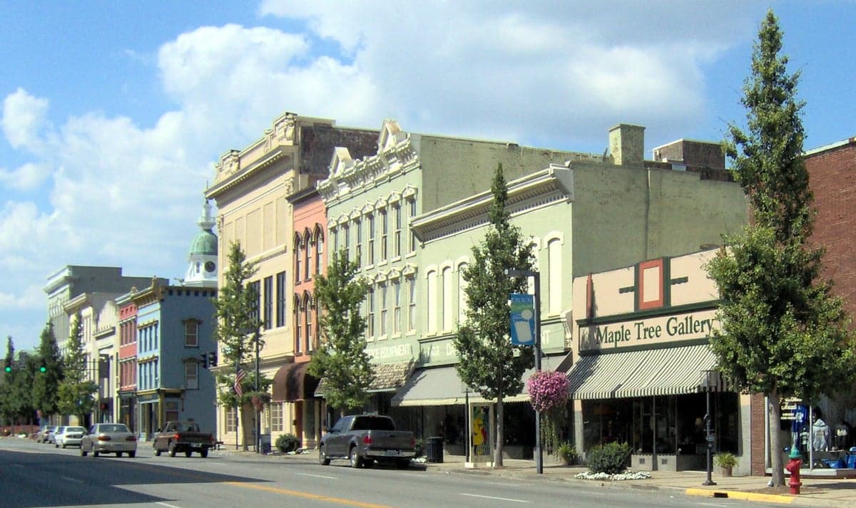
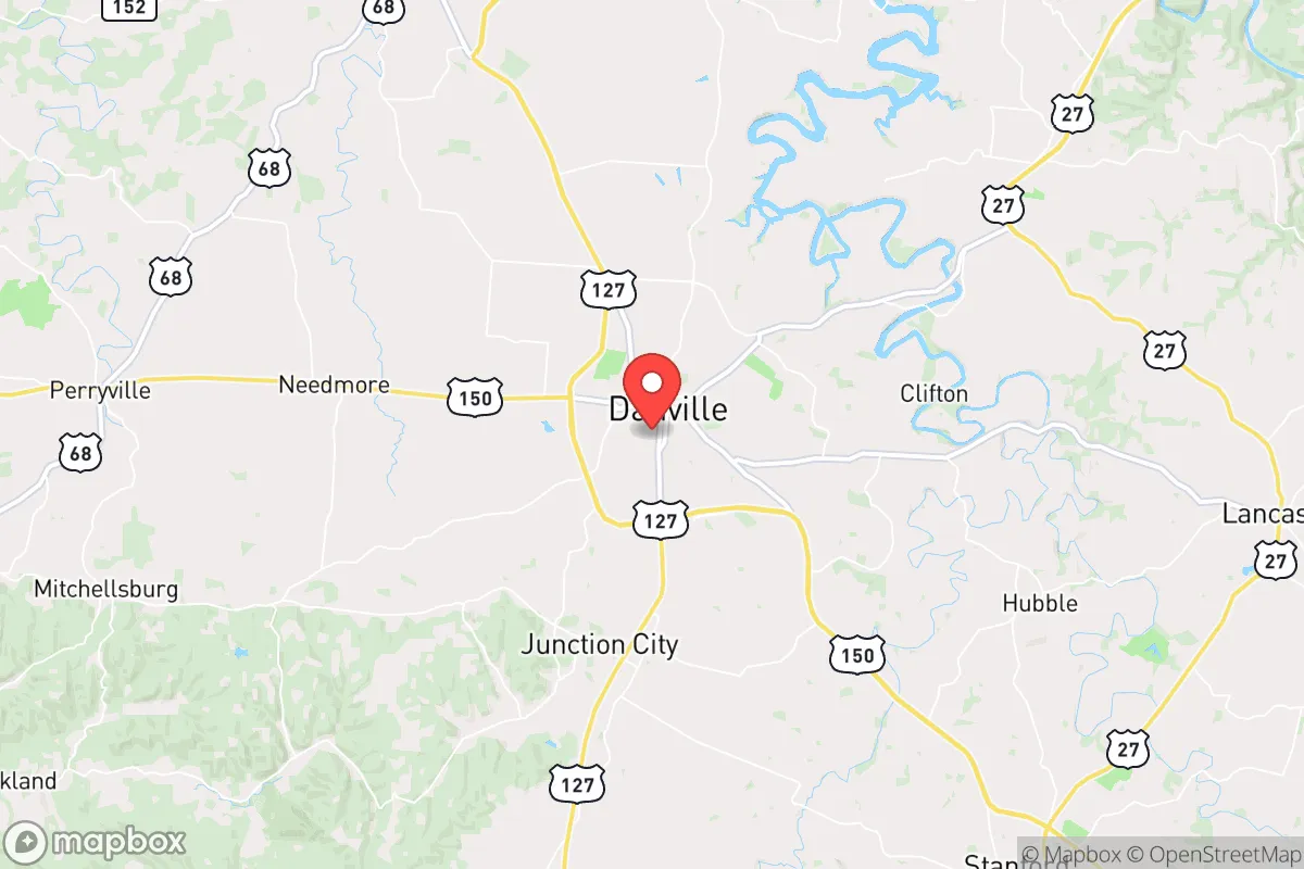
Danville, Kentucky, sits in a strategic sweet spot that resilience-minded relocators should take seriously: far enough from major population centers to avoid the worst of cascading collapse scenarios, yet close enough to access critical infrastructure when needed. Located roughly 35 miles southwest of Lexington and 90 miles southeast of Louisville, this Boyle County seat of roughly 17,000 people offers a blend of agricultural self-sufficiency, modest industrial base, and a historically stable community fabric. For those assessing long-term survivability in an era of increasing civic unrest, supply chain fragility, and potential mass casualty events, Danville presents a defensible, resource-rich option that doesn't carry the extreme isolation penalties of more remote Appalachian locations.
Geographic position and natural advantages for long-term stability
Danville's location in the Bluegrass region's inner ring provides genuine natural advantages that preppers and survivalists should weigh carefully. The area sits atop the Kentucky River watershed, with reliable groundwater access and numerous springs dotting the surrounding countryside—a critical factor when municipal water systems become compromised. The terrain is gently rolling rather than mountainous, which means agricultural land is actually usable for food production, unlike steeper regions to the east. Soils in Boyle County are predominantly Maury silt loam, some of the most productive in the state, supporting corn, soybeans, tobacco, and livestock operations. This isn't theoretical: Boyle County ranks in the top 20% of Kentucky counties for agricultural output, with over 700 farms covering 60% of the county's land area. For a relocator thinking about food security, that means local produce and meat are available even if national distribution networks fail. The climate is temperate four-season, with average annual rainfall around 48 inches—enough to sustain rain-fed agriculture without the drought risks of western states. Winters are cold enough to suppress pest populations but rarely severe enough to cause infrastructure collapse. The absence of major floodplains, earthquake zones, or hurricane tracks means Danville avoids the most common natural disaster triggers that could compound a man-made crisis.
Risks, exposures, and proximity to fallout-relevant landmarks
No location is immune, and Danville has specific vulnerabilities that a serious assessment must flag. The most immediate concern is proximity to the Blue Grass Army Depot in Richmond, roughly 25 miles northeast. This facility stores chemical weapons and conventional munitions—including the aging M55 rocket inventory awaiting destruction. A catastrophic event there, whether accidental or targeted, could produce a chemical hazard zone extending into Boyle County depending on wind direction. Additionally, Interstate 75 runs just 15 miles east of Danville, a major north-south evacuation and logistics corridor that would become a chokepoint during any regional crisis. If civil unrest triggers mass urban exodus from Lexington or Louisville, I-75 and US-127 (which runs directly through Danville) would see heavy traffic, potentially bringing looting, resource competition, and security threats. The nearby Ghent Generating Station, a coal-fired power plant on the Ohio River about 60 miles northwest, is a potential target for sabotage or grid failure cascades. On the positive side, Danville has no nuclear power plants within 50 miles—the nearest is the now-decommissioned Blue Grass Station facility—and no major petrochemical refineries. The area's lack of high-value strategic targets (no major military bases, no Fortune 500 headquarters, no critical internet infrastructure) actually works in its favor: it's unlikely to be a primary target in any coordinated attack scenario. The risk profile is moderate, not extreme, and manageable with proper planning.
Practical resilience for a relocator: food, water, energy, and defensibility
For the individual or family looking to establish a sustainable foothold, Danville's practical resilience metrics are encouraging. Water is the single most critical resource in any collapse scenario, and Boyle County's groundwater is generally high-quality and accessible via shallow wells (typical depths of 50-150 feet). The Kentucky River runs along the county's western edge, providing a surface water backup, though treatment would be necessary. The local agricultural infrastructure means seed stock, livestock feed, and farming equipment are available from multiple suppliers within a 20-minute drive—a redundancy that matters when supply chains fragment. Energy-wise, the area is served by Kentucky Utilities, which draws from a mix of coal, natural gas, and hydroelectric sources. Grid reliability is average for rural Kentucky, but solar potential is decent at roughly 4.5 peak sun hours per day, enough to offset critical loads with a modest panel array. Wood heating is viable given the surrounding hardwood forests, and propane delivery is widespread for backup cooking and heating. Defensibility is where Danville shows its character: the town itself is compact and walkable, with a historic downtown grid that can be secured at key intersections. The surrounding countryside offers numerous rural properties with good sight lines, natural tree cover, and limited road access—ideal for a retreat-style setup. The local population skews older and more conservative, with a strong church and civic organization presence that would likely self-organize for mutual aid during extended disruptions. Crime rates are low by national standards, with violent crime roughly half the national average, though property crime has ticked up slightly since 2020. The Boyle County Sheriff's Office maintains a visible presence, and the local community is armed—Kentucky is a constitutional carry state—which serves as a deterrent to opportunistic threats.
The overall strategic picture for Danville is one of calculated viability rather than absolute safety. It lacks the extreme isolation of, say, the Montana Rockies or the Alaska interior, which means it's more exposed to secondary effects of urban collapse—refugee flows, supply chain interruptions, and information warfare. But it compensates with genuine resource abundance, a functional local economy, and a community that hasn't yet been hollowed out by the cultural and economic forces destabilizing larger cities. For the conservative-leaning relocator who wants to be prepared without going full hermit, Danville offers a middle path: close enough to civilization to maintain employment and access healthcare, far enough to avoid being caught in the blast radius when things go sideways. The key is to act before the window closes—land prices in Boyle County have been rising as awareness spreads, and the best water-access properties are already being picked up by out-of-state buyers. If you're serious about resilience, Danville deserves a hard look, but don't expect it to stay under the radar much longer.
* Values derived from national, state, county, city and local statistics and may differ in a specific area. Last updated: 2026-04-21T09:44:24.000Z
Narrative content on this page is AI-generated and may contain mistakes. Verify any details that matter before acting on them.
ReloMaps may earn a commission from affiliate links at no extra cost to you.