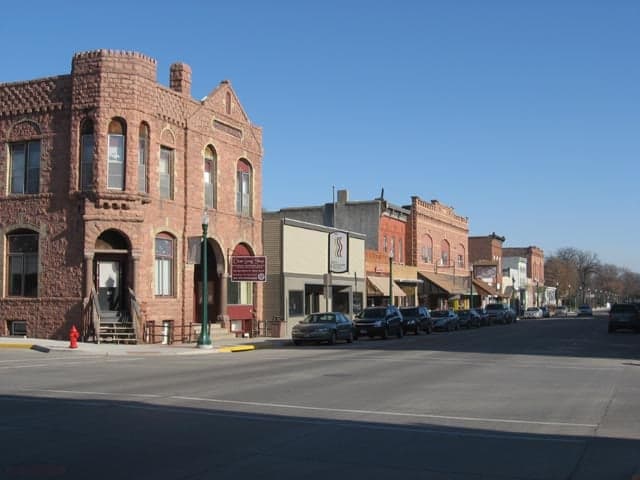
Photo: Wikipedia
Strategic Assessment of Dell Rapids, SD
Workable tactical position. Some exposure to population density or targets, but generally defensible in a crisis.
What does the Strategic Assessment tell us?
Our Strategic Assessment grades tactical survivability of an area. Major population centers, military targets, fallout zones, natural disasters, and border exposure all drive risk — lower exposure means a more defensible position in a crisis.
This is heavily inspired by Joel Skousen's Strategic Relocation book. Highly recommended you checkout the book ($)What does this tell us?
Our Strategic Assessment grades tactical survivability of an area. Major population centers, military targets, fallout zones, natural disasters, and border exposure all drive risk — lower exposure means a more defensible position in a crisis.
This is heavily inspired by Joel Skousen's Strategic Relocation book. Highly recommended you checkout the book ($)Strategic Pillars

Key Distances
Regional Safe Places
Below is our recommended "safe zones" in South Dakota and the surrounding area based on our strategic heuristics. For most people, it's unrealistic to live in a “safe zone” full-time due to work, family or other personal reasons. They tend to be more rural. However, many of these areas are perfect for second homes and retreat properties that double as a vacation home or even a short-term rental.


Important Note: For informational purposes only. This does not mean nothing bad ever happens in the green zones. Please use common sense. This is based on public data and modeled with AI. We tried to take a conservative approach but mistakes happen. We update this regularly as new information becomes available.
Solar Generator Recommendations
Backup power matters more here than in safer locations. We've picked three solar generators across budgets and capacity tiers — start with the budget unit if you only need a few essentials, or step up if you want to run a fridge and HVAC for days at a time.

Jackery Portable Power Station Explorer 300
Budget OptionPower on the Go: Weighing only 11 lbs, it's convenient to set up and store with book-sized foldable solar panels

BLUETTI Portable Power Station AC180
Designed for both indoor and outdoor scenarios, AC180 is highly capable as it has a robost capacity and continuous output power.

EF ECOFLOW DELTA Pro Ultra Power Station
Upgraded PickEcoFlow DELTA Pro Ultra is a whole-home energy system designed to grow with your family. Integrated with the Smart Home Panel 2, it scales to meet your evolving energy needs — keeping your home powered, intelligent, and secure through every stage of life.
We earn a commission, at no additional cost to you.
Strategic Assessment Analysis
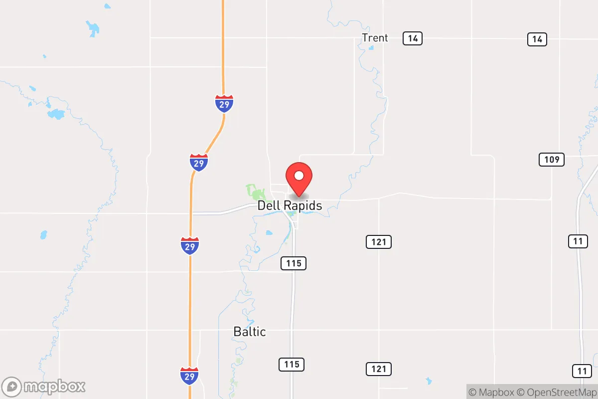
Dell Rapids, South Dakota, offers a surprisingly robust strategic position for those prioritizing resilience and long-term stability, combining small-town isolation with practical access to essential resources. Located roughly 20 miles northeast of Sioux Falls along the Big Sioux River, this community of roughly 4,000 people sits in a sweet spot—close enough to a major regional hub for supplies and medical care, yet far enough to avoid the immediate chaos of a metropolitan collapse. The town’s agricultural base, reliable water source, and low population density make it a defensible and self-sufficient location for individuals and families looking to weather civic unrest, economic disruption, or natural disasters.
Geographic position and natural advantages for long-term stability
Dell Rapids’ location in Minnehaha County provides a blend of rural seclusion and logistical connectivity that is rare in the Upper Midwest. The Big Sioux River runs directly through town, offering a consistent surface water source that can be treated or filtered for drinking and irrigation—a critical asset in any grid-down scenario. The surrounding landscape is predominantly flat, fertile farmland, which means local food production is not just possible but historically ingrained; the area is part of the Corn Belt, with ample grain and livestock operations within a 10-mile radius. The town sits at an elevation of around 1,500 feet, which is high enough to avoid major flood risks from the river (though low-lying areas near the banks can flood during heavy rains). Winters are harsh, with average January lows near 10°F, but this cold climate acts as a natural deterrent to many biological threats and reduces the viability of pests that thrive in warmer regions. The nearest interstate, I-29, is about 15 miles west, providing a route for evacuation or supply runs without placing the town directly on a major transit corridor that could become a chokepoint during unrest. Dell Rapids is also roughly 50 miles from the Minnesota border, offering a secondary escape route if conditions in South Dakota deteriorate.
Risks, exposures, and proximity to fallout-relevant landmarks
While Dell Rapids is far from the coastal megacities that are prime targets for nuclear or EMP attacks, it is not without exposure. The most significant risk is its proximity to Sioux Falls, which is home to Ellsworth Air Force Base (about 90 miles west) and a major regional medical center—both potential targets in a conflict scenario. Sioux Falls also hosts a large rail yard and several industrial facilities that could be secondary targets. Fallout patterns from a strike on Ellsworth or the Minneapolis-St. Paul area (about 200 miles northeast) could theoretically drift over Dell Rapids depending on wind direction, but the prevailing westerlies typically push fallout eastward, away from the town. The Big Sioux River itself is a vulnerability: upstream industrial or agricultural runoff could contaminate the water supply in a disaster, requiring pre-positioned filtration systems. The town’s small size means it lacks a dedicated hospital (the nearest is in Sioux Falls), so a major medical emergency would require a 25-minute drive—a risk for those with chronic conditions or injuries. Tornadoes are a real seasonal threat, with Minnehaha County averaging 2-3 tornadoes per year; a direct hit could level much of the town’s older housing stock. However, the low population density means that a tornado would affect fewer people than in a suburban sprawl, and the agricultural landscape provides open sightlines for early warning.
Practical resilience for a relocator: food, water, energy, and defensibility
For a relocator focused on self-sufficiency, Dell Rapids offers a strong foundation. Food security is excellent: the town is surrounded by corn, soybean, and cattle operations, and local farmers’ markets operate seasonally. The Dell Rapids School District runs a community garden program, and several families maintain private gardens. For long-term storage, the area’s cold winters allow for natural root cellaring, and the dry climate reduces spoilage risks compared to humid regions. Water is the town’s standout asset: the Big Sioux River provides a year-round surface source, and the underlying Dakota Aquifer is accessible via private wells (most homes in the area have well water, though the town itself is on municipal supply). A simple hand pump or solar-powered well pump can secure water independence. Energy is more challenging: the grid is reliable but vulnerable to ice storms and tornadoes. Solar panels are viable (the area gets about 200 sunny days per year), but battery storage is essential for winter months. Wood heating is common, with ample timber along the river and in nearby state parks like Palisades State Park (10 miles north). Defensibility is moderate: the town is laid out in a compact grid, with the river forming a natural boundary on the west side. The main roads—SD-115 and SD-145—are two-lane and easily monitored. The local police department has 6-8 officers, and the Minnehaha County Sheriff’s Office provides backup, but in a prolonged SHTF scenario, residents would need to organize their own neighborhood watch or security teams. The town’s population is overwhelmingly white (over 95%) and politically conservative, which may reduce cultural friction but also means less diversity of skills—medical professionals and mechanics are in short supply.
Overall strategic picture for conservative-minded relocators
Dell Rapids is not a hardened bunker location, but it is a viable base of operations for a family or small group seeking to ride out moderate-to-severe disruptions. Its strengths—abundant water, local food production, low crime, and distance from primary targets—outweigh its weaknesses, which are mainly logistical (distance to advanced medical care) and climatic (harsh winters). For a conservative audience concerned with federal overreach, economic instability, or civil unrest, the town’s strong Second Amendment culture (South Dakota has constitutional carry and no magazine restrictions) and independent-minded population are significant assets. The local economy is tied to agriculture and small business, not government contracts or tech, so it is less vulnerable to federal shutdowns or market crashes. The biggest strategic gap is the lack of a dedicated prepper community or formal mutual-aid network; newcomers would need to build relationships organically through churches, the local gun club, or the Minnehaha County Emergency Management office. If you are looking for a place that balances isolation with access, and where you can dig a well, grow a garden, and keep a rifle without raising eyebrows, Dell Rapids deserves a serious look. Just bring a good winter coat and a water filter.
* Values derived from national, state, county, city and local statistics and may differ in a specific area. Last updated: 2026-04-19T04:54:00.000Z
Narrative content on this page is AI-generated and may contain mistakes. Verify any details that matter before acting on them.
ReloMaps may earn a commission from affiliate links at no extra cost to you.