Photo: Wikipedia
Strategic Assessment of El Paso, TX
Multiple tactical vulnerabilities. Population density, target proximity, or disaster risk are likely compounding. A retreat property and exit planning is required.
What does the Strategic Assessment tell us?
Our Strategic Assessment grades tactical survivability of an area. Major population centers, military targets, fallout zones, natural disasters, and border exposure all drive risk — lower exposure means a more defensible position in a crisis.
This is heavily inspired by Joel Skousen's Strategic Relocation book. Highly recommended you checkout the book ($)What does this tell us?
Our Strategic Assessment grades tactical survivability of an area. Major population centers, military targets, fallout zones, natural disasters, and border exposure all drive risk — lower exposure means a more defensible position in a crisis.
This is heavily inspired by Joel Skousen's Strategic Relocation book. Highly recommended you checkout the book ($)Strategic Pillars

Key Distances
Regional Safe Places
Below is our recommended "safe zones" in Texas and the surrounding area based on our strategic heuristics. For most people, it's unrealistic to live in a “safe zone” full-time due to work, family or other personal reasons. They tend to be more rural. However, many of these areas are perfect for second homes and retreat properties that double as a vacation home or even a short-term rental.


Important Note: For informational purposes only. This does not mean nothing bad ever happens in the green zones. Please use common sense. This is based on public data and modeled with AI. We tried to take a conservative approach but mistakes happen. We update this regularly as new information becomes available.
Solar Generator Recommendations
Backup power matters more here than in safer locations. We've picked three solar generators across budgets and capacity tiers — start with the budget unit if you only need a few essentials, or step up if you want to run a fridge and HVAC for days at a time.

Jackery Portable Power Station Explorer 300
Budget OptionPower on the Go: Weighing only 11 lbs, it's convenient to set up and store with book-sized foldable solar panels

BLUETTI Portable Power Station AC180
Designed for both indoor and outdoor scenarios, AC180 is highly capable as it has a robost capacity and continuous output power.

EF ECOFLOW DELTA Pro Ultra Power Station
Upgraded PickEcoFlow DELTA Pro Ultra is a whole-home energy system designed to grow with your family. Integrated with the Smart Home Panel 2, it scales to meet your evolving energy needs — keeping your home powered, intelligent, and secure through every stage of life.
We earn a commission, at no additional cost to you.
Strategic Assessment Analysis
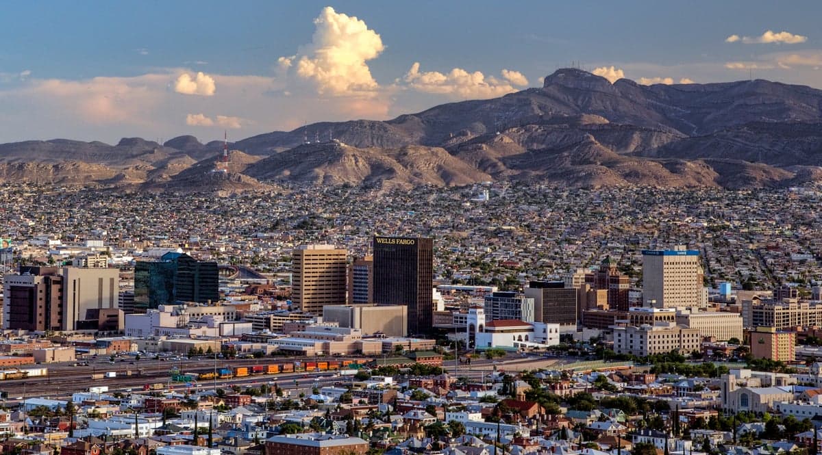
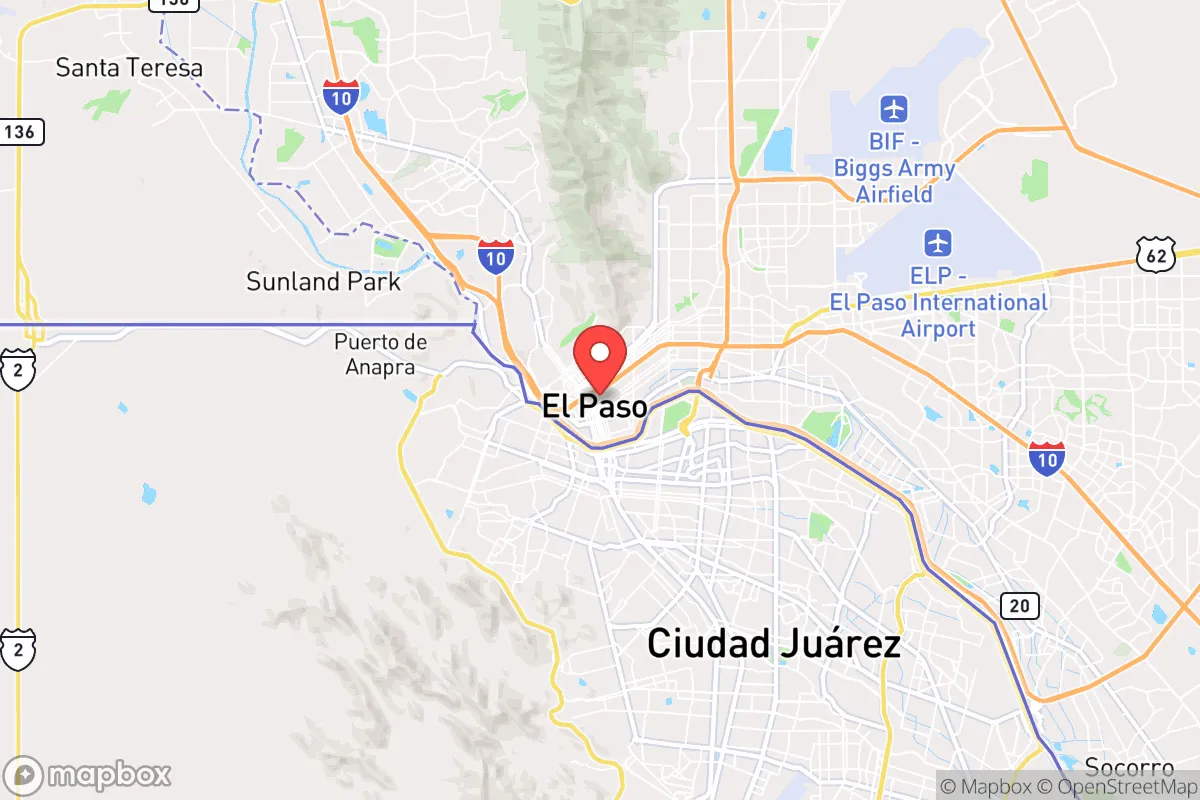
El Paso, Texas, offers a unique strategic profile for those prioritizing resilience and self-sufficiency. Its location at the far western tip of Texas, directly across the Rio Grande from Ciudad Juárez, Mexico, and a short drive from New Mexico, creates a geographic buffer zone that few other American cities can match. While the city itself is a population center of roughly 680,000, its isolation from major metropolitan corridors—over 550 miles from Dallas, 300 miles from Albuquerque, and 800 miles from Houston—means it is far removed from the cascading effects of a major disaster or civil unrest in larger, more interconnected urban hubs. For a relocator with a prepper mindset, this distance from primary targets and chokepoints is a significant strategic asset, though it comes with its own set of trade-offs regarding supply lines and regional dependencies.
Geographic isolation and natural defensive advantages
El Paso sits in a high desert valley at 3,800 feet elevation, flanked by the Franklin Mountains to the north and the Rio Grande to the south. This natural bowl provides a degree of topographical defensibility—the mountains create a physical barrier to the north and east, while the river and international border define the southern and western edges. The surrounding terrain is arid, sparsely populated, and offers limited road access, which can be a double-edged sword. On one hand, it means fewer escape routes and a higher reliance on a single major highway (I-10) for resupply. On the other hand, it makes the area inherently less attractive to large-scale refugee flows or military staging compared to, say, the I-35 corridor. The region's low population density outside the city limits—much of Hudspeth and Otero counties are empty—provides a buffer zone that could be exploited for retreat or observation. The dry climate also reduces risks from mold, rust, and waterborne pathogens, which is a practical advantage for long-term food and equipment storage.
Risks, exposures, and proximity to fallout-relevant landmarks
The most glaring risk for El Paso is its immediate adjacency to Ciudad Juárez, a city of roughly 1.5 million people with a history of cartel violence and instability. In a scenario of national breakdown, the border could become a funnel for mass migration, criminal activity, or even armed incursions. The presence of multiple Border Patrol stations, military installations (Fort Bliss), and federal law enforcement assets in the area means El Paso is a high-value target for any group seeking to disrupt U.S. border security. Fort Bliss itself, a major Army post with air defense and armored units, is a double-edged asset: it provides a potential security umbrella but also makes the city a legitimate military target in a conflict scenario. Additionally, the nearby White Sands Missile Range (about 80 miles north) and the Los Alamos National Laboratory (about 250 miles north) are potential fallout-relevant landmarks. A major incident at either site could produce a radioactive plume that, depending on wind patterns, might affect El Paso. The city's water supply, drawn from the Rio Grande and the Hueco Bolson aquifer, is vulnerable to contamination from upstream agricultural runoff or deliberate sabotage. The region's reliance on a single interstate (I-10) for bulk goods also means a single bridge collapse or blockade could severely disrupt supply chains within days.
Practical resilience for a relocator: food, water, energy, and defensibility
For a relocator serious about self-sufficiency, El Paso presents a mixed picture. Water is the most critical vulnerability. The region averages less than 10 inches of rain per year, and the Rio Grande is heavily allocated and often runs dry. Rainwater harvesting is possible but requires significant storage capacity—a 1,000-square-foot roof yields only about 600 gallons per inch of rain. The Hueco Bolson aquifer is being depleted faster than it recharges. Any long-term plan must include deep wells (200-400 feet) or a reliable water delivery service. On the energy front, the area averages 300+ sunny days per year, making solar power a highly viable option. Net metering is available through El Paso Electric, and off-grid setups are feasible with battery storage. Natural gas is also abundant in the Permian Basin region, about 200 miles east, so propane and natural gas supplies are relatively stable. Food production is challenging due to the arid climate, but the growing season is long (March through November), and with irrigation, you can produce vegetables, beans, and even some grains. Local farmers' markets and the El Paso County Coliseum area host occasional agricultural events, but the region is not a breadbasket—most food is trucked in. Defensibility at the property level is good: the terrain allows for clear sightlines, and the low crime rate in the better neighborhoods (like the West Side or the Upper Valley) means you can establish a low-profile, defensible homestead without drawing attention. However, the city's layout is sprawling, and many suburban developments lack natural chokepoints. A rural property in the surrounding county (Hudspeth or Otero) would offer far better defensibility but at the cost of access to medical care and supplies.
The overall strategic picture for El Paso is one of calculated trade-offs. Its isolation from the major population centers of Texas and the Southwest is a genuine advantage for those seeking to avoid the fallout of urban collapse, mass casualty events, or civil unrest. The presence of Fort Bliss provides a layer of security that most other cities lack, but it also makes the area a potential target. The border proximity is the single greatest wildcard—it offers opportunities for cross-border trade and cultural exchange in stable times, but in a crisis, it could become a liability. For a conservative-leaning relocator who values self-reliance, low population density, and a climate that supports off-grid energy, El Paso is worth a serious look. Just be prepared to invest heavily in water infrastructure, maintain a low profile, and keep a close eye on the southern horizon. It's not a bug-out location for the faint of heart, but for those who understand the risks and plan accordingly, it offers a defensible, resilient base far from the chaos of the coasts and the I-35 corridor.
* Values derived from national, state, county, city and local statistics and may differ in a specific area. Last updated: 2026-04-14T07:27:33.000Z
Narrative content on this page is AI-generated and may contain mistakes. Verify any details that matter before acting on them.
ReloMaps may earn a commission from affiliate links at no extra cost to you.