
Photo: Wikipedia
Strategic Assessment of Elkhart, IN
Meaningful friction. Expect exposure to either population pressure, blast zones, or natural disaster risk. Consider buying a retreat property.
What does the Strategic Assessment tell us?
Our Strategic Assessment grades tactical survivability of an area. Major population centers, military targets, fallout zones, natural disasters, and border exposure all drive risk — lower exposure means a more defensible position in a crisis.
This is heavily inspired by Joel Skousen's Strategic Relocation book. Highly recommended you checkout the book ($)What does this tell us?
Our Strategic Assessment grades tactical survivability of an area. Major population centers, military targets, fallout zones, natural disasters, and border exposure all drive risk — lower exposure means a more defensible position in a crisis.
This is heavily inspired by Joel Skousen's Strategic Relocation book. Highly recommended you checkout the book ($)Strategic Pillars

Key Distances
Regional Safe Places
Below is our recommended "safe zones" in Indiana and the surrounding area based on our strategic heuristics. For most people, it's unrealistic to live in a “safe zone” full-time due to work, family or other personal reasons. They tend to be more rural. However, many of these areas are perfect for second homes and retreat properties that double as a vacation home or even a short-term rental.

Important Note: For informational purposes only. This does not mean nothing bad ever happens in the green zones. Please use common sense. This is based on public data and modeled with AI. We tried to take a conservative approach but mistakes happen. We update this regularly as new information becomes available.
Solar Generator Recommendations
Backup power matters more here than in safer locations. We've picked three solar generators across budgets and capacity tiers — start with the budget unit if you only need a few essentials, or step up if you want to run a fridge and HVAC for days at a time.

Jackery Portable Power Station Explorer 300
Budget OptionPower on the Go: Weighing only 11 lbs, it's convenient to set up and store with book-sized foldable solar panels

BLUETTI Portable Power Station AC180
Designed for both indoor and outdoor scenarios, AC180 is highly capable as it has a robost capacity and continuous output power.

EF ECOFLOW DELTA Pro Ultra Power Station
Upgraded PickEcoFlow DELTA Pro Ultra is a whole-home energy system designed to grow with your family. Integrated with the Smart Home Panel 2, it scales to meet your evolving energy needs — keeping your home powered, intelligent, and secure through every stage of life.
We earn a commission, at no additional cost to you.
Strategic Assessment Analysis
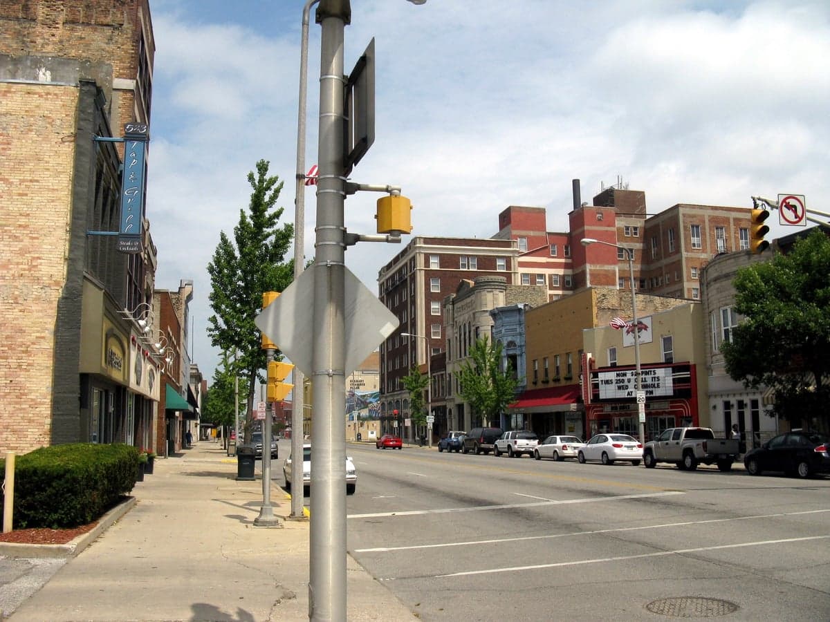
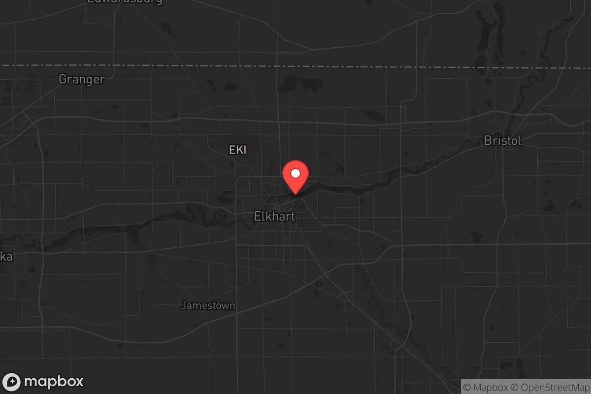
Elkhart, Indiana, sits in a strategic sweet spot that preppers and survivalists should take seriously: it offers genuine industrial resilience without the glaring vulnerabilities of a major metro. Located in the northern tier of the state, roughly 15 miles east of South Bend and 100 miles east of Chicago, Elkhart is the self-proclaimed "RV Capital of the World," producing over 80% of the nation's recreational vehicles and a significant share of its manufactured homes. This manufacturing backbone gives the area a built-in economic buffer against national downturns, but more importantly for a strategic relocator, it means a local population skilled in fabrication, mechanics, and hands-on trades—exactly the kind of human capital that matters when supply chains falter. The city itself has around 53,000 residents, with Elkhart County pushing 210,000, giving you enough community density for mutual support without the anonymity and chaos of a million-plus population center. For someone thinking about where to ride out civic unrest, mass casualty events, or systemic breakdowns, Elkhart offers a rare combination: proximity to Great Lakes freshwater, a working-class ethos that hasn't been fully gentrified, and a location that is close enough to major arteries to be relevant but far enough to avoid the blast radius of worst-case scenarios.
Geographic position and natural advantages for long-term survival
Elkhart’s geography is its first and strongest card. The city sits at the confluence of the St. Joseph River and the Elkhart River, which means surface water is abundant—a critical factor when municipal systems might fail or become contaminated. The St. Joseph River flows west into Lake Michigan, giving you a potential water route to the Great Lakes if ground travel becomes compromised. The surrounding terrain is flat to gently rolling, typical of the Midwest, which is a double-edged sword: it’s excellent for agriculture and easy movement, but offers little in the way of natural defensive terrain. However, the area is dotted with small woodlots, farm ponds, and rural homesteads that provide cover and decentralized living options. The soil in Elkhart County is among the most productive in Indiana, part of the fertile Maumee Lake Plains, meaning that with a little know-how, a family could supplement food supplies from a garden or small farm. The climate is continental, with cold winters and warm summers—nothing extreme by Midwest standards, but enough to require serious preparation for heating and winter food storage. The lack of major fault lines, hurricane zones, or wildfire corridors means that natural disaster risk is low; the primary weather threats are tornadoes (typically EF-2 or less in this region) and occasional blizzards. For a relocator, the takeaway is clear: Elkhart sits on a reliable water source, has arable land within a 15-minute drive, and is far enough from coastal chaos to be a plausible secondary hub if the coasts become untenable.
Risks, exposures, and proximity to fallout-relevant landmarks
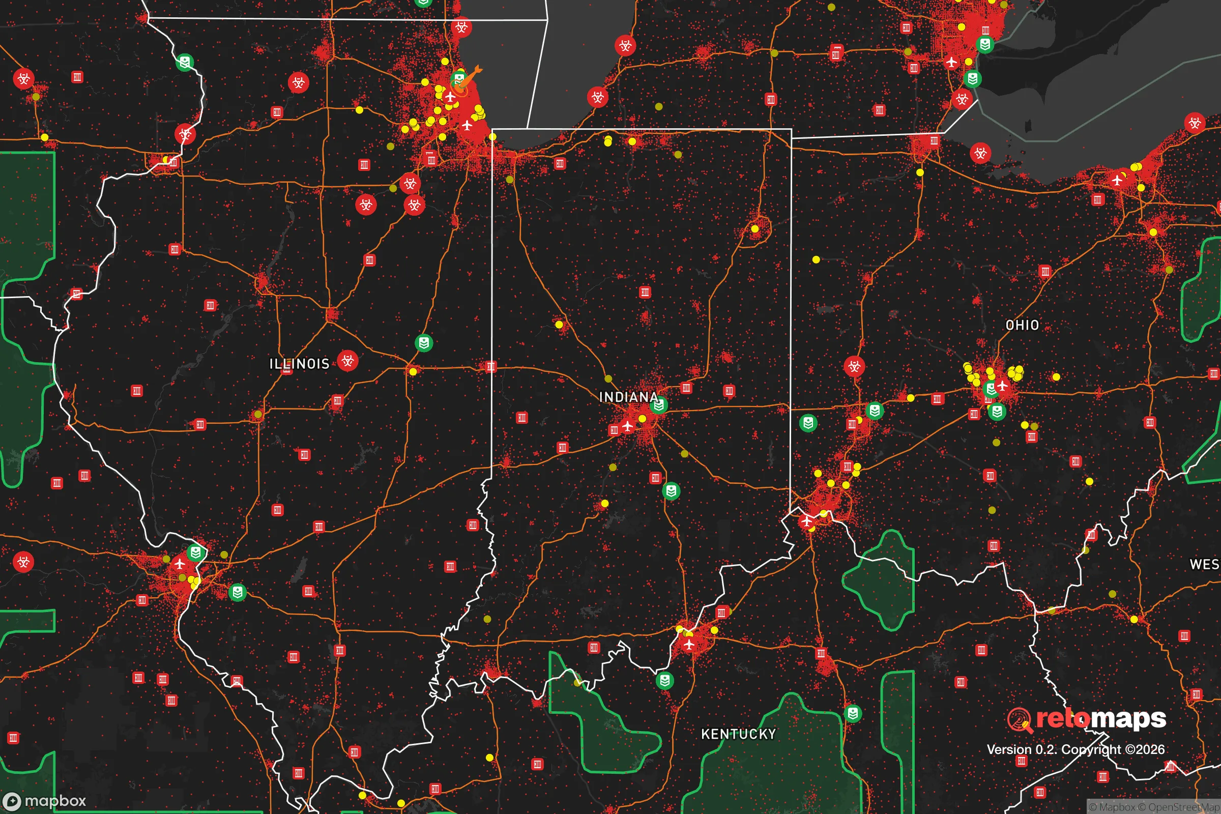
No strategic assessment is honest without naming the liabilities. Elkhart’s biggest exposure is its proximity to the Chicago metropolitan area—roughly 100 miles west. In a mass evacuation scenario, Chicago’s 2.7 million residents (9.5 million in the metro) would likely flood the interstates, and I-80/I-90 runs directly through the region. If you’re in Elkhart when that happens, you’re on the eastern edge of the outflow, but you’re still close enough to feel the ripple effects of panic buying, fuel shortages, and refugee movement. The city itself has a rail yard and a major highway junction (US-20 and SR-19), which are both logistical assets and potential chokepoints. There are no nuclear power plants within a 50-mile radius—the closest is the Donald C. Cook plant in Bridgman, Michigan, about 40 miles northwest—but the region does have a concentration of industrial facilities that handle chemicals, including RV manufacturing plants that store paints, solvents, and propane. A major industrial accident or targeted disruption at one of these facilities could create localized hazards. On the plus side, Elkhart is not near any obvious high-value military or government targets; the closest major base is Grissom Air Reserve Base, about 60 miles south, which is a refueling wing and not a primary strategic asset. The risk profile is moderate: you’re not in a blast zone, but you’re within a day’s drive of a major urban collapse zone. For a prepper, that means you need a plan for the first 72 hours of a crisis, when the Chicago exodus could reach your doorstep.
Practical resilience for a relocator: food, water, energy, and defensibility
For someone actually moving to Elkhart with a prepper mindset, the practicalities break down into four categories. Water: The St. Joseph River is the obvious primary source, but it’s also a public water supply for the city, meaning it could be a target for contamination. A well on a rural property outside city limits is the gold standard—Elkhart County has good groundwater availability, with typical well depths of 50-150 feet. Food: The county is a major agricultural producer, with corn, soybeans, and dairy operations dominating. Local farmers’ markets and CSAs are plentiful, and the Amish and Mennonite communities in the surrounding area (especially around Nappanee and Middlebury) practice low-tech, resilient farming methods. Building relationships with these communities is a force multiplier—they have the skills and tools for off-grid living that most suburbanites lack. Energy: The grid is typical Midwest reliability—occasional winter outages, but nothing chronic. Solar is viable, though winter cloud cover reduces output; a backup generator with propane storage is the standard recommendation. Natural gas is widely available in the city, but rural properties often rely on propane or fuel oil. Defensibility: Elkhart itself is not defensible—it’s a flat, spread-out city with multiple entry points. The strategic play is to buy or rent on the rural fringe, preferably on a dead-end road with a single access point, within 10-15 minutes of the city for work but far enough to have a buffer. Properties along the St. Joseph River east of the city offer good cover and water access. The local gun culture is strong—Indiana is a constitutional carry state, and Elkhart County has a robust network of shooting ranges and gun shops. For a relocator, the practical resilience score is high: you can secure water, grow food, generate power, and defend a perimeter, but it requires deliberate property selection and community integration, not just showing up.
The overall strategic picture for Elkhart is one of cautious optimism for the prepared relocator. It’s not a bug-out paradise—there are no mountains, no remote valleys, no natural fortifications. What it offers is something more sustainable for the long haul: a working economy that doesn’t depend on government or finance, a population that still knows how to fix things with their hands, and a location that balances access to Great Lakes resources with distance from the most likely flashpoints. The risks are real—Chicago’s shadow, industrial hazards, and the flat terrain—but they are manageable with planning. For a conservative-leaning individual or family who wants to be part of a community that values self-reliance, trades, and local resilience, Elkhart deserves a serious look. It’s not the place to hide; it’s the place to build.
* Values derived from national, state, county, city and local statistics and may differ in a specific area. Last updated: 2026-04-22T09:09:50.000Z
Narrative content on this page is AI-generated and may contain mistakes. Verify any details that matter before acting on them.
ReloMaps may earn a commission from affiliate links at no extra cost to you.