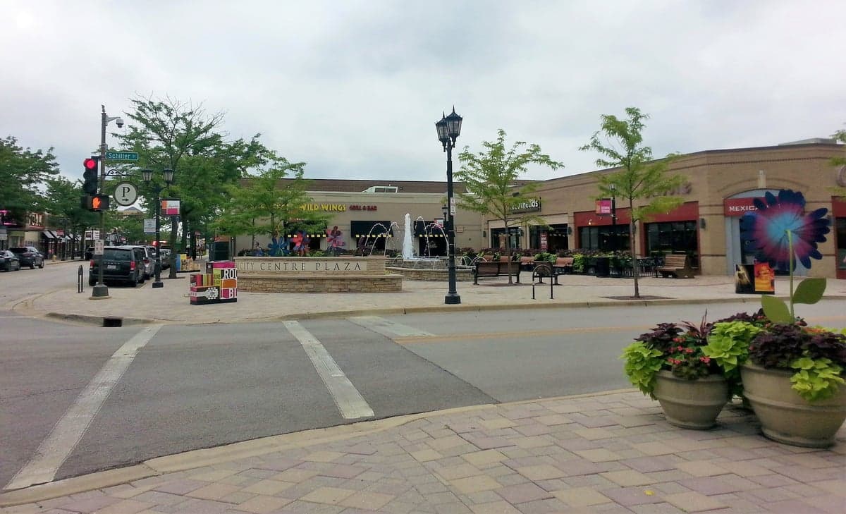
Photo: Wikipedia
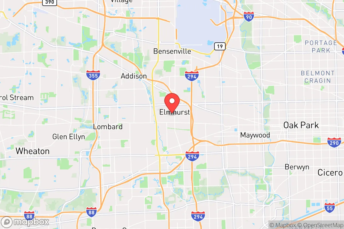
Strategic Assessment of Elmhurst, IL
Multiple tactical vulnerabilities. Population density, target proximity, or disaster risk are likely compounding. A retreat property and exit planning is required.
What does the Strategic Assessment tell us?
Our Strategic Assessment grades tactical survivability of an area. Major population centers, military targets, fallout zones, natural disasters, and border exposure all drive risk — lower exposure means a more defensible position in a crisis.
This is heavily inspired by Joel Skousen's Strategic Relocation book. Highly recommended you checkout the book ($)What does this tell us?
Our Strategic Assessment grades tactical survivability of an area. Major population centers, military targets, fallout zones, natural disasters, and border exposure all drive risk — lower exposure means a more defensible position in a crisis.
This is heavily inspired by Joel Skousen's Strategic Relocation book. Highly recommended you checkout the book ($)Strategic Pillars

Key Distances
Regional Safe Places
Below is our recommended "safe zones" in Illinois and the surrounding area based on our strategic heuristics. For most people, it's unrealistic to live in a “safe zone” full-time due to work, family or other personal reasons. They tend to be more rural. However, many of these areas are perfect for second homes and retreat properties that double as a vacation home or even a short-term rental.
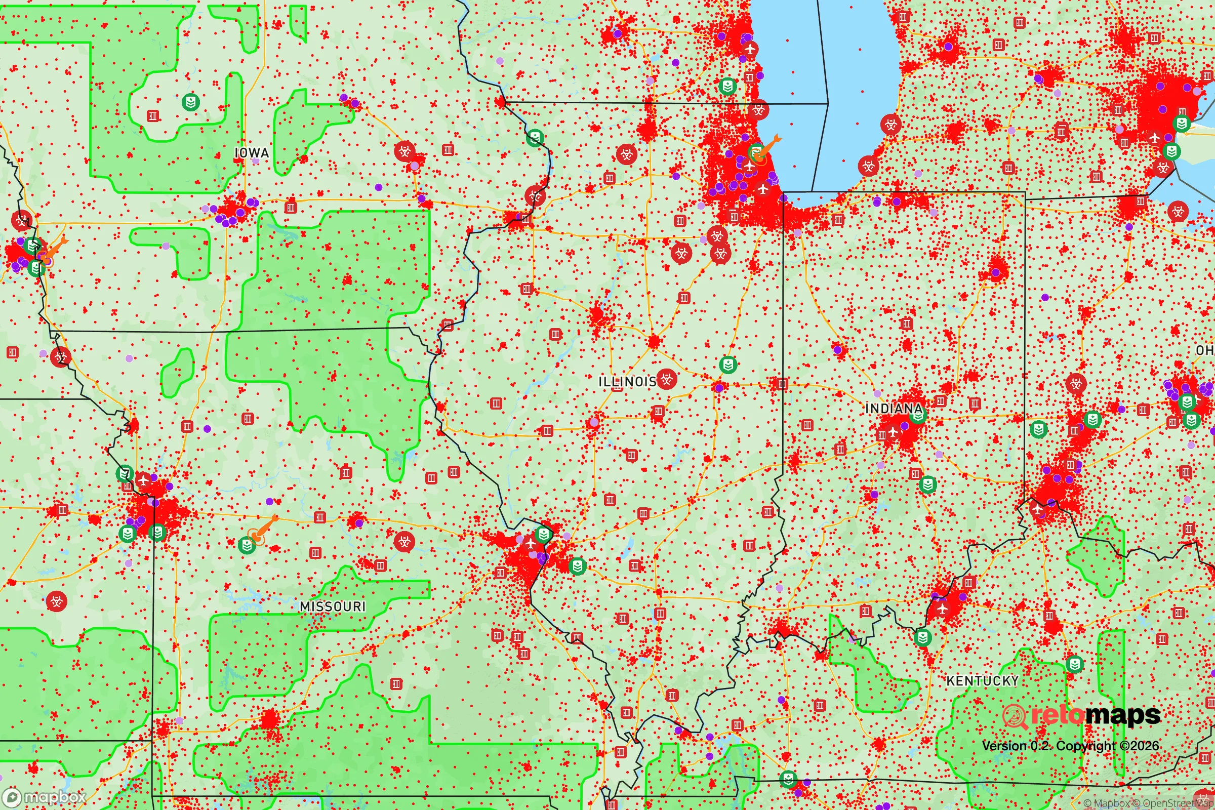
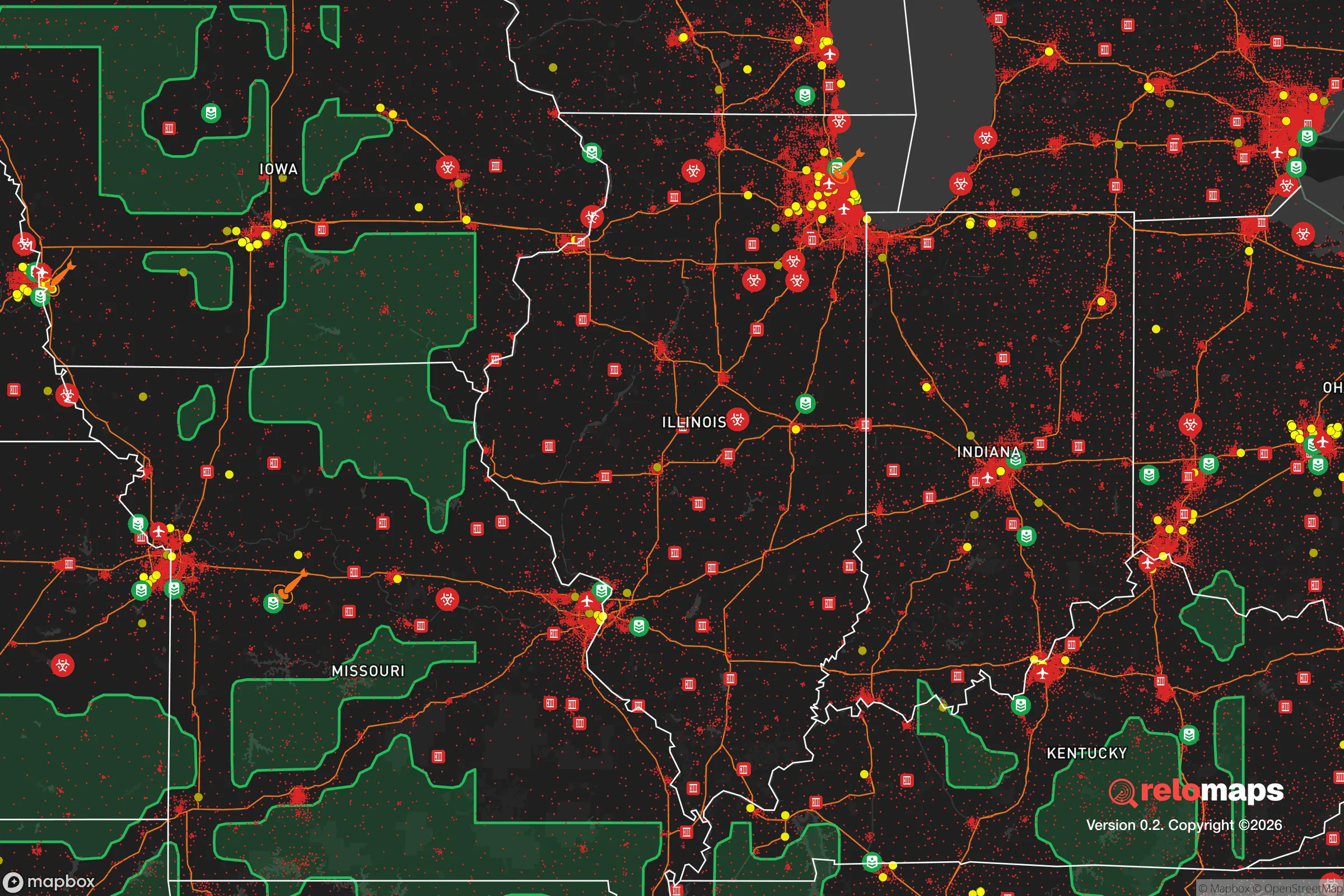
Important Note: For informational purposes only. This does not mean nothing bad ever happens in the green zones. Please use common sense. This is based on public data and modeled with AI. We tried to take a conservative approach but mistakes happen. We update this regularly as new information becomes available.
Solar Generator Recommendations
Backup power matters more here than in safer locations. We've picked three solar generators across budgets and capacity tiers — start with the budget unit if you only need a few essentials, or step up if you want to run a fridge and HVAC for days at a time.

Jackery Portable Power Station Explorer 300
Budget OptionPower on the Go: Weighing only 11 lbs, it's convenient to set up and store with book-sized foldable solar panels

BLUETTI Portable Power Station AC180
Designed for both indoor and outdoor scenarios, AC180 is highly capable as it has a robost capacity and continuous output power.

EF ECOFLOW DELTA Pro Ultra Power Station
Upgraded PickEcoFlow DELTA Pro Ultra is a whole-home energy system designed to grow with your family. Integrated with the Smart Home Panel 2, it scales to meet your evolving energy needs — keeping your home powered, intelligent, and secure through every stage of life.
We earn a commission, at no additional cost to you.
Strategic Assessment Analysis
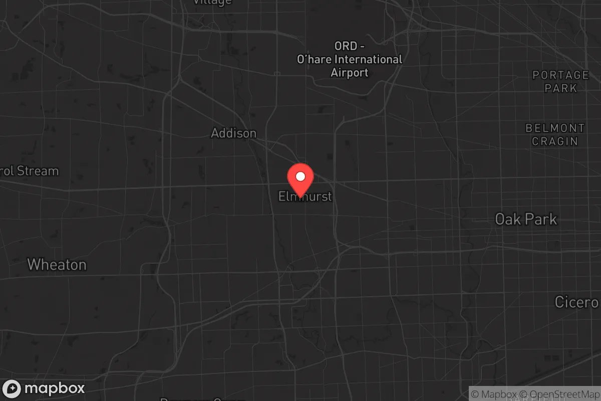
Elmhurst, Illinois, sits in a precarious but potentially defensible position roughly 16 miles west of downtown Chicago, offering a mix of suburban stability and strategic drawbacks for those prioritizing long-term resilience. Its location along the Union Pacific West rail line and proximity to I-290 and I-294 make it a logistical node, but that same connectivity is a double-edged sword in a crisis scenario. For a conservative-leaning relocator focused on preparedness, Elmhurst presents a trade-off: solid local infrastructure and a historically low-crime reputation, but with significant exposure to the risks that come with being within the blast radius and fallout zone of a major metropolitan target.
Geographic position and natural advantages for long-term survival
Elmhurst’s geography is defined by its position on the western edge of the Chicago metropolitan area, where the dense suburban sprawl begins to thin into more rural DuPage County. The area sits on relatively flat, well-drained glacial till, which means flooding risks are moderate compared to river-adjacent suburbs like Elmhurst’s own Salt Creek corridor. The Salt Creek Greenway, a 15-mile ribbon of forest preserve, offers a natural buffer and potential wildlife corridor for foraging or evasion, though it’s heavily trafficked by hikers and cyclists in normal times. The presence of multiple forest preserves—including Fullersburg Woods and the Waterfall Glen Forest Preserve—provides limited but real cover and water access. However, the region lacks significant elevation changes, which reduces natural defensibility; there are no hills or ridges to use as observation points or fallback positions. The soil is fertile enough for small-scale gardening, but the growing season is short (roughly 150 days), and the harsh winters demand robust food storage and heating plans. For a relocator, the key natural advantage is the abundance of groundwater—the area sits atop the shallow Silurian dolomite aquifer—but well access is restricted in most residential zones, meaning reliance on municipal water is a vulnerability.
Risks, exposures, and proximity to fallout-relevant landmarks
The most glaring risk for Elmhurst is its proximity to Chicago, a Tier 1 target for any large-scale conflict or terrorist event. The city lies within the 30-mile fallout zone of downtown Chicago’s financial and government centers, and within 50 miles of the O’Hare International Airport and the Argonne National Laboratory—both high-value targets. A ground burst at either location would deposit lethal fallout across DuPage County within hours, with Elmhurst directly in the prevailing westerly wind path. Additionally, the I-290 corridor is a known evacuation choke point; in a mass exodus scenario, the expressways would gridlock within minutes, trapping residents. The area also sits near the Willowbrook Rail Yard and multiple freight lines carrying hazardous materials, including crude oil and anhydrous ammonia, which pose secondary risks from derailments or sabotage. On the civil unrest front, Elmhurst’s relative affluence and homogeneous population make it a potential target for looting or organized crime during a breakdown of order, as seen in the 2020 riots that reached nearby Oak Brook and Naperville. The local police force is well-funded (Elmhurst PD has about 60 sworn officers), but response times would degrade rapidly in a regional emergency. For the prepper, the biggest exposure is the lack of a defensible perimeter—Elmhurst is a grid of interconnected streets with no natural barriers, making it difficult to secure a neighborhood.
Practical resilience for a relocator: food, water, energy, and defensibility
For a single individual or family looking to hunker down, Elmhurst offers a mixed bag. Water security is the weakest link: the city draws from Lake Michigan via the Chicago water system, which is vulnerable to contamination or sabotage at the intake cribs. A prolonged outage would force reliance on stored water or the Salt Creek, which is polluted with urban runoff and requires heavy filtration. Rainwater collection is legal in Illinois but limited to 5,000 gallons per property, and most homes lack the gutter systems for serious harvesting. Food security is more promising: the area has a high density of grocery stores (Jewel-Osco, Mariano’s, Whole Foods) within a 2-mile radius, but these would empty within 48 hours of a crisis. The Elmhurst Farmers Market runs May through October, offering local produce, but it’s seasonal. For long-term storage, the many basements in older homes (pre-1950s construction) provide cool, dark spaces ideal for canned goods and freeze-dried stores. Energy resilience is a bright spot: ComEd’s grid is relatively reliable, but natural gas heating is the norm, and a prolonged blackout would leave homes without heat in winter. Solar panels are feasible (DuPage County has net metering), but most HOAs restrict visible installations. Generators are common in the area, and propane refill stations are available at multiple U-Haul and hardware stores. Defensibility is the hardest challenge: Elmhurst’s street layout is a classic suburban grid with cul-de-sacs, which can be barricaded at key intersections, but the sheer number of entry points makes a full perimeter impractical. The best strategy is to choose a home on a dead-end street or near the Salt Creek Greenway for a quick escape route. The Elmhurst Police Department’s emergency management division runs a CERT program, but participation is low; building a neighborhood watch or mutual-aid group is essential. For a relocator, the ideal property is a brick or stone house (common in the central historic district) with a basement, a fenced yard, and access to a well—though wells are rare in the city limits.
The overall strategic picture for Elmhurst is one of calculated risk. It offers a high quality of life in normal times—good schools, low crime, and a strong tax base—but those same attributes make it a target in a crisis. The proximity to Chicago is a liability that cannot be mitigated by individual preparedness alone; a regional evacuation or fallout event would overwhelm local resources. For the conservative prepper, Elmhurst works best as a secondary location—a place to maintain a foothold in the Midwest with access to jobs and amenities, but with a bug-out plan to a more rural property in western Illinois or Wisconsin. If you’re committed to staying, focus on water storage, a backup heat source, and building relationships with neighbors who share your mindset. The area’s resilience is real but brittle: it holds up well under moderate stress, but a major shock would expose its dependence on fragile urban systems. Choose Elmhurst for its stability, but never mistake that stability for safety.
* Values derived from national, state, county, city and local statistics and may differ in a specific area. Last updated: 2026-04-29T19:15:29.000Z
Narrative content on this page is AI-generated and may contain mistakes. Verify any details that matter before acting on them.
ReloMaps may earn a commission from affiliate links at no extra cost to you.