Photo: Wikipedia
Strategic Assessment of Everson, WA
Meaningful friction. Expect exposure to either population pressure, blast zones, or natural disaster risk. Consider buying a retreat property.
What does the Strategic Assessment tell us?
Our Strategic Assessment grades tactical survivability of an area. Major population centers, military targets, fallout zones, natural disasters, and border exposure all drive risk — lower exposure means a more defensible position in a crisis.
This is heavily inspired by Joel Skousen's Strategic Relocation book. Highly recommended you checkout the book ($)What does this tell us?
Our Strategic Assessment grades tactical survivability of an area. Major population centers, military targets, fallout zones, natural disasters, and border exposure all drive risk — lower exposure means a more defensible position in a crisis.
This is heavily inspired by Joel Skousen's Strategic Relocation book. Highly recommended you checkout the book ($)Strategic Pillars

Key Distances
Regional Safe Places
Below is our recommended "safe zones" in Washington and the surrounding area based on our strategic heuristics. For most people, it's unrealistic to live in a “safe zone” full-time due to work, family or other personal reasons. They tend to be more rural. However, many of these areas are perfect for second homes and retreat properties that double as a vacation home or even a short-term rental.
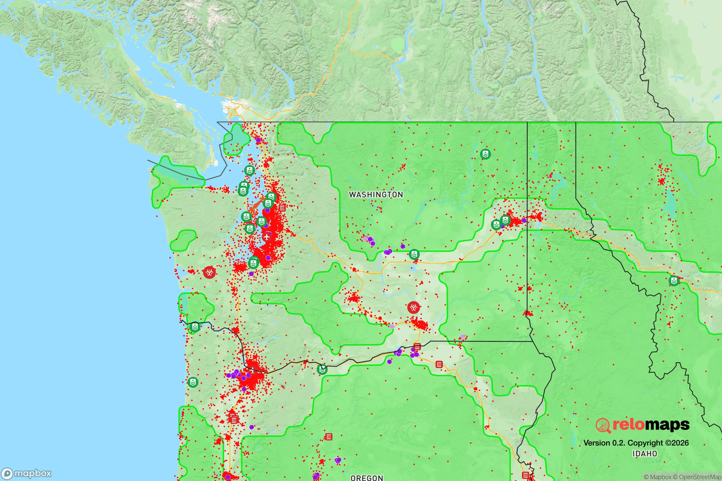
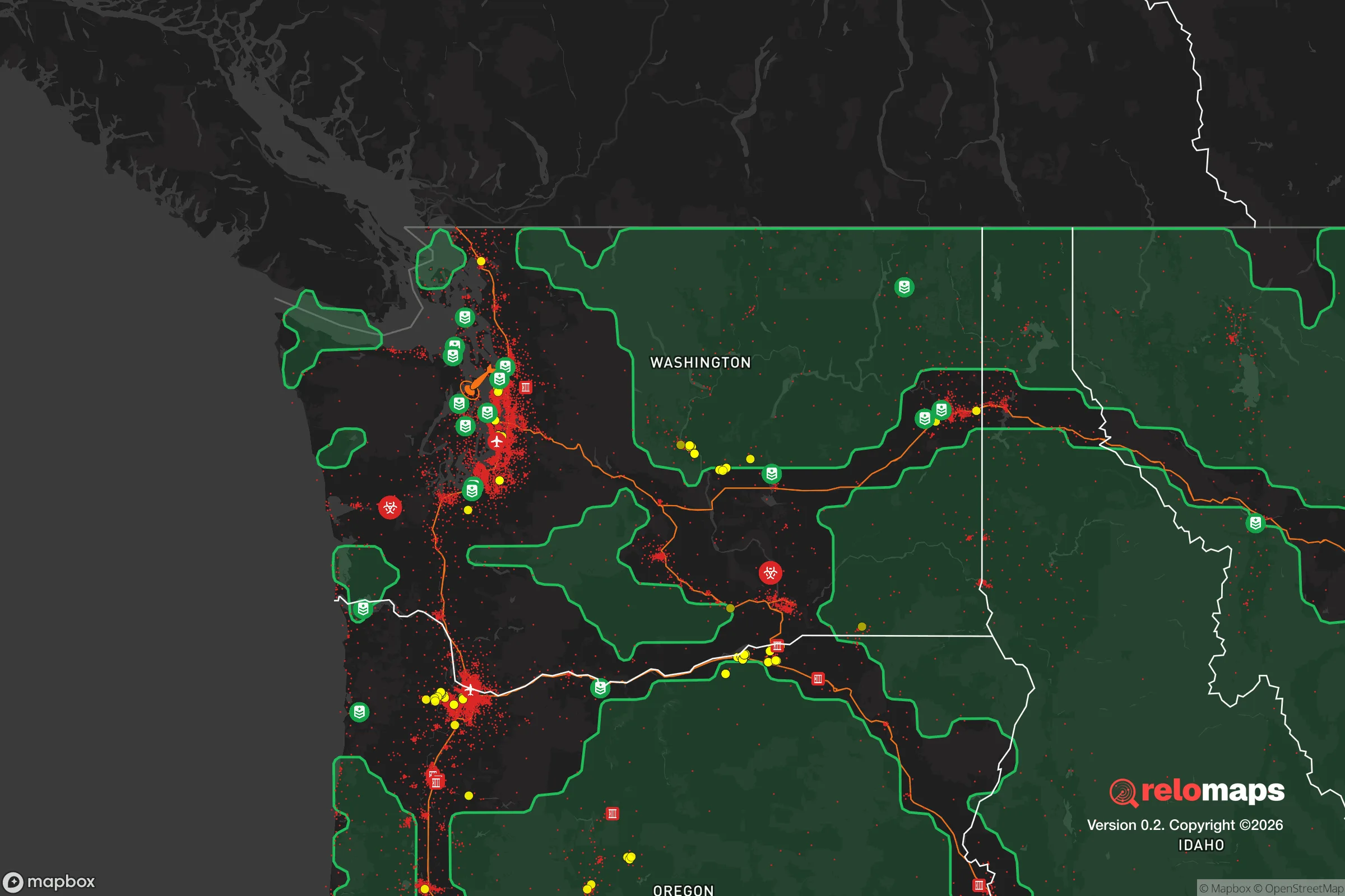


Important Note: For informational purposes only. This does not mean nothing bad ever happens in the green zones. Please use common sense. This is based on public data and modeled with AI. We tried to take a conservative approach but mistakes happen. We update this regularly as new information becomes available.
Solar Generator Recommendations
Backup power matters more here than in safer locations. We've picked three solar generators across budgets and capacity tiers — start with the budget unit if you only need a few essentials, or step up if you want to run a fridge and HVAC for days at a time.

Jackery Portable Power Station Explorer 300
Budget OptionPower on the Go: Weighing only 11 lbs, it's convenient to set up and store with book-sized foldable solar panels

BLUETTI Portable Power Station AC180
Designed for both indoor and outdoor scenarios, AC180 is highly capable as it has a robost capacity and continuous output power.

EF ECOFLOW DELTA Pro Ultra Power Station
Upgraded PickEcoFlow DELTA Pro Ultra is a whole-home energy system designed to grow with your family. Integrated with the Smart Home Panel 2, it scales to meet your evolving energy needs — keeping your home powered, intelligent, and secure through every stage of life.
We earn a commission, at no additional cost to you.
Strategic Assessment Analysis
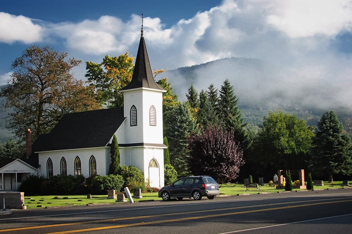
Everson, Washington, offers a compelling strategic position for those prioritizing resilience and self-sufficiency, balancing proximity to Bellingham’s resources with a distinctly rural buffer. Its location in the Nooksack River Valley, roughly 15 miles from the Canadian border and 20 miles from Bellingham, provides a blend of agricultural self-reliance and access to critical infrastructure without the density and target profile of a major urban center. For a relocator thinking seriously about disaster readiness, Everson’s small-town character—population around 2,500—and its position within Whatcom County’s fertile floodplain create a unique set of advantages and trade-offs that demand careful evaluation.
Geographic position and natural advantages for self-sufficiency
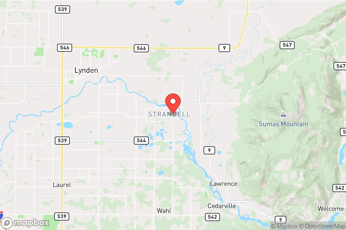
Everson sits at the confluence of the Nooksack and Sumas rivers, a location that historically defined its agricultural economy and continues to offer tangible benefits for self-sufficiency. The surrounding valley is among the most productive farmland in western Washington, with rich alluvial soils supporting dairy operations, berry farms, and vegetable crops. For a relocator aiming to grow food or source it locally, this is a significant asset—the area’s growing season, while short, is reliable, and the proximity to farms like those in the nearby Lynden area means fresh produce and dairy are readily available. The town’s elevation is low, around 85 feet, but the surrounding foothills of the Cascade Range, visible to the east, provide a natural barrier against coastal storm surges and offer potential retreat options if the valley floor becomes compromised. The Canadian border, just a 15-minute drive north, adds a layer of strategic depth: cross-border supply chains, medical facilities in Abbotsford (British Columbia), and an alternate jurisdiction for relocation or resupply are all within reach, though border closures during a crisis could complicate this advantage. The Nooksack River itself, while a flood risk, also serves as a potential water source for irrigation or emergency use, provided proper treatment systems are in place.
Risks, exposures, and proximity to fallout-relevant landmarks
The most significant risk in Everson is flooding. The Nooksack River has a history of major flood events—most notably in November 2021, when record-breaking rainfall caused widespread inundation that cut off roads, damaged homes, and displaced residents for days. Everson’s location at the river’s confluence makes it particularly vulnerable; the 2021 flood saw water levels exceed the 100-year floodplain, and climate projections suggest such events will become more frequent. For a resilience-minded relocator, this means any property must be evaluated for flood risk—FEMA flood maps are a starting point, but local knowledge of drainage patterns and historical high-water marks is essential. Earthquake risk is moderate, with the Cascadia subduction zone capable of producing a magnitude 9.0 event, but Everson’s distance from the coast (roughly 40 miles inland) reduces tsunami risk and places it in a zone where shaking, while severe, may be less intense than in Seattle or Portland. The town’s proximity to Bellingham (population 90,000) and the Canadian border introduces man-made risks: Bellingham is a regional transportation hub with an international airport, a deep-water port, and a major oil refinery (the BP Cherry Point refinery, about 25 miles west). In a conflict or major disruption, these are high-value targets that could draw fallout—both literal radioactive fallout from a nuclear event and secondary effects like supply chain disruptions or population displacement. The Sumas border crossing, a major commercial port of entry, is another potential chokepoint; a crisis could see it closed or overwhelmed with traffic, cutting off the Canadian option. Everson’s small size and rural character make it a lower-priority target than Bellingham or the refinery, but its proximity—within 20 miles of both—means it lies within the potential fallout zone of any attack on those assets. Prevailing winds from the west would carry contamination toward the Cascades, potentially affecting Everson depending on the specific event.
Practical resilience for a relocator: food, water, energy, and defensibility
For a relocator serious about self-sufficiency, Everson’s practical resilience is a mixed bag. Food security is a standout strength: the agricultural base means local food production is viable, with farmers’ markets in nearby Lynden and Bellingham, and the ability to raise livestock or grow crops on even modest acreage. The Nooksack River and local groundwater wells provide water, but treatment is critical—surface water requires filtration and boiling due to agricultural runoff and potential contamination during floods. Well water should be tested for nitrates and coliform bacteria, common in farming areas. Energy resilience is a weak point: the grid is served by Puget Sound Energy, and power outages are common during winter storms and floods. Solar potential is limited by the region’s cloud cover—Everson averages only 152 sunny days per year, well below the national average of 205. Backup generation, whether propane, diesel, or battery storage, is a near-necessity for any off-grid or semi-off-grid setup. Wood heating is practical, given the surrounding forests, but air quality regulations in Whatcom County can restrict burning during inversions. Defensibility is moderate: Everson’s layout is compact, with a few main roads (Highway 539 and Highway 9) providing access, which can be easily monitored or blocked. The surrounding farmland offers open sightlines, but the flat terrain provides little natural cover. The town’s small population means a tight-knit community—neighbors know each other, which aids mutual aid but also means outsiders are noticed quickly. For a relocator, integrating into the community is essential for long-term resilience; isolationism will be counterproductive here. Medical facilities are limited to a small clinic in Everson; serious emergencies require a 20-minute drive to Bellingham’s PeaceHealth St. Joseph Medical Center or a 30-minute drive to Abbotsford Regional Hospital in Canada. Stockpiling medications and first-aid supplies is advisable, as hospital capacity could be overwhelmed in a crisis.
The overall strategic picture for Everson is one of calculated trade-offs. Its agricultural productivity, small population, and border proximity offer genuine advantages for a relocator seeking a base that can sustain itself through disruptions. But the flood risk is real and worsening, the energy grid is unreliable, and the proximity to Bellingham and the BP refinery introduces a vulnerability that cannot be ignored. For someone willing to invest in flood mitigation—elevated construction, flood barriers, or choosing property on higher ground—and backup power systems, Everson can be a viable long-term haven. It is not a remote bunker; it is a working agricultural town with a practical, no-nonsense character that rewards preparation and community engagement. The key is to treat it as a strategic asset, not a fantasy escape: know the flood zones, build redundancy into your water and power systems, and cultivate relationships with local farmers and tradespeople. Done right, Everson offers a defensible, productive base within reach of critical resources—but only if you go in with eyes open to its specific risks.

* Values derived from national, state, county, city and local statistics and may differ in a specific area. Last updated: 2026-08-17T22:33:56.000Z
Narrative content on this page is AI-generated and may contain mistakes. Verify any details that matter before acting on them.
ReloMaps may earn a commission from affiliate links at no extra cost to you.

