
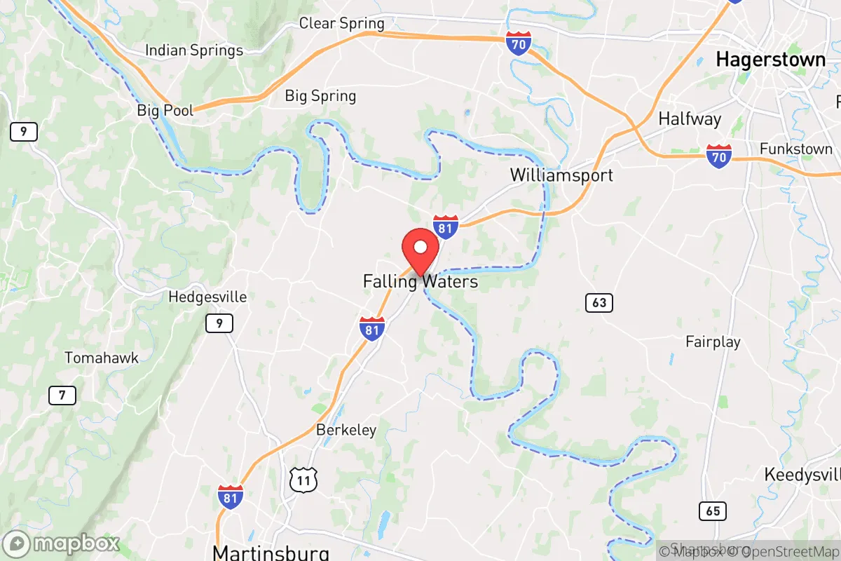
Strategic Assessment of Falling Waters, WV
Workable tactical position. Some exposure to population density or targets, but generally defensible in a crisis.
What does the Strategic Assessment tell us?
Our Strategic Assessment grades tactical survivability of an area. Major population centers, military targets, fallout zones, natural disasters, and border exposure all drive risk — lower exposure means a more defensible position in a crisis.
This is heavily inspired by Joel Skousen's Strategic Relocation book. Highly recommended you checkout the book ($)What does this tell us?
Our Strategic Assessment grades tactical survivability of an area. Major population centers, military targets, fallout zones, natural disasters, and border exposure all drive risk — lower exposure means a more defensible position in a crisis.
This is heavily inspired by Joel Skousen's Strategic Relocation book. Highly recommended you checkout the book ($)Strategic Pillars

Key Distances
Regional Safe Places
Below is our recommended "safe zones" in West Virginia and the surrounding area based on our strategic heuristics. For most people, it's unrealistic to live in a “safe zone” full-time due to work, family or other personal reasons. They tend to be more rural. However, many of these areas are perfect for second homes and retreat properties that double as a vacation home or even a short-term rental.


Important Note: For informational purposes only. This does not mean nothing bad ever happens in the green zones. Please use common sense. This is based on public data and modeled with AI. We tried to take a conservative approach but mistakes happen. We update this regularly as new information becomes available.
Solar Generator Recommendations
Backup power matters more here than in safer locations. We've picked three solar generators across budgets and capacity tiers — start with the budget unit if you only need a few essentials, or step up if you want to run a fridge and HVAC for days at a time.

Jackery Portable Power Station Explorer 300
Budget OptionPower on the Go: Weighing only 11 lbs, it's convenient to set up and store with book-sized foldable solar panels

BLUETTI Portable Power Station AC180
Designed for both indoor and outdoor scenarios, AC180 is highly capable as it has a robost capacity and continuous output power.

EF ECOFLOW DELTA Pro Ultra Power Station
Upgraded PickEcoFlow DELTA Pro Ultra is a whole-home energy system designed to grow with your family. Integrated with the Smart Home Panel 2, it scales to meet your evolving energy needs — keeping your home powered, intelligent, and secure through every stage of life.
We earn a commission, at no additional cost to you.
Strategic Assessment Analysis
Falling Waters, West Virginia, sits in a narrow band of the Eastern Panhandle that offers genuine strategic depth for those thinking seriously about resilience, but it is not a remote sanctuary—it is a buffer-zone position with real trade-offs. Located roughly 90 minutes from Washington, D.C., and 20 minutes from the Maryland line, this unincorporated community of about 900 people occupies a corridor that has historically been a transportation chokepoint (the Potomac River and I-81 both run through it) and a natural funnel for any movement along the Eastern Seaboard. For a relocator with a prepper mindset, the key question is whether the area’s access to rural West Virginia’s interior outweighs its proximity to the Baltimore-Washington metropolitan complex—and the answer depends heavily on how you define “prepared.”
Geographic position and natural advantages for long-term survival
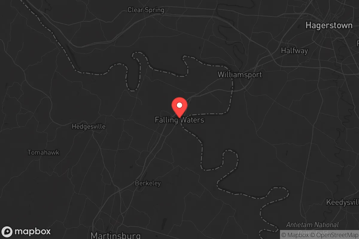
Falling Waters sits at the intersection of the Potomac River and the Chesapeake & Ohio Canal towpath, with the Appalachian Mountains rising to the west. The immediate terrain is rolling hills and river bottomland, not high mountain country, but it provides several structural advantages. The Potomac itself is a reliable surface water source, and the area’s karst geology means numerous springs and seeps—useful for off-grid water if you know where to look. The C&O Canal National Historical Park, which runs 184.5 miles from Georgetown to Cumberland, passes directly through Falling Waters, offering a potential foot or bike evacuation corridor that avoids major highways. The surrounding forests are mixed hardwood, providing fuel, building material, and game (deer, turkey, small game) in moderate abundance. The climate is temperate four-season, with average January lows around 22°F and July highs near 86°F—no extreme cold or heat that would stress off-grid systems, but enough winter to require serious heating plans. The area’s elevation (roughly 400–600 feet) keeps it above the Potomac’s floodplain in most spots, though low-lying parcels near the river are flood-prone. For a relocator, the natural advantage here is not isolation—it’s the combination of water, timber, and a defensible river boundary that can be monitored from the bluffs above.
Risks, exposures, and proximity to fallout-relevant landmarks
This is where Falling Waters gets complicated. The community lies less than 10 miles from the Maryland border and roughly 70 miles from the center of Washington, D.C. In a scenario involving a nuclear detonation in the National Capital Region (NCR), prevailing winds from the west-southwest would carry fallout directly toward the Eastern Panhandle—Falling Waters is in the primary downwind zone for any D.C.-area event. The nearby Fort Detrick in Frederick, Maryland (about 25 miles northeast) is a U.S. Army biodefense research lab and a potential target. The Davis-Monthan-style logistics hub at Martinsburg’s Eastern West Virginia Regional Airport (10 miles south) could become a military staging area during a crisis, drawing unwanted attention. Interstate 81, which runs through Falling Waters, is a major north-south trucking route; during a collapse scenario, it would become a chokepoint for refugees moving out of the Baltimore-Washington corridor. The area’s proximity to the D.C. exurbs means a significant population of “weekend warriors” and second-home owners who would flee the city in a crisis, potentially overwhelming local resources. For a relocator, the risk profile is clear: Falling Waters is not a retreat—it is a forward operating base that would see heavy traffic and potential contamination within the first 48 hours of a major event. The counterargument is that the same geography that makes it vulnerable also makes it a good place to monitor and intercept information from the outside world, if that’s part of your strategy.
Practical resilience for a relocator: food, water, energy, and defensibility
For day-to-day resilience, Falling Waters offers a mixed bag. The soil in the Potomac bottomland is rich loam, suitable for market gardening and small-scale agriculture—many local farms already grow corn, hay, and vegetables. The growing season runs roughly April to October, long enough for most staple crops. Water is abundant from the Potomac, but you’ll need filtration or boiling capacity; the river carries agricultural runoff and upstream sewage. Well water is common in the area, with typical depths of 100–300 feet, but new wells require permits from the Berkeley County Health Department. Electricity comes from the regional grid (FirstEnergy/Potomac Edison), which has been prone to outages during storms—solar with battery backup is a wise investment, as the area gets about 200 sunny days per year. Natural gas is available in parts of Falling Waters, but many homes use propane or heating oil. For defensibility, the terrain is not ideal: the river valley is open, with few natural chokepoints other than the bridges over the Potomac. The community itself is spread out along WV 901 and I-81, making it hard to secure a perimeter. However, the C&O Canal towpath provides a concealed movement corridor along the river, and the wooded ridges to the west offer observation points. The nearest hospital is Berkeley Medical Center in Martinsburg (15 minutes south), which is a Level III trauma center—adequate for routine emergencies but not for mass casualty events. For a relocator, the practical resilience here requires active preparation: stockpiling at least 90 days of supplies, establishing a secure water source, and having a bug-out plan for moving deeper into the West Virginia mountains (the Monongahela National Forest is about 90 minutes west).
The overall strategic picture for Falling Waters is that of a high-risk, high-reward buffer zone. It offers genuine natural resources, a defensible river boundary, and proximity to the Appalachian interior, but it sits directly in the path of any exodus from the D.C. metro area and within fallout range of a major target. For a single individual or family with a conservative, self-reliant mindset, the area works best as a staging point rather than a final retreat—a place to build skills, store supplies, and monitor the situation before moving deeper into the mountains if needed. The local culture is rural and largely conservative (Berkeley County voted +36 R in 2024), with a strong hunting and firearms tradition, which aligns with a prepper lifestyle. But the proximity to the I-81 corridor and the D.C. exurbs means you cannot afford complacency. If you are looking for a place to ride out a slow-burn collapse while maintaining access to the outside world, Falling Waters is a viable option. If you are looking for a remote, off-grid sanctuary where you can disappear, keep driving west.
* Values derived from national, state, county, city and local statistics and may differ in a specific area. Last updated: 2026-04-23T05:59:21.000Z
Narrative content on this page is AI-generated and may contain mistakes. Verify any details that matter before acting on them.
ReloMaps may earn a commission from affiliate links at no extra cost to you.