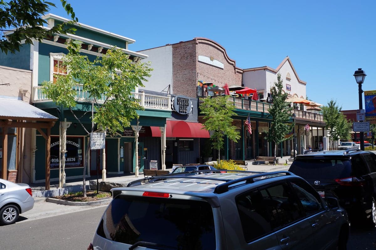
Photo: Wikipedia
Strategic Assessment of Folsom, CA
Multiple tactical vulnerabilities. Population density, target proximity, or disaster risk are likely compounding. A retreat property and exit planning is required.
What does the Strategic Assessment tell us?
Our Strategic Assessment grades tactical survivability of an area. Major population centers, military targets, fallout zones, natural disasters, and border exposure all drive risk — lower exposure means a more defensible position in a crisis.
This is heavily inspired by Joel Skousen's Strategic Relocation book. Highly recommended you checkout the book ($)What does this tell us?
Our Strategic Assessment grades tactical survivability of an area. Major population centers, military targets, fallout zones, natural disasters, and border exposure all drive risk — lower exposure means a more defensible position in a crisis.
This is heavily inspired by Joel Skousen's Strategic Relocation book. Highly recommended you checkout the book ($)Strategic Pillars

Key Distances
Regional Safe Places
Below is our recommended "safe zones" in California and the surrounding area based on our strategic heuristics. For most people, it's unrealistic to live in a “safe zone” full-time due to work, family or other personal reasons. They tend to be more rural. However, many of these areas are perfect for second homes and retreat properties that double as a vacation home or even a short-term rental.




Important Note: For informational purposes only. This does not mean nothing bad ever happens in the green zones. Please use common sense. This is based on public data and modeled with AI. We tried to take a conservative approach but mistakes happen. We update this regularly as new information becomes available.
Solar Generator Recommendations
Backup power matters more here than in safer locations. We've picked three solar generators across budgets and capacity tiers — start with the budget unit if you only need a few essentials, or step up if you want to run a fridge and HVAC for days at a time.

Jackery Portable Power Station Explorer 300
Budget OptionPower on the Go: Weighing only 11 lbs, it's convenient to set up and store with book-sized foldable solar panels

BLUETTI Portable Power Station AC180
Designed for both indoor and outdoor scenarios, AC180 is highly capable as it has a robost capacity and continuous output power.

EF ECOFLOW DELTA Pro Ultra Power Station
Upgraded PickEcoFlow DELTA Pro Ultra is a whole-home energy system designed to grow with your family. Integrated with the Smart Home Panel 2, it scales to meet your evolving energy needs — keeping your home powered, intelligent, and secure through every stage of life.
We earn a commission, at no additional cost to you.
Strategic Assessment Analysis
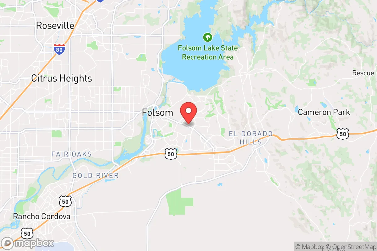
Folsom, California, presents a mixed strategic picture for the relocation-minded reader focused on resilience and self-sufficiency. Its location at the base of the Sierra Nevada foothills, roughly 25 miles east of Sacramento, offers a meaningful buffer from the densest urban corridors while still providing access to critical infrastructure. The area benefits from a strong local economy anchored by a major employer, a reliable water supply from Folsom Lake, and a topography that provides natural defensibility, but it also sits within striking distance of high-value targets in the Sacramento region and faces real seismic and wildfire risks that demand serious consideration.
Geographic position and natural advantages for long-term stability
Folsom's geographic position is its strongest asset in a resilience analysis. The city sits on the western edge of the Sierra Nevada, where the terrain begins to rise into the foothills, offering a natural elevation advantage over the flat Sacramento Valley. This elevation provides better drainage, cooler summer temperatures, and a degree of separation from the flood-prone areas of the valley floor. The American River runs directly through Folsom, and the massive Folsom Lake reservoir — created by Folsom Dam — sits immediately to the northeast. This water body is a critical resource, providing the city with a direct, gravity-fed water supply that is less vulnerable to pumping failures than many other California communities. The surrounding terrain includes a mix of oak woodlands and rolling hills, which offer natural chokepoints and observation advantages for anyone concerned with perimeter security or situational awareness. The city's position also places it roughly 40 miles from the Sierra crest, meaning access to high-altitude retreat zones, forest resources, and less populated mountain communities is feasible within a day's drive, assuming road access remains intact.
Risk exposure, seismic threats, and proximity to high-value targets
No resilience assessment of Folsom can ignore its exposure to natural and man-made risks. The most significant natural threat is seismic activity. Folsom sits near several active fault systems, including the Folsom Lake fault zone and the larger Sierra Nevada fault system. A major earthquake on the western Sierra front could damage Folsom Dam, which would have catastrophic downstream consequences. While the dam has undergone seismic retrofitting, it remains a point of concern. A 2023 seismic risk assessment by the California Department of Water Resources rated the dam's failure risk as "moderate to high" in a worst-case scenario, though the probability of such an event in any given year remains low. Wildfire is the second major natural risk. The city's eastern and northern edges abut wildland-urban interface zones, and the 2022 Mosquito Fire burned within 15 miles of Folsom. The area's prevailing winds from the west mean that smoke and ember showers from Sierra fires are a recurring seasonal hazard. From a man-made risk perspective, Folsom's proximity to Sacramento — a major state government, transportation, and logistics hub — is a double-edged sword. Sacramento contains multiple high-value targets, including the state capitol, major rail yards, Interstate 5 and 80 corridors, and a significant Air Force base (Travis AFB, roughly 40 miles southwest). In a conflict or major disruption scenario, these assets could draw attention. Folsom's distance from these targets provides some buffer, but it is not remote. The city is also directly adjacent to the Folsom State Prison and the California State Prison, Sacramento, which house thousands of inmates. In a breakdown of civil order, these facilities could become sources of instability or targets for extraction efforts, a factor rarely discussed in standard relocation guides.
Practical resilience: food, water, energy, and defensibility for a relocator
For a relocator serious about self-sufficiency, Folsom offers a mixed but workable foundation. Water is the strongest category: Folsom's municipal water supply comes from Folsom Lake, which has a storage capacity of over 975,000 acre-feet. Even in drought years, the lake typically maintains significant reserves, and the city's water treatment infrastructure is modern and well-maintained. For those with property near the lake or the American River, surface water access is excellent, though legal appropriation requires permits. Groundwater in the area is available but deeper than in the valley, typically requiring wells of 200 to 400 feet. Food resilience is moderate. The surrounding Sacramento Valley is some of the most productive agricultural land in the world, but Folsom itself is suburban, with limited farmland within city limits. Local farmers' markets and CSAs are available, but a relocator would need to secure acreage in the surrounding county (El Dorado or Placer) for serious food production. The area's Mediterranean climate allows for year-round growing with irrigation. Energy resilience is a weak point. The grid in Folsom is served by Sacramento Municipal Utility District (SMUD), which has a good reliability record but is still vulnerable to PSPS (Public Safety Power Shutoff) events during high fire risk. Solar adoption is high in the area, and net metering policies are favorable, but battery storage is essential for true off-grid capability. Natural gas is widely available for backup heating and cooking. Defensibility is where Folsom's suburban character becomes a liability. The city's layout is typical of modern master-planned communities: cul-de-sacs, winding roads, and multiple access points. While the terrain provides some natural chokepoints — particularly along the American River canyon and the ridges east of town — the sheer number of entry roads from Sacramento, Rancho Cordova, and El Dorado Hills makes perimeter control impractical for any small group. For a relocator, the ideal property would be on the eastern edge of Folsom, near the foothills, with a single access road and good line of sight, rather than in the dense suburban core near Highway 50.
The overall strategic picture for Folsom is one of qualified viability. It is not a remote survivalist retreat, nor is it a high-risk urban core. It occupies a middle ground that may appeal to the relocator who wants a strong economic base, excellent water resources, and reasonable proximity to mountain retreat zones, while accepting the risks of suburban density, seismic exposure, and proximity to Sacramento's target profile. The key to making Folsom work as a resilience hub is property selection: choose the eastern foothill edge, invest in seismic retrofitting and wildfire hardening, secure independent water and power systems, and maintain a vehicle capable of navigating mountain roads when the highway is compromised. For the reader who wants a balance of modern convenience and strategic depth, Folsom is a defensible choice — but only with eyes wide open to its limitations.

* Values derived from national, state, county, city and local statistics and may differ in a specific area. Last updated: 2026-08-23T00:50:34.000Z
Narrative content on this page is AI-generated and may contain mistakes. Verify any details that matter before acting on them.
ReloMaps may earn a commission from affiliate links at no extra cost to you.

