Photo: Wikipedia
Strategic Assessment of Fort Pierre, SD
Strong survivability profile. Good buffer from population centers, with manageable environmental and tactical risks.
What does the Strategic Assessment tell us?
Our Strategic Assessment grades tactical survivability of an area. Major population centers, military targets, fallout zones, natural disasters, and border exposure all drive risk — lower exposure means a more defensible position in a crisis.
This is heavily inspired by Joel Skousen's Strategic Relocation book. Highly recommended you checkout the book ($)What does this tell us?
Our Strategic Assessment grades tactical survivability of an area. Major population centers, military targets, fallout zones, natural disasters, and border exposure all drive risk — lower exposure means a more defensible position in a crisis.
This is heavily inspired by Joel Skousen's Strategic Relocation book. Highly recommended you checkout the book ($)Strategic Pillars

Key Distances
Regional Safe Places
Below is our recommended "safe zones" in South Dakota and the surrounding area based on our strategic heuristics. For most people, it's unrealistic to live in a “safe zone” full-time due to work, family or other personal reasons. They tend to be more rural. However, many of these areas are perfect for second homes and retreat properties that double as a vacation home or even a short-term rental.


Important Note: For informational purposes only. This does not mean nothing bad ever happens in the green zones. Please use common sense. This is based on public data and modeled with AI. We tried to take a conservative approach but mistakes happen. We update this regularly as new information becomes available.
Solar Generator Recommendations
Backup power matters more here than in safer locations. We've picked three solar generators across budgets and capacity tiers — start with the budget unit if you only need a few essentials, or step up if you want to run a fridge and HVAC for days at a time.

Jackery Portable Power Station Explorer 300
Budget OptionPower on the Go: Weighing only 11 lbs, it's convenient to set up and store with book-sized foldable solar panels

BLUETTI Portable Power Station AC180
Designed for both indoor and outdoor scenarios, AC180 is highly capable as it has a robost capacity and continuous output power.

EF ECOFLOW DELTA Pro Ultra Power Station
Upgraded PickEcoFlow DELTA Pro Ultra is a whole-home energy system designed to grow with your family. Integrated with the Smart Home Panel 2, it scales to meet your evolving energy needs — keeping your home powered, intelligent, and secure through every stage of life.
We earn a commission, at no additional cost to you.
Strategic Assessment Analysis
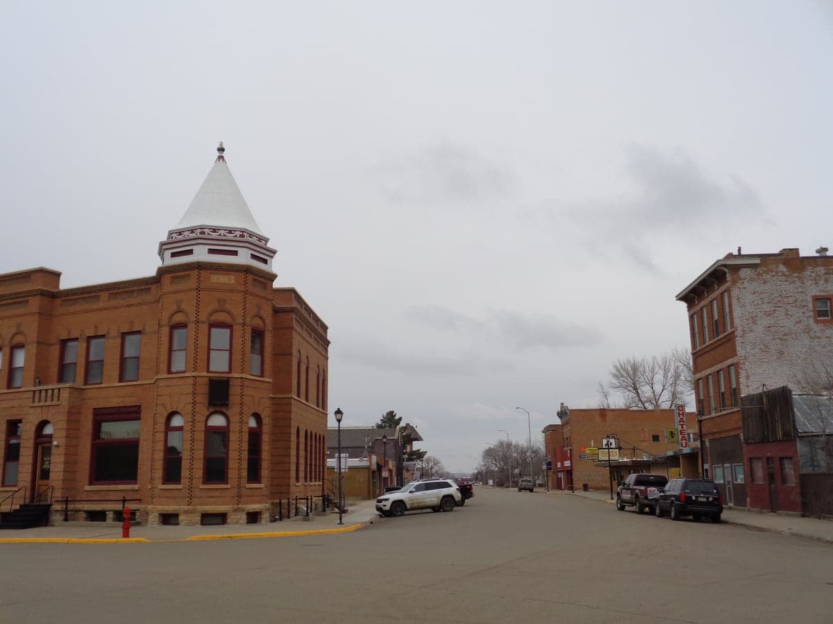
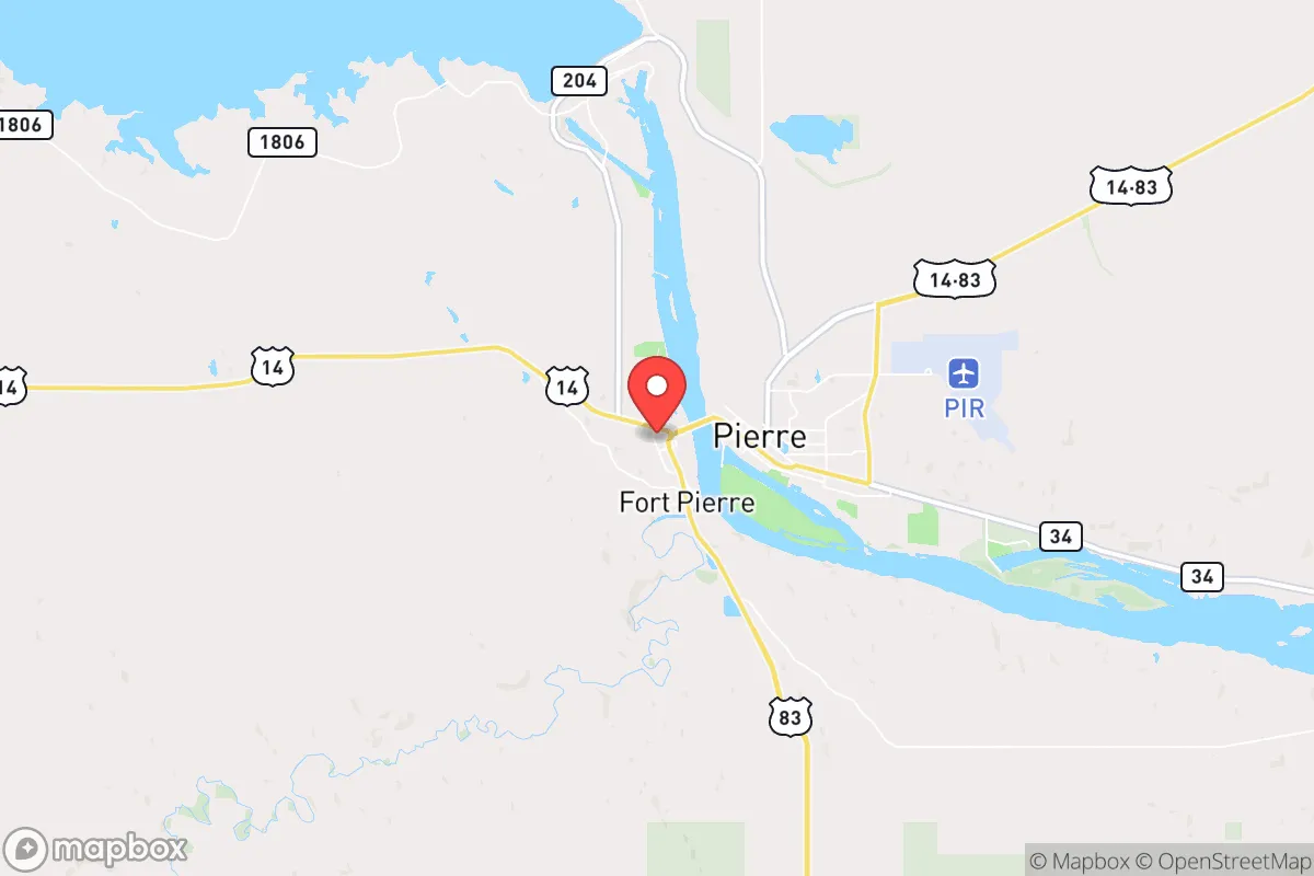
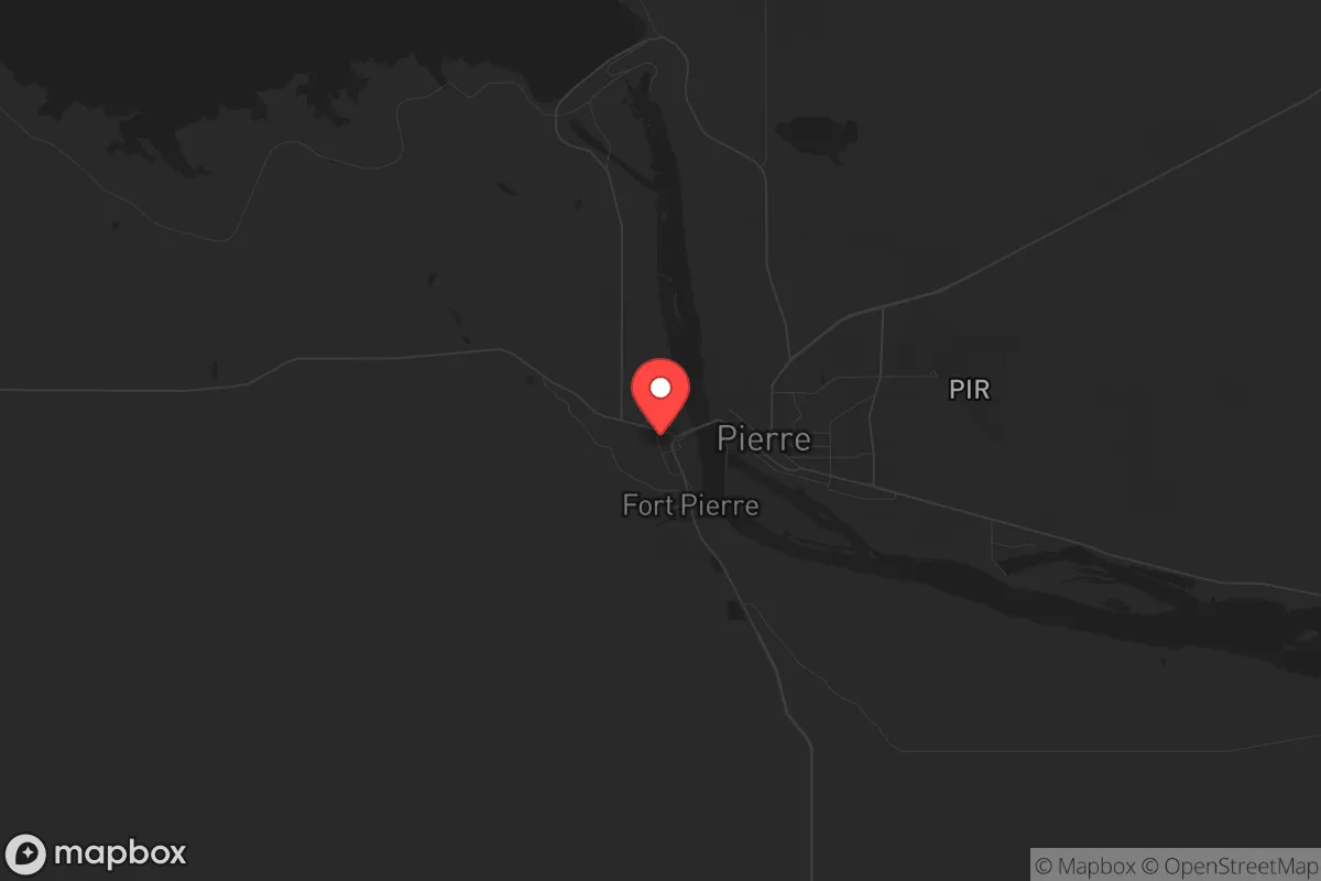
Fort Pierre, South Dakota, presents a compelling case for the strategic relocator, offering a blend of geographic isolation and logistical connectivity that is rare in the Lower 48. This town of roughly 2,100 people sits directly across the Missouri River from its larger twin, Pierre (the state capital), but its character and strategic value are distinct. For those prioritizing resilience against civic unrest, supply chain disruptions, and natural disasters, Fort Pierre’s position as a low-profile, resource-adjacent community with direct access to the Missouri River and the vast, sparsely populated plains of central South Dakota makes it a serious candidate for a long-term relocation base.
Geographic position and natural advantages for long-term security
Fort Pierre’s primary strategic asset is its location at the intersection of the Missouri River and major transportation corridors, yet far enough from any major population center to avoid the immediate fallout of urban collapse. The nearest city of significant size is Sioux Falls, over 200 miles to the east, and the sprawling metro areas of Denver and Minneapolis are each over 400 miles away. This distance is a critical buffer against the cascading effects of a major disaster—whether economic collapse, civil unrest, or a pandemic—that would first overwhelm densely populated regions. The Missouri River provides a reliable, year-round freshwater source, a non-negotiable for any long-term survival scenario. The surrounding landscape is a mix of rolling prairie and river breaks, offering ample space for private food production, water catchment, and low-visibility living. The area’s low population density means that in a crisis, competition for resources would be far less intense than in suburban or urban environments. Additionally, the region’s elevation and inland position make it relatively immune to the most common natural disasters: hurricanes, earthquakes, and tsunamis are non-factors here. The primary weather risk is severe winter storms and occasional drought, both of which are manageable with proper preparation.
Risks, exposures, and proximity to fallout-relevant landmarks
No location is without vulnerabilities, and Fort Pierre has specific exposures that a prepper must account for. The most obvious is its proximity to the state capital, Pierre, which sits just across the river. While Pierre’s population is only about 14,000, it is a political and administrative hub. In a scenario of widespread civil unrest or a contested election, the capital could become a target for protests, federal intervention, or even martial law enforcement. The presence of state government buildings, law enforcement headquarters, and the South Dakota National Guard headquarters in Pierre means that any major national instability could draw unwanted attention and activity to the immediate area. Fort Pierre itself is not the target, but its proximity to the capital means it could be affected by checkpoints, curfews, or the movement of security forces. Another consideration is the Oahe Dam, located just north of Pierre on the Missouri River. This massive hydroelectric dam is a critical piece of infrastructure for the region’s power grid. While a dam failure is extremely unlikely, it is a single point of failure that could disrupt power and water supply for hundreds of miles. For the strategic relocator, this means having off-grid power and water storage is not optional—it’s essential. Finally, the area is within a few hundred miles of Ellsworth Air Force Base near Rapid City, which houses B-1B bombers. In a major conflict, this base could be a target, though the distance (about 150 miles) provides a reasonable safety buffer. The key takeaway: Fort Pierre is not in a high-risk zone, but it is close enough to potential secondary effects that a serious prepper should plan for self-sufficiency, not reliance on local infrastructure.
Practical resilience for a relocator: food, water, energy, and defensibility
For the individual or family looking to establish a resilient homestead, Fort Pierre offers a workable foundation. Water is the first priority, and the Missouri River is a massive, reliable source. However, surface water requires treatment—filtration, boiling, or chemical purification—so a well on private property is the gold standard. The local water table is generally accessible, and many rural properties have existing wells. For food, the growing season is short (roughly 120 frost-free days), but the fertile river bottomlands can support robust gardens, and the surrounding prairie is suitable for livestock, particularly cattle, goats, and poultry. Hunting and fishing are also viable: the Missouri River offers walleye, catfish, and other species, and the area has healthy populations of deer and pheasant. Local farmers’ markets and co-ops in Pierre provide some backup, but a serious prepper should plan to produce the majority of their own calories. Energy resilience is a mixed bag. The grid is reasonably stable, but winter storms can cause outages. Solar is viable, with the region averaging over 200 sunny days per year, but winter days are short and snow cover can reduce output. A backup generator with stored fuel or a small wind turbine are practical additions. Defensibility is a strong point. The low population density means that a well-chosen property—set back from main roads, with natural cover from river breaks or tree lines—can be very difficult to observe or approach. The local culture is heavily oriented toward hunting, firearms ownership, and self-reliance, which means that neighbors are more likely to be assets than liabilities in a crisis. The Stanley County Sheriff’s Office and the Pierre Police Department are professional but stretched thin over large areas, so the community ethos is one of mutual aid rather than reliance on rapid law enforcement response.
The overall strategic picture for Fort Pierre is that of a solid, unglamorous base camp for those serious about long-term preparedness. It lacks the dramatic mountain defenses of a Montana hideout or the remote isolation of the Alaskan bush, but it offers a realistic balance: access to a major river, low population density, a conservative and self-reliant local culture, and a location far enough from major targets to avoid the worst of a national crisis. The proximity to Pierre is a double-edged sword—it provides access to medical facilities, supplies, and a regional airport, but it also introduces a political and administrative risk that must be factored into any plan. For the relocator who is willing to invest in off-grid infrastructure, build community relationships, and accept the harsh winters, Fort Pierre is a defensible, resource-rich location that could serve as a stable home base through the coming years of uncertainty. It is not a fantasy retreat; it is a working, practical option for those who understand that resilience is built, not found.
* Values derived from national, state, county, city and local statistics and may differ in a specific area. Last updated: 2026-04-20T14:13:57.000Z
Narrative content on this page is AI-generated and may contain mistakes. Verify any details that matter before acting on them.
ReloMaps may earn a commission from affiliate links at no extra cost to you.