
Photo: Wikipedia
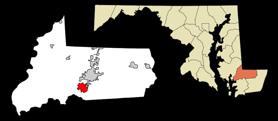
Strategic Assessment of Fruitland, MD
Meaningful friction. Expect exposure to either population pressure, blast zones, or natural disaster risk. Consider buying a retreat property.
What does the Strategic Assessment tell us?
Our Strategic Assessment grades tactical survivability of an area. Major population centers, military targets, fallout zones, natural disasters, and border exposure all drive risk — lower exposure means a more defensible position in a crisis.
This is heavily inspired by Joel Skousen's Strategic Relocation book. Highly recommended you checkout the book ($)What does this tell us?
Our Strategic Assessment grades tactical survivability of an area. Major population centers, military targets, fallout zones, natural disasters, and border exposure all drive risk — lower exposure means a more defensible position in a crisis.
This is heavily inspired by Joel Skousen's Strategic Relocation book. Highly recommended you checkout the book ($)Strategic Pillars

Key Distances
Regional Safe Places
Below is our recommended "safe zones" in Maryland and the surrounding area based on our strategic heuristics. For most people, it's unrealistic to live in a “safe zone” full-time due to work, family or other personal reasons. They tend to be more rural. However, many of these areas are perfect for second homes and retreat properties that double as a vacation home or even a short-term rental.


Important Note: For informational purposes only. This does not mean nothing bad ever happens in the green zones. Please use common sense. This is based on public data and modeled with AI. We tried to take a conservative approach but mistakes happen. We update this regularly as new information becomes available.
Solar Generator Recommendations
Backup power matters more here than in safer locations. We've picked three solar generators across budgets and capacity tiers — start with the budget unit if you only need a few essentials, or step up if you want to run a fridge and HVAC for days at a time.

Jackery Portable Power Station Explorer 300
Budget OptionPower on the Go: Weighing only 11 lbs, it's convenient to set up and store with book-sized foldable solar panels

BLUETTI Portable Power Station AC180
Designed for both indoor and outdoor scenarios, AC180 is highly capable as it has a robost capacity and continuous output power.

EF ECOFLOW DELTA Pro Ultra Power Station
Upgraded PickEcoFlow DELTA Pro Ultra is a whole-home energy system designed to grow with your family. Integrated with the Smart Home Panel 2, it scales to meet your evolving energy needs — keeping your home powered, intelligent, and secure through every stage of life.
We earn a commission, at no additional cost to you.
Strategic Assessment Analysis
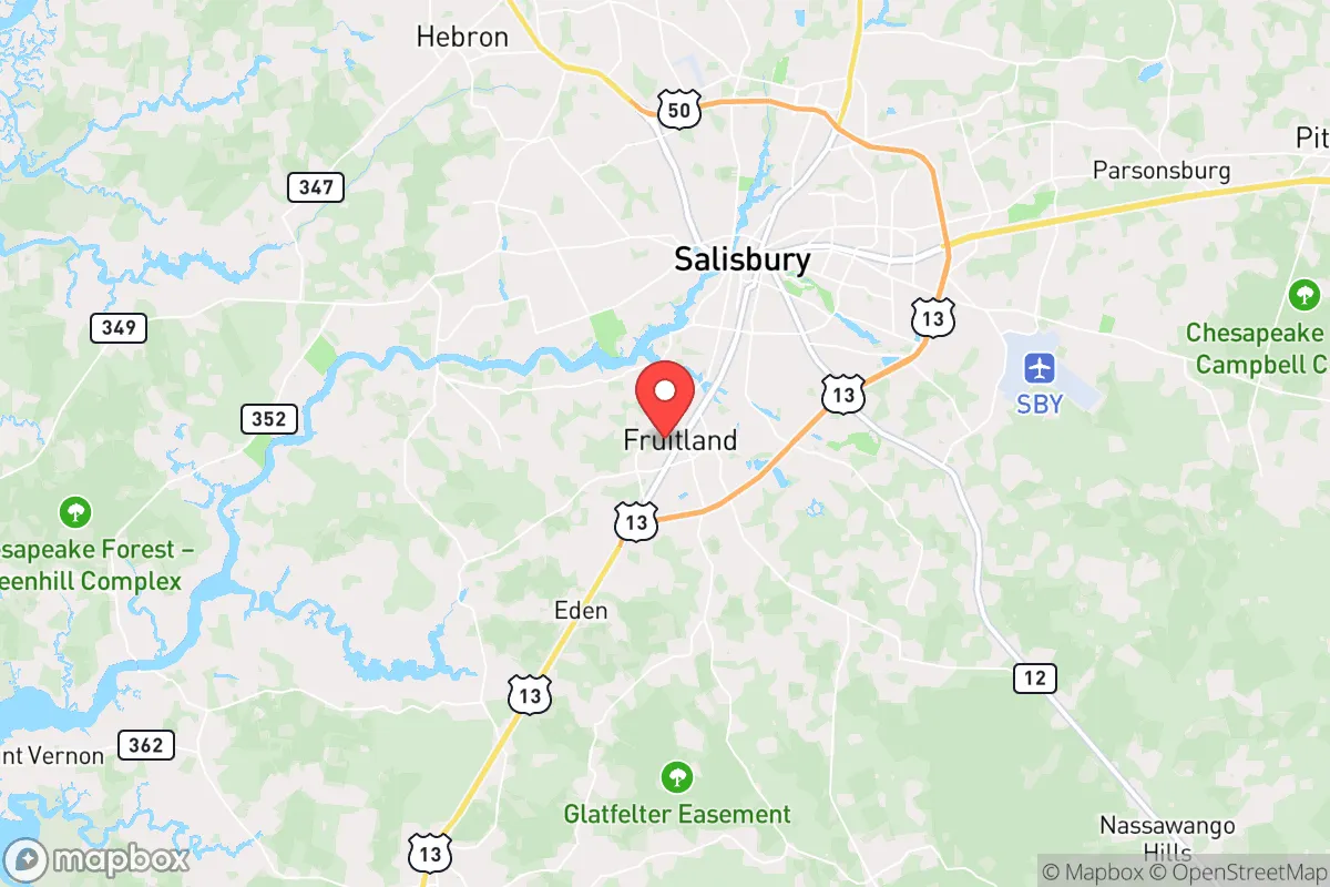
Fruitland, Maryland, sits in a precarious but potentially workable position for those prioritizing resilience and strategic relocation. Located in Wicomico County on Maryland's Eastern Shore, it offers a blend of rural buffer and small-town infrastructure that can support a prepared household. Its key advantage is geographic insulation from the immediate blast zones of major Eastern Seaboard targets, while its key liability is proximity to the Salisbury metro area and the region's vulnerability to sea-level rise and storm surge. For a conservative-leaning prepper or survivalist, Fruitland is a location that demands careful, active mitigation rather than passive safety.
Geographic position and natural advantages for long-term stability
Fruitland's position on the Delmarva Peninsula provides a natural moat against the kind of cascading chaos that would follow a major event in Washington, D.C., Baltimore, or Philadelphia. The Chesapeake Bay Bridge and the Bay Bridge Tunnel are chokepoints that would likely be closed or heavily contested in a crisis, effectively isolating the Eastern Shore from the worst of the urban exodus. This isolation is a double-edged sword—it limits your ability to leave, but it also limits the number of desperate people who can reach you. The surrounding landscape is flat, agricultural, and sparsely populated compared to the western shore. This means ample space for private food production, rainwater catchment, and off-grid energy systems without drawing attention. The area's groundwater is generally plentiful and shallow, making well drilling a viable option for most properties. The climate is temperate, with a long growing season that supports three-season gardening and small-scale livestock. For a family looking to establish a semi-autonomous homestead within striking distance of coastal resources, the natural base here is solid.
Risks, exposures, and proximity to fallout-relevant landmarks
The most significant strategic weakness of Fruitland is its proximity to Salisbury, the regional hub, and its location within the broader Washington-Baltimore fallout footprint. Salisbury is home to a regional airport, a major hospital (TidalHealth Peninsula Regional), and a state university—all of which are potential secondary targets or nodes of civil unrest in a national emergency. Fruitland is roughly 30 miles from the Atlantic coast and the Indian River Inlet, a potential chokepoint for naval or logistical activity. More concerning is the area's vulnerability to natural disaster. The Eastern Shore is flat and low-lying; a Category 2 or higher hurricane making landfall near Ocean City would inundate large portions of Wicomico County, including Fruitland's lower-lying areas. Storm surge from the Wicomico River, which runs through Salisbury, could push water miles inland. Additionally, the region is within the 100-mile radius of the Calvert Cliffs Nuclear Power Plant, located across the bay in Lusby, Maryland. While a meltdown scenario is low-probability, the prevailing winds would carry fallout across the bay toward the Eastern Shore. Any relocator must have a fallout shelter plan and a stockpile of potassium iodide as a baseline precaution. The area's dependence on the Salisbury economy also means that a prolonged disruption to that city—whether from civil unrest, pandemic, or supply chain collapse—would ripple directly into Fruitland's grocery stores, fuel stations, and medical services.
Practical resilience for a relocator: food, water, energy, and defensibility
For the serious prepper, Fruitland offers a mixed bag of practical advantages and hard requirements. Water is the strongest asset here. The shallow aquifer means a well can be drilled for under $5,000 in most cases, and hand pumps or solar-powered pumps can keep water flowing without grid power. Rainwater collection is also straightforward, with average annual rainfall of around 45 inches. Food production is viable but requires land. The sandy, loamy soil is good for row crops, but you'll need at least 2-5 acres to achieve meaningful self-sufficiency. The local agricultural economy means seed, fertilizer, and livestock feed are readily available at farm supply stores like Southern States in Salisbury. Deer and waterfowl are abundant for hunting, and the Chesapeake Bay's seafood is a major protein source—if you have a boat or access to the shore. Energy independence is achievable but not trivial. The area gets plenty of sun for solar panels, and net metering is available through the local utility (Delmarva Power). However, the flat terrain means wind turbines are less effective, and the region's humidity and salt air accelerate corrosion on exposed equipment. A backup generator running on propane or diesel is a must. Defensibility is the weakest link. Fruitland is not a natural fortress. The terrain is open farmland and scattered subdivisions, with few natural chokepoints or high ground. Perimeter security, neighborhood watch coordination, and a low-profile lifestyle are essential. Living on a dead-end road or a property with a long, gated driveway is far preferable to a house on a main thoroughfare. The local culture is generally conservative and self-reliant, which means you'll find neighbors who share your values, but also a sheriff's office that may be overwhelmed in a crisis. Building relationships with nearby farmers and gun owners is a practical step, not just a social one.
The overall strategic picture for Fruitland is one of calculated trade-offs. It is not a bug-out location for a total collapse scenario—the lack of defensible terrain and the proximity to Salisbury's potential chaos are real liabilities. However, for a relocator who wants to stay within a few hours of the Mid-Atlantic job market while maintaining a prepared homestead, it offers a viable middle ground. The key is to treat Fruitland as a base for active resilience, not passive safety. Invest in a well, solar panels, a root cellar, and a community of like-minded neighbors. Stockpile for at least 90 days of self-sufficiency, and have a plan to either ride out a coastal storm or evacuate inland to higher ground west of the bay. If you go in with eyes open and a solid prep plan, Fruitland can work. If you expect the government or the local infrastructure to save you, you will be disappointed.
* Values derived from national, state, county, city and local statistics and may differ in a specific area. Last updated: 2026-04-22T01:44:57.000Z
Narrative content on this page is AI-generated and may contain mistakes. Verify any details that matter before acting on them.
ReloMaps may earn a commission from affiliate links at no extra cost to you.