
Photo: Wikipedia
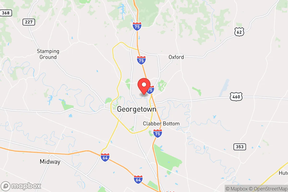
Strategic Assessment of Georgetown, KY
Meaningful friction. Expect exposure to either population pressure, blast zones, or natural disaster risk. Consider buying a retreat property.
What does the Strategic Assessment tell us?
Our Strategic Assessment grades tactical survivability of an area. Major population centers, military targets, fallout zones, natural disasters, and border exposure all drive risk — lower exposure means a more defensible position in a crisis.
This is heavily inspired by Joel Skousen's Strategic Relocation book. Highly recommended you checkout the book ($)What does this tell us?
Our Strategic Assessment grades tactical survivability of an area. Major population centers, military targets, fallout zones, natural disasters, and border exposure all drive risk — lower exposure means a more defensible position in a crisis.
This is heavily inspired by Joel Skousen's Strategic Relocation book. Highly recommended you checkout the book ($)Strategic Pillars

Key Distances
Regional Safe Places
Below is our recommended "safe zones" in Kentucky and the surrounding area based on our strategic heuristics. For most people, it's unrealistic to live in a “safe zone” full-time due to work, family or other personal reasons. They tend to be more rural. However, many of these areas are perfect for second homes and retreat properties that double as a vacation home or even a short-term rental.


Important Note: For informational purposes only. This does not mean nothing bad ever happens in the green zones. Please use common sense. This is based on public data and modeled with AI. We tried to take a conservative approach but mistakes happen. We update this regularly as new information becomes available.
Solar Generator Recommendations
Backup power matters more here than in safer locations. We've picked three solar generators across budgets and capacity tiers — start with the budget unit if you only need a few essentials, or step up if you want to run a fridge and HVAC for days at a time.

Jackery Portable Power Station Explorer 300
Budget OptionPower on the Go: Weighing only 11 lbs, it's convenient to set up and store with book-sized foldable solar panels

BLUETTI Portable Power Station AC180
Designed for both indoor and outdoor scenarios, AC180 is highly capable as it has a robost capacity and continuous output power.

EF ECOFLOW DELTA Pro Ultra Power Station
Upgraded PickEcoFlow DELTA Pro Ultra is a whole-home energy system designed to grow with your family. Integrated with the Smart Home Panel 2, it scales to meet your evolving energy needs — keeping your home powered, intelligent, and secure through every stage of life.
We earn a commission, at no additional cost to you.
Strategic Assessment Analysis
Georgetown, Kentucky, sits in a sweet spot that few relocation analysts can point to with confidence: close enough to major infrastructure to keep supply chains open, but far enough from the primary blast zones and population chokepoints that define most "prepper" destinations. The city’s position along Interstate 75, roughly 15 miles north of Lexington and 70 miles south of Cincinnati, gives it a logistical backbone without the daily exposure to the kind of civil unrest that tends to ignite in larger urban cores. For a conservative-leaning individual or family looking to maintain a low profile while retaining access to medical, industrial, and agricultural resources, Georgetown offers a rare combination of buffer and connectivity that many rural-only retreats simply cannot match.
Geographic position and natural advantages for long-term stability
Georgetown’s real strategic value begins with its placement in the Bluegrass region, a zone defined by limestone-filtered aquifers, deep fertile soils, and a temperate climate that supports year-round food production. The area sits atop the Kentucky River watershed, with multiple tributaries and springs within a 20-minute drive, meaning water security is not a theoretical exercise here—it’s a practical reality. The surrounding farmland is among the most productive in the eastern United States, with Scott County ranking consistently in the top tier for corn, soybeans, and tobacco yields. For a relocator thinking in terms of subsistence or barter, this is not abstract; it means that even if national supply chains fracture, the local agricultural base can sustain a significant population for months. The terrain is gently rolling, not mountainous, which makes it defensible without being impassable—a key distinction. You can set up perimeter observation points on the higher ridges east of town, but you won’t get trapped by winter snow or washed-out mountain roads. The climate is four-season but moderate, with average January lows around 24°F and July highs near 86°F, reducing the risk of extreme weather events that could compound a crisis. Tornadoes are a concern, but Scott County sits outside the highest-risk Dixie Alley corridor, and the local emergency management infrastructure is well-funded and practiced.
Risks, exposures, and proximity to fallout-relevant landmarks
No location is immune, and Georgetown has its share of vulnerabilities that a serious prepper must weigh. The most immediate concern is its proximity to Interstate 75, a major north-south evacuation and logistics corridor. In a mass casualty event or civil unrest scenario, I-75 could become a chokepoint for refugees fleeing Lexington or Cincinnati, and Georgetown sits directly in that funnel. The city’s population of roughly 37,000 could swell rapidly if urban populations displace outward, straining local resources. Additionally, Georgetown is home to the Toyota Motor Manufacturing Kentucky plant, one of the largest automotive assembly facilities in the world, employing over 8,000 people. While this provides economic stability in normal times, it also represents a high-value target for any coordinated disruption—whether from cyberattacks, supply chain sabotage, or physical sabotage. The plant’s reliance on just-in-time delivery means that even a localized event could ripple outward, but for a relocator, the risk is more immediate: the plant’s workforce and their families represent a dense, dependent population that could overwhelm local infrastructure if the plant shuts down or becomes a focal point for unrest. On the fallout front, Georgetown is roughly 70 miles from the nearest major nuclear infrastructure—the Tennessee Valley Authority’s Sequoyah Nuclear Plant near Chattanooga is about 180 miles south, and the Ohio River’s nuclear plants (Zimmer, Beaver Valley) are over 200 miles away. That’s a comfortable buffer for fallout dispersion, but not so far that you’re isolated from medical or industrial support. The real exposure is not nuclear but chemical: the region has numerous fertilizer and chemical storage facilities along the Ohio River corridor, and prevailing winds from the west could carry airborne contaminants into Scott County within hours of a major industrial accident. A relocator should plan for at least a 72-hour shelter-in-place capability with HEPA filtration and sealed rooms.
Practical resilience for a relocator: food, water, energy, and defensibility
For a single individual or a family, Georgetown’s practical resilience comes down to four pillars: food, water, energy, and defensibility. On food, the local farmers’ markets and co-ops are robust, but the real advantage is the ability to buy directly from producers. Scott County has over 400 farms, and many operate roadside stands or CSA programs that don’t require a middleman. A relocator with a half-acre lot can realistically produce a significant portion of their own vegetables and eggs within a single growing season. The soil pH here is naturally alkaline due to the limestone bedrock, which means less amendment work for most garden crops. Water is the stronger card: the Georgetown Municipal Water and Sewer Service draws from the Kentucky River and multiple deep wells, and the system has backup generators and redundant intake points. For a private well, the water table sits at about 30 to 60 feet in most of the county, and drilling costs are reasonable—around $15 to $25 per foot. A hand pump or solar-powered well pump can provide off-grid water indefinitely. Energy is where Georgetown shows its weakness: the local grid is served by Kentucky Utilities, which relies heavily on coal and natural gas, and while the region has not experienced rolling blackouts like those in California or Texas, the aging transmission infrastructure is vulnerable to both weather and cyberattack. Solar is viable here—the area averages about 200 sunny days per year—but a relocator should plan for battery storage and a backup generator, preferably dual-fuel. Defensibility is mixed. The city itself is laid out in a traditional grid, which is not ideal for perimeter defense, but the surrounding rural areas offer numerous properties with natural chokepoints: creek crossings, ridge lines, and limited road access. The local law enforcement presence is solid—Scott County Sheriff’s Office maintains a visible patrol—but in a widespread crisis, response times could stretch to hours. A relocator should prioritize a property with a clear line of sight to the main approach road and at least two egress routes. The community itself is tight-knit and conservative, which in a crisis translates to faster mutual aid and less likelihood of looting or opportunistic crime. The Georgetown-Scott County Emergency Management Agency runs regular community preparedness drills, and the local ham radio club (Scott County Amateur Radio Society) is active and well-organized—a resource that could become critical if cell networks go down.
The overall strategic picture for Georgetown is one of calculated trade-offs. It is not a remote bunker location, and it should not be treated as one. What it offers is a defensible, resource-rich base within a day’s drive of multiple urban centers, with enough agricultural and water security to sustain a family through a medium-term disruption. The risks—proximity to I-75, the Toyota plant, and chemical corridors—are real but manageable with proper planning. For a conservative relocator who values community, self-sufficiency, and the ability to maintain a normal life while preparing for the abnormal, Georgetown represents one of the more balanced options in the eastern United States. It is not a place to hide; it is a place to stand your ground, with good soil under your feet and good neighbors at your back.
* Values derived from national, state, county, city and local statistics and may differ in a specific area. Last updated: 2026-04-21T09:46:36.000Z
Narrative content on this page is AI-generated and may contain mistakes. Verify any details that matter before acting on them.
ReloMaps may earn a commission from affiliate links at no extra cost to you.