Photo: Wikipedia
Strategic Assessment of Goose Creek, SC
Multiple tactical vulnerabilities. Population density, target proximity, or disaster risk are likely compounding. A retreat property and exit planning is required.
What does the Strategic Assessment tell us?
Our Strategic Assessment grades tactical survivability of an area. Major population centers, military targets, fallout zones, natural disasters, and border exposure all drive risk — lower exposure means a more defensible position in a crisis.
This is heavily inspired by Joel Skousen's Strategic Relocation book. Highly recommended you checkout the book ($)What does this tell us?
Our Strategic Assessment grades tactical survivability of an area. Major population centers, military targets, fallout zones, natural disasters, and border exposure all drive risk — lower exposure means a more defensible position in a crisis.
This is heavily inspired by Joel Skousen's Strategic Relocation book. Highly recommended you checkout the book ($)Strategic Pillars

Key Distances
Regional Safe Places
Below is our recommended "safe zones" in South Carolina and the surrounding area based on our strategic heuristics. For most people, it's unrealistic to live in a “safe zone” full-time due to work, family or other personal reasons. They tend to be more rural. However, many of these areas are perfect for second homes and retreat properties that double as a vacation home or even a short-term rental.


Important Note: For informational purposes only. This does not mean nothing bad ever happens in the green zones. Please use common sense. This is based on public data and modeled with AI. We tried to take a conservative approach but mistakes happen. We update this regularly as new information becomes available.
Solar Generator Recommendations
Backup power matters more here than in safer locations. We've picked three solar generators across budgets and capacity tiers — start with the budget unit if you only need a few essentials, or step up if you want to run a fridge and HVAC for days at a time.

Jackery Portable Power Station Explorer 300
Budget OptionPower on the Go: Weighing only 11 lbs, it's convenient to set up and store with book-sized foldable solar panels

BLUETTI Portable Power Station AC180
Designed for both indoor and outdoor scenarios, AC180 is highly capable as it has a robost capacity and continuous output power.

EF ECOFLOW DELTA Pro Ultra Power Station
Upgraded PickEcoFlow DELTA Pro Ultra is a whole-home energy system designed to grow with your family. Integrated with the Smart Home Panel 2, it scales to meet your evolving energy needs — keeping your home powered, intelligent, and secure through every stage of life.
We earn a commission, at no additional cost to you.
Strategic Assessment Analysis
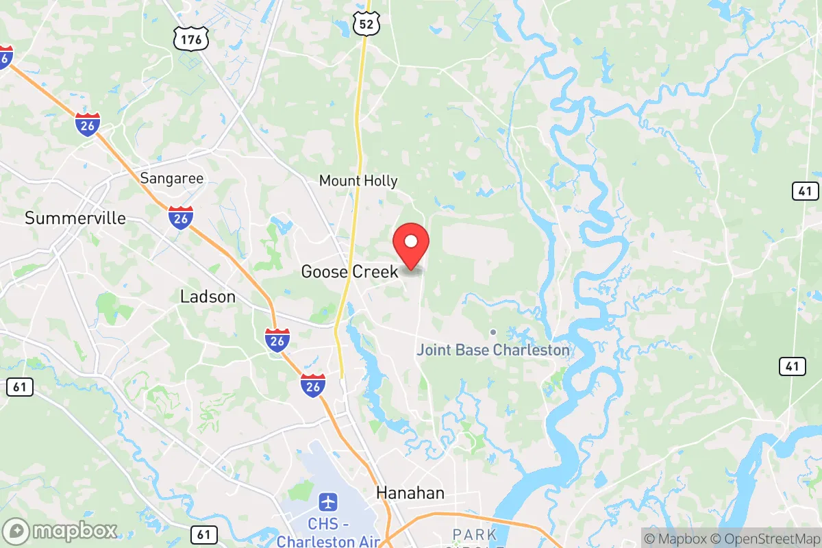
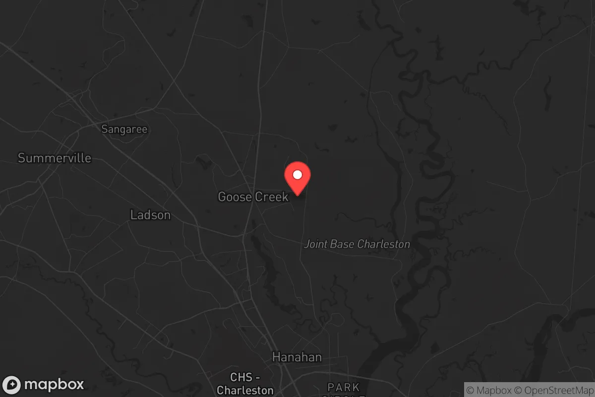
Goose Creek, South Carolina, offers a strategic paradox for the conservative prepper: it sits within the blast radius of a major military-industrial target yet provides the kind of logistical depth and community resilience that makes long-term survival possible. Located roughly 20 miles northwest of Charleston and 10 miles from Joint Base Charleston, this Berkeley County town of roughly 45,000 residents occupies a sweet spot between coastal vulnerability and inland defensibility. For the relocator weighing civic unrest, grid-down scenarios, or mass casualty events, Goose Creek demands a clear-eyed assessment of its assets and its liabilities.
Geographic position and natural advantages for long-term survival
Goose Creek’s primary strategic asset is its position on the Cooper River system, which feeds directly into the Atlantic via Charleston Harbor. This means unlimited access to freshwater for filtration and transport, a critical advantage in any prolonged disruption of municipal water supplies. The area sits on the Atlantic Coastal Plain, with elevations averaging just 15–30 feet above sea level, which is low but not flood-prone in the immediate Goose Creek vicinity—most flooding risk is concentrated closer to the coast or along the Santee River basin to the north. The surrounding Berkeley County is heavily forested with pine and hardwood, offering ample cover, fuel, and building material for off-grid setups. The climate is humid subtropical, with a growing season of roughly 240 days, allowing for year-round food production if you know what you’re doing. Winters are mild (average January lows around 35°F), meaning cold-weather survival gear is less critical than heat and hydration management. The area’s position also places it outside the direct fallout plume of a Charleston port strike or a Savannah River Site incident, as prevailing winds generally blow from the southwest, pushing contamination toward the ocean or inland away from Goose Creek depending on the season.
Risks, exposures, and proximity to fallout-relevant landmarks
Here’s where the analysis gets uncomfortable. Goose Creek is within 10 miles of Joint Base Charleston, a major Air Force base housing C-17 transport squadrons, the 628th Air Base Wing, and a Navy weapons station. In a peer-level conflict or a major terrorist event, that base is a high-priority target. A ground burst on the base would produce a lethal radiation zone extending roughly 5–10 miles downwind, which would cover most of Goose Creek. The same logic applies to the Port of Charleston, roughly 20 miles southeast—a choke point for U.S. supply chains that would be hit early in any conflict. Additionally, the Savannah River Site (a nuclear weapons tritium production facility) is about 90 miles southwest; a catastrophic release there would put Goose Creek in a moderate fallout zone depending on wind direction. On the plus side, Goose Creek is far enough from downtown Charleston (20 miles) to avoid the immediate civil unrest and looting that would follow a major event in the city. The town’s layout—sprawling subdivisions mixed with rural patches—means you can find a home with acreage and a well without being isolated. The biggest day-to-day risk is hurricane storm surge: Goose Creek is outside the 100-year floodplain for surge, but heavy rain from a Cat 3+ storm could cause localized flooding. The area also has a moderate tornado risk, though nothing like the Plains.
Practical resilience for a relocator: food, water, energy, and defensibility
For the prepper looking to set up a sustainable homestead, Goose Creek offers a mixed bag. Water is abundant: the Cooper River and its tributaries (including the Back River and Goose Creek Reservoir) provide surface water year-round, and the aquifer depth in Berkeley County is around 100–200 feet, making a hand-pump well feasible. The county’s water table is high, so shallow wells are common. Food production is viable: the soil is sandy loam with decent drainage, and you can grow tomatoes, peppers, squash, beans, and greens from March through November. Deer, turkey, and wild hogs are plentiful in the surrounding Francis Marion National Forest (30 minutes east), providing a protein source that won’t require a grocery store. The main challenge is energy independence: the area is heavily dependent on the grid, with Duke Energy serving most of Berkeley County. Solar is viable (average 5.2 peak sun hours per day), but you’ll need battery storage for the frequent summer thunderstorms that knock out power for 4–12 hours at a time. Natural gas is available in town but not in rural areas—propane tanks are the standard backup. Defensibility is moderate: Goose Creek is not a natural fortress like a mountain valley, but the dense pine forests and winding creeks provide natural chokepoints. The town’s layout—with major arteries like US-52 and I-26 funneling traffic—means you can monitor approach routes. The local population skews military and conservative, which means a high percentage of households are armed and have basic medical training. The Berkeley County Sheriff’s Office is well-funded and responsive, but in a grid-down scenario, you’re on your own for the first 72 hours at least.
The overall strategic picture for a conservative relocator
Goose Creek is not a bug-out location—it’s a live-in-place option for someone who wants to be close to coastal resources without being in the kill zone. The trade-off is clear: you get excellent water access, a long growing season, and a community of like-minded, self-reliant neighbors, but you also live within striking distance of a primary military target and a major port. For the single individual or family who is willing to invest in a well, solar panels, and a root cellar, Goose Creek offers a better risk/reward ratio than downtown Charleston or Summerville, which are more exposed to both fallout and civil unrest. The key is to buy property north of Red Bank Road or west of US-176, where lot sizes increase and density drops. Avoid anything within 5 miles of the base or the port. If you’re looking for a place where you can ride out the next decade of instability while still having access to a Lowcountry lifestyle, Goose Creek is worth a serious look—just don’t mistake it for a remote survival bunker. It’s a strategic compromise, and like any compromise, it requires you to know exactly what you’re getting into.
* Values derived from national, state, county, city and local statistics and may differ in a specific area. Last updated: 2026-04-30T00:46:48.000Z
Narrative content on this page is AI-generated and may contain mistakes. Verify any details that matter before acting on them.
ReloMaps may earn a commission from affiliate links at no extra cost to you.