Photo: Wikipedia
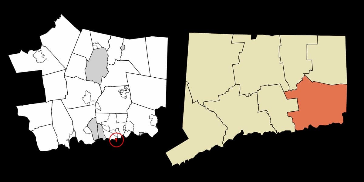
Strategic Assessment of Groton Long Point, CT
Multiple tactical vulnerabilities. Population density, target proximity, or disaster risk are likely compounding. A retreat property and exit planning is required.
What does the Strategic Assessment tell us?
Our Strategic Assessment grades tactical survivability of an area. Major population centers, military targets, fallout zones, natural disasters, and border exposure all drive risk — lower exposure means a more defensible position in a crisis.
This is heavily inspired by Joel Skousen's Strategic Relocation book. Highly recommended you checkout the book ($)What does this tell us?
Our Strategic Assessment grades tactical survivability of an area. Major population centers, military targets, fallout zones, natural disasters, and border exposure all drive risk — lower exposure means a more defensible position in a crisis.
This is heavily inspired by Joel Skousen's Strategic Relocation book. Highly recommended you checkout the book ($)Strategic Pillars

Key Distances
Regional Safe Places
Below is our recommended "safe zones" in Connecticut and the surrounding area based on our strategic heuristics. For most people, it's unrealistic to live in a “safe zone” full-time due to work, family or other personal reasons. They tend to be more rural. However, many of these areas are perfect for second homes and retreat properties that double as a vacation home or even a short-term rental.


Important Note: For informational purposes only. This does not mean nothing bad ever happens in the green zones. Please use common sense. This is based on public data and modeled with AI. We tried to take a conservative approach but mistakes happen. We update this regularly as new information becomes available.
Solar Generator Recommendations
Backup power matters more here than in safer locations. We've picked three solar generators across budgets and capacity tiers — start with the budget unit if you only need a few essentials, or step up if you want to run a fridge and HVAC for days at a time.

Jackery Portable Power Station Explorer 300
Budget OptionPower on the Go: Weighing only 11 lbs, it's convenient to set up and store with book-sized foldable solar panels

BLUETTI Portable Power Station AC180
Designed for both indoor and outdoor scenarios, AC180 is highly capable as it has a robost capacity and continuous output power.

EF ECOFLOW DELTA Pro Ultra Power Station
Upgraded PickEcoFlow DELTA Pro Ultra is a whole-home energy system designed to grow with your family. Integrated with the Smart Home Panel 2, it scales to meet your evolving energy needs — keeping your home powered, intelligent, and secure through every stage of life.
We earn a commission, at no additional cost to you.
Strategic Assessment Analysis
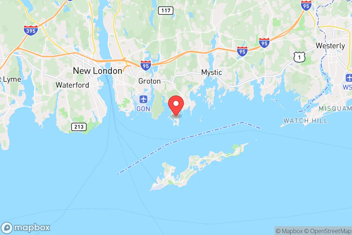
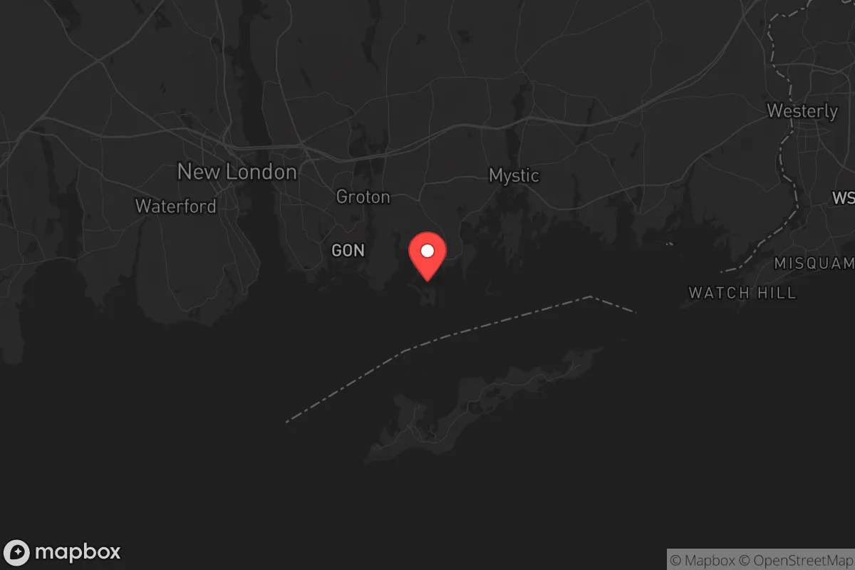
Groton Long Point, Connecticut, presents a complex strategic picture for the conservative prepper or survivalist. Its primary advantage is its insular geography—a narrow peninsula jutting into Fishers Island Sound—which offers a natural chokepoint for defense and a degree of separation from the mainland's chaos. However, this same geography creates a vulnerability: it's a literal dead-end, with only one road in and out, and its proximity to the submarine base in Groton and the dense population corridors of New London and New York makes it a high-risk zone for fallout, civil unrest, and mass casualty events. For a relocator prioritizing long-term resilience, this location demands a sober, trade-off-heavy assessment.
Geographic position and natural advantages for a strategic retreat
The peninsula's layout is the single strongest argument for Groton Long Point. The land is roughly a mile long and a quarter-mile wide, with the Atlantic on three sides. This means any approach by land is funneled through a single, narrow causeway—easily monitored, barricaded, or defended by a small, determined group. The surrounding water provides a natural moat, complicating any large-scale incursion from the mainland. For a prepper, this defensibility is gold. The maritime climate also moderates temperatures, reducing the severity of winter storms compared to inland Connecticut, and the saltwater environment supports marine life, offering a potential food source via fishing and shellfishing. The area's low elevation and sandy soil, however, mean it's not suited for deep well drilling or large-scale agriculture; you're dependent on the mainland for most bulk supplies. The natural beauty and relative quiet of the off-season are bonuses, but they don't replace hard logistical needs.
Risks, exposures, and proximity to fallout-relevant landmarks
Here's where the analysis turns grim. Groton Long Point sits less than five miles from the Naval Submarine Base New London, a primary target in any major conflict. In a nuclear exchange or a sophisticated terrorist strike, this base is a high-value target. The prevailing winds from the southwest would carry fallout directly over the peninsula. Furthermore, the area is sandwiched between the I-95 corridor and the Long Island Sound shipping lanes. In a scenario of mass evacuation from New York or Boston, Groton Long Point would be a funnel point for desperate people, not a refuge. The single road access becomes a liability: a single accident, a downed bridge, or a hostile group blocking the causeway turns the peninsula into a cage. The nearby Millstone Nuclear Power Station in Waterford, while not a military target, is a potential source of radiological release in a cascading failure scenario. For a relocator, the risk profile here is high—you're betting that the base is never hit and that civil unrest never blocks your only exit.
Practical resilience for a relocator: food, water, energy, and defensibility
Let's break down the day-to-day survival logistics. Water is the critical weakness. The peninsula relies on a municipal water system fed from the mainland. A grid-down event or contamination of the source would leave residents without potable water within hours. You would need to stockpile at least a 30-day supply per person, plus have means to collect rainwater or desalinate seawater—a complex and energy-intensive process. Food is a mixed bag. The local waters offer bluefish, striped bass, and shellfish, but these are seasonal and require knowledge and gear. There is no arable land on the point itself; any gardening would require raised beds with imported soil. You are dependent on supply runs to Groton or New London, which become dangerous in unrest. Energy is moderately workable. The coastal location is excellent for small-scale wind turbines, and solar panels can be mounted on roofs, though salt spray accelerates corrosion. A backup generator with a large fuel cache is essential, as the grid is vulnerable to storms and sabotage. Defensibility is the one strong point. The narrow geography means a small team can secure the causeway. Neighbors in a tight-knit community (many are second-home owners, but a core of year-round residents exists) could form a watch. However, the lack of escape routes means you must hold that line—there is no fallback position. For a single individual or a family, this is a high-stakes, high-commitment location.
The overall strategic picture for Groton Long Point is one of a high-risk, high-reward outpost for the prepared relocator. It offers a defensible redoubt with natural barriers, but it sits in the shadow of a primary military target and a major evacuation corridor. The practical challenges of water and food independence are severe, and the single-point-of-failure access road is a constant vulnerability. For a conservative prepper who values isolation and is willing to invest heavily in water storage, renewable energy, and a robust security plan, it could serve as a temporary safe haven. But for anyone seeking a low-profile, self-sufficient, and strategically secure long-term retreat, the risks of being trapped on a peninsula next to a submarine base likely outweigh the defensive advantages. This location is best viewed as a short-term bug-out location for those with a boat and a mainland fallback, not a permanent homestead for the end of the world as we know it.
* Values derived from national, state, county, city and local statistics and may differ in a specific area. Last updated: 2026-05-03T20:21:56.000Z
Narrative content on this page is AI-generated and may contain mistakes. Verify any details that matter before acting on them.
ReloMaps may earn a commission from affiliate links at no extra cost to you.