
Photo: Leo Heisenberg via Unsplash
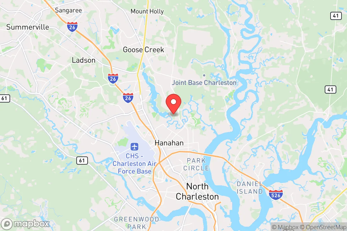
Strategic Assessment of Hanahan, SC
Multiple tactical vulnerabilities. Population density, target proximity, or disaster risk are likely compounding. A retreat property and exit planning is required.
What does the Strategic Assessment tell us?
Our Strategic Assessment grades tactical survivability of an area. Major population centers, military targets, fallout zones, natural disasters, and border exposure all drive risk — lower exposure means a more defensible position in a crisis.
This is heavily inspired by Joel Skousen's Strategic Relocation book. Highly recommended you checkout the book ($)What does this tell us?
Our Strategic Assessment grades tactical survivability of an area. Major population centers, military targets, fallout zones, natural disasters, and border exposure all drive risk — lower exposure means a more defensible position in a crisis.
This is heavily inspired by Joel Skousen's Strategic Relocation book. Highly recommended you checkout the book ($)Strategic Pillars

Key Distances
Regional Safe Places
Below is our recommended "safe zones" in South Carolina and the surrounding area based on our strategic heuristics. For most people, it's unrealistic to live in a “safe zone” full-time due to work, family or other personal reasons. They tend to be more rural. However, many of these areas are perfect for second homes and retreat properties that double as a vacation home or even a short-term rental.


Important Note: For informational purposes only. This does not mean nothing bad ever happens in the green zones. Please use common sense. This is based on public data and modeled with AI. We tried to take a conservative approach but mistakes happen. We update this regularly as new information becomes available.
Solar Generator Recommendations
Backup power matters more here than in safer locations. We've picked three solar generators across budgets and capacity tiers — start with the budget unit if you only need a few essentials, or step up if you want to run a fridge and HVAC for days at a time.

Jackery Portable Power Station Explorer 300
Budget OptionPower on the Go: Weighing only 11 lbs, it's convenient to set up and store with book-sized foldable solar panels

BLUETTI Portable Power Station AC180
Designed for both indoor and outdoor scenarios, AC180 is highly capable as it has a robost capacity and continuous output power.

EF ECOFLOW DELTA Pro Ultra Power Station
Upgraded PickEcoFlow DELTA Pro Ultra is a whole-home energy system designed to grow with your family. Integrated with the Smart Home Panel 2, it scales to meet your evolving energy needs — keeping your home powered, intelligent, and secure through every stage of life.
We earn a commission, at no additional cost to you.
Strategic Assessment Analysis
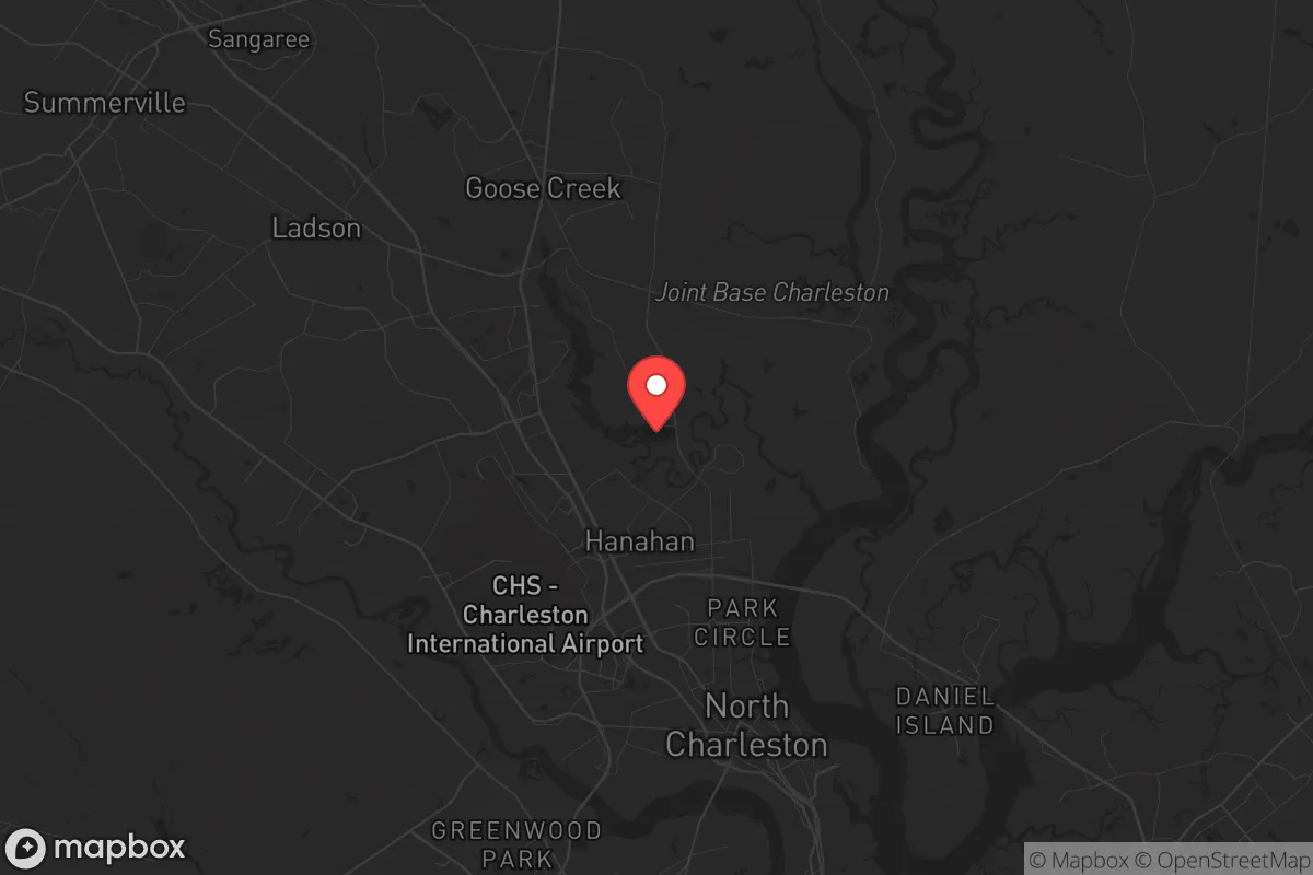
Hanahan, South Carolina, occupies a deceptively strategic position in the Lowcountry, but its resilience profile is a study in contradictions. Located just north of Charleston and nestled between the Cooper River and the Goose Creek Reservoir, this bedroom community of roughly 22,000 offers proximity to coastal resources while maintaining a suburban buffer from the densest urban chaos. For a relocator thinking in terms of civic unrest, mass casualty events, and long-term preparedness, Hanahan’s location is a double-edged sword: it provides access to critical infrastructure and natural water, but it sits squarely within the blast radius of one of the most strategically vulnerable regions on the Eastern Seaboard.
Geographic position and natural advantages for long-term survival
Hanahan’s geography is defined by water and marsh, which cuts both ways for a prepper. The city is bounded by the Cooper River to the east and the Goose Creek Reservoir to the west, offering abundant freshwater sources and potential for small-scale fishing, but also creating chokepoints for evacuation. The area sits on the Atlantic Coastal Plain, with elevations rarely exceeding 20 feet above sea level, meaning flooding from storm surge or prolonged rain is a real concern. On the plus side, the surrounding wetlands and tidal creeks provide natural barriers against ground-level intrusion—anyone approaching on foot would have to navigate marsh, mud, and mosquito-infested lowlands. The region’s subtropical climate supports year-round growing seasons, a major advantage for anyone serious about food independence. The soil is sandy and acidic, but with raised beds and composting, you can produce greens, tomatoes, peppers, and root vegetables from March through November. The nearby Francis Marion National Forest, about 30 minutes northeast, offers over 250,000 acres of public land for foraging, hunting, and bug-out options, though it’s heavily trafficked by hikers and hunters during normal times.
Risks, exposures, and proximity to fallout-relevant landmarks
Here’s where the analysis gets sobering. Hanahan is roughly 10 miles from the Port of Charleston, one of the busiest container ports on the East Coast and a prime target for any adversary looking to cripple supply chains. The city is also within 15 miles of Joint Base Charleston, a major Air Force installation that houses C-17 transport squadrons and the 628th Air Base Wing. In a conventional conflict or terror scenario, that base is a high-value target. The nearby Naval Weapons Station Charleston, which straddles the Cooper River and borders Hanahan directly, stores and handles munitions for the Navy—a literal powder keg in a crisis. A mass casualty event or EMP strike hitting Charleston’s port or military infrastructure would send shockwaves through Hanahan, both literally and logistically. The city’s evacuation routes are limited: I-26 runs west toward Columbia, but it’s a single corridor that bottlenecks quickly. The only other major road is US-52/Remount Road, which feeds into North Charleston’s urban grid. In a panic scenario, expect gridlock within minutes. Flooding from a hurricane or storm surge would also cut off the peninsula, turning Hanahan into an island with limited egress. The 2015 historic floods and Hurricane Hugo in 1989 are reminders that this area can be underwater fast.
Practical resilience for a relocator: food, water, energy, and defensibility
For someone serious about self-sufficiency, Hanahan offers a mixed bag. The municipal water supply comes from the Edisto River via the Charleston Water System, which is vulnerable to contamination from upstream industrial sites or saltwater intrusion during storm surges. A well is not a given here—most residential lots are on city water, and drilling a private well requires permits and can hit brackish water at depth. Rainwater catchment is legal and practical, with average annual rainfall of 48 inches, but you’ll need storage capacity and filtration. The local soil is not ideal for large-scale gardening without amendment, but community gardens and backyard plots are common in the older neighborhoods. Energy-wise, Dominion Energy provides electricity, and the grid is prone to outages during hurricanes and thunderstorms. Solar panels with battery backup are a smart investment, but HOA restrictions in some subdivisions may limit installation. Natural gas is available in parts of Hanahan, which is useful for cooking and heating off-grid. Defensibility is moderate: the city’s layout is a mix of suburban cul-de-sacs and older grid streets near the water. The newer developments off Yeamans Hall Road offer better sightlines and fewer entry points, while the older areas near the reservoir have more cover but also more foot traffic. In a collapse scenario, the proximity to the Naval Weapons Station could be a liability—military checkpoints and road closures would be likely, and the area could become a no-go zone. On the other hand, the presence of active-duty and retired military personnel in the community means a higher-than-average number of armed, trained residents. That’s a double-edged sword: it deters casual looters but could also attract unwanted attention from organized groups.
The overall strategic picture for a conservative relocator
Hanahan is not a bug-out location—it’s a suburban buffer zone with serious trade-offs. For a single individual or family looking to ride out moderate disruptions while maintaining access to Charleston’s job market and medical infrastructure, it works. The cost of living is reasonable for the region, with median home prices around $350,000 as of 2025, and property taxes are low by national standards. The local government is small and responsive, with a city council that leans conservative on fiscal issues. But for anyone planning for long-term grid-down scenarios, civil war, or major geopolitical instability, the risks of being within 20 miles of a major port, military base, and munitions depot are hard to ignore. The best use of Hanahan is as a staging ground—a place to build skills, store supplies, and establish relationships before a crisis forces a move inland. The real strategic play is to use Hanahan’s resources (water access, growing season, military community) to prepare for a relocation to the Upstate or the Appalachians, where elevation, distance from targets, and defensible terrain are far superior. If you’re set on staying, invest in a boat—the Cooper River and the Intracoastal Waterway are your only reliable escape routes when the roads clog. And keep your head on a swivel: in a real crisis, Hanahan’s proximity to power will be both its greatest asset and its most dangerous liability.
* Values derived from national, state, county, city and local statistics and may differ in a specific area. Last updated: 2026-04-29T20:04:29.000Z
Narrative content on this page is AI-generated and may contain mistakes. Verify any details that matter before acting on them.
ReloMaps may earn a commission from affiliate links at no extra cost to you.