Photo: Wikipedia
Strategic Assessment of Haverhill, MA
Multiple tactical vulnerabilities. Population density, target proximity, or disaster risk are likely compounding. A retreat property and exit planning is required.
What does the Strategic Assessment tell us?
Our Strategic Assessment grades tactical survivability of an area. Major population centers, military targets, fallout zones, natural disasters, and border exposure all drive risk — lower exposure means a more defensible position in a crisis.
This is heavily inspired by Joel Skousen's Strategic Relocation book. Highly recommended you checkout the book ($)What does this tell us?
Our Strategic Assessment grades tactical survivability of an area. Major population centers, military targets, fallout zones, natural disasters, and border exposure all drive risk — lower exposure means a more defensible position in a crisis.
This is heavily inspired by Joel Skousen's Strategic Relocation book. Highly recommended you checkout the book ($)Strategic Pillars

Key Distances
Regional Safe Places
Below is our recommended "safe zones" in Massachusetts and the surrounding area based on our strategic heuristics. For most people, it's unrealistic to live in a “safe zone” full-time due to work, family or other personal reasons. They tend to be more rural. However, many of these areas are perfect for second homes and retreat properties that double as a vacation home or even a short-term rental.


Important Note: For informational purposes only. This does not mean nothing bad ever happens in the green zones. Please use common sense. This is based on public data and modeled with AI. We tried to take a conservative approach but mistakes happen. We update this regularly as new information becomes available.
Solar Generator Recommendations
Backup power matters more here than in safer locations. We've picked three solar generators across budgets and capacity tiers — start with the budget unit if you only need a few essentials, or step up if you want to run a fridge and HVAC for days at a time.

Jackery Portable Power Station Explorer 300
Budget OptionPower on the Go: Weighing only 11 lbs, it's convenient to set up and store with book-sized foldable solar panels

BLUETTI Portable Power Station AC180
Designed for both indoor and outdoor scenarios, AC180 is highly capable as it has a robost capacity and continuous output power.

EF ECOFLOW DELTA Pro Ultra Power Station
Upgraded PickEcoFlow DELTA Pro Ultra is a whole-home energy system designed to grow with your family. Integrated with the Smart Home Panel 2, it scales to meet your evolving energy needs — keeping your home powered, intelligent, and secure through every stage of life.
We earn a commission, at no additional cost to you.
Strategic Assessment Analysis
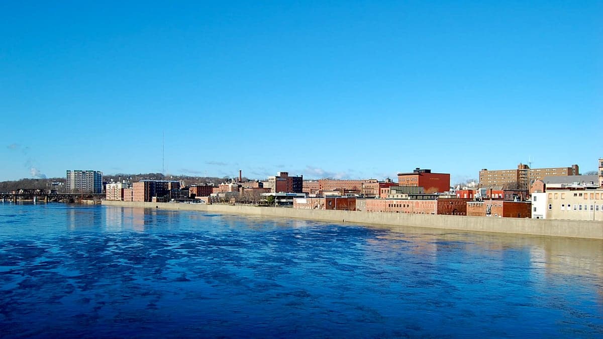
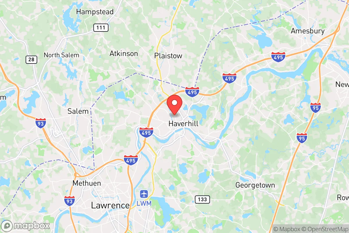
Haverhill, Massachusetts, sits in a precarious strategic position that demands careful consideration for anyone prioritizing resilience and preparedness. Located roughly 35 miles north of Boston and straddling the Merrimack River, the city offers a mix of historical infrastructure and modern suburban sprawl, but its proximity to major population centers and critical infrastructure introduces significant vulnerabilities. For the conservative-minded relocator focused on self-reliance and avoiding the fallout of societal instability, Haverhill presents a complex calculus: it is close enough to urban resources to be useful in calm times, yet dangerously near the blast zones, refugee flows, and supply chain disruptions that would accompany any major crisis. The city’s resilience is not inherent—it must be actively engineered by those who choose to live here, and even then, the geographic hand it has been dealt imposes hard limits.
Geographic position and natural advantages for long-term survival
Haverhill’s location along the Merrimack River provides a reliable, if not pristine, water source—a critical asset for any long-term survival scenario. The river is navigable for small craft and offers a potential route for trade or evacuation, though it also serves as a natural corridor for movement, which could be a double-edged sword in a crisis. The city sits within the broader Merrimack Valley, a region characterized by rolling hills, mixed hardwood forests, and pockets of agricultural land. To the north and west, the terrain becomes more rugged as you approach the New Hampshire border, offering potential retreat areas with lower population density. However, Haverhill itself is a dense, built-up environment—its population of roughly 67,000 is packed into about 35 square miles, meaning that any localized disaster would affect a large number of people in a relatively small area. The city’s elevation is modest, with most of the developed area sitting below 100 feet above sea level, which limits natural defensibility. The river also brings flood risk; the Merrimack has a history of major flooding events, most notably in 1936 and 2006, which could compound any crisis by destroying infrastructure and contaminating water supplies. For a prepper, the natural advantages here are real but marginal—the river is a lifeline, but the flat, dense layout is a liability.
Risks, exposures, and proximity to fallout-relevant landmarks
The most glaring vulnerability for Haverhill is its proximity to Boston, a Tier 1 target in any major conflict scenario. Boston is home to Logan International Airport, the Port of Boston, multiple research universities with dual-use technologies, and the headquarters of several defense contractors. In a nuclear exchange or large-scale terrorist event, the city would be a primary target, and Haverhill sits well within the fallout plume radius for a ground burst in Boston. Even a conventional attack on the city’s infrastructure—say, a cyberattack on the electrical grid or a physical strike on the Tobin Bridge—would send shockwaves up the I-95 corridor, which runs directly through Haverhill. The city is also within 20 miles of the Seabrook Nuclear Power Plant in New Hampshire, a facility that has been a source of controversy for decades. A catastrophic failure at Seabrook, whether from accident or sabotage, would render large swaths of the Merrimack Valley uninhabitable for generations. Additionally, Haverhill is bisected by major transportation arteries: Interstate 495, Route 97, and the MBTA commuter rail line. In a collapse scenario, these routes would become chokepoints for refugee movement, looting parties, and military checkpoints. The city’s industrial history—once a shoe-manufacturing hub—has left behind brownfields and old factory sites that could harbor environmental hazards if neglected during a crisis. For the survivalist, the risk profile here is high: you are living in the shadow of multiple high-value targets, with limited natural barriers to slow the chaos that would follow a major event.
Practical resilience for a relocator: food, water, energy, and defensibility
For a single individual or family looking to establish a resilient household in Haverhill, the practical challenges are significant but not insurmountable. Water is the most critical concern—while the Merrimack River is a reliable source, it is also heavily polluted with agricultural runoff, industrial chemicals, and sewage overflows. Any long-term reliance on the river would require a robust filtration and purification system, such as a Berkey or a UV-based setup, plus a means of transporting water from the riverbank to your property. Municipal water comes from the Merrimack and is treated, but in a grid-down scenario, the treatment plants would fail within hours. Drilling a private well is an option in some parts of the city, but much of Haverhill is served by municipal water, and well permits are not guaranteed. Food resilience is equally challenging. The city has limited agricultural land—there are a few community gardens and small farms on the outskirts, but the vast majority of food is imported via the same supply chains that would collapse in a crisis. Stockpiling is essential, but Haverhill’s housing stock is dominated by older multi-family homes and condos, many of which lack the basement space or secure storage for a serious prepper’s pantry. Energy resilience is a mixed bag. The grid is reliable in normal times, but it is vulnerable to both natural disasters (ice storms, hurricanes) and man-made threats (cyberattacks, EMP). Solar panels are viable, but many homes in Haverhill have roofs that are shaded by mature trees or oriented poorly for maximum sun exposure. A backup generator running on propane or natural gas is a more practical option, but natural gas lines are vulnerable to earthquakes and sabotage. Defensibility is the weakest link. Haverhill is a dense, walkable city with a grid-like street pattern in the downtown area, making it difficult to secure a perimeter. The best strategy for a relocator would be to choose a property on the northern or western edges of the city, closer to the New Hampshire border, where lots are larger and neighbors are fewer. Even then, the city’s overall layout offers little in the way of natural chokepoints or elevated positions for observation. For the serious prepper, Haverhill is a location that demands constant vigilance and a high level of self-sufficiency—it is not a place where you can simply hunker down and wait out a crisis.
The overall strategic picture for Haverhill is one of calculated risk. It is not a survivalist’s paradise, nor is it a death trap. The city offers access to the Merrimack River, proximity to the less-dense regions of southern New Hampshire, and a community that, while politically mixed, has a strong working-class ethos that could foster mutual aid in a crisis. But the downsides are equally real: proximity to Boston, the Seabrook nuclear plant, and major transportation corridors means that Haverhill would be on the front lines of any regional disaster. For the conservative relocator who values preparedness, the key is to treat Haverhill as a base of operations rather than a final redoubt. Build your supplies, establish relationships with like-minded neighbors, and have a bug-out plan that takes you north into the New Hampshire woods or west toward the Berkshires. Haverhill can work, but only if you approach it with clear eyes and a hard-nosed understanding of its limitations. It is a place for those who are willing to put in the work, not for those seeking a turnkey survival haven.
* Values derived from national, state, county, city and local statistics and may differ in a specific area. Last updated: 2026-05-01T05:45:35.000Z
Narrative content on this page is AI-generated and may contain mistakes. Verify any details that matter before acting on them.
ReloMaps may earn a commission from affiliate links at no extra cost to you.