
Photo: Wikipedia
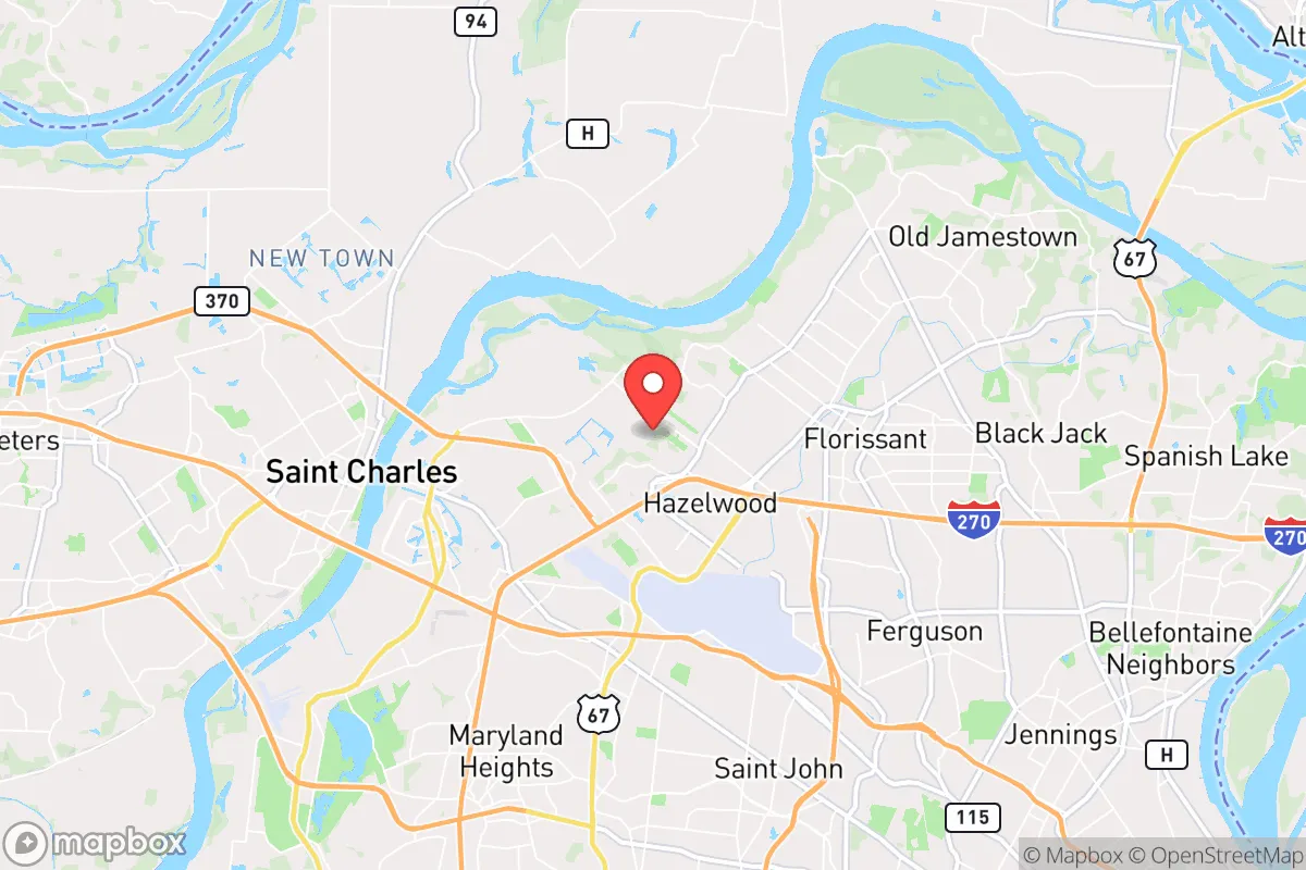
Strategic Assessment of Hazelwood, MO
Meaningful friction. Expect exposure to either population pressure, blast zones, or natural disaster risk. Consider buying a retreat property.
What does the Strategic Assessment tell us?
Our Strategic Assessment grades tactical survivability of an area. Major population centers, military targets, fallout zones, natural disasters, and border exposure all drive risk — lower exposure means a more defensible position in a crisis.
This is heavily inspired by Joel Skousen's Strategic Relocation book. Highly recommended you checkout the book ($)What does this tell us?
Our Strategic Assessment grades tactical survivability of an area. Major population centers, military targets, fallout zones, natural disasters, and border exposure all drive risk — lower exposure means a more defensible position in a crisis.
This is heavily inspired by Joel Skousen's Strategic Relocation book. Highly recommended you checkout the book ($)Strategic Pillars

Key Distances
Regional Safe Places
Below is our recommended "safe zones" in Missouri and the surrounding area based on our strategic heuristics. For most people, it's unrealistic to live in a “safe zone” full-time due to work, family or other personal reasons. They tend to be more rural. However, many of these areas are perfect for second homes and retreat properties that double as a vacation home or even a short-term rental.


Important Note: For informational purposes only. This does not mean nothing bad ever happens in the green zones. Please use common sense. This is based on public data and modeled with AI. We tried to take a conservative approach but mistakes happen. We update this regularly as new information becomes available.
Solar Generator Recommendations
Backup power matters more here than in safer locations. We've picked three solar generators across budgets and capacity tiers — start with the budget unit if you only need a few essentials, or step up if you want to run a fridge and HVAC for days at a time.

Jackery Portable Power Station Explorer 300
Budget OptionPower on the Go: Weighing only 11 lbs, it's convenient to set up and store with book-sized foldable solar panels

BLUETTI Portable Power Station AC180
Designed for both indoor and outdoor scenarios, AC180 is highly capable as it has a robost capacity and continuous output power.

EF ECOFLOW DELTA Pro Ultra Power Station
Upgraded PickEcoFlow DELTA Pro Ultra is a whole-home energy system designed to grow with your family. Integrated with the Smart Home Panel 2, it scales to meet your evolving energy needs — keeping your home powered, intelligent, and secure through every stage of life.
We earn a commission, at no additional cost to you.
Strategic Assessment Analysis
Hazelwood, Missouri, sits in a peculiar strategic pocket—close enough to St. Louis to be useful, far enough to avoid the worst of a collapse scenario. Its resilience hinges on a mix of industrial infrastructure, river access, and a suburban layout that offers more defensible options than a dense urban core. For a relocator thinking in terms of decades, not just next year, Hazelwood presents a calculated trade-off: proximity to a major city is a liability in unrest, but the area's specific geography and existing hard infrastructure offer genuine advantages for those who plan ahead.
Geographic position and natural advantages for long-term survival
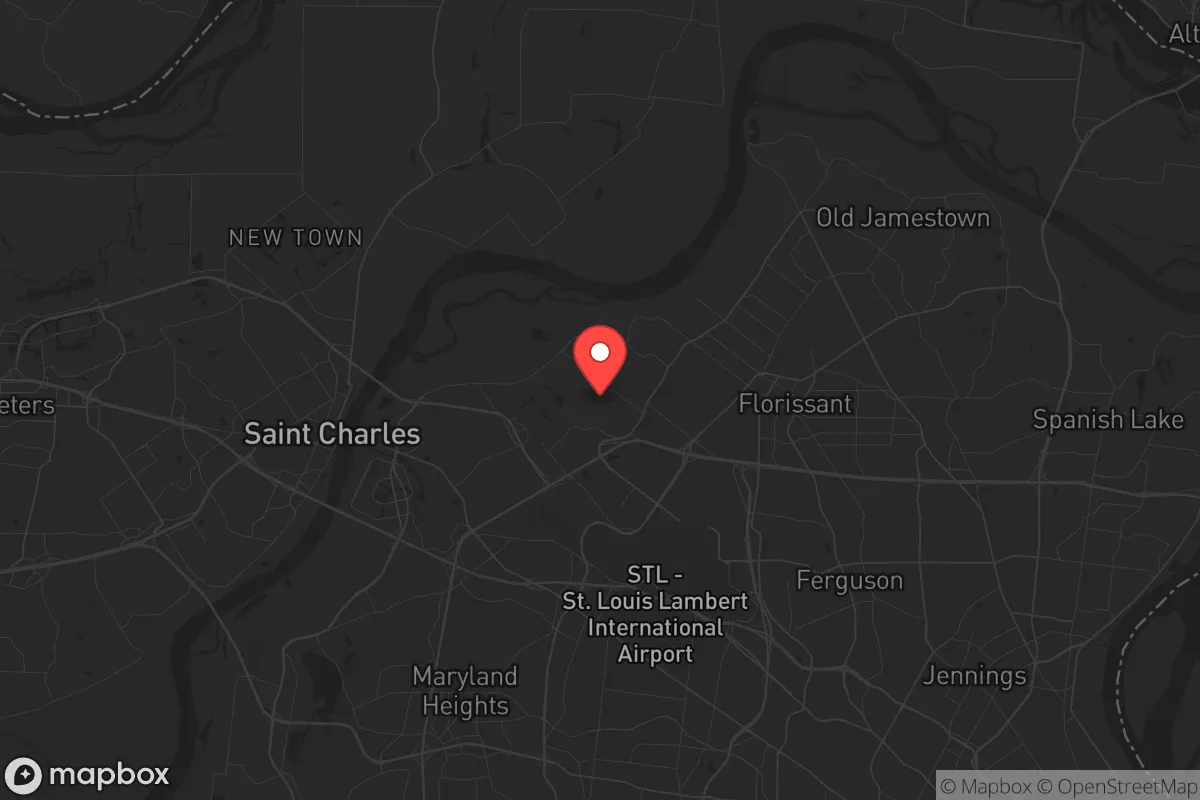
Hazelwood sits in the Missouri River floodplain, about 12 miles northwest of downtown St. Louis. That river access is the single most important natural feature for a prepper mindset. The Missouri River provides a reliable water source for filtration, irrigation, and transport if roads become impassable. The surrounding terrain is mostly flat with scattered wooded areas—not ideal for mountain redoubts, but workable for small-scale agriculture and defensive positioning if you choose a property with good sightlines. The area sits on the Missouri River alluvial aquifer, meaning groundwater is relatively accessible for wells, though you'll want to test for agricultural runoff. The local climate is four-season continental: hot, humid summers and cold winters. That means you need to plan for both heat stress and freezing pipes, but it also means a longer growing season than points north. Hazelwood's position also places it outside the immediate blast and fallout zones of any known strategic targets in the St. Louis metro, though that's a relative statement—more on that below.
Risks, exposures, and proximity to fallout-relevant landmarks
The biggest strategic liability is Hazelwood's proximity to Lambert–St. Louis International Airport, which sits directly adjacent to the city's southern border. In a major conflict or terrorist event, an international airport is a high-value target for both kinetic strikes and secondary attacks. The airport also concentrates federal law enforcement, TSA, and National Guard assets, which could become a flashpoint during civil unrest. Hazelwood is also within 20 miles of the St. Louis Arch and downtown federal buildings, as well as major rail yards and interstate bridges (I-70, I-270) that could be targeted for disruption. The nearby Missouri River bridges at St. Charles and Chesterfield are chokepoints that would be contested in any evacuation scenario. On the industrial side, Hazelwood hosts several chemical storage facilities and a major rail classification yard—both potential sources of hazardous material spills or secondary explosions. For a survivalist, the rule is simple: you can live near these things, but you need a plan to get away from them quickly. The city's own emergency management plans acknowledge flood risk from the Missouri and Coldwater Creek, the latter of which has historical radioactive contamination from Cold War-era uranium processing at the former St. Louis Airport Site. That contamination is largely remediated, but it's a reminder that the area has a legacy of industrial hazards that could resurface in a degraded response environment.
Practical resilience for a relocator: food, water, energy, and defensibility
For daily life and long-term sustainability, Hazelwood offers a mixed bag. Water is the strongest suit: the Missouri River is a reliable surface source, and the local water utility draws from the alluvial aquifer. A well-drilling permit is obtainable, and many older homes in the area already have private wells. You'll want to budget for a hand pump or solar-powered pump as a backup. Food resilience is moderate. The surrounding St. Charles County and northern St. Louis County have active farmland, but Hazelwood itself is mostly residential and light industrial. You'll need to secure land for a garden or greenhouse—look for properties with at least a quarter-acre of arable soil. The local farmers' markets and CSAs are good for normal times, but in a crisis, you can't rely on them. Energy is a weak point. The grid here is served by Ameren Missouri, which has a mixed reliability record—outages from storms are common, and the aging infrastructure is vulnerable to both cyberattack and physical sabotage. Solar is viable, but you'll need battery storage and a backup generator for winter cloud cover. Natural gas is available in most neighborhoods, which is useful for heating and cooking if the grid goes down, but the gas lines themselves are a target. Defensibility is the hardest variable. Hazelwood is a typical suburban grid of cul-de-sacs and arterial roads. That layout is easy to navigate for outsiders and hard to secure. Your best bet is a property on a dead-end street with natural barriers (tree lines, creeks) and a single access point. Avoid homes near major thoroughfares like Lindbergh Boulevard or I-270. The local police department is professional but understaffed—response times in a crisis will be measured in hours, not minutes. You need to be your own first responder. The broader community is a mix of working-class families, retirees, and younger renters. There is a visible veteran presence, which is a positive for mutual aid networks. Gun ownership is common, and Missouri is a constitutional carry state, so legal barriers to self-defense are minimal. That said, the area has seen an uptick in property crime since 2020, including vehicle thefts and burglaries—a sign that social cohesion is fraying, which is exactly the kind of trend a prepper watches.
The overall strategic picture for Hazelwood is one of calculated risk. It is not a remote survivalist paradise, and it never will be. What it offers is a middle-ground option: close enough to St. Louis to access medical care, supplies, and employment in normal times, but with enough geographic buffers and infrastructure to ride out a moderate crisis. The river, the aquifer, and the industrial base give you tools that a purely suburban bedroom community lacks. The airport, the chemical plants, and the urban proximity are the trade-offs. For a single individual or a family willing to invest in hardening a property, building a community network, and maintaining a realistic evacuation plan, Hazelwood can work. But it demands vigilance. If you're looking for a place to hunker down and wait out the storm, this isn't it. If you're looking for a base of operations with options—stay, bug out, or adapt—Hazelwood deserves a serious look.
* Values derived from national, state, county, city and local statistics and may differ in a specific area. Last updated: 2026-05-01T05:55:07.000Z
Narrative content on this page is AI-generated and may contain mistakes. Verify any details that matter before acting on them.
ReloMaps may earn a commission from affiliate links at no extra cost to you.