

Photo: Wikipedia
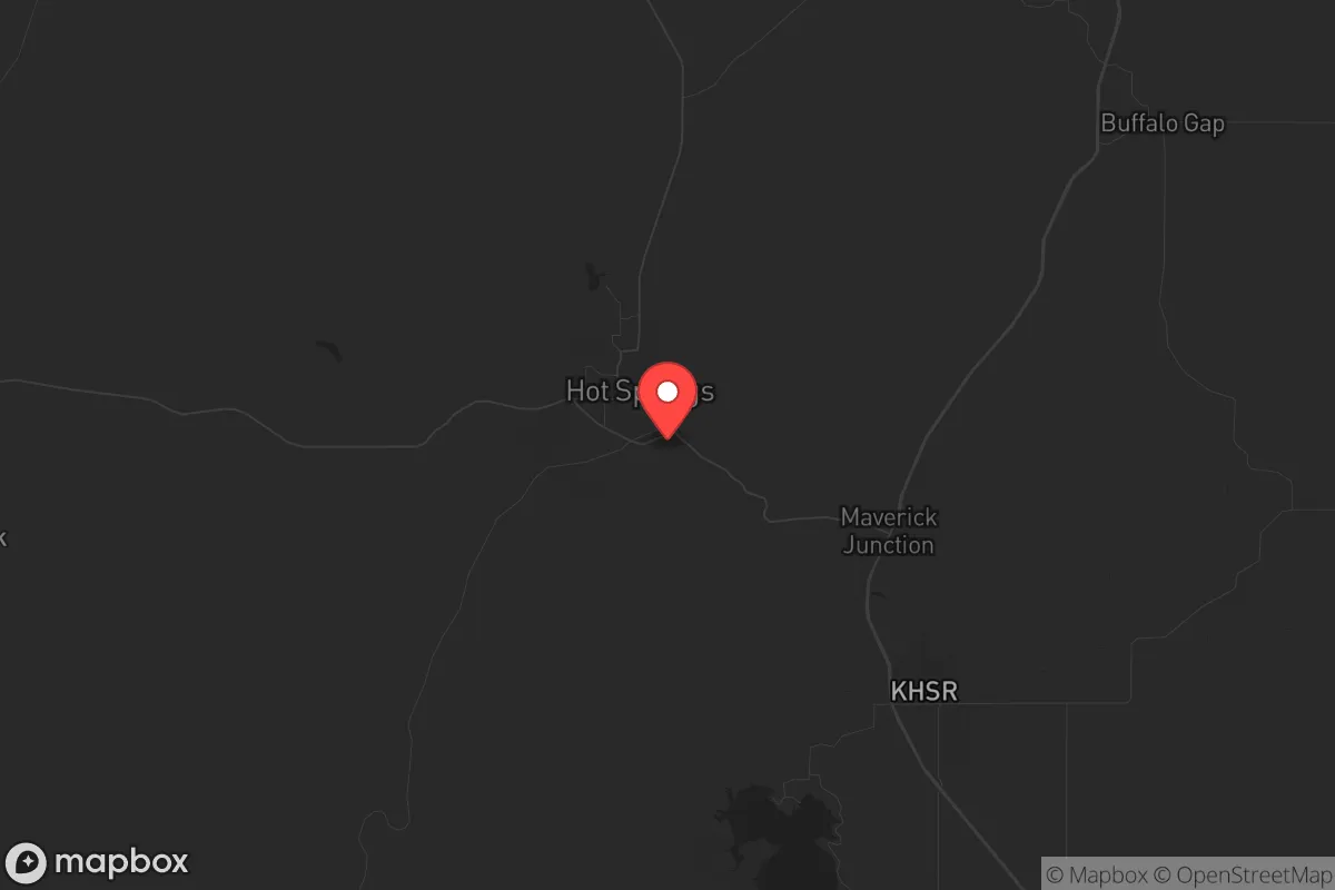
Strategic Assessment of Hot Springs, SD
Strong survivability profile. Good buffer from population centers, with manageable environmental and tactical risks.
What does the Strategic Assessment tell us?
Our Strategic Assessment grades tactical survivability of an area. Major population centers, military targets, fallout zones, natural disasters, and border exposure all drive risk — lower exposure means a more defensible position in a crisis.
This is heavily inspired by Joel Skousen's Strategic Relocation book. Highly recommended you checkout the book ($)What does this tell us?
Our Strategic Assessment grades tactical survivability of an area. Major population centers, military targets, fallout zones, natural disasters, and border exposure all drive risk — lower exposure means a more defensible position in a crisis.
This is heavily inspired by Joel Skousen's Strategic Relocation book. Highly recommended you checkout the book ($)Strategic Pillars

Key Distances
Regional Safe Places
Below is our recommended "safe zones" in South Dakota and the surrounding area based on our strategic heuristics. For most people, it's unrealistic to live in a “safe zone” full-time due to work, family or other personal reasons. They tend to be more rural. However, many of these areas are perfect for second homes and retreat properties that double as a vacation home or even a short-term rental.


Important Note: For informational purposes only. This does not mean nothing bad ever happens in the green zones. Please use common sense. This is based on public data and modeled with AI. We tried to take a conservative approach but mistakes happen. We update this regularly as new information becomes available.
Solar Generator Recommendations
Backup power matters more here than in safer locations. We've picked three solar generators across budgets and capacity tiers — start with the budget unit if you only need a few essentials, or step up if you want to run a fridge and HVAC for days at a time.

Jackery Portable Power Station Explorer 300
Budget OptionPower on the Go: Weighing only 11 lbs, it's convenient to set up and store with book-sized foldable solar panels

BLUETTI Portable Power Station AC180
Designed for both indoor and outdoor scenarios, AC180 is highly capable as it has a robost capacity and continuous output power.

EF ECOFLOW DELTA Pro Ultra Power Station
Upgraded PickEcoFlow DELTA Pro Ultra is a whole-home energy system designed to grow with your family. Integrated with the Smart Home Panel 2, it scales to meet your evolving energy needs — keeping your home powered, intelligent, and secure through every stage of life.
We earn a commission, at no additional cost to you.
Strategic Assessment Analysis
Hot Springs, South Dakota, presents a compelling strategic option for those prioritizing resilience, offering a blend of geographic isolation, natural resource access, and a low-profile existence that is increasingly rare in the Lower 48. Its location in the southern Black Hills, away from major interstate corridors and population centers like Rapid City (about 50 miles north), provides a natural buffer against the cascading effects of urban unrest, grid collapse, or mass casualty events. The town’s small population—roughly 3,700—and its history as a frontier outpost mean the local culture already leans toward self-reliance, a trait that aligns well with a conservative, prepper-oriented worldview. For the single individual or family looking to step off the grid of vulnerability, Hot Springs offers a foundation that is both defensible and sustainable, provided one understands its specific risks and advantages.
Geographic position and natural advantages for long-term survival
Hot Springs sits in a unique geological pocket at the southern edge of the Black Hills, an uplifted island of forested mountains surrounded by the high plains. This position offers several hard-to-replicate survival advantages. The area is far from any major metropolitan target—Denver is over 350 miles away, and the nearest city of any consequence, Rapid City, is small enough (pop. 77,000) that it would not be a primary fallout or unrest epicenter. The surrounding terrain is rugged, with the Black Hills providing natural cover, elevation, and a complex network of canyons and draws that make large-scale movement difficult for any potential threat. The local water table is exceptional; the area sits atop the Madison Aquifer, and the town is named for its warm springs that flow at a consistent 87°F year-round. This geothermal water source is a strategic asset—it cannot be frozen, poisoned, or easily disrupted, and it provides a reliable water supply even during prolonged power outages or drought. The hills themselves are rich in timber for construction and fuel, and the local wildlife population (deer, elk, turkey) is robust enough to supplement food stores. For a relocator, the key takeaway is that Hot Springs offers a defensible, resource-rich pocket that is far enough from the chaos of the coasts and the Front Range to buy you time.
Risks, exposures, and proximity to fallout-relevant landmarks
No location is without vulnerabilities, and Hot Springs has several that a strategic relocator must weigh. The most immediate concern is its proximity to Ellsworth Air Force Base, located about 45 miles north near Rapid City. Ellsworth is home to the 28th Bomb Wing and operates B-1B Lancer bombers, making it a high-priority target in any major conflict involving strategic assets. While 45 miles provides a significant buffer against a direct blast, the fallout plume from a ground burst or a strike on the base’s munitions storage could drift south depending on prevailing winds. The prevailing wind pattern in the Black Hills is generally from the northwest, which would push fallout toward the plains east of the hills, but a shift could put Hot Springs in a secondary danger zone. Additionally, the Black Hills themselves host the Minuteman Missile National Historic Site and decommissioned silos, but more critically, the region contains active missile fields in western South Dakota and eastern Wyoming. While these are not immediate fallout sources, the presence of strategic military infrastructure within a 100-mile radius means Hot Springs is not in a true “nuclear shadow.” For the prepper, this means a robust shelter plan—basement, earth-bermed structure, or cave—is non-negotiable. The area also faces natural risks: wildfire is a genuine threat in the dry summers, and the town’s location in a valley can concentrate smoke and limit evacuation routes. The only major road in and out is US-18/US-385, a two-lane highway that could become a choke point during a mass evacuation. You need to plan for self-extraction via secondary routes or off-road capability.
Practical resilience for a relocator: food, water, energy, and defensibility
For the individual or family looking to establish a resilient homestead, Hot Springs offers a mix of immediate advantages and required work. Water is the strongest asset: the warm springs are a municipal source, but many properties in the surrounding county have access to shallow wells tapping the same aquifer. A hand pump or solar-powered well can provide water independence. The growing season is short (about 120 days) but productive—the southern Black Hills microclimate is milder than the surrounding plains, and you can reliably grow cool-weather crops like potatoes, carrots, and leafy greens. The local soil is rocky but workable with raised beds. For energy, the area has good solar exposure (over 220 sunny days per year) and consistent winds that make small-scale wind turbines viable. Wood heating is the standard here, and the national forest allows for permitted firewood collection. Defensibility is where Hot Springs shines: the town is compact, with a single main street and limited access points. The surrounding hills provide natural observation points, and the population density is low enough that you can secure a property with a clear field of view. The local sheriff’s office is small but responsive, and the community is tight-knit—people know their neighbors, which is a double-edged sword. Outsiders are viewed with some suspicion, but for a conservative relocator who keeps a low profile and contributes, integration is straightforward. The biggest practical gap is medical infrastructure: the local hospital, Fall River Health Services, is a critical access facility with limited capacity. A serious trauma or chronic condition will require a 50-mile drive to Rapid City, which could be impossible during a crisis. Stocking your own medical supplies and training in basic emergency medicine is essential.
The overall strategic picture for Hot Springs is that of a solid B+ location—not a perfect redoubt, but one of the better options in the continental US for those who want to be far from the fray without going completely off-grid in Alaska. Its strengths are real: abundant geothermal water, defensible terrain, low population density, and a culture that still values self-sufficiency. Its weaknesses are manageable with planning: proximity to a strategic military target, wildfire risk, and limited medical access. For the conservative relocator who is serious about resilience—who is willing to dig a shelter, store a year’s worth of supplies, and learn to live with a wood stove—Hot Springs offers a foundation that is hard to beat in the Lower 48. The key is to treat it as a base of operations, not a passive retreat. The area rewards preparation and punishes complacency, which is exactly the mindset required for the times ahead.
* Values derived from national, state, county, city and local statistics and may differ in a specific area. Last updated: 2026-04-23T10:33:01.000Z
Narrative content on this page is AI-generated and may contain mistakes. Verify any details that matter before acting on them.
ReloMaps may earn a commission from affiliate links at no extra cost to you.