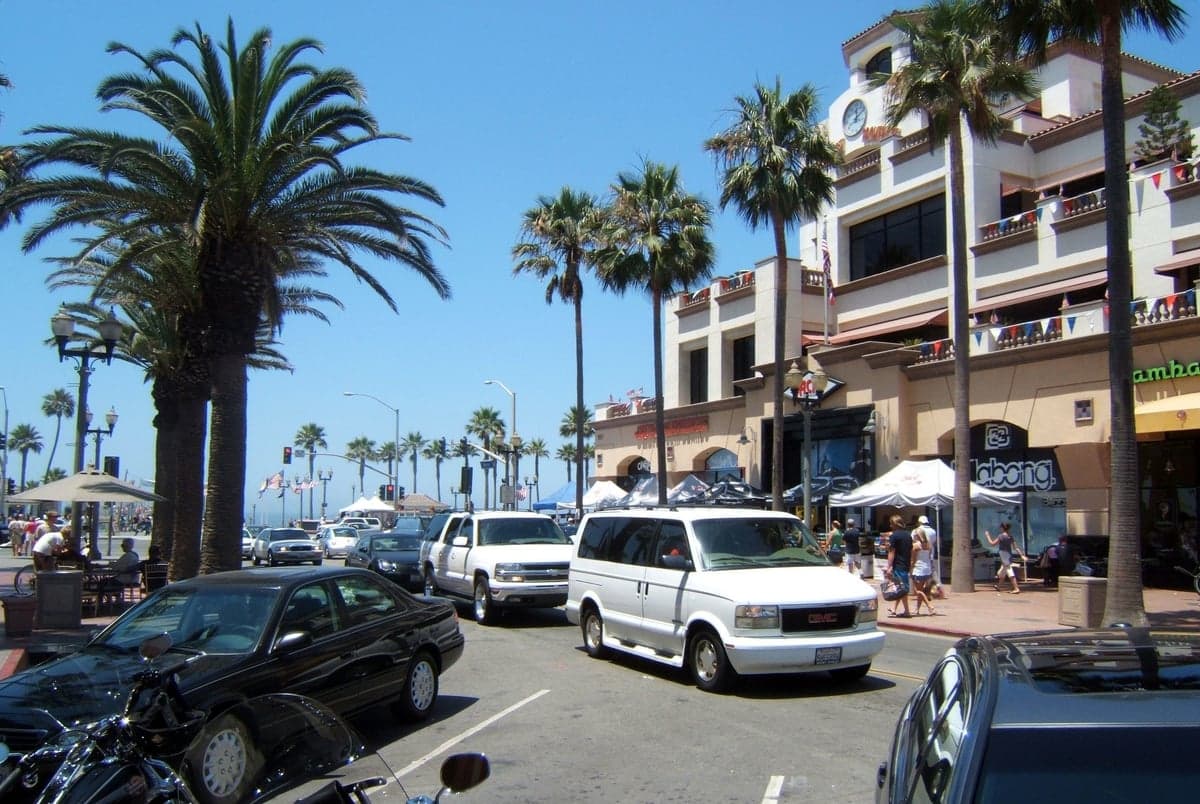
Photo: Wikipedia
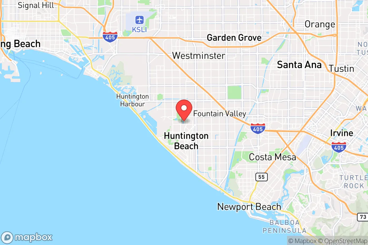
Strategic Assessment of Huntington Beach, CA
High tactical risk. This location is likely close to major population centers, strategic targets, or sits in a high-disaster corridor. A retreat property and careful exit planning is required.
What does the Strategic Assessment tell us?
Our Strategic Assessment grades tactical survivability of an area. Major population centers, military targets, fallout zones, natural disasters, and border exposure all drive risk — lower exposure means a more defensible position in a crisis.
This is heavily inspired by Joel Skousen's Strategic Relocation book. Highly recommended you checkout the book ($)What does this tell us?
Our Strategic Assessment grades tactical survivability of an area. Major population centers, military targets, fallout zones, natural disasters, and border exposure all drive risk — lower exposure means a more defensible position in a crisis.
This is heavily inspired by Joel Skousen's Strategic Relocation book. Highly recommended you checkout the book ($)Strategic Pillars

Key Distances
Regional Safe Places
Below is our recommended "safe zones" in California and the surrounding area based on our strategic heuristics. For most people, it's unrealistic to live in a “safe zone” full-time due to work, family or other personal reasons. They tend to be more rural. However, many of these areas are perfect for second homes and retreat properties that double as a vacation home or even a short-term rental.


Important Note: For informational purposes only. This does not mean nothing bad ever happens in the green zones. Please use common sense. This is based on public data and modeled with AI. We tried to take a conservative approach but mistakes happen. We update this regularly as new information becomes available.
Solar Generator Recommendations
Backup power matters more here than in safer locations. We've picked three solar generators across budgets and capacity tiers — start with the budget unit if you only need a few essentials, or step up if you want to run a fridge and HVAC for days at a time.

Jackery Portable Power Station Explorer 300
Budget OptionPower on the Go: Weighing only 11 lbs, it's convenient to set up and store with book-sized foldable solar panels

BLUETTI Portable Power Station AC180
Designed for both indoor and outdoor scenarios, AC180 is highly capable as it has a robost capacity and continuous output power.

EF ECOFLOW DELTA Pro Ultra Power Station
Upgraded PickEcoFlow DELTA Pro Ultra is a whole-home energy system designed to grow with your family. Integrated with the Smart Home Panel 2, it scales to meet your evolving energy needs — keeping your home powered, intelligent, and secure through every stage of life.
We earn a commission, at no additional cost to you.
Strategic Assessment Analysis
Huntington Beach, California, presents a deeply conflicted strategic picture for the conservative prepper. On one hand, its coastal position offers a temperate climate and a degree of natural insulation from inland chaos; on the other, it sits squarely within the bullseye of Southern California’s sprawling urban megaplex, with all the attendant risks of civil unrest, supply chain collapse, and proximity to high-value government and military targets. For a relocator weighing long-term survivability against lifestyle, this is not a fortress—it’s a high-risk, high-reward outpost that demands a clear-eyed assessment of its geographic realities and vulnerabilities.
Geographic position and natural advantages for long-term survival
Huntington Beach’s primary strategic asset is its location on the Pacific coast, which provides a reliable source of marine life, a moderating climate that reduces heating and cooling demands, and a potential evacuation route by sea if inland roads become impassable. The city sits on a relatively flat coastal plain, which simplifies construction and gardening compared to the steep canyons of inland Orange County. The nearby Bolsa Chica Ecological Reserve and Huntington Beach Wetlands offer natural barriers to development and could serve as foraging grounds or defensive perimeters in a grid-down scenario. The area’s Mediterranean climate—with average highs in the 70s and lows rarely below 45°F—means that temperature-related survival challenges are minimal, and water needs for personal hydration and small-scale agriculture are lower than in desert or mountain regions. However, the same geography that makes the area livable also makes it a magnet for population density: Huntington Beach’s population of roughly 200,000 swells to over 10 million within a 30-mile radius when factoring in Los Angeles, Long Beach, and Anaheim. That density is a double-edged sword—it provides economic opportunity in stable times but becomes a liability when civil order breaks down, as mass migration from inland areas would overwhelm local resources within days.
Risks, exposures, and proximity to fallout-relevant landmarks
The most glaring vulnerability for a prepper in Huntington Beach is its proximity to high-value targets that would attract kinetic or cyber attacks during a major conflict. The Port of Long Beach and Port of Los Angeles, located just 15 miles north, are the busiest container ports in the Western Hemisphere and would be primary targets for any adversary seeking to cripple the U.S. economy. The nearby San Onofre Nuclear Generating Station (SONGS), though decommissioned, still holds spent nuclear fuel on site—a potential radiological hazard if the facility were struck or sabotaged. Additionally, the city lies within 20 miles of Joint Forces Training Base Los Alamitos, a key military logistics hub, and within 30 miles of Vandenberg Space Force Base to the north. In a scenario involving civil unrest, Huntington Beach’s reputation as a conservative enclave within a deep-blue state could make it a flashpoint. The city’s beachfront and pier are iconic gathering spots that could become targets for protest or looting, as seen during the 2020 George Floyd protests when Huntington Beach saw significant property damage and arson. Evacuation routes are severely constrained: the Pacific Coast Highway (CA-1) and I-405 are the only major arteries, and both are prone to gridlock during emergencies, as demonstrated during the 2023 Tropical Storm Hilary evacuations. For a relocator, the takeaway is clear: Huntington Beach offers a decent baseline for daily life but is a poor choice for a primary bug-out location due to its exposure to coastal flooding (tsunami risk from a Cascadia event), wildfire smoke from inland fires, and the sheer volume of desperate people who would flow toward the coast in a crisis.
Practical resilience for a relocator: food, water, energy, and defensibility
When assessing day-to-day survivability in Huntington Beach, the numbers are sobering. The city relies almost entirely on imported water from the Colorado River and the State Water Project, both of which are vulnerable to drought, earthquake damage to aqueducts, or sabotage. Local groundwater is brackish and requires desalination, which is energy-intensive. The Orange County Water District’s Groundwater Replenishment System provides some recycled water, but it’s a high-tech solution that depends on a functioning power grid. For a prepper, this means storing at least 30 days of water per person is non-negotiable, and a Berkey or similar gravity filter is essential for treating any available surface water from the ocean (via distillation) or local runoff. Food resilience is marginally better: the city has a strong farmers’ market culture and several community gardens, but the vast majority of food is trucked in from the Central Valley or Mexico, meaning a fuel shortage would empty grocery shelves within 72 hours. Backyard gardening is feasible on standard residential lots, but soil quality varies and salt spray from the ocean can stunt growth. Energy is a mixed bag: the area has abundant solar potential (over 280 sunny days per year), and many homes already have rooftop panels, but net metering policies are being rolled back, and battery storage is expensive. A generator with a 50-gallon propane tank is a practical baseline for a family of four. Defensibility is the weakest link. Huntington Beach is a dense, flat suburb with a grid street pattern—ideal for mobility but terrible for creating chokepoints. Most homes are single-family detached with fenced yards, but the fences are typically wood or vinyl, offering little ballistic protection. The city’s police department is well-funded and responsive in normal times, but during a widespread collapse, they would be overwhelmed by calls from the entire coastal corridor. A relocator should prioritize a home on a cul-de-sac with a single access point, preferably near the wetlands or a greenbelt that provides a natural buffer. Firearms ownership is relatively high in Huntington Beach compared to the rest of Orange County, but the city’s strict local ordinances on magazine capacity and concealed carry (mirroring state law) limit defensive options.
The overall strategic picture for Huntington Beach is one of calculated risk. It offers a stable, climate-friendly base for a family that values beach access, conservative local governance, and a strong sense of community—but it is not a survivalist’s paradise. The city’s location within the Los Angeles megaplex means that any major disruption—whether from earthquake, civil unrest, or geopolitical conflict—will bring cascading failures that are hard to mitigate. For a single individual or a family willing to invest in robust water storage, off-grid energy, and a well-rehearsed evacuation plan to a secondary location inland (perhaps in the San Bernardino Mountains or the Mojave Desert), Huntington Beach can work as a primary residence. But for those seeking true strategic depth—a place where you can hunker down for months without outside support—this is not it. The ocean is a resource, but it’s also a magnet. In a crisis, the coast draws people like a flame draws moths, and Huntington Beach is right on the edge of the fire.
* Values derived from national, state, county, city and local statistics and may differ in a specific area. Last updated: 2026-04-24T11:47:44.000Z
Narrative content on this page is AI-generated and may contain mistakes. Verify any details that matter before acting on them.
ReloMaps may earn a commission from affiliate links at no extra cost to you.