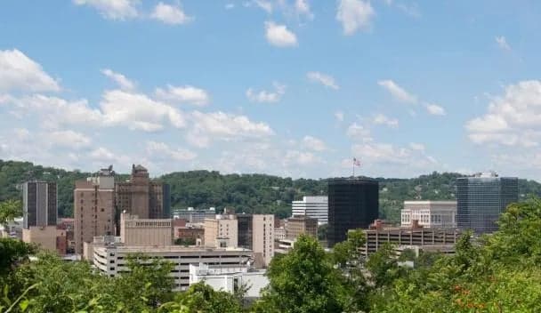
Strategic Assessment of Hurricane, WV
Meaningful friction. Expect exposure to either population pressure, blast zones, or natural disaster risk. Consider buying a retreat property.
What does the Strategic Assessment tell us?
Our Strategic Assessment grades tactical survivability of an area. Major population centers, military targets, fallout zones, natural disasters, and border exposure all drive risk — lower exposure means a more defensible position in a crisis.
This is heavily inspired by Joel Skousen's Strategic Relocation book. Highly recommended you checkout the book ($)What does this tell us?
Our Strategic Assessment grades tactical survivability of an area. Major population centers, military targets, fallout zones, natural disasters, and border exposure all drive risk — lower exposure means a more defensible position in a crisis.
This is heavily inspired by Joel Skousen's Strategic Relocation book. Highly recommended you checkout the book ($)Strategic Pillars

Key Distances
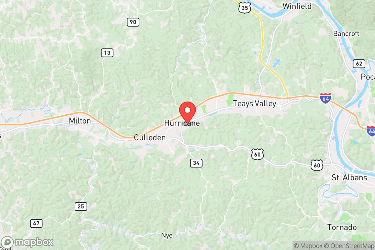
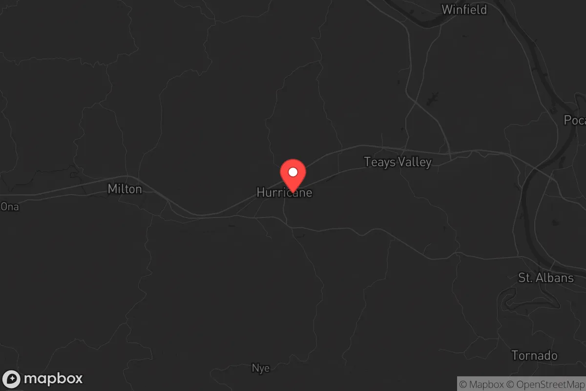
Regional Safe Places
Below is our recommended "safe zones" in West Virginia and the surrounding area based on our strategic heuristics. For most people, it's unrealistic to live in a “safe zone” full-time due to work, family or other personal reasons. They tend to be more rural. However, many of these areas are perfect for second homes and retreat properties that double as a vacation home or even a short-term rental.


Important Note: For informational purposes only. This does not mean nothing bad ever happens in the green zones. Please use common sense. This is based on public data and modeled with AI. We tried to take a conservative approach but mistakes happen. We update this regularly as new information becomes available.
Solar Generator Recommendations
Backup power matters more here than in safer locations. We've picked three solar generators across budgets and capacity tiers — start with the budget unit if you only need a few essentials, or step up if you want to run a fridge and HVAC for days at a time.

Jackery Portable Power Station Explorer 300
Budget OptionPower on the Go: Weighing only 11 lbs, it's convenient to set up and store with book-sized foldable solar panels

BLUETTI Portable Power Station AC180
Designed for both indoor and outdoor scenarios, AC180 is highly capable as it has a robost capacity and continuous output power.

EF ECOFLOW DELTA Pro Ultra Power Station
Upgraded PickEcoFlow DELTA Pro Ultra is a whole-home energy system designed to grow with your family. Integrated with the Smart Home Panel 2, it scales to meet your evolving energy needs — keeping your home powered, intelligent, and secure through every stage of life.
We earn a commission, at no additional cost to you.
Strategic Assessment Analysis
Hurricane, West Virginia, offers a strategic blend of geographic isolation and practical resilience that appeals to those prioritizing long-term preparedness. Located in Putnam County, this town of roughly 6,500 sits in the Appalachian foothills, roughly 30 miles from Charleston and 45 miles from Huntington, placing it close enough for supply runs but far enough to avoid the immediate fallout of urban collapse. The area’s low population density, rugged terrain, and limited through-traffic make it a defensible position for individuals and families seeking to weather civic unrest, mass casualty events, or natural disasters. For a conservative-leaning audience focused on self-reliance, Hurricane’s location provides a buffer zone—not a fortress, but a solid base camp for those willing to put in the work.
Geographic position and natural advantages for long-term survival
Hurricane sits in the Kanawha River Valley, surrounded by the Appalachian Mountains, which act as a natural barrier against large-scale movement and surveillance. The town’s elevation—around 700 feet—keeps it above most floodplains, though the nearby Kanawha River and several creeks offer reliable water sources. The surrounding hills are heavily forested with oak, hickory, and pine, providing cover, firewood, and game like deer and turkey. The climate is temperate, with average highs in the 80s during summer and lows in the 20s in winter, meaning you can grow food for about six months of the year without a greenhouse. The soil in the valley is decent for small-scale gardening, but the hillsides are rocky and steep, limiting large-scale agriculture. For a prepper, this means you’ll need to plan for food storage and possibly hydroponics or raised beds. The area’s low seismic activity and minimal tornado risk (compared to the Plains) reduce the chance of natural disasters compounding a crisis. However, the region does see occasional ice storms and flooding along the river, so a well-drained property on higher ground is a must.
Risks, exposures, and proximity to fallout-relevant landmarks
The biggest strategic downside is Hurricane’s proximity to Charleston, a city of roughly 47,000 that hosts a major chemical corridor along the Kanawha River. The Union Carbide plant in South Charleston and several other industrial facilities handle hazardous materials, making a chemical spill or targeted attack a real concern if civil order breaks down. Additionally, Interstate 64 runs directly through Hurricane, providing a highway for refugees fleeing Charleston or Huntington during a crisis. This could turn the town into a chokepoint or a target for looters. The Yeager Airport in Charleston is a potential FEMA or military staging area, which could draw unwanted attention. On the plus side, Hurricane is far from major military bases (like Fort Knox or the Pentagon) and nuclear power plants (the closest is Beaver Valley in Pennsylvania, over 200 miles away). The Greenbrier Resort bunker (the former congressional fallout shelter) is about 90 miles southeast, but that’s a high-value target, not a safe zone. For a relocator, the key is to avoid being on the main evacuation routes—choose a property off the beaten path, preferably on a dead-end road or in a hollow.
Practical resilience for a relocator: food, water, energy, and defensibility
Water is abundant in Hurricane, with the Kanawha River and numerous creeks providing surface water, but you’ll need to treat it—industrial runoff and agricultural pollution are real concerns. Well water is common in rural areas, and many properties have private wells, which is a major advantage over municipal systems that could fail during a grid-down scenario. For food, the local growing season runs from April to October, and the area has a strong hunting culture—deer, turkey, and small game are plentiful. The Putnam County Farmers Market in nearby Winfield is a good source for seeds and local produce, but don’t rely on it during a crisis. Stockpiling non-perishables from the local Kroger or Walmart in Hurricane is wise, but those stores will empty quickly. Energy-wise, the region is coal country, and many homes still use propane or oil for heating. Solar panels are viable, but the hilly terrain and frequent cloud cover reduce efficiency—plan for a backup generator or wood stove. Defensibility is mixed: the town itself is a typical small American town with a main street and suburban sprawl, but the surrounding hills offer natural chokepoints. A property with a long driveway, a creek for water, and a view of the road gives you a tactical advantage. The local sheriff’s office is responsive, but during a widespread event, you’re on your own—Putnam County has about 1.2 deputies per 1,000 residents, which is thin for a crisis.
Overall, Hurricane, WV, is a solid B+ option for a strategic relocation. It’s not a remote bunker in Montana, but it’s also not a suburban trap in a flood zone. The key is to buy land outside the town limits, preferably on a ridge or in a hollow, and to invest in water filtration, a wood stove, and a reliable vehicle (4WD is essential for winter storms). The community is predominantly conservative and rural, with a strong church presence and a “mind your own business” attitude—useful for keeping a low profile. The biggest threats are the nearby chemical plants and the interstate, but with proper planning, you can mitigate those. If you’re looking for a place that balances access to resources with a buffer from urban chaos, Hurricane deserves a serious look. Just don’t expect it to stay quiet if the SHTF—everyone within 50 miles will have the same idea.
* Values derived from national, state, county, city and local statistics and may differ in a specific area. Last updated: 2026-04-23T05:41:14.000Z
Narrative content on this page is AI-generated and may contain mistakes. Verify any details that matter before acting on them.
ReloMaps may earn a commission from affiliate links at no extra cost to you.