

Photo: Wikipedia
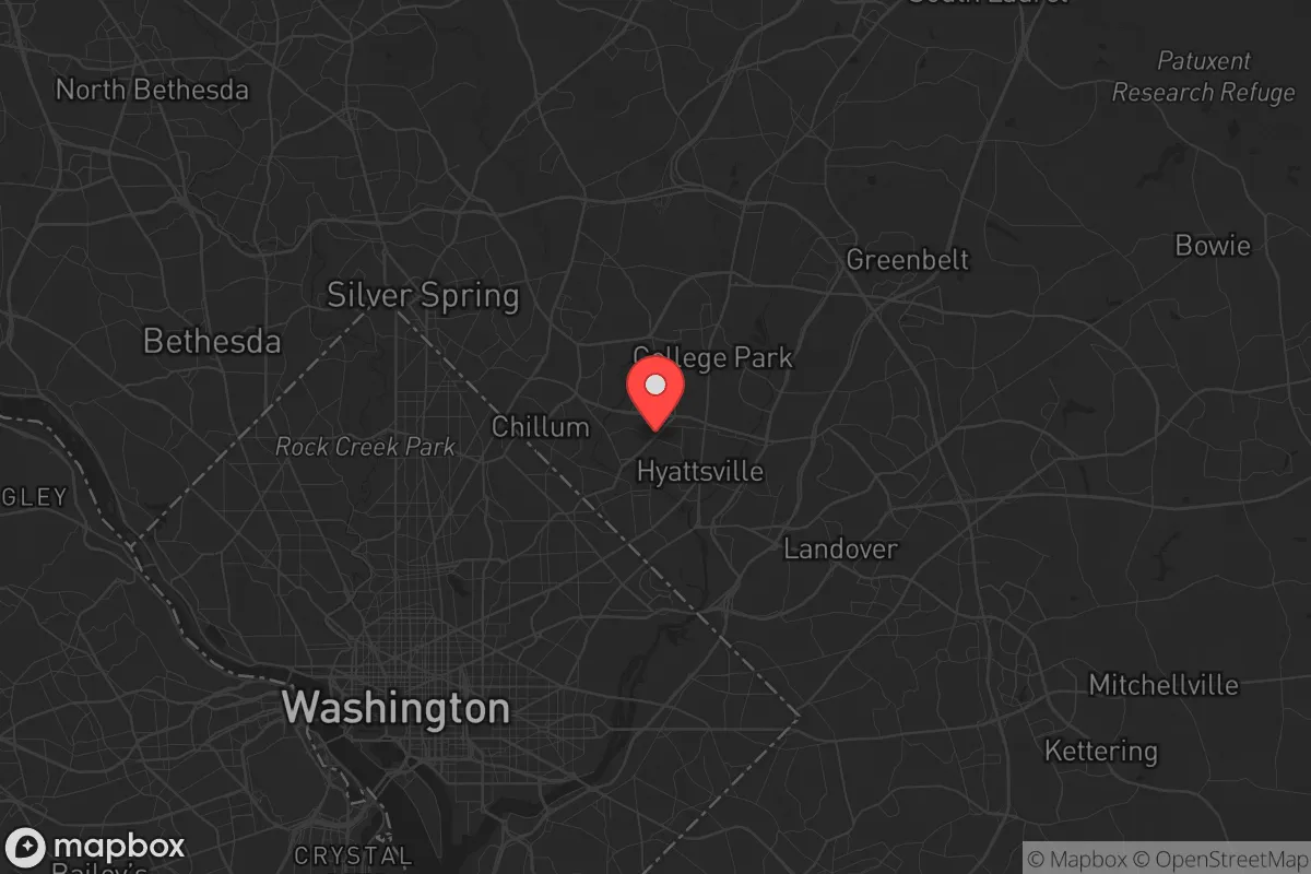
Strategic Assessment of Hyattsville, MD
Multiple tactical vulnerabilities. Population density, target proximity, or disaster risk are likely compounding. A retreat property and exit planning is required.
What does the Strategic Assessment tell us?
Our Strategic Assessment grades tactical survivability of an area. Major population centers, military targets, fallout zones, natural disasters, and border exposure all drive risk — lower exposure means a more defensible position in a crisis.
This is heavily inspired by Joel Skousen's Strategic Relocation book. Highly recommended you checkout the book ($)What does this tell us?
Our Strategic Assessment grades tactical survivability of an area. Major population centers, military targets, fallout zones, natural disasters, and border exposure all drive risk — lower exposure means a more defensible position in a crisis.
This is heavily inspired by Joel Skousen's Strategic Relocation book. Highly recommended you checkout the book ($)Strategic Pillars

Key Distances
Regional Safe Places
Below is our recommended "safe zones" in Maryland and the surrounding area based on our strategic heuristics. For most people, it's unrealistic to live in a “safe zone” full-time due to work, family or other personal reasons. They tend to be more rural. However, many of these areas are perfect for second homes and retreat properties that double as a vacation home or even a short-term rental.


Important Note: For informational purposes only. This does not mean nothing bad ever happens in the green zones. Please use common sense. This is based on public data and modeled with AI. We tried to take a conservative approach but mistakes happen. We update this regularly as new information becomes available.
Solar Generator Recommendations
Backup power matters more here than in safer locations. We've picked three solar generators across budgets and capacity tiers — start with the budget unit if you only need a few essentials, or step up if you want to run a fridge and HVAC for days at a time.

Jackery Portable Power Station Explorer 300
Budget OptionPower on the Go: Weighing only 11 lbs, it's convenient to set up and store with book-sized foldable solar panels

BLUETTI Portable Power Station AC180
Designed for both indoor and outdoor scenarios, AC180 is highly capable as it has a robost capacity and continuous output power.

EF ECOFLOW DELTA Pro Ultra Power Station
Upgraded PickEcoFlow DELTA Pro Ultra is a whole-home energy system designed to grow with your family. Integrated with the Smart Home Panel 2, it scales to meet your evolving energy needs — keeping your home powered, intelligent, and secure through every stage of life.
We earn a commission, at no additional cost to you.
Strategic Assessment Analysis
Hyattsville, Maryland, presents a complex strategic picture for the conservative prepper. Its primary advantage—proximity to the federal government and the Washington, D.C. power grid—is also its greatest liability. While the area has shown resilience through decades of suburban change, its location within the I-495 beltway places it directly in the path of any major civil unrest, terrorist strike, or cascading infrastructure failure targeting the capital. For a relocator prioritizing long-term survivability and self-sufficiency, Hyattsville is a high-risk, high-visibility position that demands a clear-eyed assessment of its natural defenses and its exposure to fallout-relevant targets.
Geographic position and natural advantages for a prepper
Hyattsville sits on the eastern edge of Prince George's County, roughly 7 miles from the U.S. Capitol. Its geography offers a mix of older suburban development and patches of green space, including the 1,200-acre Greenbelt National Park to the north and the Anacostia River corridor to the west. The area's elevation is modest—around 100 feet above sea level—but it lacks significant topographic barriers that would slow a mob or provide natural defensibility. The Northeast Branch of the Anacostia River runs through the city, offering a potential water source, but it's heavily silted and polluted in stretches. The region's clay-heavy soils make digging bunkers or deep wells difficult without specialized equipment. On the plus side, the Baltimore-Washington Parkway and U.S. Route 1 provide multiple egress routes north and east, though these arteries would clog immediately during an evacuation. The proximity to Joint Base Andrews (8 miles southeast) is a double-edged sword: it's a military asset that could provide security in a crisis, but it's also a prime target for a first strike or sabotage.
Risks, exposures, and proximity to fallout-relevant landmarks
This is where Hyattsville's strategic calculus turns sharply negative. The city lies within the primary blast and fallout zone of any nuclear or conventional attack on Washington, D.C. The Capitol, White House, Pentagon, and numerous intelligence agencies are all within a 10-mile radius. A single 10-kiloton ground burst at the National Mall would produce lethal fallout extending into Hyattsville within 30 minutes. Beyond nuclear threats, the area is a high-probability target for civil unrest. The 2020 riots saw looting and arson spread from D.C. into Prince George's County, with Hyattsville's own Route 1 corridor experiencing business closures and security incidents. The city's population density—roughly 4,500 people per square mile—means that any evacuation would be chaotic and dangerous. Additionally, the Anacostia River bridges and the Capital Beltway interchange are single points of failure that could trap residents in a gridlock scenario. The presence of University of Maryland, College Park (3 miles north) adds a volatile element: large student populations have historically been flashpoints for protests that can escalate into property destruction.
Practical resilience for a relocator: food, water, energy, and defensibility
For a prepper looking to hunker down, Hyattsville offers limited options. Municipal water comes from the Washington Aqueduct, which draws from the Potomac River—a system vulnerable to contamination or sabotage. A backup well is unlikely in most residential lots due to the clay substrate and shallow water table (20-40 feet), which is often contaminated with urban runoff. Food storage is feasible in basements, but many older homes in Hyattsville have damp crawl spaces, not dry cellars. The city's zoning restricts livestock and large gardens in most residential areas, so self-sufficiency in food is legally constrained. Energy resilience is a bright spot: Maryland has net metering policies that allow solar panel installation, and the area gets decent sun (about 200 sunny days per year). However, Pepco's grid reliability is below average for the region, with frequent outages during storms. A generator or battery backup is essential. Defensibility is poor: most homes are on small lots with close neighbors, and the street grid offers multiple approaches for any threat. The Hyattsville Police Department is small (around 40 officers) and would be overwhelmed in a major event. The best defensive strategy here is not to fortify but to have a pre-planned bug-out route to rural areas in western Maryland or Pennsylvania, ideally within 30 minutes' drive.
The overall strategic picture for Hyattsville is one of calculated risk. It offers the convenience of urban amenities and a dense social network, but at the cost of being a primary target zone for any major disruption to the federal government. For a conservative relocator who values community and proximity to work, it can work as a temporary base—provided you have a robust evacuation plan, at least two weeks of supplies, and a secondary location secured outside the beltway. But for anyone serious about long-term survival, self-sufficiency, and avoiding the fallout of a collapsing system, Hyattsville is a place to pass through, not to dig in. The smart money is on rural counties to the north and west, where the land is cheaper, the neighbors are fewer, and the targets are smaller.
* Values derived from national, state, county, city and local statistics and may differ in a specific area. Last updated: 2026-04-22T03:51:18.000Z
Narrative content on this page is AI-generated and may contain mistakes. Verify any details that matter before acting on them.
ReloMaps may earn a commission from affiliate links at no extra cost to you.